In February 2025, more than 20 fires were started by dry lightning strikes in western lutruwita/ Tasmania.
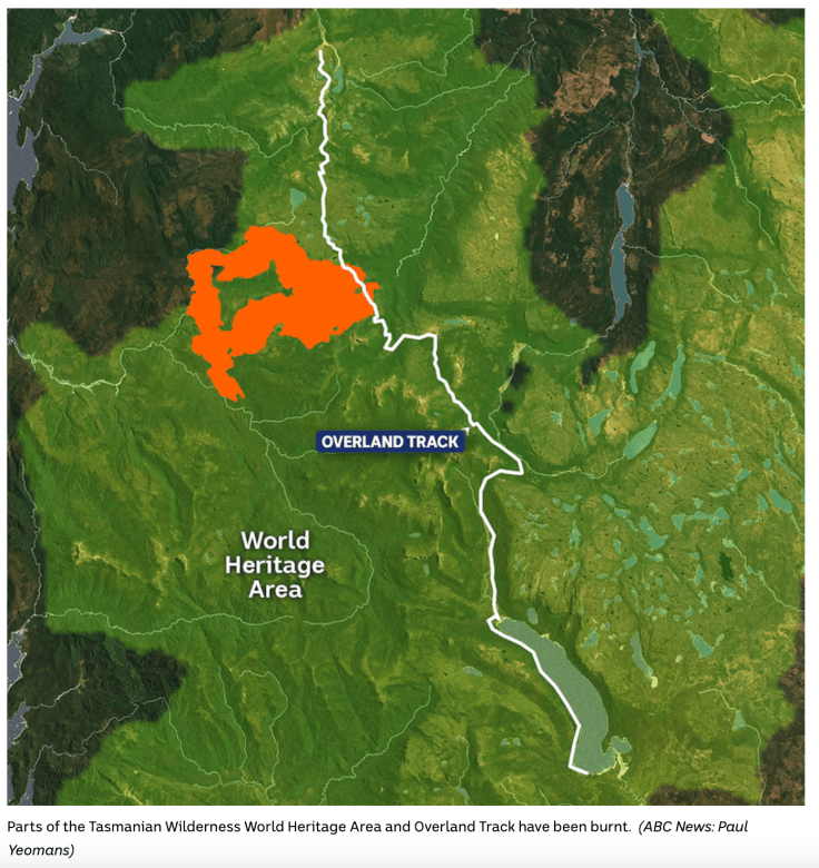
Some small blazes were quickly extinguished, and those that got away went on to burn more than 90,000 hectares of Tasmania, especially public land and within the Cradle Mountain Lake St Clair national park. The Canning Peak fire burnt sections of the famous Overland walking track (around 860m of boardwalk and a foot bridge were damaged), precious sections of pencil pine and other fire sensitive communities were impacted, and a hut belonging to a guiding company was lost.
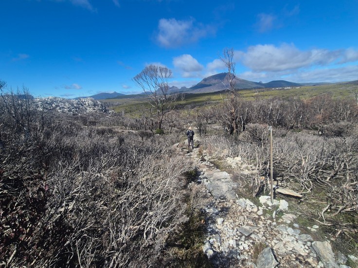
A year on, I managed to get in to have a look at the eastern edge of the fire, along the section that burnt across the Overland Track.
We know that dry lightning strikes are becoming more common in western Tasmania. This is leading to more frequent burns in remote areas, raising significant questions for land managers. Do we trust that the very large reserves are big enough to cope with wild fire? Or do we need to intervene to stop the small fires before they become uncontrollable? With so much scattered vegetation that will be killed by hot fires, action was required. While the fire burnt from the remote western section of the park, by the time it crossed the Overland Track, it was of significant size and running across a very long front, and so required sustained efforts to stop it from burning much more sensitive communities to the north east.
The fire was managed by TAS Parks and Wildlife Service and from the outside it has to be said that they put a lot of resources onto this fire, especially given the other big blazes happening further west at the same time. Air tractor planes flew loads of water from Lake St Clair, helicopters did bucket drops, a large back burn was created to (unsuccessfully) protect the tourism hut at Pine Forest Moor, and remote area crews were deployed on the ground. Fire crews were brought in from New South Wales, the ACT and Aotearoa/ New Zealand. Retardant was used to create a line that stopped the fire burning up towards Cradle Mountain.
Scientists say damage from fires caused by lightning strikes has increased dramatically since the start of the millennium, and is expected to continue to worsen as summers became hotter and drier under global heating. Remnant fire sensitive vegetation communities, such as those dominated by Pencil Pine, Celery Top Pine, Myrtle Beech, Deciduous Beech, and King Billy Pine, are very vulnerable to fire, and likely to be badly damaged or lost on a local scale when burnt. So fire fighters need to do their best to keep fire out of these communities.
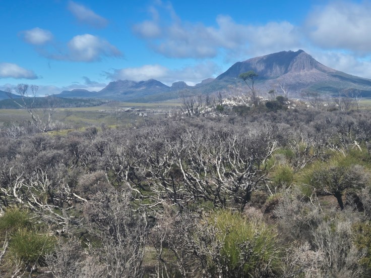
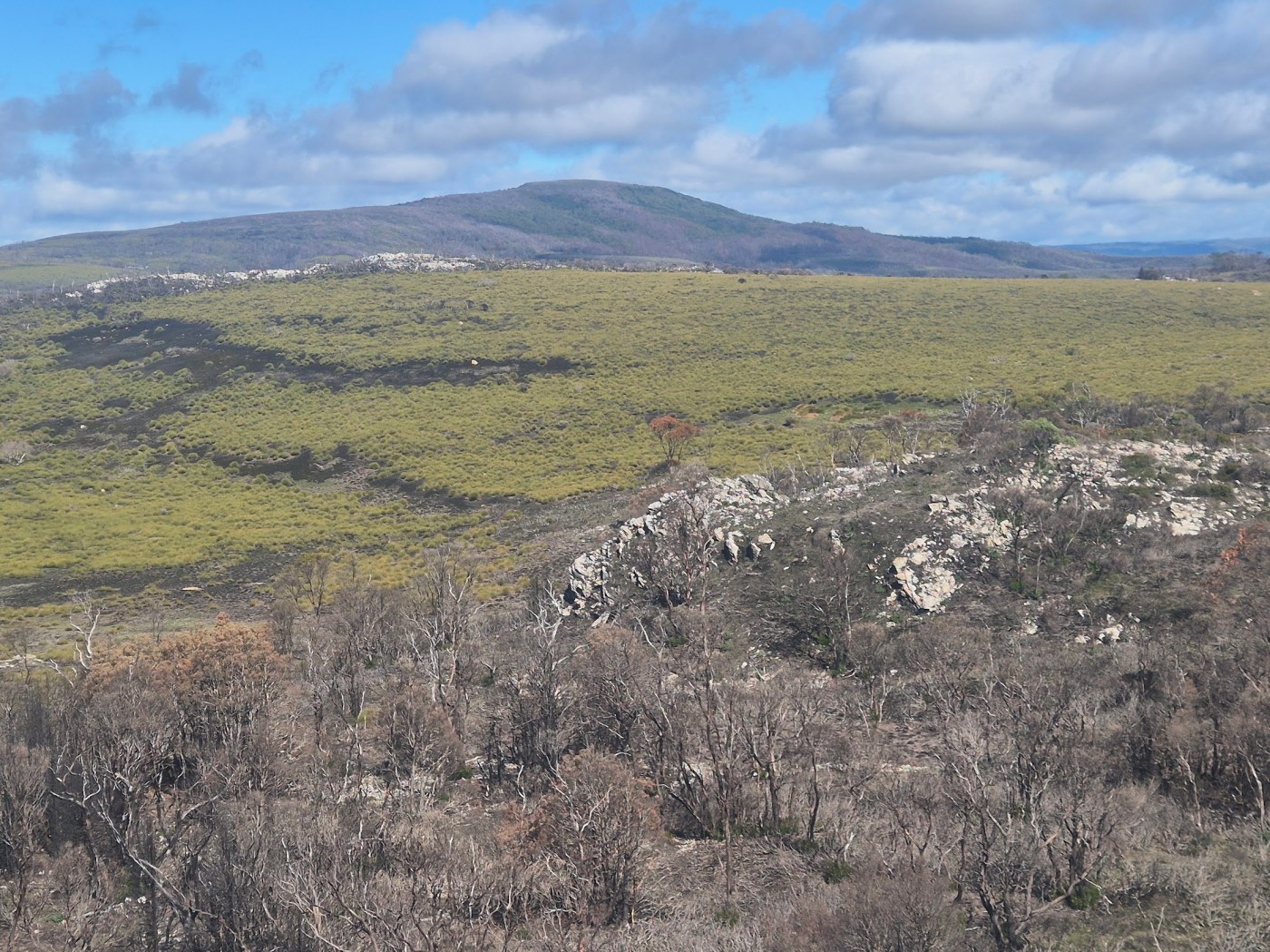
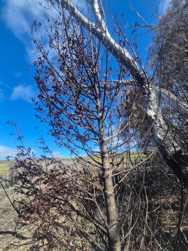
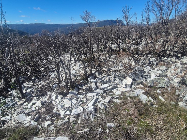
It’s a strange feeling to see a large fire scar within the national park. Walking over the rise just south of the hut at Lake Windemere, a vast area of burnt out country looks ridiculously green against the backdrop of some of the grandest peaks in the park. Travelling over a series of gentle slopes dropping to the east, there are many hectares of burnt out button grass plains and fields of low heathy shrub lands. The button grass loves a good fire and is already thriving, with what looks like good diversity of other low growing species such as sedges (these tend to get squeezed out as the button grass grows). The heathlands didn’t have a huge amount of new growth as yet but were clearly on the road to recovery. While many individual snow gums had been killed, a large percentage were reshooting from the base or branches.
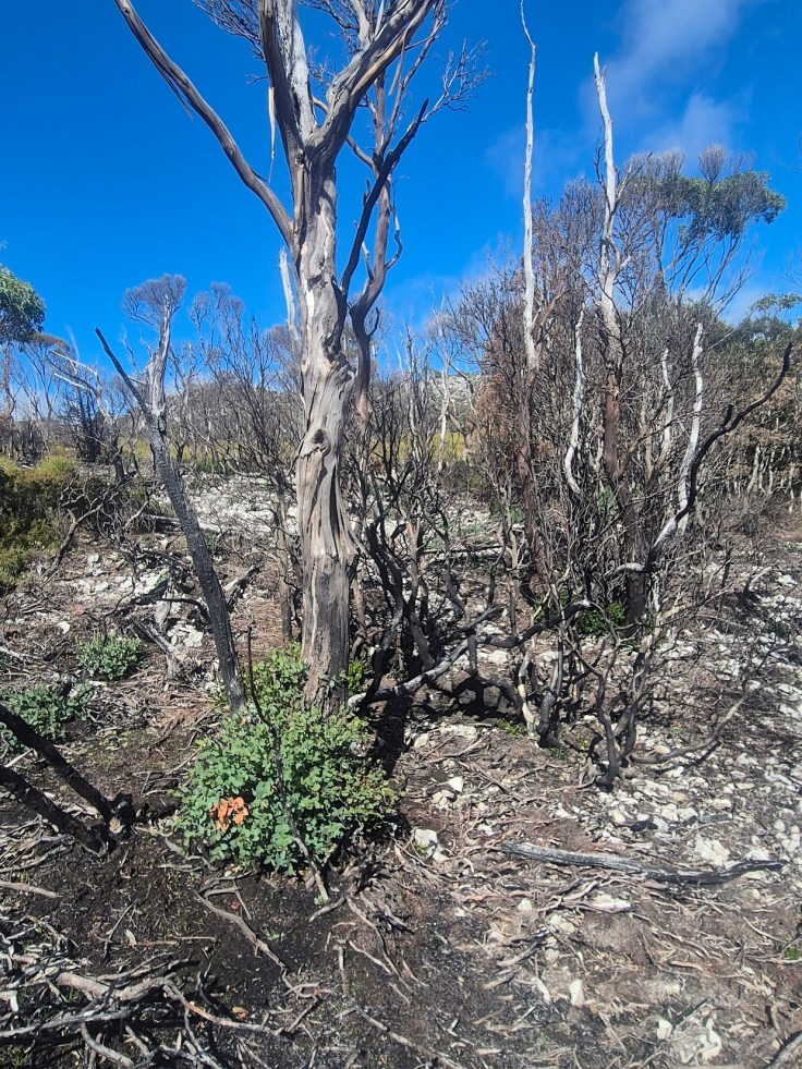
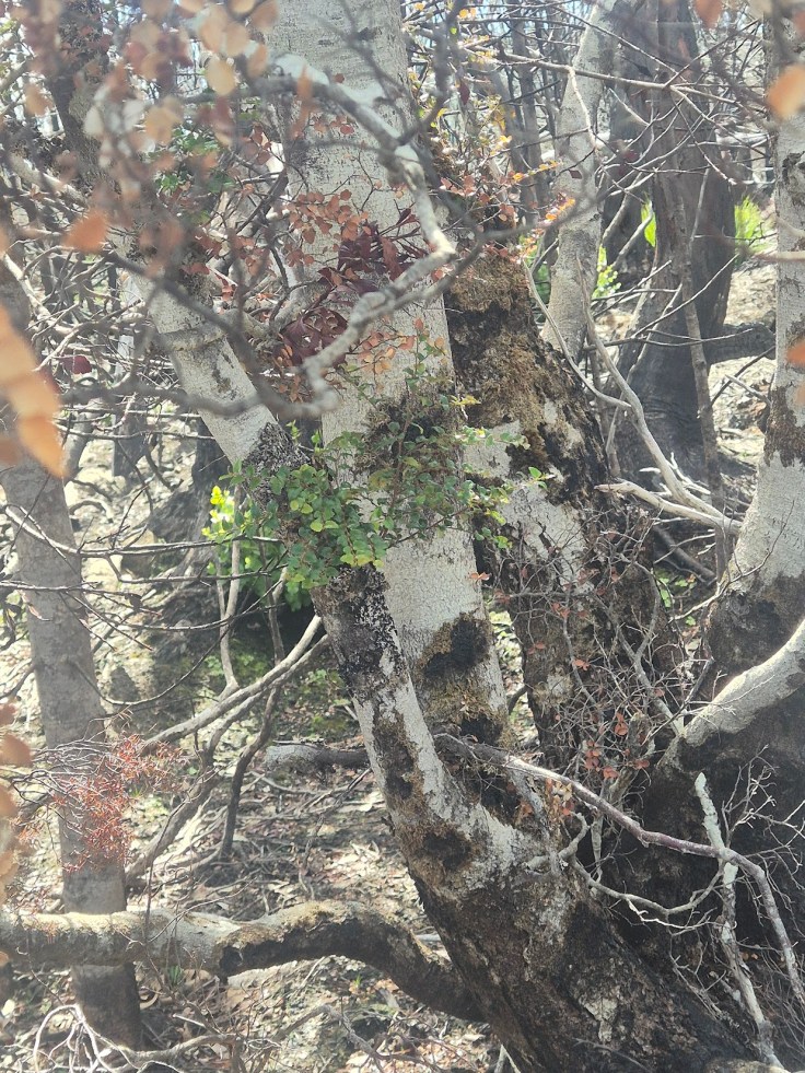
As expected, the impacts were worst amongst the old Gondwanic vegetation. We didn’t see a single Celery Top pine that had survived being burnt. The thickets of Nothofagus were badly damaged where small groves were growing but where the fire had passed into thick tall Nothofagus dominated forest things were better: it seemed that the outer trees acted as a barrier for the radiant heat, with the fire slowing as it hit the second layer of trees. This demonstrates that these old fire sensitive systems, which grow thick forests with a limited understory of flammable shrubs, act as a barrier to the spread of fire across the land. So, encouraging cool temperate rainforest – with its dense, cool environment under the canopy – will act as a natural ‘speed bump’ to any large fires burning through a landscape.
I was keen to see how burnt pencil pines were bearing up. We know that these trees are fire haters and often killed by fire. Being incredibly slow growing and quite poor at seed dispersal, a hot fire can wipe out local populations for many decades. In the zone we walked through we saw hardly any fire impacted pencil pines – although we do know that stands of trees were impacted in the 2025 fire.
The wild mountainous terrain of Cradle Mountain Lake St Clair feels like an ancient place and the mark of recent fire feels strange and jarring. But the entire region is a giant mosaic of fire hating and fire loving vegetation communities and our task as the world warms up and dries out landscapes, is to try and keep the good fire in the right zones (especially grasslands and button grass) and out of the fire sensitive communities.
The 2025 fire saw solid application of air and ground resources to contain it and a huge effort from the ground crews of remote area firefighters. A great effort from the Parks Service and the crews brought in from other states and countries avoided what could have been a much more destructive fire.


Leave a comment