Search

Mountain Journal

Environment, news, culture from the Australian Alps

Tag

bushwalking

Guided walk to Mt Wills, May 20

Last month Friends of the Earth hosted a mountain roadtrip to visit some special places in the Alps. This included a walk to Mt Wills and the areas threatened by logging.

The forests that will be cut were very impressive, older alpine ash forests.

Mt Wills itself is a magical ‘island in the sky’ of isolated snow gum woodland, largely dominated by older trees.

We had a lot of requests to host another walk, so here it is.

Public walk to Mt Wills and the proposed coupes

Saturday May 20

Continue reading “Guided walk to Mt Wills, May 20”

Alpine time in Tasmania

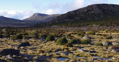
What’s not to love about lutruwita/ Tasmania? Mild climate, wild landscapes, endless mountains, remarkable forests, wonderful rivers. If you love the higher alpine country, and rocky peaks, there is so much to do, and so many places to visit.

But compared with the high country of NSW and Victoria, you generally need to do some work to get into the alpine zones. There are few easy 2WD roads to get up high, like the tourist road up kunanyi/ Mt Wellington, the road over the Central Plateau past yingina/ the Great Lake, the Ben Lomond plateau, the road to Lake Mackenzie and so on.

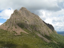
But in most places you do need to walk and climb to get to treeline and above. That’s one of the things that makes these places so special. I recently had the chance to get back to Mt Rufus, a peak in the south of the Cradle Mountain Lake St Clair national park, which has an elegant long alpine ridge that leads to incredible views of the west, south west and central mountains.

Continue reading “Alpine time in Tasmania”

A long, slow wander along the Australian Alps Walking Track

Many mountain people will know Josh Kynaston for the music he plays with his partner Evie as the duo Life Dreamers. They are regulars at many venues across the valley towns and mountains of north eastern Victoria. Joshua loves music. And walking in the hills. He has a plan to combine the two passions – doing a slow traverse of the Australian Alps Walking Track (AAWR) in late 2022, starting at the southern end. And writing new songs and maybe an album as he goes.

Continue reading “A long, slow wander along the Australian Alps Walking Track”

Is this the summer you do the AAWT?

Its walking season. And people are getting out, despite some crazy weather. A friend has just left on the Australian Alps Walking Track (AAWT). Another is about to leave. A work mate is planning to walk it in autumn.  And I am seeing many posts from people who were out on the track during recent epic snowfalls. It seems like our premier long distance trail is getting a lot of love at present.

Many of the usual issues will remain, like sections that are hard to find in the hill and valley country in the south (although in early 2023, the section of the AAWT from Mt Sunday to Low Saddle, which has been problematic for walkers for some time has now been cleared by volunteers from Bushwalking Victoria). In the northern end, the heavy rains are making it hard to do river crossings in places like the Murrumbidgee and Eucumbene rivers and Morass Creek. Fire regrowth in some areas is also making for some hard navigation. And the road from Mt Beauty to Falls Creek will be closed through summer, making support and food drops on the Bogong High Plains slightly more problematic (you can reach the High Plains via Omeo). Because of heavy rains, there are many local road closures in the mountains.

But, as always it is a great adventure.

Continue reading “Is this the summer you do the AAWT?”

Help protect the Alpine National Park from development

The Falls to Hotham Crossing is a lovely three day walk from the resort town of Falls Creek, across the Bogong High Plains, to Mt Hotham. Managed by Parks Victoria (PV), you need to book to use the designated campsites near Cope Hut and Dibbins hut. It is a hugely popular walk.

There are also plans to extend and reroute the Crossing, turning it a five day ‘serviced hiking opportunity’ in the Alpine National Park.

The Victorian National Parks Association (VNPA) opposes the commercial aspects of this proposal, and says There is already too much pressure on parks: invasive pests and weeds, increased bushfires and climate change impacts, and rapidly growing visitor numbers. That’s why they were set aside to protect nature in perpetuity. This insidious attempt to commercialise the Alpine National Park and compromise its carefully considered management plan must be stopped. But we need to work together if we’re going to protect our precious Alps.’

Continue reading “Help protect the Alpine National Park from development”

The Australian Alps Walking Track

There are many incredible long distance walking tracks crossing the mountains of the world. Some, like the Pacific Crest Trail or PCT, which goes from Mexico to the Canadian border, have a high profile and see thousands undertake (or at least start) the journey each year. After the Overland Track, our most famous long distance mountain walking track would be the Australian Alps Walking Track, or AAWT, which stands out because of the smaller numbers of people who undertake it, its relative remoteness, and the fact that long distances of poorly marked tracks can make for difficult route finding. There are not many towns along the way (only a couple of ski resorts) and food drops can be a lot of work to organise and very time consuming (in contrast, along the PCT people mail supplies to themselves in the towns the trail passes through).

Continue reading “The Australian Alps Walking Track”

Falls to Hotham Crossing: Visual Impact Assessment released

The Falls to Hotham Alpine Crossing is a popular 3 day walk across the Bogong High Plains. It has two designated campsites that you need to book. For many years the Victorian government has been pursuing the further development of the walk, with a diversion to Mt Feathertop. This would turn it into a five-day 57-kilometre walk. Many people have expressed concern that the proposal includes a commercial aspect, with four campsites with structures included as part of the plan, which would be run by a commercial operator. PV say that ‘walkers will still be able to camp in other locations along the track and complete the crossing for free if they don’t want to use the new overnight facilities’.

Community consultation was undertaken between 2016 and 2018 to create the Master Plan. Parks Victoria have just made two announcements about the project:

  • That K2LD Architects have been appointed to create designs for the project.
  • They have also released the Landscape and Visual Impact Assessment. PV say ‘This assessment is a detailed independent assessment of the visual impacts of the project on the landscape. In particular, it considers impacts of roofed accommodation’.

Continue reading “Falls to Hotham Crossing: Visual Impact Assessment released”

A solo journey through the Alps

The Australian Alps Walking Track (AAWT) is the premier long distance trail through the Australian mountains. Stretching about 680 km from Walhalla in Victoria, it passes through the Alpine National Park in Victoria, Kosciusko National Park in NSW and finally into Namadgi National Park in the ACT. Alicia Crossley recently walked it solo. This is her reflection.

Continue reading “A solo journey through the Alps”

‘Sea to Summit Forest Trail’ market research released

Activists have been campaigning for the creation of the ‘Emerald Link’ park in East Gippsland, which aims to protect the more-or-less intact ecosystems that run from the coast to the mountains. A long distance walking trail is an integral part of the proposal. The proposed Sea to Summit Forest Trail would create a network of walking tracks linking the coastal town of Bemm River and the existing Wilderness Coast walk to the summit of Mount Ellery, the highest mountain in far East Gippsland.

The Victorian government has recently released market research findings, which is part of the $1.5 million Andrews government’s investment in planning for the walk.

Continue reading “‘Sea to Summit Forest Trail’ market research released”

What’s happening with the Falls to Hotham Alpine Crossing?

The Falls to Hotham Crossing is a lovely three day walk from the resort town of Falls Creek, across the Bogong High Plains, to Mt Hotham. Managed by Parks Victoria (PV), you need to book to use the designated campsites near Cope Hut and Dibbins hut. It is a hugely popular walk.

There are also plans to extend and reroute the Crossing, turning it a five day ‘serviced hiking opportunity’ in the Alpine National Park. After the finalisation of the Master Plan for the walk, the state government allocated $2 million of funds in the 2018/19 budget. Then additional funds were allocated to continue the planning for the project, including Stage 1 of the construction.

Parks Victoria say ‘The Falls to Hotham Alpine Crossing will be one of Australia’s outstanding alpine walking experiences that captures the essence of the Australian Alps – the solitude, the seasons, the breathtaking beauty and the stories of the High Country’. However there has been sustained opposition to the proposal because it will see development of private commercial infrastructure (including small accomodation ‘pods’) within the Alpine National Park.

PV are currently focused on completing the Environmental Values Assessment. PV say that the assessment will ‘ensure potential impacts are identified and that the appropriate avoidance and mitigation measures are put in place. The planning process is aimed at reducing current and future impacts on the values of the national park’.

Continue reading “What’s happening with the Falls to Hotham Alpine Crossing?”

Finding the beauty at home

So, chances are that not many of you are heading off for a skiing, walking or climbing adventure in the northern hemisphere this summer. Luckily we have lots of amazing country on our doorstep.

It’s a great chance to get out somewhere you’ve never been or go back to that place you’ve been dreaming about for years.

If you need a bit of inspiration, check here for some links to films on backyard adventures.

Where are you heading this summer and what are your plans for 2021?

Some of my plans:

  • a long walk on the central plateau of Tasmania
  • a winter camp out on The Twins
  • a long ski in over The Bluff to Mt Howitt
  • lots of hitting the groomers at Hotham
  • maybe a winter road trip to TAS to check out Ben Lomond, Rufus and Mt Field
  • an end of season trip and camp on Mt Loch

Please feel free to share yours.

No commercial development on ‘the People’s mountain’!

The Falls to Hotham Crossing is a lovely three day walk from the resort town of Falls Creek, across the Bogong High Plains, to Mt Hotham. Managed by Parks Victoria, you need to book to use the designated campsites near Cope Hut and Dibbins hut. It is a hugely popular walk.

There are also plans to extend and reroute the Crossing, turning it a five day ‘serviced hiking opportunity’ in the Alpine National Park. In the state budget for 2018/19, there was an allocation of funds to help make the project a reality. Now additional funds have been allocated to continue the planning for the project, including Stage 1 of the construction.

The proposal has been widely criticised because it will help open up previously undeveloped areas near Mt Feathertop and allow private development within the Alpine National Park. It will see a major upgrade of the route that currently follows Diamantina Spur up to the Razorback from the West Kiewa valley.

The Falls to Hotham Alpine Crossing is part of a ‘branded portfolio’ of four long-distance walks known as ‘Walk Victoria’s Icons’ and is being strongly backed by the Victorian government. Outdoor, nature based tourism is a great thing. It’s good for individual and public health, and great for regional economies. However, private commercial development within a national park is strongly opposed by many people. 

Continue reading “No commercial development on ‘the People’s mountain’!”

Blog at WordPress.com.

Up ↑