The far north western edge of the Central Plateau feels remote even though it looks out over the farmed plains of northern Tasmania.
This is country that I had been looking at for years. From the Walls of Jerusalem or from the higher peaks in Cradle Mountain park, the far north west corner of the Central Plateau sits as a high border to the mountains, and seems wonderfully remote. Unlike a lot of the Biblical names in Central TAS, many of the names in this area are beautifully evocative: Lake Nameless, Forty Lakes Peak, Ironstone Mountain.
A big part of the appeal for me is the lack of tracks and a big mass of open sub alpine country. Finally I have got out into it, walking from Lake McKenzie to the Long Tarns, then back via Higgs Track and Lake Nameless in mid March 2013. It has been slightly updated in late March 2024.
I wondered about whether to write track notes. This is a place that doesn’t feel like it needs more people. For all its wildness, it is incredibly fragile. For a lot of the time we were walking I felt like a vandal, trying to avoid the cushion plants, and with only limited foot traffic you can still see obvious erosion in lots of places …. but it is sublime and magical country. It is part of the most extensive and continuous alpine and open sub alpine terrain in the state. Take care of the place, be mindful of waste and vegetation, and have a great walk.
This is suggested as a four day round trip from Lake McKenzie. This is one of the spots on the Plateau where you can start up high rather than having to climb up from a valley.
You really need the 1:25,000 Maps Lake McKenzie and Pillans to make this trip.
Day 1
Drive to the Lake McKenzie dam wall, off the Mersey Forestry road. Just before you reach the dam wall, you will see a dirt road on your right (no signage), turn here and you will see the obvious car park near the locked gate. There is Hydro signage, saying it is a private road, but you can walk along here.
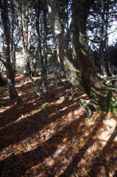
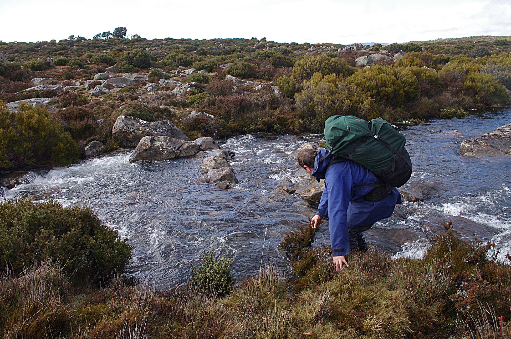
Start walking past the gate along the road, cross the obvious creek/ spillway which is formed of large rocks. Walk up the hill – you will soon see a large tea tree on your left with pink flagging tape – this is where you will emerge on day 4.
There are 2 options to start the walk to Blue Peaks.
Option 1: after the pink tagging, you will soon see a sign from a UTS reseacher and a faint pad on your left, which you follow – please see additional notes from Philip Ryan in the Comments section below.
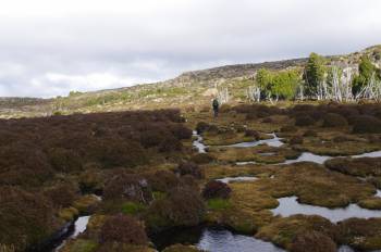
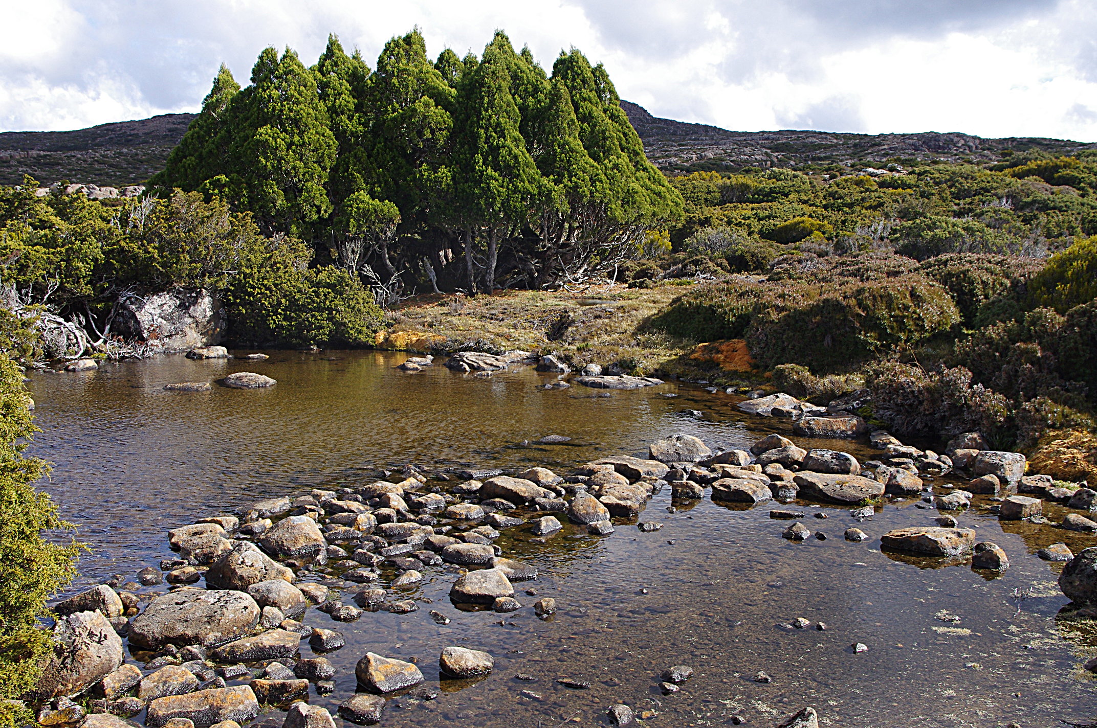
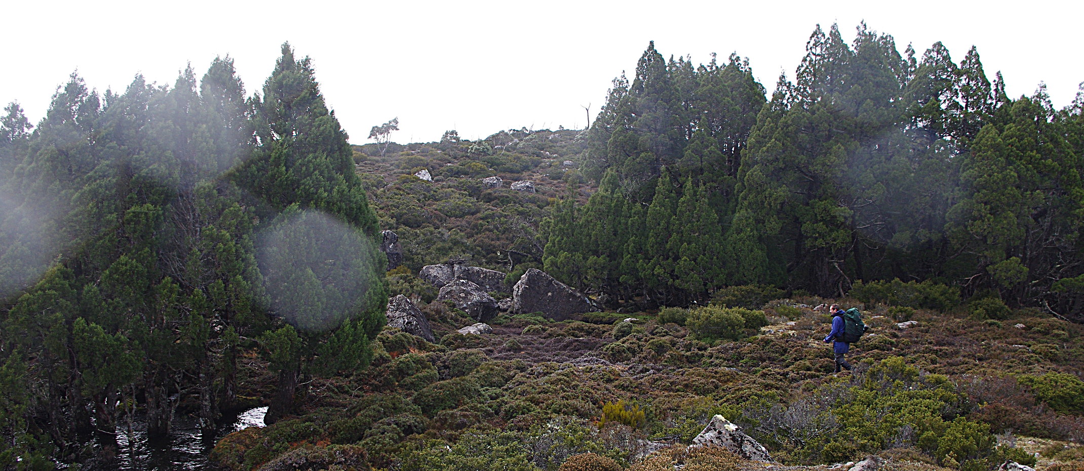
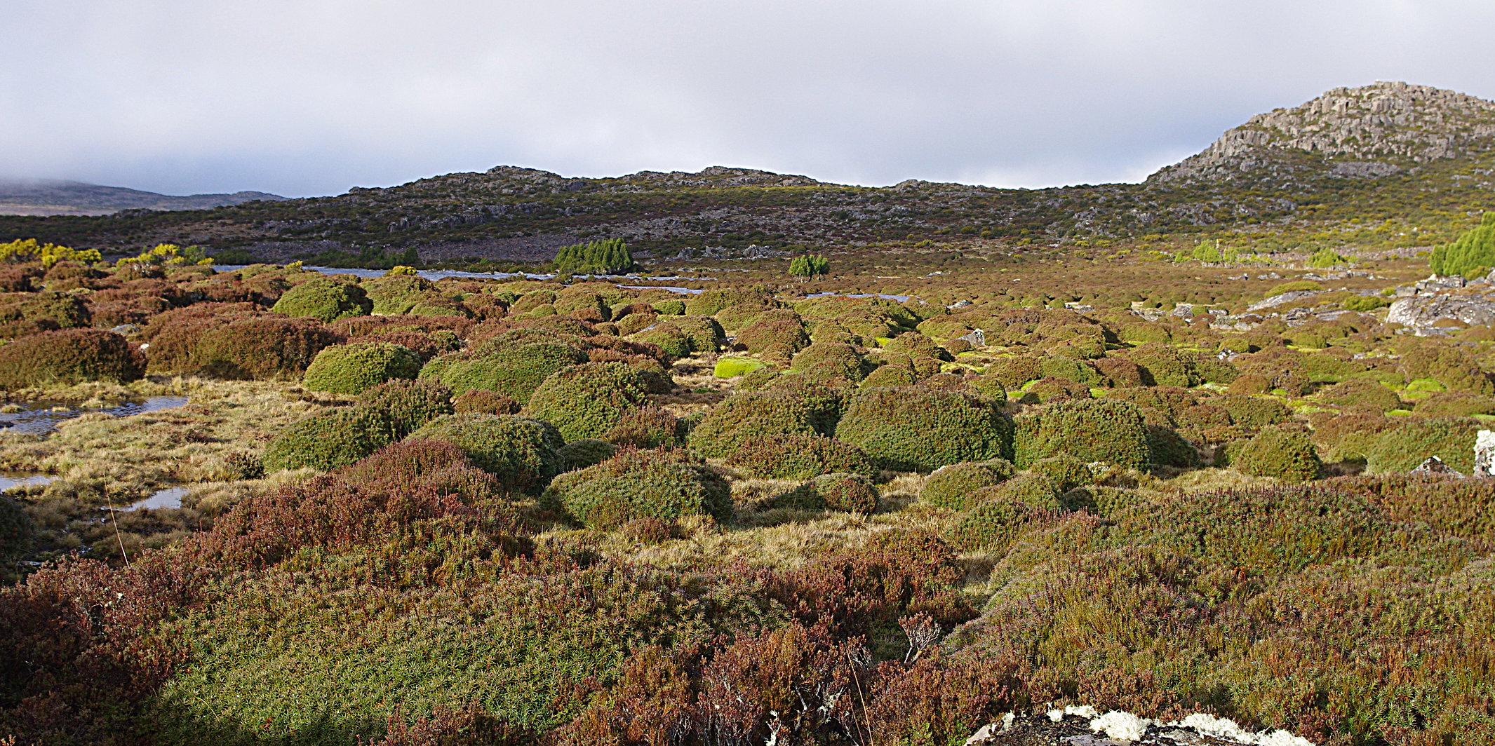
Option 2: Continue on up the hill a few hundred metres more to a small old quarry. There should be a cairn- turn left here and follow the faint track and cairns, quickly climbing out of the scrubby forest into more open terrain. This is what the next few days will be like – low shrubs, water and lakes, scattered groves of pencil pine.
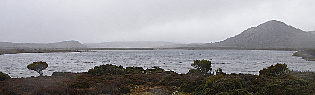
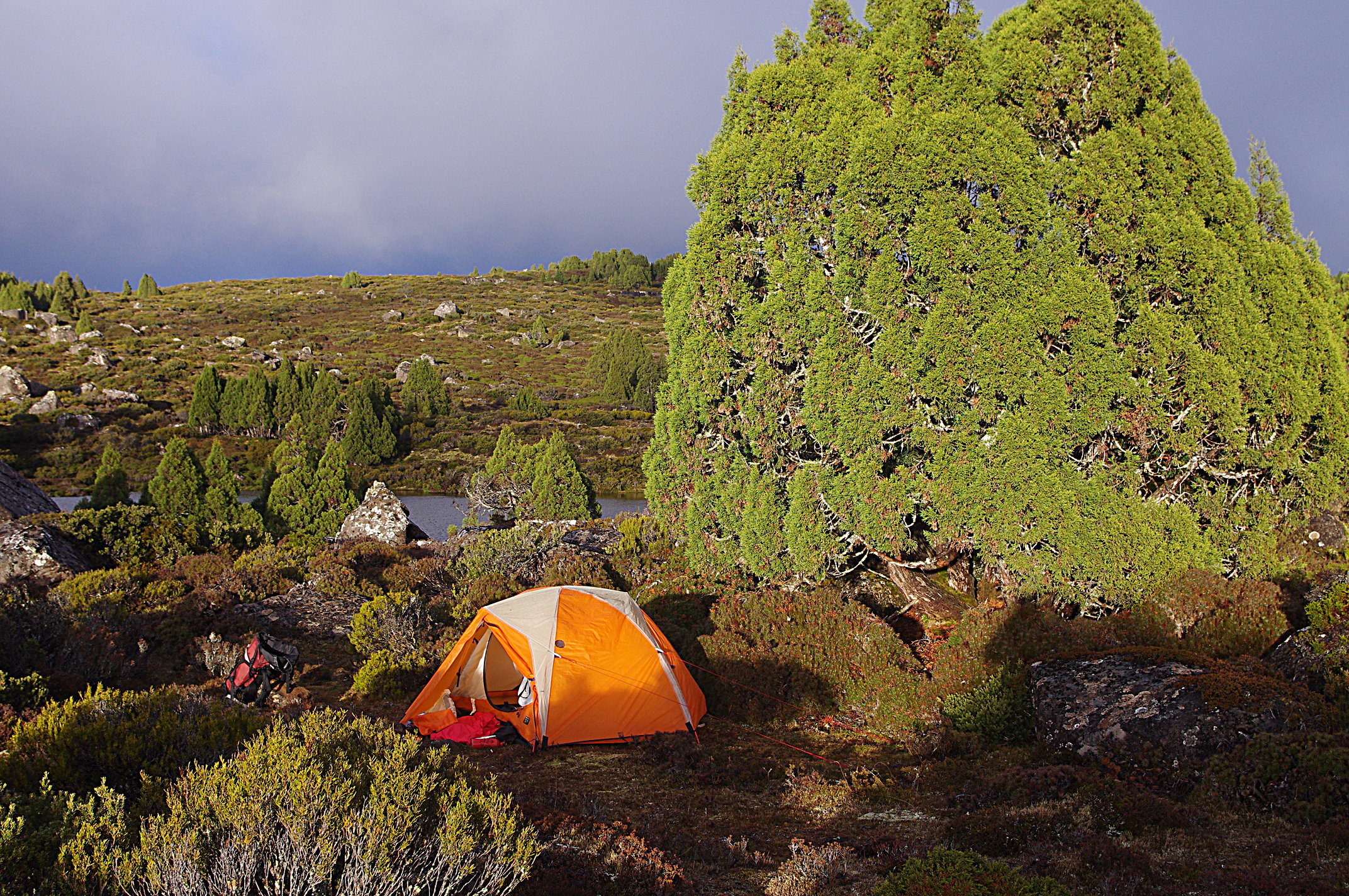
Once out of the trees, the track is easy to follow, eventually passing Blue Peaks and descending through a boulder field to Middle lake. This should take about 2 to 2.5 hours walking from the car. This area is treeless, and completely open to the weather, and there are various spots to camp, here and further along the lake. The primo spot is the first large open area you see as you reach the lake, right by the water. We had strong winds from the NW, so kept walking around the first point to get a more sheltered site, with great views of the sharp point of Little Throne.
The open valley under Blue Peaks, filled by lake and moor, made me think of the Scottish highlands.
Day 2
Continue on the faint trail around Middle Lake, and cross the outlet creek. The track more or less disappears here. Just follow your nose, stay fairly close to the lake, passing to the west of Little Throne. There is a nice fairly sheltered campsite just past this hill, up on the left.
As you leave Little Throne Lake, head towards the open saddle to the east of Turrana Heights, and veer to the right as you start to climb out of the valley. A small ravine cuts down from the saddle, we found easier walking on the right and nice rock slabs just before the saddle itself.
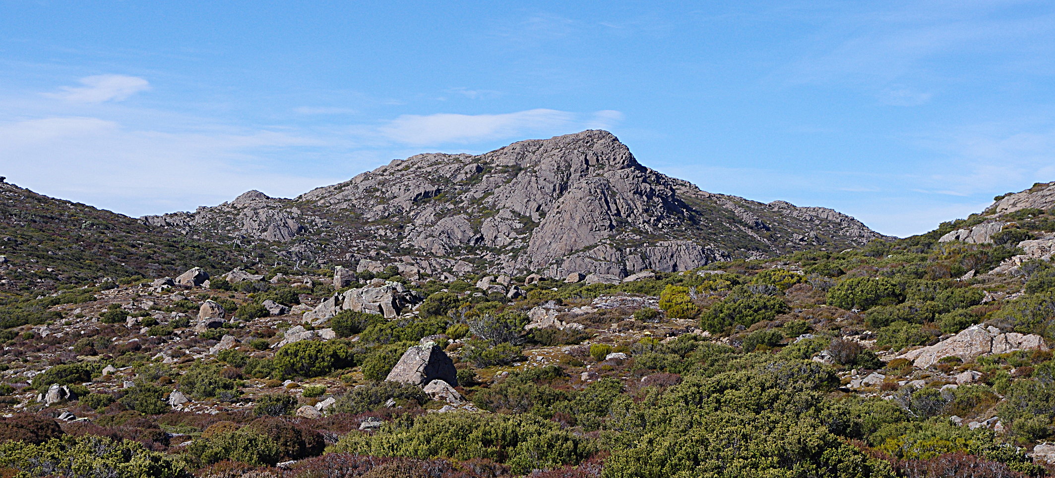
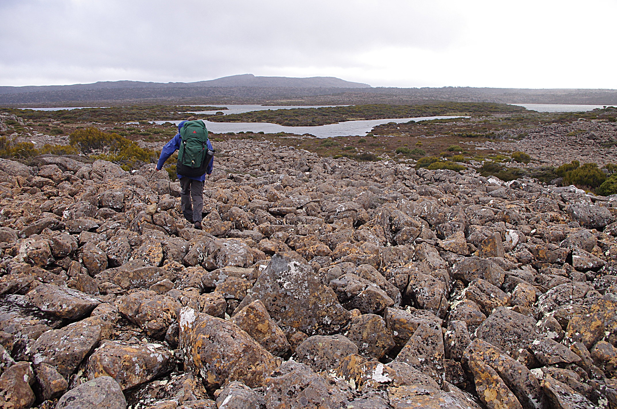
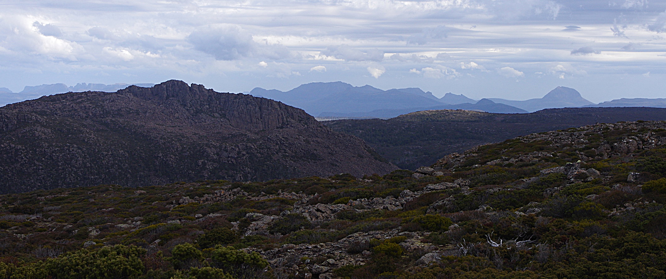
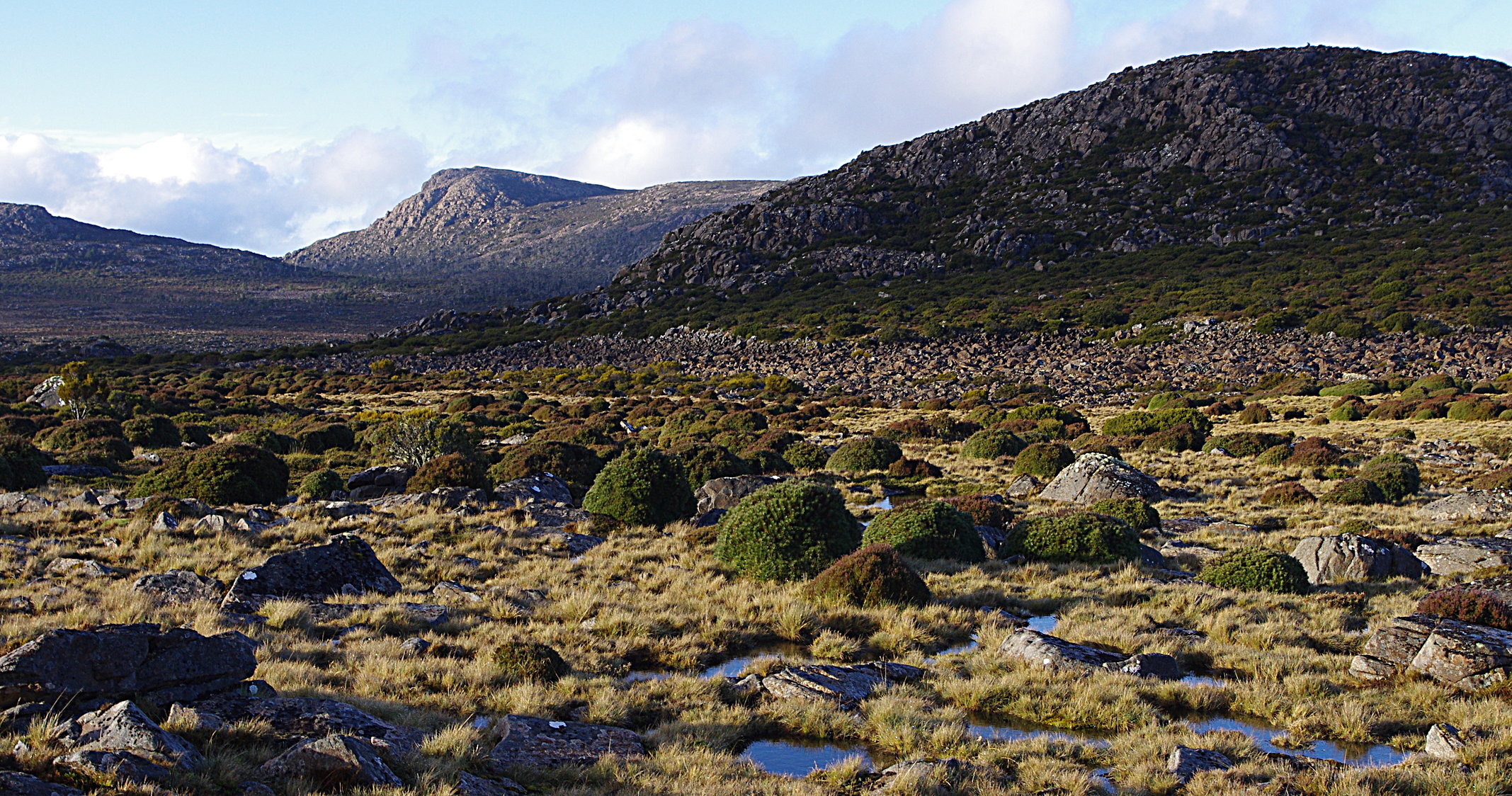
A nice rocky hill is now obvious in front of you, which would make a nice detour, simply marked with its height – 1364 – on the Pillans map (GR 498758). You can continue through the saddle and past the larger lakes beyond to come out at Higgs Track, but from the rock slabs we veered slightly right to gain the ridge line, then on to the summit of Turrana Heights. From here there are fantastic views of Mt Jerusalem and other peaks around the Walls.
This is slightly more alpine country, with delightful walking through open shrubs and grasses. Either follow the ridge that leads direct to the summit of Turrana Bluff, or walk halfway along the ridge and cut into the basin under the peak, passing stands of pencil pine and small tarns to gain the southern ridgeline of the Bluff. This avoids about 100 m of vertical climb and probably 1.5km of walking.
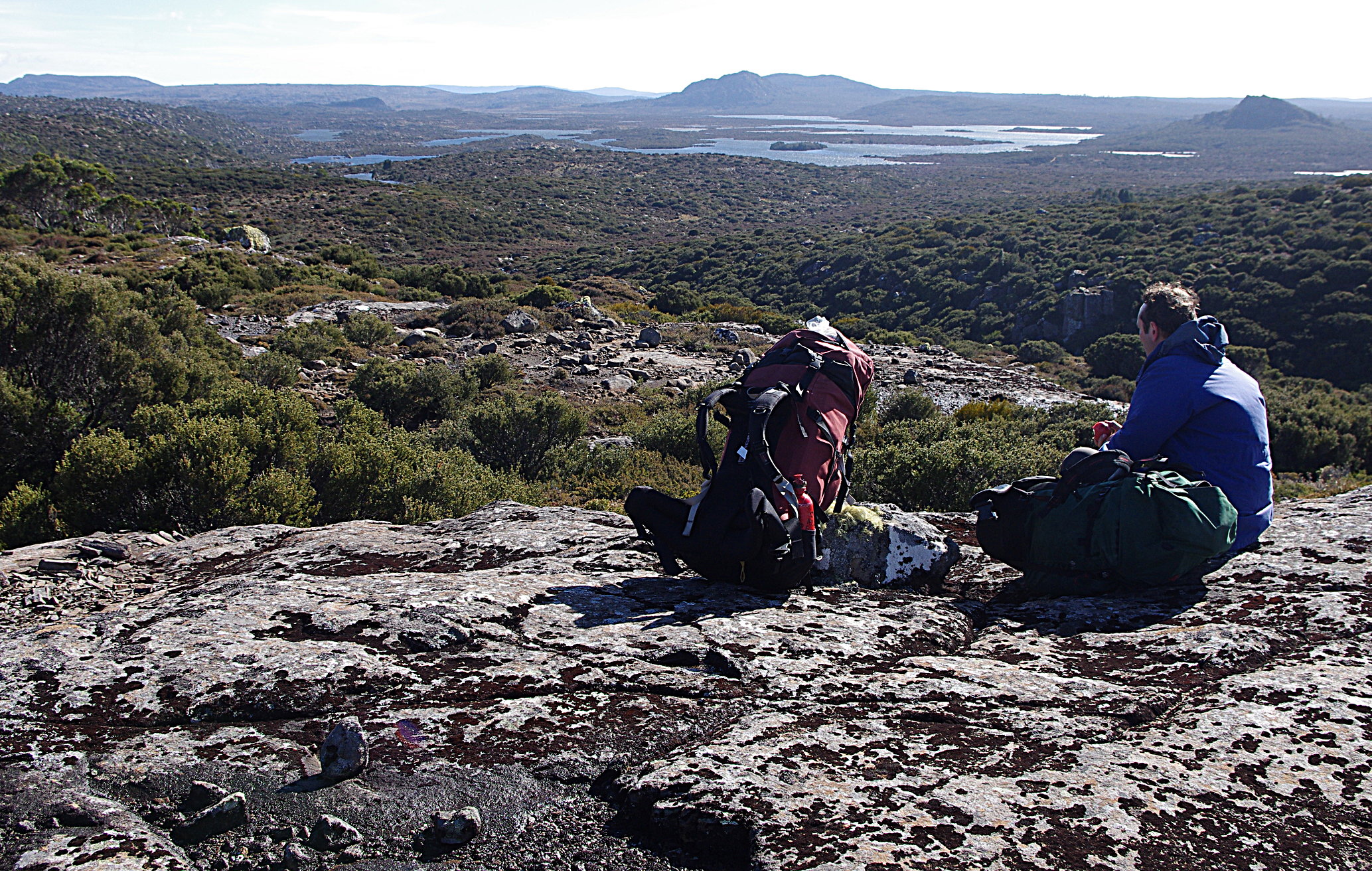
The views from Turrana Bluff are superb: not only the Walls and flat terrain of the Central Plateau but glimpses into Cradle Mtn NP: Ossa and blocky Pelion West. All the section from Middle Lake is off track. If you camped on Middle Lake, you should be able to enjoy lunch on the Heights or the Bluff.
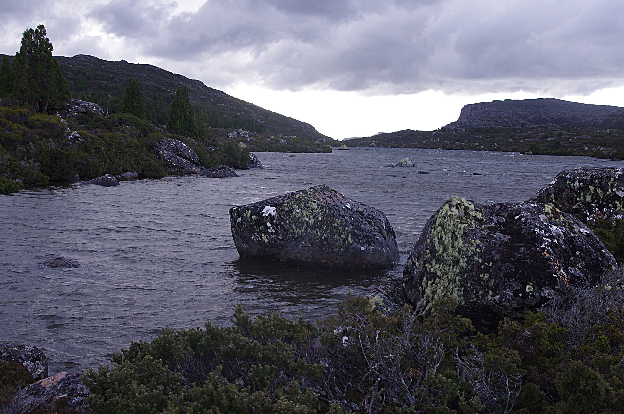
The edge of Turrana Bluff is an impressive cliff line and, beyond that, the deep impression of the Fisher Valley is below you, where a walking track comes in from the Mersey forestry road. Follow the edge of the escarpment in a southerly direction. Long Tarns are in view by now, as is the head of the Fisher valley and Mersey Crag beyond.
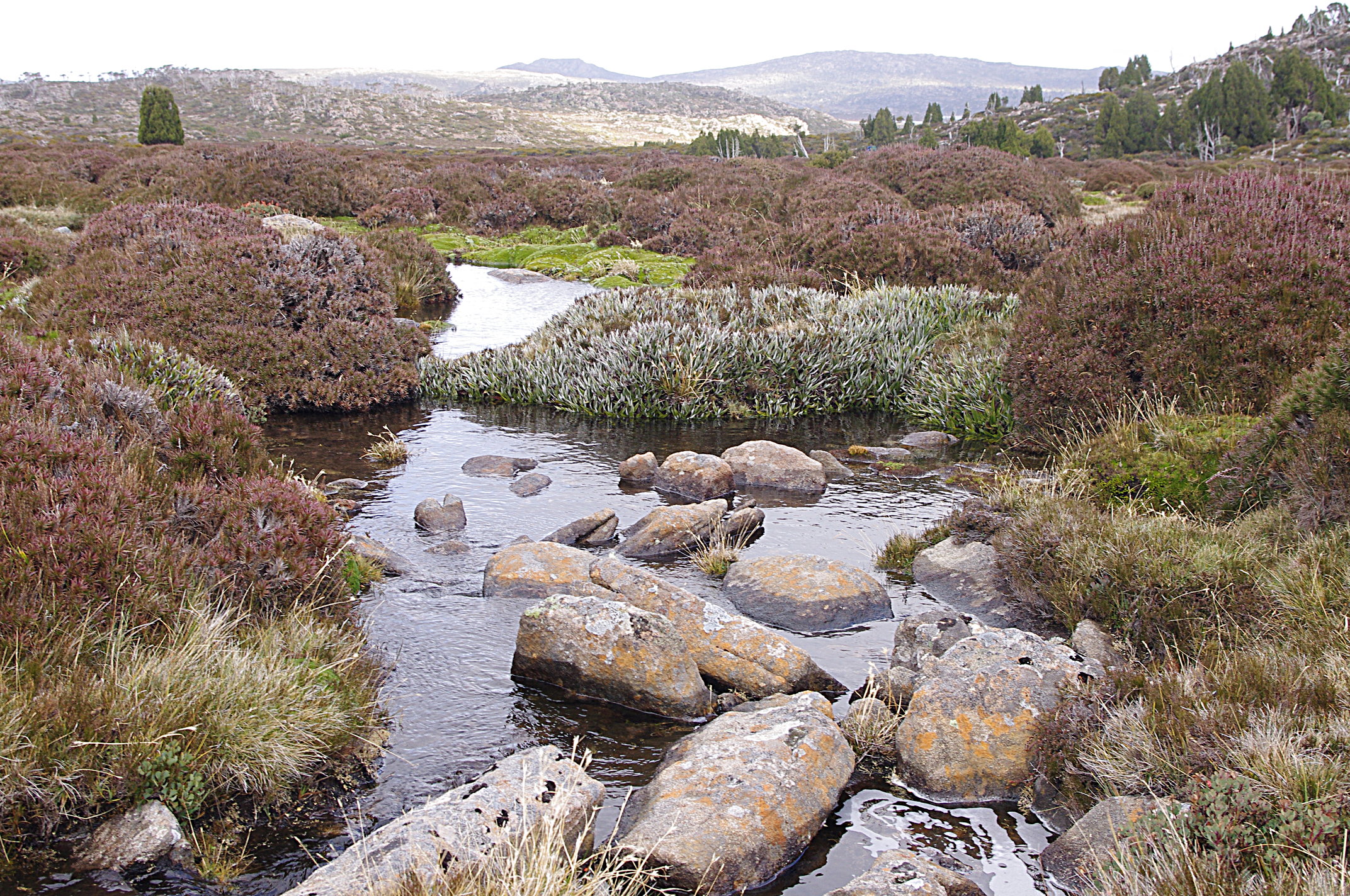
You want to follow the ridge down from Turrana Bluff, heading towards the lower hill in front of you, then skirt right – staying high and passing through some lovely stands of Pine, before emerging in the saddle where Long Tarns drain into the Fisher valley. There are a number of small open camps in the vicinity. The Fisher track is quite easy to find. Turn left, travelling along the western side of Long Tarns.
We had bad weather – high winds, rain and snow – so decided to camp early. The best spot we saw was in the Pine forest just a few hundred metres from where you start walking on the Fisher River trail, near the start of the Long Tarns, and slightly up on the right along a faint trail. A second option is to continue along until you reach the end of the first long Tarn. Turn right here towards the Pine forest and there are a few small campsites.
If the weather is good I would recommend going a bit further, at least to the end of Long Tarns, so the next day is shorter. But be aware that the pine forests end at Long Tarns and you are again in more open country.
Day 3
NB: Having a GPS would allow you to do this walk in poor visibility. We lost the Higgs ‘trail’ a few times and relied on taking bearings off hill 1364 to figure out where we were on a few occasions. Without visibility this would be a much tougher walk.
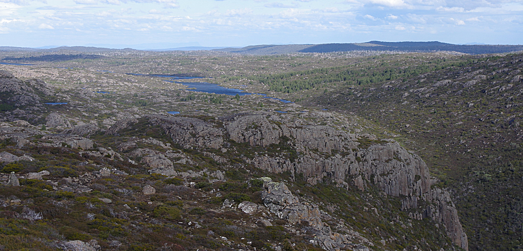
From the end of the first Long Tarn, keep going straight ahead along the narrow and obvious ‘isthmus’, crossing a stream at the end and then regaining the western shore of Long Tarn. The land beyond here tends to be more open, and harder to find sheltered camps.
As you reach the southern end of the Long Tarns, the track has turned into a pad, then a rumour… but in a few hundred metres you should hit the Higgs ‘track’. If you reach the next tarns south of Long Tarns you have gone too far.
Higgs track is mentioned in various guide books and was blazed in the early 1900s. It’s hard to imagine droving cattle through this area. I wonder if the obvious erosion in various places is a legacy of this practice.
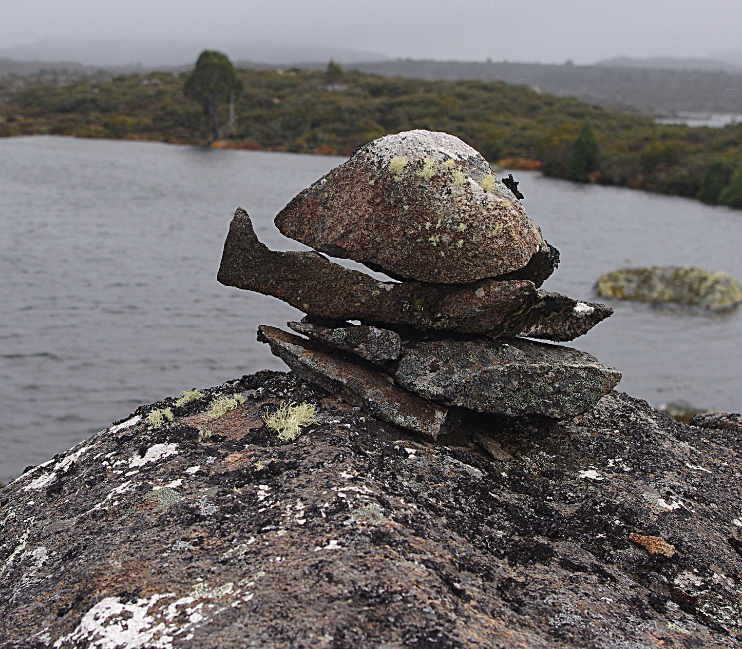
The Higgs track is marked by cairns rather than a foot pad, and the pads that exist are often braided. Many of the cairns are elaborate efforts, and covered in sheets of lichen, which at a distance can make them look like boulders rather than markers.
 We struggled to find the cairns at first and just followed ‘weaknesses’ in the vegetation (which are often animal pads) in the direction we needed to go until we spotted the cairns.
The best advice I got from the Chapman/ Siseman guide was that the track tends to avoid the larger lakes like Gwendy, Pencil Pine, etc, and sticks to the higher ground. If you keep this in mind you should be fine. Using a GPS really takes the challenge out of it. When we lost the markers, we would take a bearing off the un named hill (peak 1364), then tried to find a tarn along that bearing to identify where we were. We never got more than 2 km from the peak as we travelled around and past it.
The guide book warns about taking an obvious cairn system that heads off towards Lake Pillans, so when they turned hard right, we kept going straight ahead, following a smaller/ newer set of cairns that quickly disappeared. This may take you to one of the lakes (Gwendy?) that has pine forests and possible campsites. After losing the cairns we kept heading roughly NE, until we were blocked a tarn which we could identify and hence we knew we had to turn right to re gain the Higgs Track. The rough map guide showing Higgs track in the Chapman/ Siseman guide was very useful. It is not marked on the 1:25,000 maps.
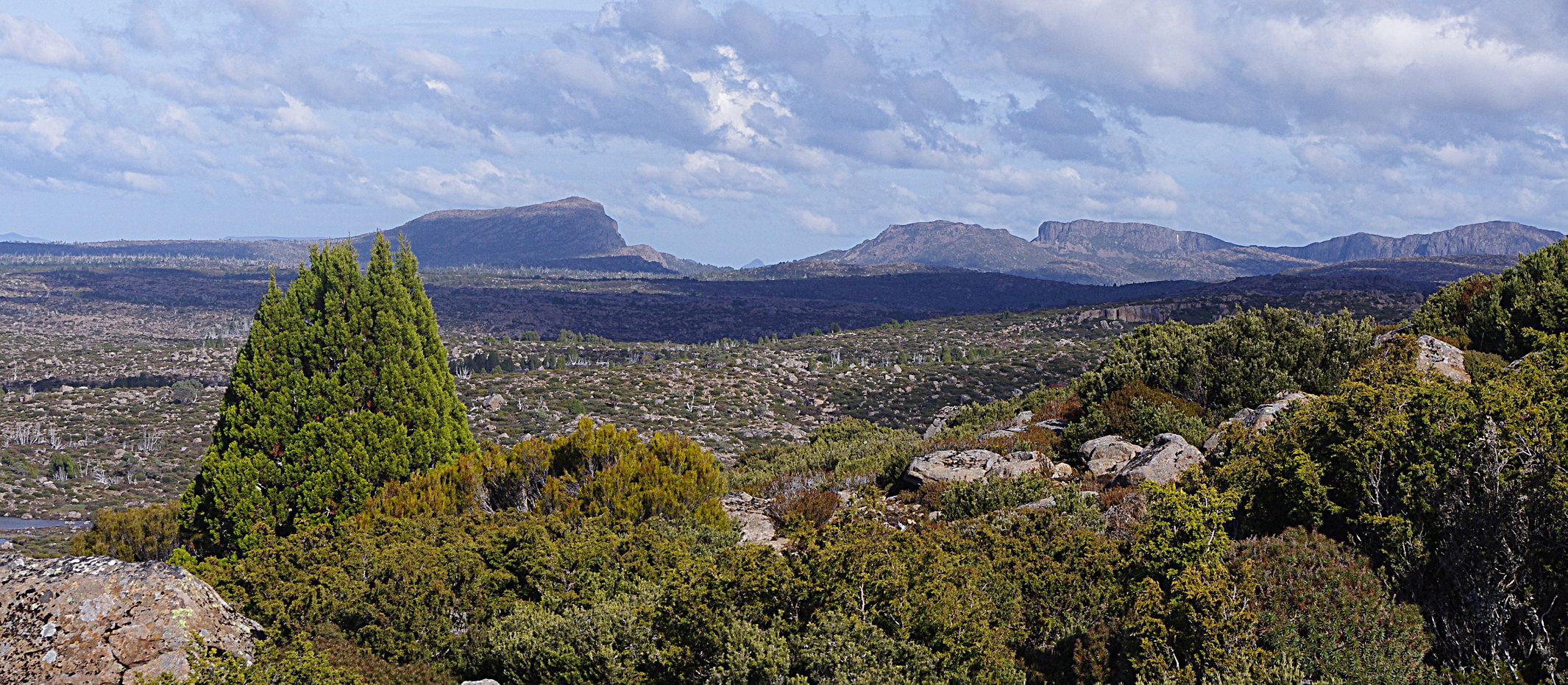
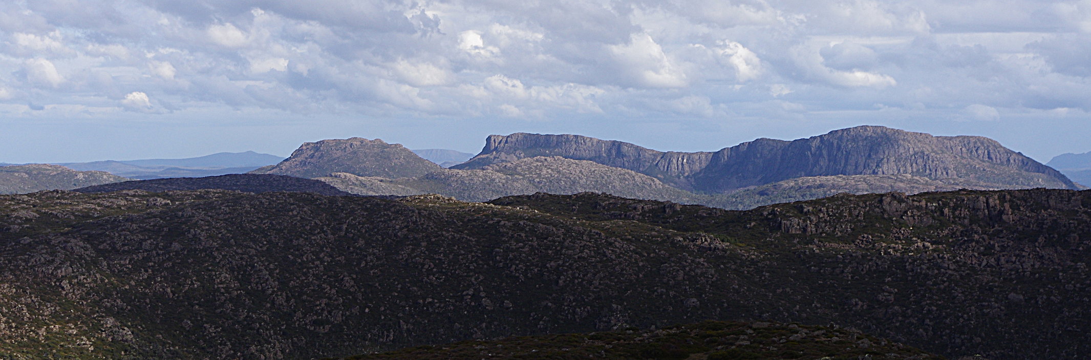
I found this next section quite well marked, with a more obvious pad, which eventually climbed to a higher ridge where there was a splendid view of Forty Lakes Peak and Ironstone Mountain. If you have time, a quick climb to the highpoint on your east would be good (marked as being 1,315m and located at GR 527768 on the Pillans map sheet).
The big valley before you has various lakes, so the trail skirts to the right and is a bit convoluted and easy to lose. But cairns generally do appear if you keep looking. As you pass the valley, climb the slopes of Forty Lakes to emerge in a delightful pass, with a scattering of tarns and Pine. It feels quite alpine again and is one of the most beautiful parts of the walk.
We lost the cairns again in the pass (I assume they veer left towards the summit). But we surmised that given it was an old droving route, it would follow the flattest/ most open option, and followed the obvious open grassy lead in front of us, under the rocky little outcrop, and towards Lake Nameless, which provides easy walking almost to the lakes edge.
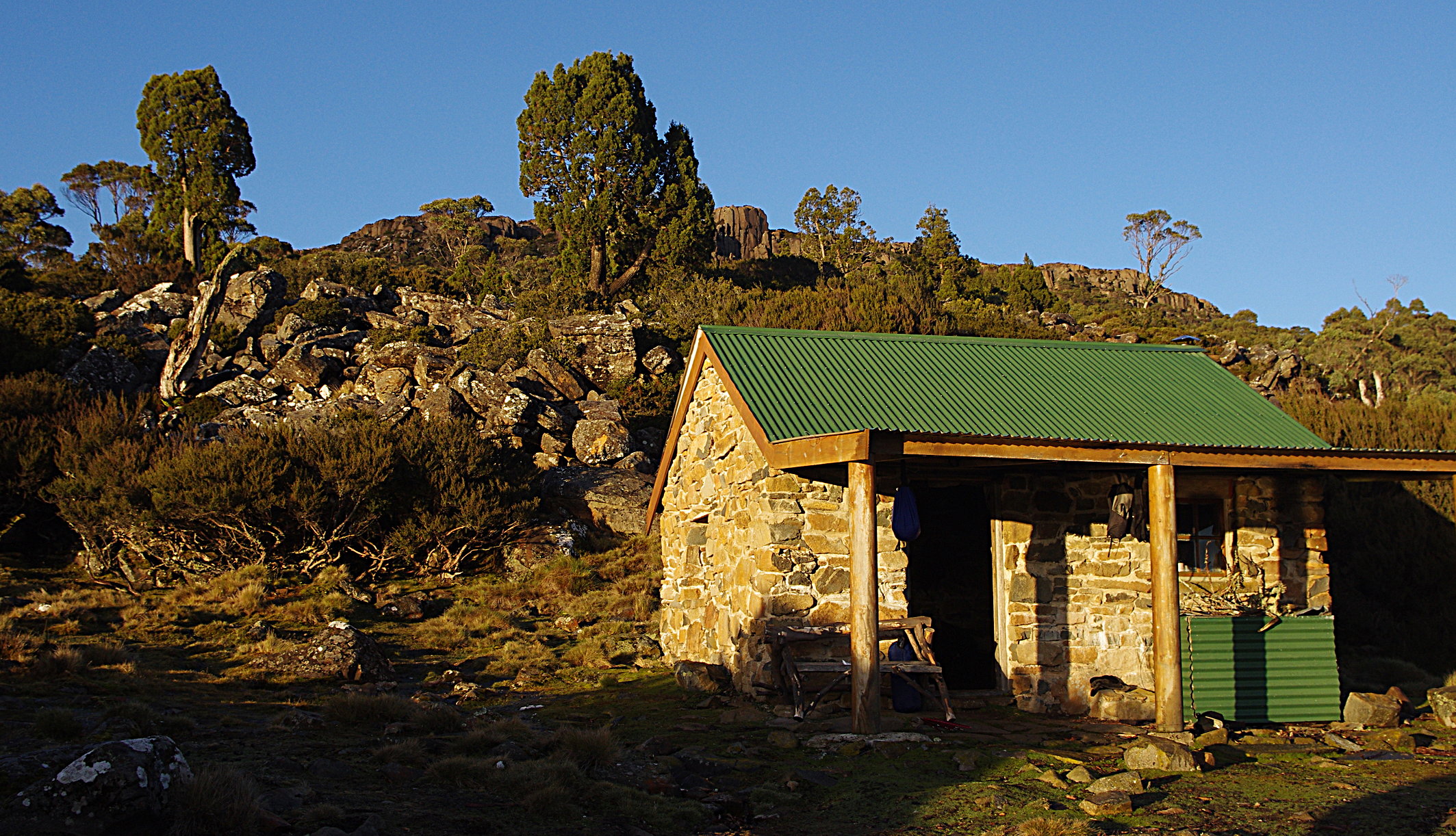
As you get almost to the lakes edge, veer left. There is a short scramble though a boulder field (explaining why the real trail doesn’t come this way) but in a few minutes you’re out into easy terrain and the Lake Nameless hut will appear slightly above you on your left. The guide says that the track comes in just behind the toilet (note that this track goes directly to the summit, and doesn’t cross to the saddle).
Lake Nameless is a small stone hut, rebuilt in 1995. It makes for a great spot to spend the night. If the hut is already occupied – this area is popular with back country fishers – there is not a lot of great camping nearby. I would suggest continuing another 20 minutes – see the notes for tomorrow.
This is a superb spot: a big lake below you, the prow of Ironstone Mountain above you, and stands of Pine and big snow gums.
As described (with a camp at Long Tarns) this is probably about 6 – 7 hours of walking.
Day 4
The beginning of the trail from the hut is fairly obvious. Follow it around to the outlet stream, cross over, then turn left shortly after (if you keep going straight ahead you end up at Lake Lucy Long). From the turnoff, the route then becomes harder to follow. Just imagine the shortest line between where the creek comes out of Lake Nameless and the lower end of Lake Explorer lake. Its mostly open country (this is where I suggest camping if the hut is full).
After you travel past Snake Lake, the track sometimes gets harder – there are a number of boulder fields – but once you start descending past Explorer Lake it is very well defined. We walked down the north side of the lake (walkers right hand side of the lake), which is the most logical way if traveling from Lake Nameless. Be aware, however that there is also a pad along the southern side of Lake Explorer which starts about half way along the lake. I don’t recommend you go that way due to the longer walking distance and potential problems finding a spot to cross the creek.
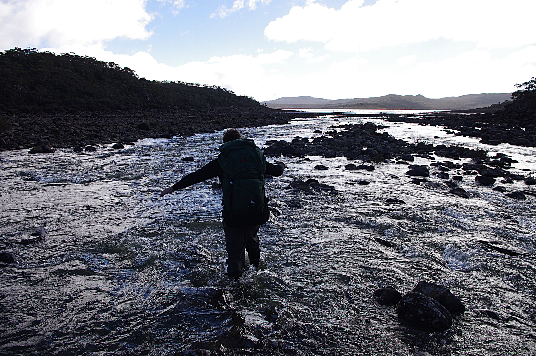
After a few more km, the Fisher River flows in from the left, and you cross Explorer Creek just below where the streams join. This could be tricky after heavy rain. If the dam water is low, go out towards the lake as the river is likely to be shallow and wide out there.
There are 2 options from here, depending on whether the dam is full or not.
Option 1: low water levels.
After crossing the river, the best bet is to walk along the left hand shoreline of Lake McKenzie and head straight out towards the obvious headland in front of you, and then climb up through the boulders to find an old 4WD trail which runs just along the tree line and takes you straight back to the dam. Cross the dam wall and follow the overflow washout back to the car park.
Option 2: full dam levels.
If it is not possible to cross the river out on the flats and then walk along the edge of the water, the second option is slightly more complex. If you follow the track until it hits the river, look carefully across the valley – you should see a snow gum on the opposite slope with pink flagging – that is where you need to go.
Go upriver a bit and find a good place to cross the river (there are 2 crossings, the second stream is smaller). Then look around until you find a pad marked with pink flagging. Follow this as it heads away from the river and climbs from the river flats onto the ridge above. It is quite obvious if you pay attention and saves a horrorshow scrub bash. As you reach the top of the ridge, it passes through a series of lovely open plains. At the top plain, there is a gap in the tape and only occassional cairns – so look around carefully – the track continues on the dam wall side of the plain (walkers right). NOTE: if you’re walking this section, take some tap and fill in the gaps!
Eventually, as you get close to the dam wall and start the descent into the valley, you will find yourself on a strange fire break type track. There is a major Y junction – go straight ahead down the hill rather than turning right. Then shortly you will see the spillway below you. At this point the best bet is to step off the fire break into the scrub, and make a straight line back to the pink taping on the tree mentioned on day one – it is a short walk across a pleasant open slope to the track, then the car park.
Some practicalities
· After heavy rain, its like the whole country leaks water, greatly reducing camping options. It also means your boots are likely to get very wet, so a change of shoes, etc, for wearing around camp is a good idea
· I have never seen so many wallabies in my life. If you have a sensitive stomach, you may want to take extra fuel to be able to boil your water, or take a filter
· This is a fuel stove only area
· The guide Cradle Mountain Lakes St Clair by John and Monica Chapman and John Siseman has useful notes on travelling in the area
· The TAS Tracks website has some additional worthwhile notes
· There is a bus service available via Adventure Seeker. A longer through walk would continue into the Walls of Jerusalem, to be picked up at the trail head on the Mersey valley forestry road


March 1, 2021 at 7:33 pm
Hey, looks like a great trip. Any chance you could share a gpx file in case the weather clags in? Tash
[hi Tash, sorry I’m a bit old school and rely on paper maps, don’t have it as a gpx file]
December 2, 2023 at 6:12 pm
That’s a fantastic write-up. Thanks. I am going to do part of this walk later in December. I wonder if you might help by being a little more specific about the route description on Day 2? You write: “…. Just follow your nose and stay fairly close to the lake (Middle Lake, I assume), passing to the west of Little Throne”. Do you mean passing to the west of Little Throne Lake (which is itself west of Little Throne (the hill)) or do you mean passing to the west of Little Throne (hill) but on the eastern shore of Little Throne Lake?
Thanks for the clarification.
cheers
Phil
FROM CAM:
hi Phil.
From memory, you stay on the east side of Middle Lake (there is a faint pad) then past Little Throne Lake staying on the east side, and under Little Throne hill (stay to the west of that). From there, the pad ends, and we stayed high as possible, but kept to the east of Turrana Hights – past a lovely tarn with pencil pines. Once you pass to the south of Turrana Heights, stay on the high ground as much as you can and head towards the northern most end of Long Tarns. Its gets scrubby and more complex as you get near the Long Tarns, so you weave your way through. Once at the north end of Long Tarns you will pick up the foot pad that follows the Little Fisher river out of the valley and heads south along the western side of Long Tarns.
Hope its a good trip.
December 2, 2023 at 10:10 pm
Thanks Cam, just the info I needed. Cheers Phil
December 31, 2023 at 12:28 pm
Just a follow up on our trip to Blue Peaks (mid-December 2023).
Unfortunately, after a few hours on the track we were beaten back by a very nasty electrical storm. I can put up with the driving rain, fog and hail but the lightning strikes were too frequent and way too close for safety so we beat a retreat. We didn’t then have time on this trip to do a re-attempt, but a couple of days later we set out on a day trip with light packs on the same route just to see the terrain: it’s very beautiful. We stopped for lunch on a rise at 55G 44824E 53817N [AGD 66] from where we could see a small bit of Middle Lake and a nice view on to Little Throne.
Just a word on finding the start of the track, which took us quite a bit of time and effort. You drive along the Lake Mackenzie Road but if you get to the actual dam wall (where the big colourful sign displays the dam statistics) then you have gone too far. Yes, there is a little dirt track off to the right here, but that is not the track you need. You need to turn right off the Lake Mackenzie road about 150 metres before you get to the dam wall. This nice wide gravel road will lead you (after just about 100m) to the small carpark and the bright yellow locked hydro gate [44844E 53854N]. There is no “fuel stove only” sign, just private property warnings from the Hydro. Beyond the gate is a new-ish crushed blue metal vehicle track. You follow this road down the hill for a few metres to cross the small boulder field that constitutes the dam overflow/outlet, then climb the hill.
You then have 2 choices to pick up the beginning of the walking track. Option 1 is about 100 metres up the hill from the gate, where a faint track veers off obliquely to the left. At present there is a University of Tasmania sign asking walkers to respect some of their research installations. This sign does not look permanent. The turn-off is at 4482E 53850N. You know you have made the correct turn because about 20 metres after the turn you meet an old concrete slab on the left. After this the track is pretty obvious, at least for a while. There are ribbons and cairns that sometimes help. Option 2 is to continue up the blue metal road for another perhaps 300 or 400 metres; on the right is a small old quarry. If you turn left opposite the quarry you will eventually find some faded old yellow ribbons and perhaps the track. (I forgot to take a GPS reading here). This track will eventually join up with the track from Option 1, but in places it is very overgrown. I think Option 1 is best.
I have 2 more tips: First, taking the track from Option 1, you will come to a vague bifurcation at about 44801E 53845N. Straight ahead leads to a world of pain and disappointment. Rather, turn sharp right (there is at least one ribbon at time of writing) to immediately meet a little stream (might just be the track in dry weather?), proceed south up the stream/track for a few metres then right to regain the track. Second, at about 44799E 53841N you meet a bit of a rock wall. Not too bad to scramble up in the dry but would be a bit sketchy in the wet with a heavy pack (especially if you were coming down it). There is an easier route circling around to the left and then right to rejoin the main track at the top of the wall.
The foregoing may help others planning to do the track. We certainly intend to return and hope the weather gods aren’t quite so nasty next time.
December 31, 2023 at 12:49 pm
oops. All my GPS coordinates are in WGS84 datum, not AGD66.
Phil