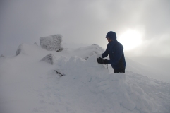
These are not track notes as such. If you have half decent map reading abilities and are good at off track travel and rock hopping (and have clear conditions) you should be fine. There are two reasonably significant lessons I learnt from my last trip to the Gould area, these are highlighted where they arise in the trip description below.
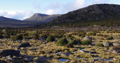
The Gould plateau feels nicely remote, even though its just a few hours walk from the ferry drop off at Narcissus hut at the head of Lake St Clair. The 1:25,000 maps show the way to Gould plateau. You travel through button grass plains, nice open euc woodland and then into wonderful old growth rainforest. Its barely a trail in many spots, and easy to miss where the trail cuts into the rainforest, in an open glade where you cross an obvious stream. From here it starts to climb and its about another hour or so until you get to the lip of the plateau, where you suddenly emerge from low scrub into the open. That last hour is hard work.

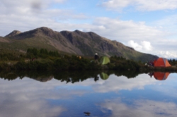
There are a whole number of incredible camp spots dotted across the many flat rock outcrops that sit between shallow alpine tarns. It can be quite exposed to the weather, however with a bit of walking (within 250 metres of where the trail comes out onto the plateau) you will find a couple of smaller and reasonably sheltered spots for a tent on the ground rather than rock. The views are great from here – Mt Olympus, Gould, the lake, Traveller Range, the Cheyne Range and that tangle of hills and ridges out west.

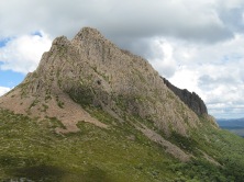
Next day you continue on the faint trail that leads directly towards the rocky face of Gould. It veers slightly to the right and enters some thick scrub. It is easy to lose it here. If so, push upwards through the belt of rainforest and scrub, finally emerging above treeline and then continue to head out right under the cliffs, following the line of least resistance. You should pick up the faint trail again once you’re above the trees and as it contours around to an obvious outcrop of conglomerate rock. You can normally get water here – in summer it may be the only spot until you get back down off the Minotaur hills. Go past and then above this rock outcrop, then head up until the Minotaur comes into view and do the nice long sidle around Mt Gould itself, crossing under the impressive face of the Minotaur (that gully system has some amazing climbing when its iced up nicely) and into the very atmospheric saddle between Gould and the Minotaur. It even has a big rock that’s like a recliner couch for a bit of a nap or some cloud or peak watching.


Then there is a short scramble up a boulder field onto the back (south side) of the Minotaur – there is fantastically exposed camping up here at the obvious spot near the pencil pines. Its all very fragile, so grab some rock platforms if you can to camp on. There is not normally water here.
A detour out to the Guardians offers a bit more of an alpine fix if you need it and have the time. You can do it as a day trip or stay up on the high exposed ridge on top. There are some tarns out there that normally provide a good supply of water.
If you stay at the ‘campsite’, continue up towards the high point of the Minotaur. Stay as high as you can, go over the top of the Minotaur and then its narrow northern prow – which has a wonderful drop off below you and beyond that a vista of the maze of lakes and rock outcrops that is the Labyrinth. The next bit can be a little bit tricky. Find the deep and very steep gully that drops into the trees from the very end of the north ridge of the Minotaur and do a controlled fall down the gully heading due north (there is usually a small cairn at the very top to mark the start of a very rough trail). At the base of the gully you will find yourself in a rocky saddle – the trail is reasonably obvious – climb over a series of ridges to eventually pop out on the trail that climbs out of Pine Valley and leads into the Labyrinth. From here, if you turn right, you will be back at Pine Valley hut in about 90 minutes and from there its a 3 hour walk back to Narcissus.


On this trip we were heading on towards the nice high country of the Ducane Range but as we were crossing over past Lake Elysia we had a serious lightening storm so we did some power walking until we could hunker down as best we could in the old growth pencil pine forest at the Pool of Memories. Then we had about 12 hours of torrential rain and more weather that was threatening to do the same. So we bailed, opting for the cosy big city lights of Pine Valley hut instead of a camp on the Ducane range. As we walked out it cleared as we crossed the low divide near Lake Elysia and it kept lifting and so we were treated to great views of the terrain we had spent a few days crossing – the sharp profile of the Minotaur and Mt Gould.

 Back amongst the hordes on the feeder track to the Overland I enjoyed the many languages, dress sense and camaraderie that comes with this famous walk. One more ferry ride and the obligatory greasy food and beers at Cynthia Bay, the clouds trailing over the lake and surrounding peaks, always a hard place to leave


Leave a comment