The devastation of Black Summer lingers in the back of everyone’s mind who knows the high country. Each year we wait to see what fires will happen, and how quickly those fires will be contained. It has been a number of years since we have had a truly awful fire season in the mountains of the mainland high country. 2025/26 has seen large and very destructive fires across much of Victoria, with Harcourt, Longwood, the Otways and Walwa probably the best known.
It has also been a summer of significant activity in the high country. This is a quick look at some of the key fires in Victoria, up until mid February. Lets hope the fire season starts to slow down from here.
As Victoria braced for the potential of catastrophic fire conditions on Friday January 9, 2026, much of the attention of media and community was understandably on the fires that were already threatening towns, farms and other human assets, especially the big fires around Walwa and Longwood.
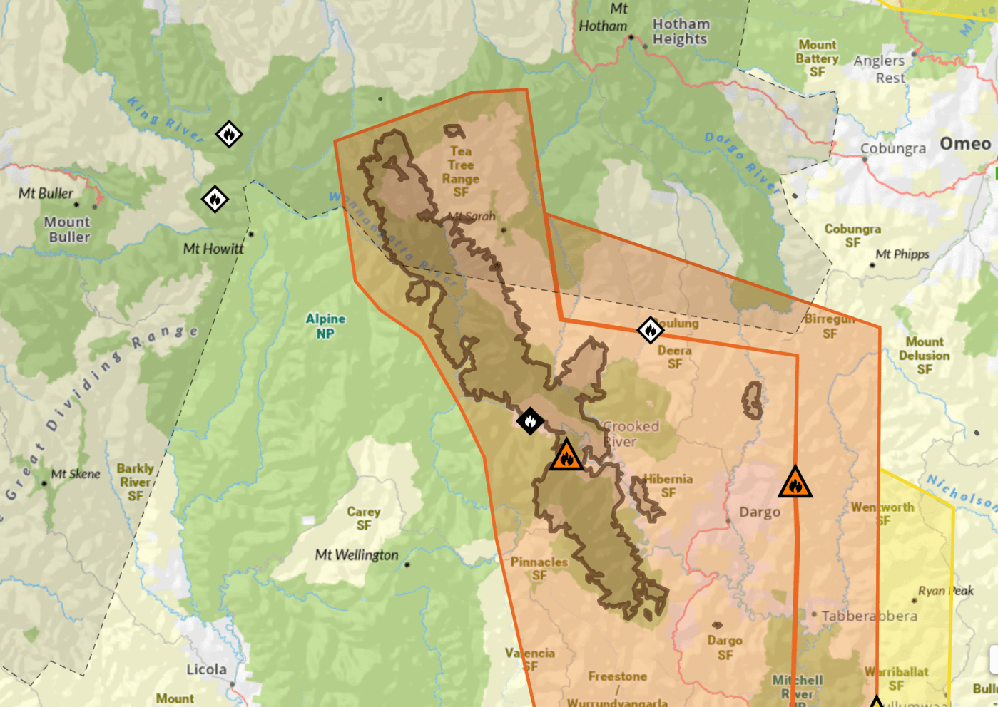
Meanwhile, multiple fires were starting due to lightning in the high country. Some, such as near Mt Howitt and on the Bogong High Plains, were contained fairly quickly. However, one has gone on to burn a significant section of the high country. The Dargo – Wonnangatta Complex (also marked as the Mt Darling – Cynthia Range fire) is not yet under control. A Complex is named where there are multiple fires in close proximity, which can then be managed by a single incident team.
We know that climate change is driving hotter and drier summers, and making fire seasons worse, and this is already impacting on mountain environments. Last summer there were significant fires across eastern Victoria and the Victorian Mountains, as well as in Tasmania. While the largest one burned in the Bunyip state park about 65km east of Melbourne, there were also fires which closed the Southern Alps and Foothills areas of the Alpine National Park, especially around Dargo and Licola.
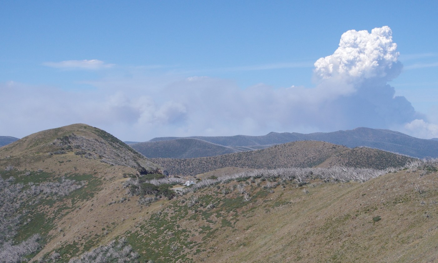
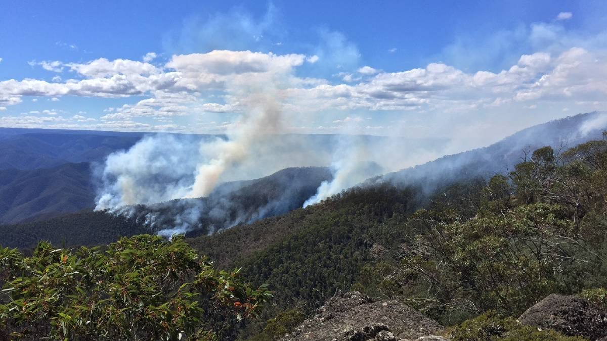
One of the features of these fires was the formation of pyrocumulus clouds (as shown in the image above, taken from the north of the fire burning out of the Dargo River and onto the Dargo High Plains, with Mt Blowhard in the foreground). The Licola fire burnt with such ferocity it was visible on the Bureau of Meteorology’s radar. A huge thundercloud formed from the fire, which then produced more than 1,200 lightning strikes, some of which sparked new fires. It created unpredictable weather conditions that hampered fire fighting efforts.
It’s been a hard summer for fires, both in Tasmania and the mainland mountains. In Victoria, more than 100,000 hectares were burnt in the high country, making it another season of ‘mega fire’ (these large fires are growing in frequency under the influence of climate change).
Here’s a quick look at the major areas that were burnt:
Most fires in the mountains (so far) have been in the foothills (see news item below from The Gippsland Times) or East Gippsland. However the CFA is now reporting fire activity in various locations in the high country.
There is a fire roughly 20km NNE of Benambra Township and the high ridge country near Mt Matlock. Check the CFA site for details.
As of friday morning, Jan 17, the CFA is reporting that
Firefighters are responding to a fire in the TAMBORITHA-CAREY RIVER area 15kms NE of Licola.
UPDATE ON TAMBORITHA FIRE, Jan 22
Fire is still going, now 150 ha in size, and the regions identified below are still closed.
UPDATE JAN 19
The fire is currently 120 hectares in size.
The Lake Tarli Karng walking track network is closed. Visitors should also stay away from tracks north of the Avon Wilderness area and the Mount Wellington to Millers Hut 4WD area.
JAN 17 NOTE ON TAMBORITHA FIRE:
Campers and walkers in the Carey River catchment, north of the Avon Wilderness Park, the Lake Tarli Karng track network and the Mount Wellington to Millers Hut 4WD area are advised to leave and all visitors should stay away from these areas.
Ground crews will be checking for vehicles and walkers, with air support if necessary.
Additionally, there is advice for Ensay, Omeo, Swifts Creek, Benambra:
Firefighters are responding to a fire in the 33 KM NE SWIFTS CREEK area in the vicinity of Brumby Rock.
There is currently no threat to communities, but you should continue to stay informed and monitor conditions.
Fire crews battle High Country lightning blazes
FIRE conditions are predicted to significantly worsen on Friday with Severe Fire Danger Ratings forecast across Gippsland.
For Sale a top temperature of 41 degrees has been forecast for Friday with a light shower of two and the chance of a thunderstorm from the early afternoon.
Work by DEPI, Parks Victoria and CFA fire fighters on Wednesday prevented the spread of many fires across Gippsland.
A band of lightning crossed parts of central and east Gippsland and sparked many small fires.
The majority of these fires have been in the area north of Briagolong and the area north of Bruthen.
Firefighting aircraft and dozers were dispatched to support firefighters on the ground.
Gippsland regional fire controller Bryan Russell commended fire crews for their speedy work in very hot and uncomfortable conditions.
As the Gippsland Times went to press crews were fighting fires at Briagolong, Dargo, Treasures, Waterford, Castleburn, Cobbannah.
In the east fires were also burning.
An all clear advice had been issued for fires at Mossiface, Bruthen and Wiseleigh.
'keep it cool. Stop climate change'. Dinner Plain, June 2011
Ben Laycock is a “painter and occasional sculptor” from Castlemaine in Central Victoria. His wonderfully vivid paintings are his interpretation of the essence of the landscapes he visits and works in. He is turning his hand to writing and we will feature some of his work on the site in coming months.
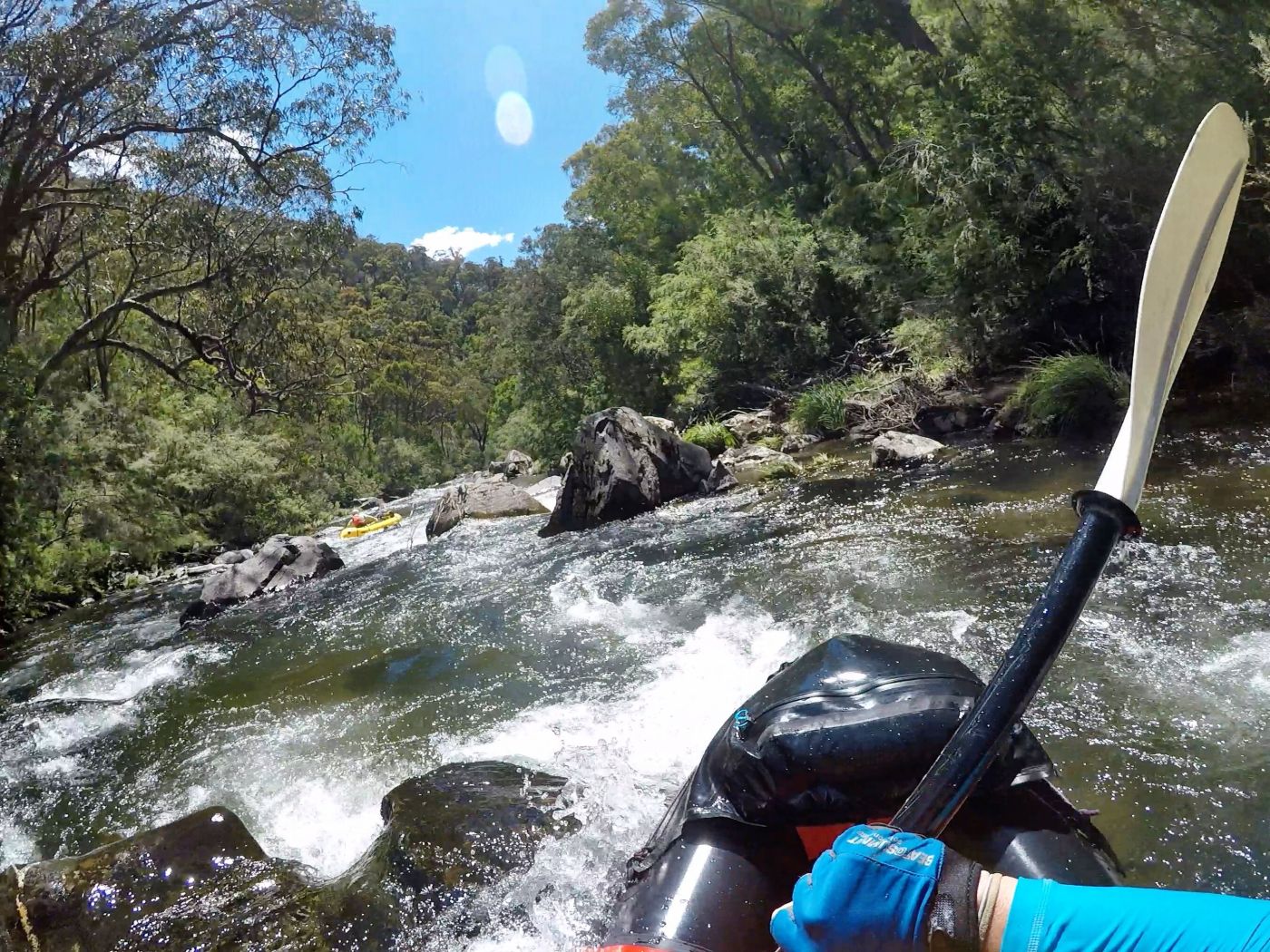
His first installment, ‘greetings from the Wonnangatta’, is now on the site. It involves reflections from a week picking walnuts on the Wonnangatta River near Dargo.


Recent Comments