I don’t know any Indigenous stories about Mt Geryon, in the southern end of Tasmania’s Cradle Mountain Lake St Clair National Park. But I do often wonder what it must have been like for the people’s who lived and passed through the incredible mountain country of central western Tasmania. To approach this mountain up Pine Valley and finally to reach the small clearing (the old ‘climbers camp’) where the bulky western face suddenly reveals itself is always an impressive, and to me, spiritual, experience. I wonder if they climbed this peak.

So many of the features of this region have been loaded down with Biblical titles or names from the Greek Classics, something that irks me whenever I scan the map or skyline. There are some great names: I love Innes High Rocky in the south west. And closer to Geryon, there is Fury Gorge, Pencil Pine Bluff, Cathedral Mountain, High Dome, Walled Mountain, The Never Never, and the beautifully appropriate Pool of Memories. These names evoke something of the place. Peaks named after early explorers also make sense. But just reeling off a list of names from western mythology seems lazy and disrespectful. But I can live with Geryon. The three-bodied giant of Greek Mythology.
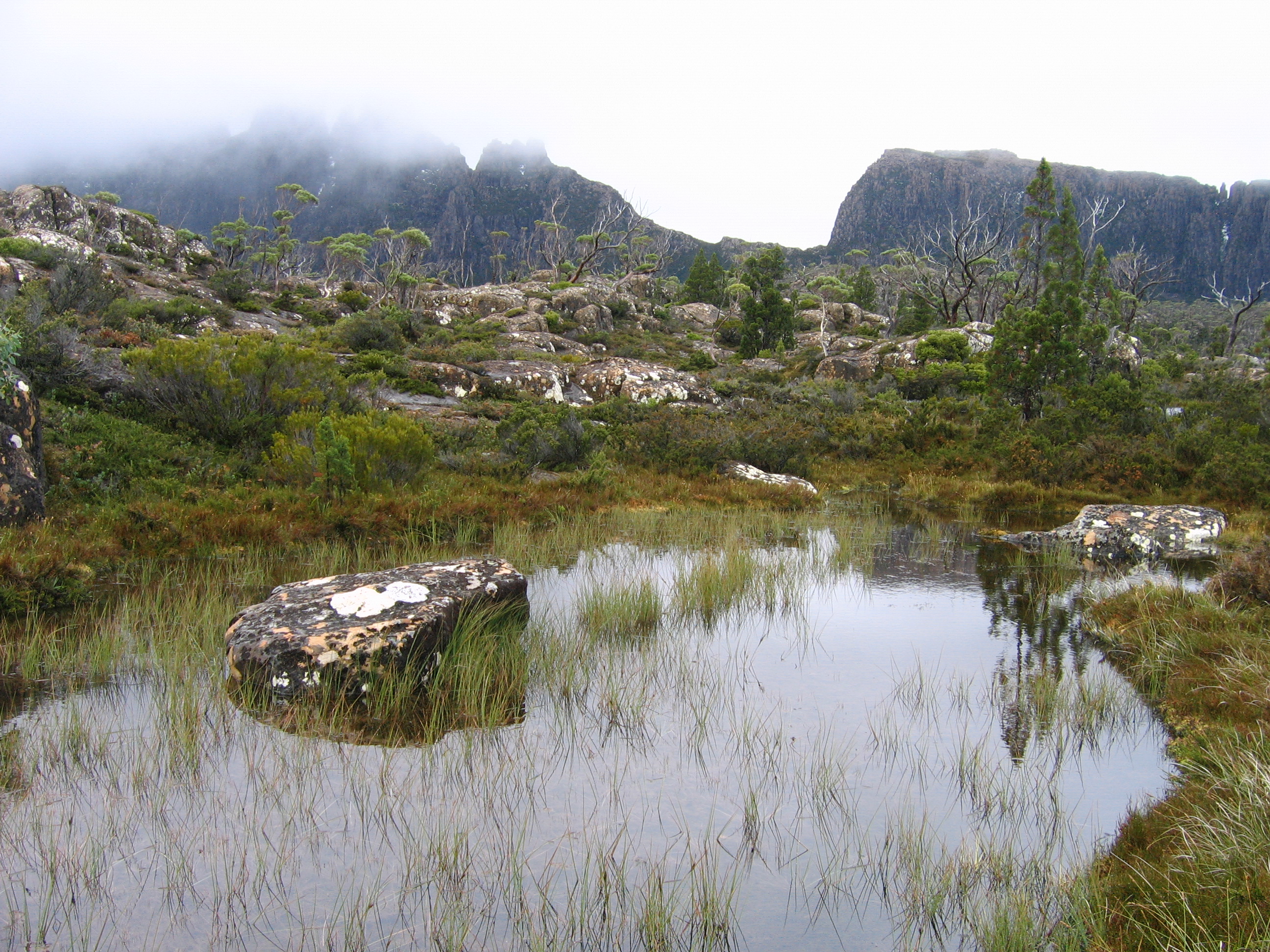
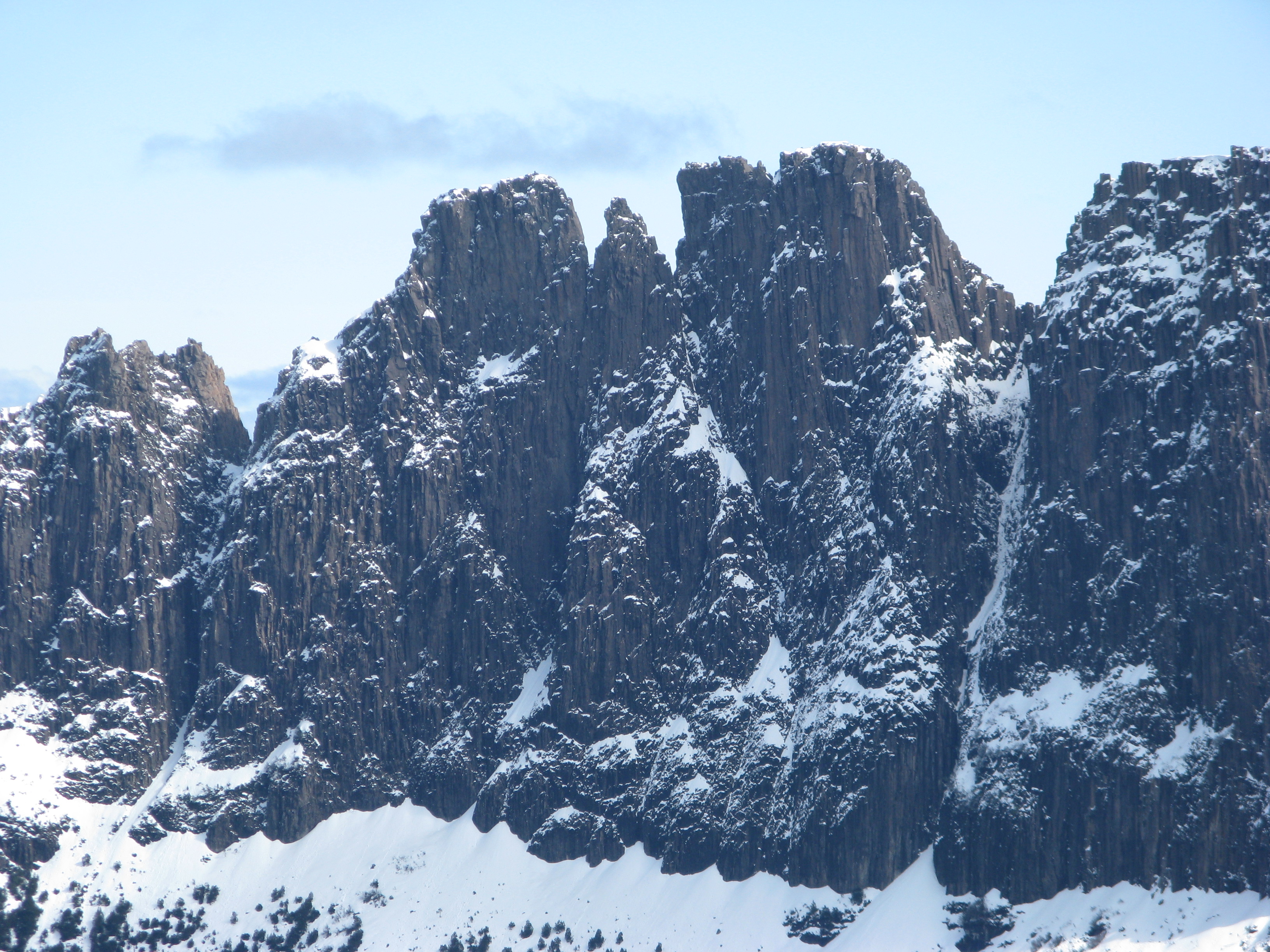
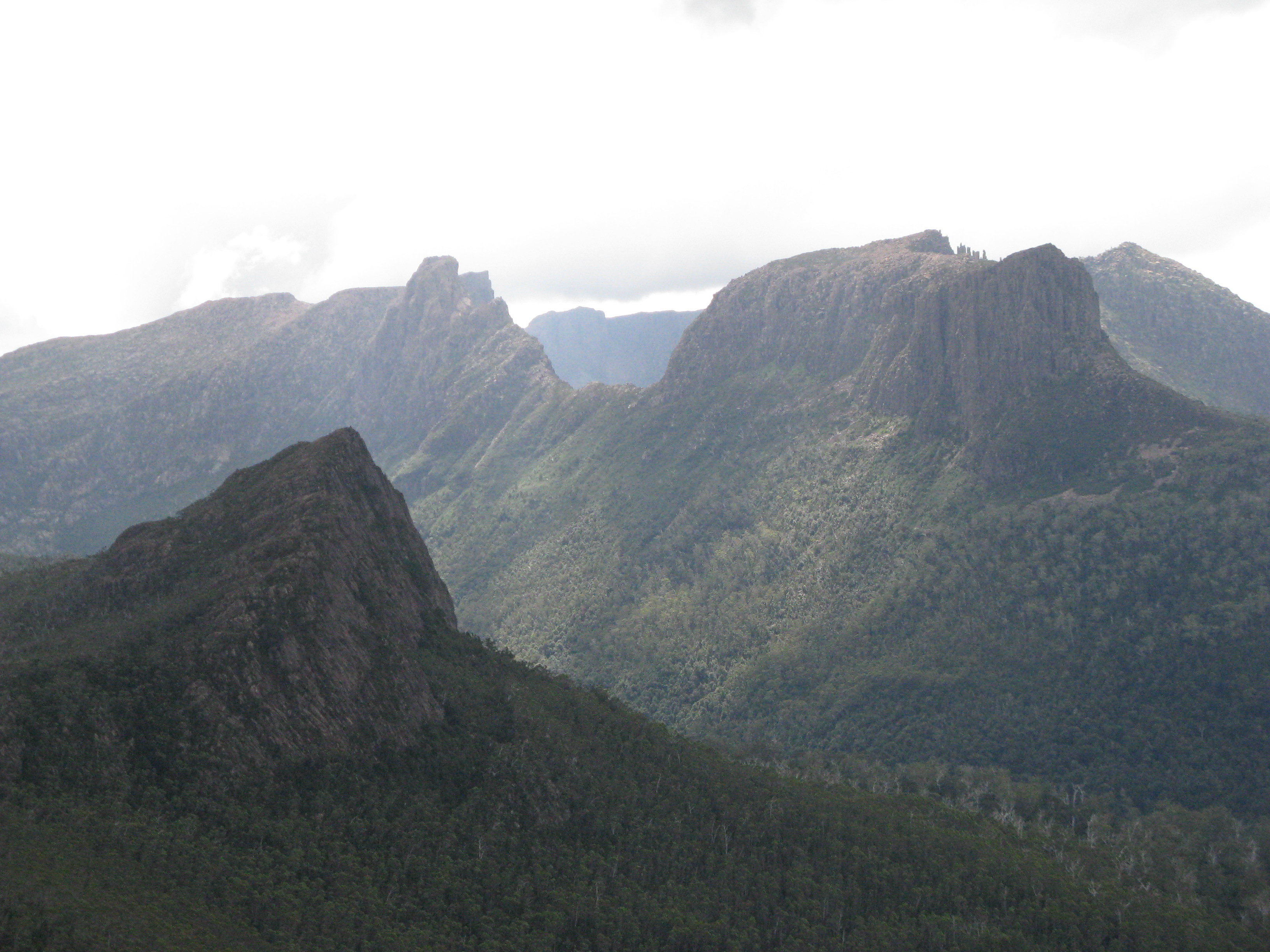
It is such a dramatic mountain, squeezed up the end of Pine Valley up against the Ducane range, and hidden in behind the bulkier looking Acropolis when seen from lake St Clair. It provides a dramatic and other worldly aspect to dinner when you’re sitting in Bert Nichols hut on the Overland track. If the word charismatic can be applied to a mountain, then it certainly applies to Geryon. Its dramatic rocky faces on the east and west constantly change their moods and even from The Labyrinth it presents itself as a ‘real’ mountain, with another thousand feet of cliffs and dramatic skyline above the Labyrinth plateau. It can be mild in The Labyrinth and storming up on Geryon and the Ducane Range. The Cephessis scree, which runs from the base of the western face down almost to Cephissus Creek, is an amazing feature, and acts as a giant staircase that leads you right to the cliffs.
Climbing the mountain
Unlike a lot of the rockier mountains in Tasmania with large faces, there is no easy way around the ‘back’ of the mountain. The easiest route, and the only one with a proper trail, is to the northern peak. Its still quite a hike, requiring a 6 to 7 hours walk from the ferry at Narcissus hut on Lake St Clair. The first recorded ascent wasn’t until 1937, when Hugh Gordon and David W Wilson from the Hobart Walking Club climbed this end of the range.
For those who don’t mind the walk in, it has some incredible rock climbing. The east face is by far the more serious prospect, and the premier climb would have to be the Shield, a 450m route at grade 24 which was established by Steve Monks and Jane Wilkinson. There are at least 70 routes recorded, ranging from some moderate classics to out there desperates on the east face.
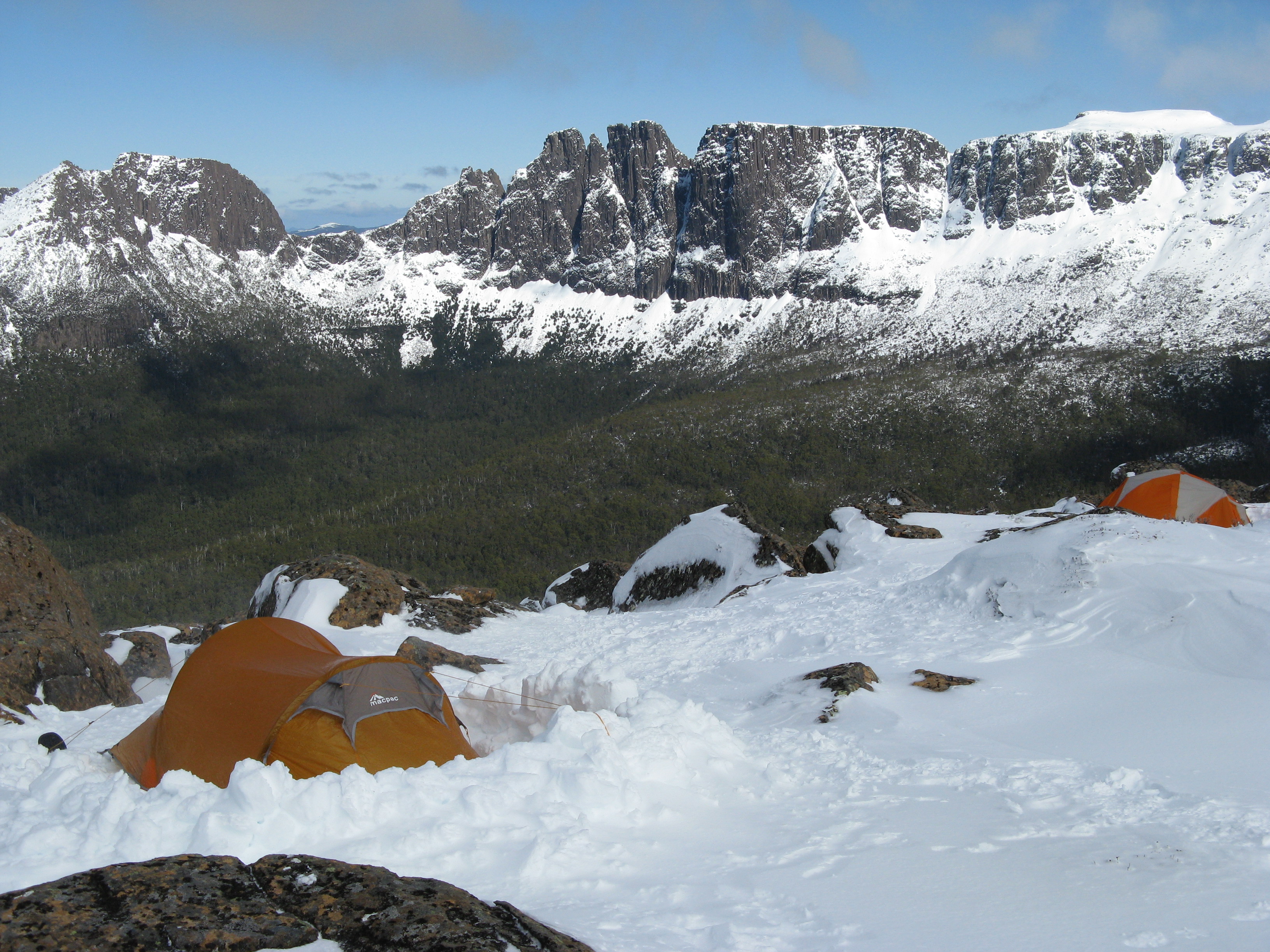
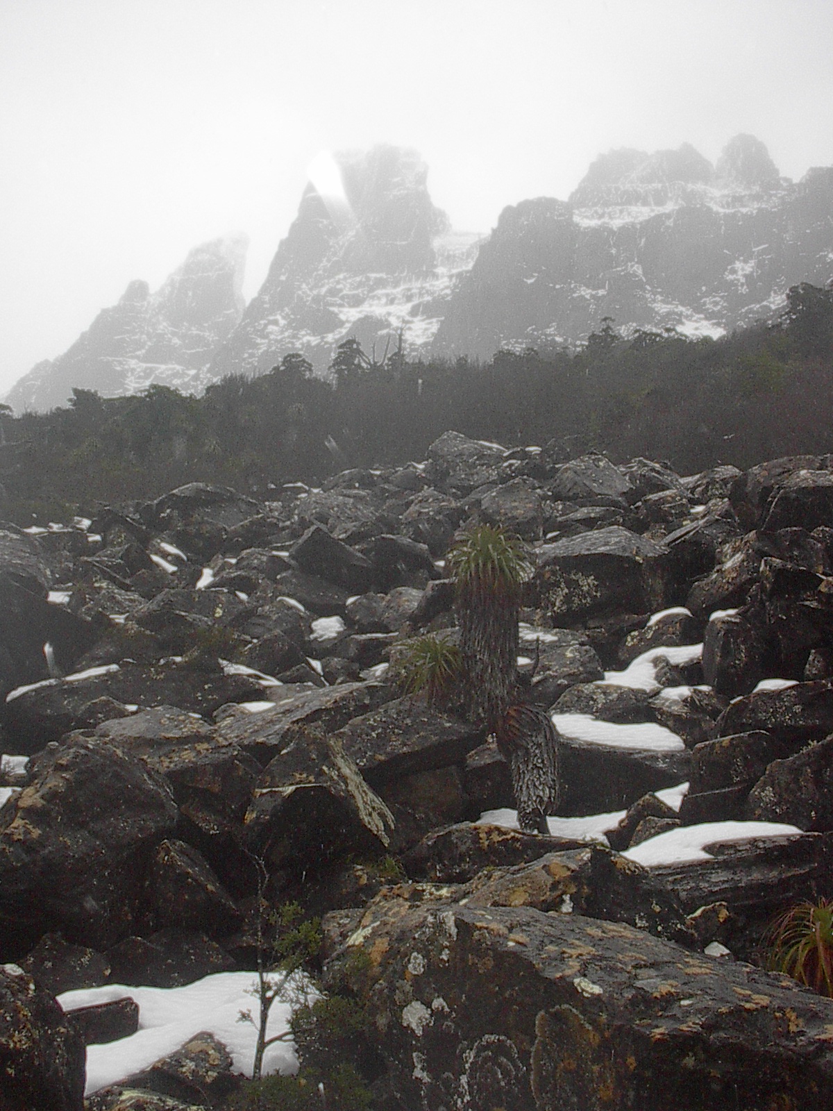
Then there is the famous Geryon Traverse, a climb and series of abseils over the three peaks. Some hardly souls attempt to head in to Geryon for ice climbing. Being Tasmania, the conditions tend towards the fickle, and I have only slogged through knee deep powder rather than found any ice. But having spent several days in the hut as snow piled up outside and massive Eucalypts creaked and swayed in the gale force winds is a memory I will hold forever. There are some good notes on the traverse and climbing on Geryon available here and some great images of the traverse here.
For hikers, the journey up from Pine Valley hut, onto The Labyrinth, and then up to the Ducane Range is an inspiring outing. From old giant Myrtle Beech dominated forest, rock scrambling up a stream bed to finally emerge on the plateau to wander through spindly snow gum and finally above the tree line, this is a superb walk. The final climb, past a narrow section and then sidling around the top of the western face has a nice sense of exposure, and feeling of being on a real mountain, as The Labyrinth and Walled Mountain appear below you.
Then, of course, there is the deciduous beech (Nothofagus gunnii) which puts on a dazzling show in late autumn. This low tree tends to exist in tangled swathes in isolated pockets of the western mountains and The Labyrinth is a favourite destination for ‘beech viewing’.
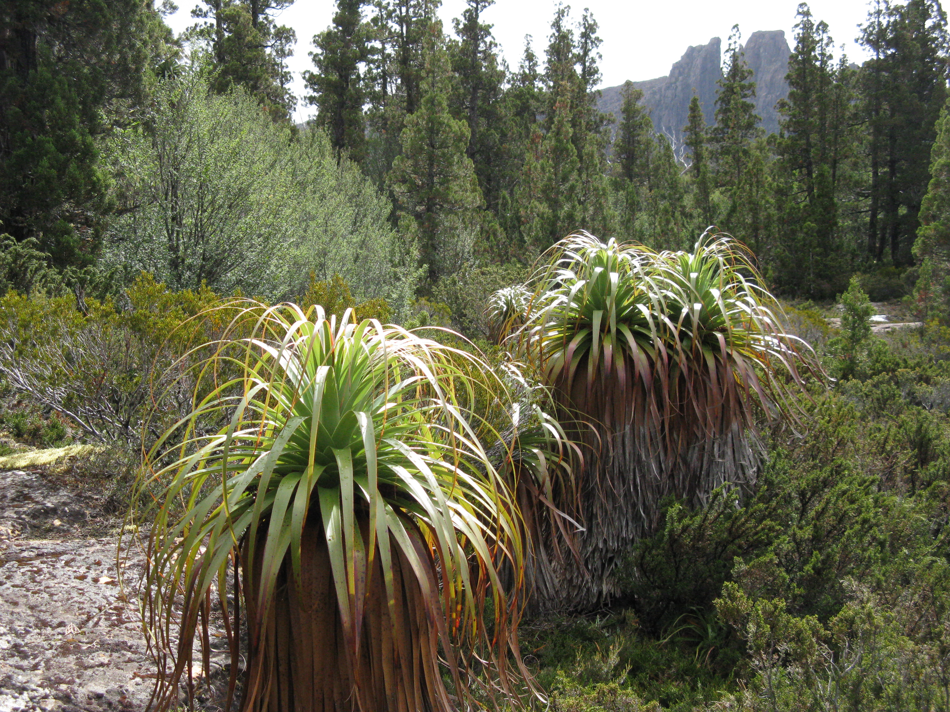
Geryon and the surrounding peaks were created through glaciation and there are many examples of glacial cirques and rock grinding. It is a grand landscape, made even more beautiful by the many small lakes, glacial tarns, and the dark, pointed pencil pines that cover the surrounding plateaus.
The Ducane Range, which lies as a big arc across the head of the Pine Valley is beautiful and wild alpine landscape, with a significant patch of ground over 1,500 metres, which tends to hold snow well. There are various scramble peaks radiating off or connected to the Ducane Range – Eros and Hyperion, Mt Massif, which is accessed via Big Gun Pass, and Geryon itself. The Ducane Traverse continues past Mt Massif to Castle Crag/ Falling Mountain and then to Ducane Gap, where it meets the Overland Track. This is a fantastic 2 or 3 day adventure which requires good route finding and boulder hopping skills.
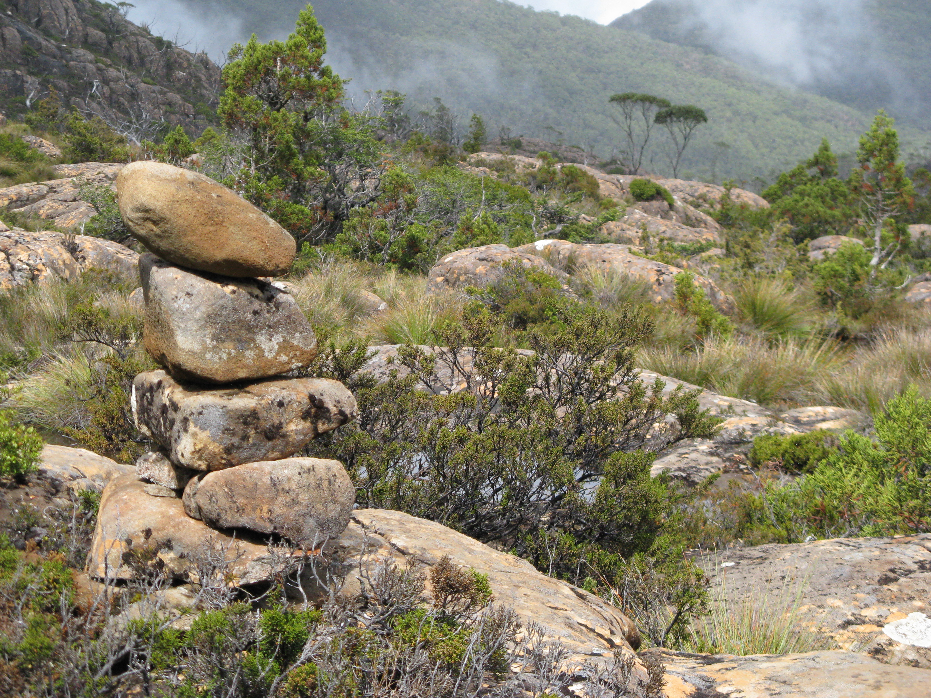
There is also a network of routes around the mountain which are neither ‘official’ or maintained, and which are largely connected to use by climbers. The main one is the route that heads upstream along the Cephissis Creek where the track to the Acropolis crosses the stream and starts to climb towards the mountain. This route follows the stream, and leads to the old climbers camp, which has space for a couple of tents amongst big old trees. From here you turn towards the mountain and head up the Cephissis scree, which leads you into a wild landscape of cliff and gully. Its difficult terrain to travel through but the views from the Geryon/ Acropolis saddle are superb.
My favourite viewing spot for the mountain is the bluffs just above the Pool of Memories, which looks out onto the headwaters of Pine Valley and directly up to the western face.
Like a lot of the higher mountain areas in Tasmania that are relatively easy to get to, these peaks are under pressure from humans. The Labyrinth in particular needs to be protected from pollution and the Parks Service discourages people from camping up on the plateau. Geryon can be climbed in a day from a camp in the Pine Valley or the Pine Valley hut. Many day walkers do the shorter trip up to the Labyrinth lookout, which does give grand views of Geryon and The Acropolis.
If you are drawn to mountains and wild landscapes, then Geryon is a must. To wind your way past glacial lakes, through groves of pencil pine and deciduous beech, as you slowly pass under the grey ramparts of Geryon’s western face would have to be one of the best walks in all of Australia. To also include the climb to the north peak makes for an unforgettable experience.
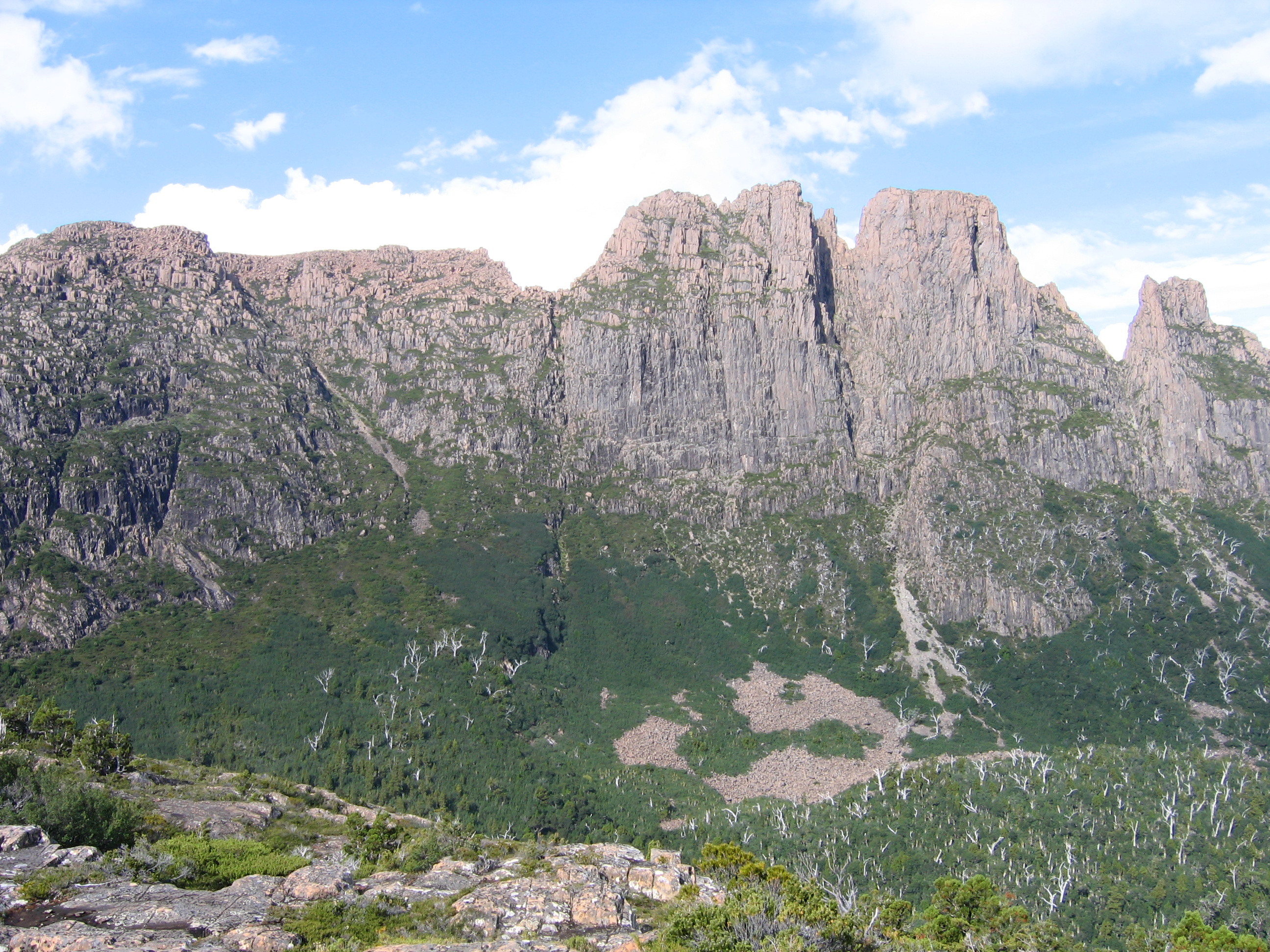
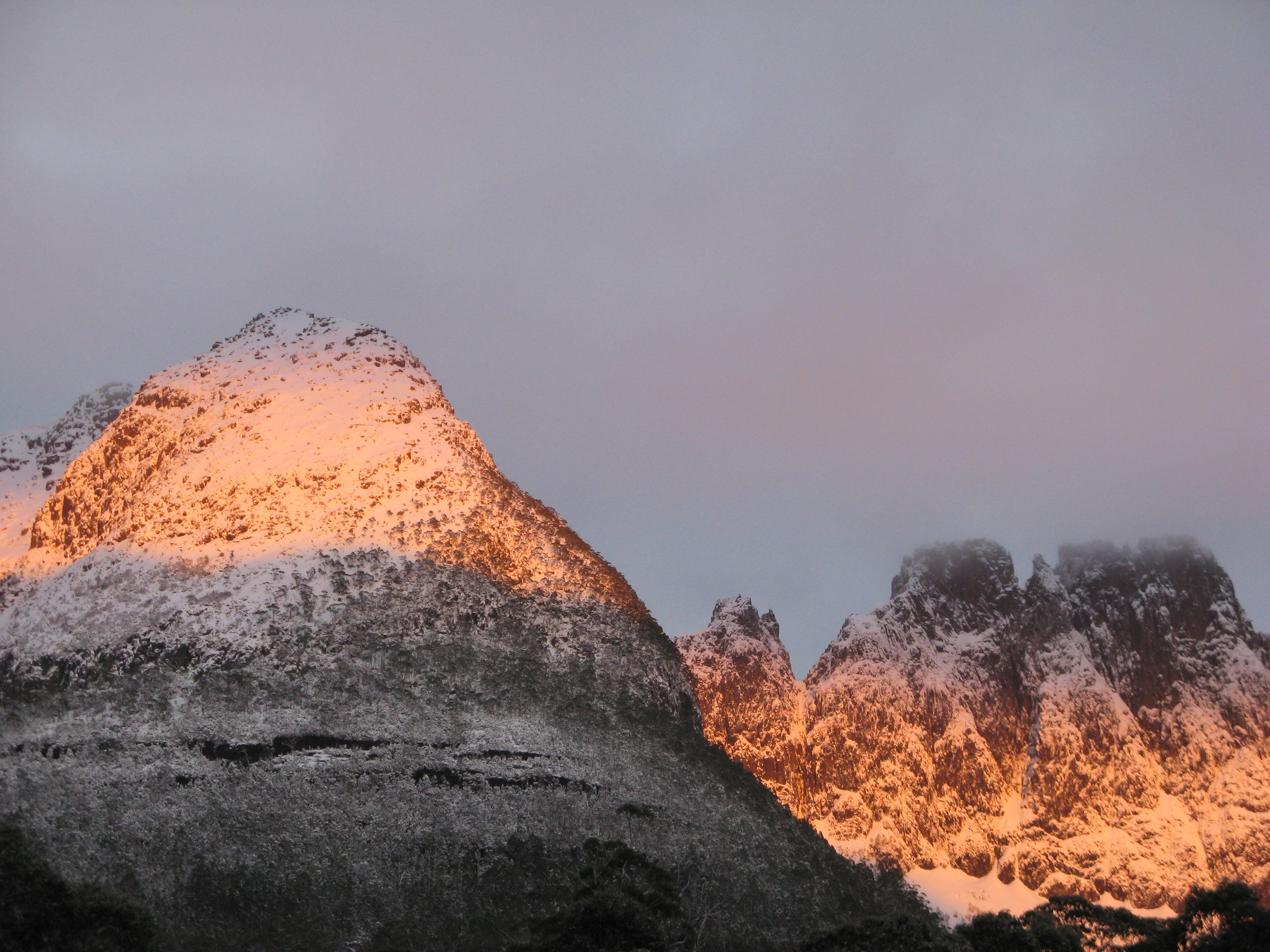
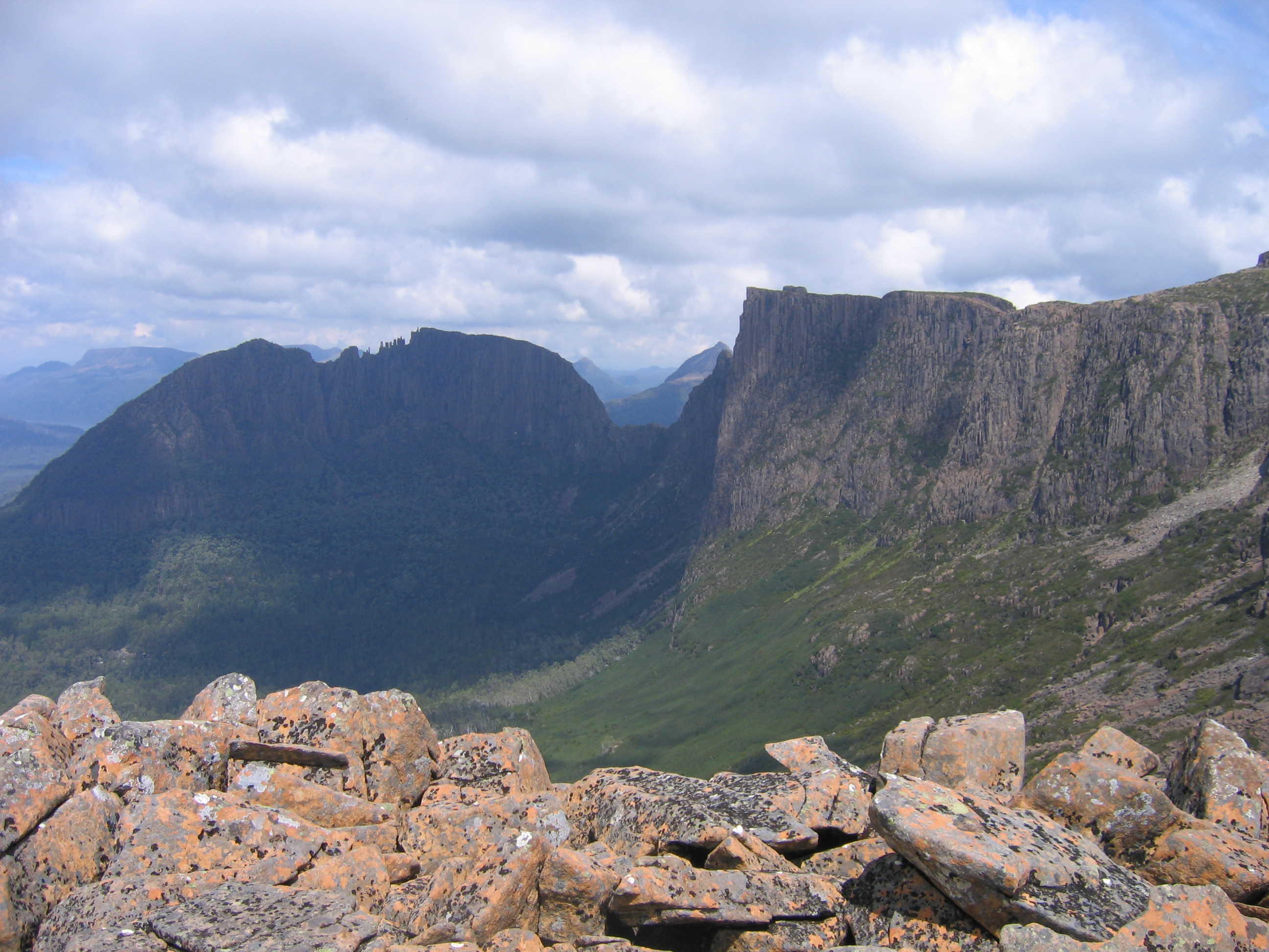
Looking up at the west face of the mountain, from the base of the Cephissus scree in Pine Valley. August.


Recent Comments