Search

Mountain Journal

Environment, news, culture from the Australian Alps

Tag

Alpine national park

Alpine grazing. Don’t like the data? Hide it.

When I went through the paperwork attached to the state government’s proposal to put cattle back into the Alpine National Park, one of the things that struck me was the fact that there was no data from the field about possible threatened plants or animals that may be impacted by the proposal.

in the Wonnangatta, looking north

The Wonnangatta is not the easiest place to get to in Victoria. Yet the Environment Minister has visited there on at least two occasions. Clearly this project is important to the minister. So it would be reasonable to assume that he would have ensured that some staff were sent to the Valley to investigate possible impacts on endangered species.

Yet in their proposal, the government relies only on desk top data searches of federal government information. Given that the government was roundly criticised for its poorly framed research methodology last time they attempted to put cattle back into the park, you would think they would at least make an effort to make the scientific case more robust this time.

But now, according to The Age, this lack of firsthand data isn’t just because of sloppy project design. It would appear that the government has deliberately withheld key information.

Tom Arup has reported that

The state government has withheld from the Commonwealth a survey of rare and threatened plants of an area of the Alpine National Park earmarked for a cattle grazing trial.

It is believed scientists at the state’s biodiversity research body – the Arthur Rylah Institute – were asked to look for rare and threatened plants in different parts of the alpine park as part of research for the high country grazing project. Their results were outlined in an unreleased report from May 2012. But the survey was not included in a recent application by Victoria to the federal government for environmental approval of a grazing trial.

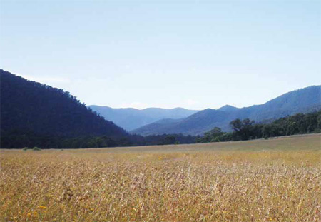
Instead an older desktop study – drawing on previously recorded data – was used to identify the extent of endangered species in the low-lying Wonnangatta Valley, where the latest trial is planned.

The unreleased 2012 plant survey found one nationally protected species of orchid known as pale golden moths and a small patch of endangered alpine bog and wetland in the valley. A large area of rare grassland and a rare plant known as spreading knawel were also found across the trial region.

The report suggests that fencing to protect the orchids, grassland and spreading knawel would be impractical and would not mitigate against the impacts of grazing.

No government is perfect. But deliberately withholding information in order to get an outcome you want is incredibly bad form. It begs the question: if this has happened in this case, how do we know it doesn’t happen routinely in attempts to introduce other aspects of environmental policy in Victoria?

Want to build private huts in a national park? Here’s your chance.

The Razorback
The Razorback

The Victorian government is currently calling for tenders to design the Falls to Hotham Alpine Crossing Master Plan. The plan will define the level of future developments which will occur along the trail – and associated infrastructure like private developments to allow overnight accommodation.

Check here for a background on the recent upgrade of the walk.

It identifies the walk as being part of a bigger program:

Walk Victoria’s Icons is a trademark brand comprising a portfolio of four long distance walks located in iconic regions renowned for their outstanding natural landscapes, wildlife and cultural values across Victoria. With a vision to be compelling, world-class, year round sustainable walking experiences, the Great Ocean Walk, Grampians Peaks Trail, Falls to Hotham Alpine Crossing and Coastal Wilderness Walk represent the quintessential nature-based attributes of the State – from dramatic coastlines to rugged mountain peaks, from remote waterways and inlets to alpine and sub-alpine scenery.

As four distinct walks the Walk Victoria’s Icons walks are designed to capture discerning high yield experience seekers who have a desire to be immersed in exceptional natural beauty that is supported by high quality products and services.

It is seen as being a

guided 2 day walk of 25km, with potential for 4 days, offers an experience that will be as challenging as it will be rewarding.

So far, so good: more people out in the hills….

The Falls to Hotham Alpine Crossing Master Plan will be lead by Parks Victoria in partnership with Tourism North East, Tourism Victoria and Regional Development Victoria.

The preferred route goes from Falls Creek, around Rocky Valley dam to Wallaces hut, then across the High Plains, descending to Dibbins hut, then downstream along the Kiewa to Diamantina spur, up to Feathertop, and out to Hotham along the razorback.

The documents say:

The main driver for this project is the need for a resolved, design-led, strategic master plan and implementation strategy (the master plan) for the FHAC which considers regional tourism and commercial opportunities in the context of recent changes to public land policy, particularly tourism investment in national parks.

That is, the Coalition governments intention to encourage private development within national parks.

The tender documents show that private accommodation is planned to be developed. Included in the brief for the tender is the requirement that the master plan:

Identify settings where opportunities may exist for potential private sector investment in on-walk roofed accommodation and/or services;

Coming soon to a national park near you? Image: Cradle Mountain huts

They use the ‘precedent image’ of private huts along the Overland Track, Tasmania.

A final decision is expected by 2015.

What do you think?

It is great that the government is providing resources to further develop walking tracks to get more people out into parks.

It is orientated towards a market that is happy to pay to have ‘luxeries’ while in the bush, like high quality acommodation, so potentially brings a new group of people into the mountains, who would currently tend to stay in the neighbouring resorts.

However, it could be the thin end of the wedge in terms of developments within parks.

It will probably bring new walking track infrastructure to what is at present a relatively remote area with only a rough trail (the Diamantina spur).

Wonnangatta grazing trial. Federal decision soon?

In January 2013, it was reported that the Mountain Cattlemen’s Association (MCAV) was lobbying the state environment minister Ryan Smith to seek permission to reintroduce cattle to the area around the Wonnangatta station.

In November 2013, it was reported that the minister had asked the federal minister to approve such a trial.

Wonnangatta River
Wonnangatta River

While spokespeople for the minister have been quoted in the media, there has been no formal statement by Ryan Smith and details on the trial have not been released to the public by the Victorian government.

However, because the Victorian government requires approval from the federal government under the EPBC Act, the paperwork for the trial is available via the federal environment department’s website. Despite the minister’s silence on the issue, at least we now know what is actually intended in the trial.

Sadly, many of the questions we have previously asked are not resolved in the application sent to the federal minister’s department.

weeds or fuel loads?

“But it was the state of the park, the threat of high intensity fires from high fuel loads and the impact this could have on its ecology – particularly snow gums – and the infestation of weeds and feral animals that were most pressing on the minds of the cattlemen”.

The Weekly Times.

Media reports have mentioned the ability of cattle grazing to reduce weeds in the Wonnangatta, however, the application only talks about the possibility of it reducing fuel loads. There is no mention of any strategies to ensure the reintroduction of cattle doesn’t bring a new set of weeds into the Wonnangatta. Does this shift from dealing with weeds and fire to just fuel reduction show that there is an admission that cattle make weed infestation worse?

The application says that the traditional owner group was consulted, and of course the MCAV was. What is strange is the claim that environment groups were consulted. Really?

Some observations about the proposed trial

Given that the government has identified fuel loads as a problem, it has not sought to find other ways to reduce fuel loads without a grazing trial.

The impact of weed spread due to grazing (one of the reasons cattle were excluded from the national park in the first case) is not specifically addressed in the proposal.

There is not yet an Environmental Management Plan (EMP) for the project. Given the experience in early 2011, when the Coalition secretly let cattle back into the High Country without a proper framework for how the trial would be managed, one has to wonder if the same thing will happen this time. The documentation says that the EMP will consider issues such as ‘pest plant and animal controls’: so let’s hope the EMP is produced before the cattle are introduced.

The study area covers around 2,200 hectares of land, with 4 ‘treatments’ to be carried out over different parcels of land: a control area, some areas being grazed, some areas grazed and burned, and some areas just burned. The documentation identified 10 ecological vegetation classes (EVCs) within the research trial area. It is not yet clear whether the 4 treatments will be carried out in each EVC.

Lack of consultation. Given that this proposal has been foisted onto the community without any attempt to explain the project beyond a couple of media grabs, it hasn’t got off to a great start if the government hopes to generate widespread support for the trial. The documentation says a ‘communications strategy’ will be created, with the development of ‘key messages’ that will inform the community on the progress of the trial. Note that consultation is a very different thing to communication.

Threats to nationally listed species. The application says the government only carried out desk top assessments of possible federally listed species in the research area. As is widely noted, animal and plant data for the region is not huge, but the government was happy to rely on what information was currently held by the federal government rather than sending a team to check the actual site. Mitigation measures, aimed to deal with any impacts on federally listed species that may be subsequently identified, will be dealt with via the EMP.

Traditional Owner (TO) attitudes to fire. One valuable aspect of the project documentation was a consultant’s report and ‘conceptual model’ of TO understandings of the role of fire in managing land in the High Country. The government is to be congratulated for commissioning this research.

So, we are a little bit closer to gaining an understanding of what is planned with the trial, although there are a significant number of areas where there is no clarity about what the government intentions are and big gaps in understanding how the project will be managed.

The federal minister is currently considering the application and will probably make a decision shortly.

take action

If this proposal troubles you, then please contact the Environment Minister and let him know.

Hotham to Falls walk upgraded, more developments to come?

The much touted ‘Falls to Hotham Alpine Crossing’ has received a substantial injection of funds in order to increase visitation.

The Border Mail reports that

on the Falls to Hotham track, starting the descent to Cobungra Gap

An $800,000 upgrade to the 37-kilometre trek has been completed and Benalla MP Bill Sykes launched it as one of Victoria’s iconic walks at the weekend.

The upgrade includes camping platforms at Cope and Dibbins Hut, signage and track development.

“The camping platforms maintain the vegetation in the area because they are elevated so people can pitch their tents without degradation,” he said.

“It’s also more comfortable for campers because there will be a breeze from below in the summer time and in the event it rains they are not going to get a wet backside.”

Dr Sykes also announced $50,000 of funding from the Victorian Regional Growth Fund to create a master plan for the next stage of the upgrade.

He said it could include looking at accommodation options along the track.

“There are people like me who are very happy to put in the kilometres during the day but would like a comfy bed at night,” he said.

“Some are happy to rough it with a stretcher and a sleeping bag but then there are others who are happy to be out in the elements but have the comforts of home.

“It widens the appeal if you have that option available.”

The master plan will also include route extensions and Dr Sykes said he wanted to encourage people with beginner and advanced routes.

He said the track upgrades were a priority because there was a growing band of people who enjoyed walking and the companionship gained from doing it in groups.

“We’ve got a magnificent scenery and we will be recognised for the beautiful high country and river valleys.”

Dr Sykes said the upgrade and master plan will lead to economic benefits.

“It will be measured in millions and millions of dollars no question about that,” he said.

Guided walking tours is another initiative Dr Sykes believes will boost tourism.

It’s great to encourage people to get out and walking in national parks. But with the pro-development in parks agenda of the current government, we should always be a bit cautious about their motivations.

For instance, what does ‘accommodation options along the track’ mean? Private huts along the route, as is the case in Tasmania?

In March 2013, the Minister for Environment and Climate Change released the Tourism Investment Opportunities of Significance in National Parks Guidelines, an information pack to guide potential investors through the process of gaining approvals and ‘taking their plans to fruition’.

The government has said it will support “sensible and sensitive developments in national parks provided they complement environmental, heritage and other values and generate a net public benefit.”

The government has also announced that it intends to introduce fees for overnight hiking in national parks.

It would appear that doing the ‘Falls to Hotham Alpine Crossing’ will attract a fee of $30, plus a $10 admin fee for the booking.

Friends of the Cobberas

The Cobberas (in foreground), The Pilot, and the Main Range of the Snowy Mountains in background. http://www.panoramio.com/photo/29813127

The Cobberas Range is a remote area in the Victoria Alpine national park, close to the NSW border.

Friends of the Cobberas is a volunteer group who are interested in the conservation of the Cobberas and adjacent areas of the Alpine National Park. The group is under the umbrella of the Victorian National Parks Association and is supported by Parks Victoria.

Members are all volunteers, working together and learning together as we tackle various projects to assist with conservation and Park management. Activities include group camp outs and walks, walking track marking and maintenance, environmental and pest animal monitoring, weed control and more.

But we need more help!! This is a remote part of Victoria and there is plenty of projects the group could get involved with if we had more members. Joining the Friends of the Cobberas has many benefits, spending time in a great part of the High Country for starters! You will meet new friends, enjoy the benefits of shared knowledge amongst members and have the satisfaction of assisting with the management and conservation of some really special places.

Visit our website today www.friendscobberas.com.au or to receive more information on membership

Email: info@friendscobberas.com.au or Phone Parks Victoria Omeo on (03) 5159 0600

December 14-15 Track marking weekend

Mt Cobberas No 1 from The Playgrounds

Escape to the mountains for a dose of sub-alpine walking before Christmas!! Help out with some track marking and once you reach the summit, relax and soak up wonderful wilderness views. For those who are happy to camp there will be a base-camp at Native Dog Flat for at least one night. Accommodation options available a bit over 1 hour from site for non-campers.

Visitors or new members most welcome.

Email: info@friendscobberas.com.au for more details.

Facebook page here.

Alpine National Park to get survey for vulnerability

This information comes from the Great Walks website.

snow gums near Mt Lovick, VIC

The eastern edge of Victoria Alpine National Park is set to receive one of the most thorough surveys ever, involving palaeontologists, geologists and biologists beginning 18 November.

Parks Victoria, Museum Victoria and 4WD Victoria will cooperate to examine the wildlife in the area and gather information about how well certain species are inhabiting the alpine terrain of the park compared to some threatened populations in other areas of Victoria.

“We love exploring the bush and this project presented a unique opportunity for our volunteers to be used for the first time in a major fauna research survey,” Project and Events Manager of 4WD Victoria Wayne Hevey said.

“Many of the high altitude species in the highest parts of Victoria are the most vulnerable in the state,” Dr Mark Norman, Head of Sciences, Museum Victoria, said.

“Over 80 researchers will be seeking the signs, sounds and movements of these wonderful creatures. The data we collect will help establish the status of many of the area’s endangered species,” said Dr Norman.

This is the fifth Bioscan to be undertaken by Parks Victoria and Museum Victoria as part of a five-year program designed to study wildlife across Victoria’s national parks, from deserts to forests to underwater kelp reefs. The program commenced in 2011.

Results will be presented at programs with four local schools and students and local residents will be able to interact with the scientists who conducted the survey at a Friday night ‘Science at the Pub.’

tree removal along the Great Alpine Road

at the Alpine rd / Dargo rd junction, Jan 2013

Last summer’s fires devastated a lot of the country around Mt Hotham.

The North West Spur fire burnt hot up and out of the Upper East Ovens valley, over the St Bernard – Sugarloaf ridge, killing a lot of the remaining Alpine Ash forests along the upper sections of the Great Alpine Road that had survived previous fires, and snow gum forests at higher elevations.

A huge effort was made to get the road open in time for Easter and winter, with massive tree felling operations along the road, and removal of debris.

The final stage in these operations is now underway, and Vic Roads will be doing works on the Great Alpine Road from November 11th through until early December to remove fire damaged trees effected by the 2013 bushfires. One of the problems has been the large number of trees killed in previous fires being burnt again this year, and becoming very likely to collapse.

For anyone that has driven the road in recent months, you will be painfully aware of the visual impacts of these operations.

What is less clear at this point is the environmental impacts of effectively clear felling a large swathe of forest along the road. As noted by VicRoads, this clearing is substantial in some areas, between 10  and 40 metres from the roadside. There have been attempts to reduce the impacts of this work, for instance removing many of the trees being felled beyond what would be normal on the forest floor, and aerial seeding of alpine ash.

But the fact remains that safety considerations for traffic has resulted in a 20 km clearcut, mostly within a national park.

The following info is from VicRoads via Hotham management.

VicRoads advises that access to sections of the Great Alpine Road will be reduced at various times from Monday 11 November until Friday 20 December to enable the safe removal of dead and dangerous bushfire damaged trees.

These works are a continuation of the tree removal works that were undertaken prior to the 2013 snow season. It is essential for VicRoads to remove these hazardous fire damaged trees from the roadside as soon as possible as they present a potential road safety hazard.

From Monday 11 November until early December, the Great Alpine Road will be closed to traffic between Harrietville and Dargo High Plains Road between 8.00am & 1.00pm and 2.00pm & 5.00pm on weekdays to enable tree removal from within 10 metres of the roadside. However, the road will be open at all other times including weekends.

From early December until Friday 20 December, tree removal will continue in an area 10-40 metres from the roadside in the Alpine National Park. This work is being undertaken in consultation with Parks Victoria. Local traffic closures will be in place with delays expected.
 
In addition to the tree removal, VicRoads will also be replacing fire damaged guardrail at 11 locations.

The Alps Link bus service between Omeo and Bright will continue to run during this time.

During the road closure period, Mount Hotham and Dinner Plain will remain accessible via Omeo and Dargo at all times.

Access between Bright and Omeo will be available via Bright-Tawonga Road (C536), Kiewa Valley Highway (C531) to Mount Beauty, then along the Bogong High Plains Road (C531) and the Omeo Highway (C543) to Omeo.

VicRoads encourages motorists travelling through the area to plan ahead and allow for significant additional travel time.

Motorists are requested to observe the changed traffic conditions for their own safety and the safety of workers nearby the road, including adhering to reduced speed limits.

VicRoads thanks the community for their patience while these important works are carried out.

For enquiries or more information about the works, please contact VicRoads on 5761 1827.

Help keep gold prospecting out of national parks!

The Baillieu Government wants to give prospectors and fossickers more freedom to dig up our most treasured national parks.The government has directed the Victorian Environmental Assessment Council (VEAC) to recommend that prospectors and fossickers should be permitted to expand their activities into the Alpine, Yarra Ranges, Baw Baw, Croajingolong, Errinundra, Lake Eildon, Lind and Mitchell River national parks, as well as the Lerderderg State Park.

Fossicking is already allowed in a number of Box-Ironbark parks in central Victoria. But despite a requirement that park managers monitor the impact of this damaging activity, no assessment has been carried out.

Prospecting in Victoria's national parks
> Take action

Our national parks are there to conserve our precious natural environments.

Please join us. VEAC cannot recommend that prospecting not be permitted in all of the parks, even if that is what its evidence shows.

PLEASE send your comments to the VEAC investigation by the deadline of Monday, 18 February 2013.

There are two easy ways to send a submission:

1. QUICK SUBMISSION

Just add your comments to our online submission and click SEND.

Quick email submission

2. PERSONAL SUBMISSION

In your own words, tell the government why our national parks should not be used for damaging activities like prospecting and gold panning.

Some suggestions:

  • Fossicking (metal detecting, digging holes and panning for gold) causes unnecessary damage to streamsides, and can threaten rare species such as ground orchids.
  • Our national parks are set aside to protect our natural areas for future generations. They are there for passive recreation, not exploitation.
  • Many of the rivers that flow through these parks are already listed as Heritage Rivers, and Natural Catchments. These additional levels of protection should be respected.
  • Fossicking is already allowed in a number of Box-Ironbark parks in central Victoria. But there has been no monitoring of their impacts as required by park management plans.
  • Fossicking and panning damages streamsides, causes erosion, and silts up rivers. In old gold-bearing streams, already worked over many years ago, mercury and other pollutants can be released into streams when soil is disturbed.
  • Fossicking and gold panning can damage the many important Aboriginal cultural heritage sites in the region.
  • While prospectors insist they behave responsibly, many don’t. The parks in the investigation area are in relatively remote areas, and fossickers’ activities will be difficult if not impossible to supervise or monitor.
  • Managing prospectors and fossicking will take park rangers away from other essential activities, at a time when staff numbers are already well below what’s needed for park management.
  • Many rivers, streams and catchments are important for rural, regional and city water supplies. We should be aiming to improve their condition, not compromise it.
  • There is already plenty of opportunity to fossick for gold in the extensive State Forest areas in eastern Victoria, outside national parks.
  • VEAC should have the opportunity to recommend no prospecting in parks, but the government has already decided that prospecting will be allowed in nine new parks (Alpine, Yarra Ranges, Baw Baw, Croajingolong, Errinundra, Lake Eildon, Lind and Mitchell River, and Lerderderg State Park).

Send your submission by Monday 18 February 2013 to:

Email: prospecting.investigation@veac.vic.gov.au

Or if sending by mail address your submission to:

VEAC
Level 6, 8 Nicholson St
East Melbourne 3002
Victoria, Australia

More information

The VEAC website has lots if useful information including maps and park overviews.

VEAC website

Read Phil Ingamells’ analysis of this issue in his article ‘Prospecting in Wonderland’.

Prospecting in Wonderland

Blog at WordPress.com.

Up ↑