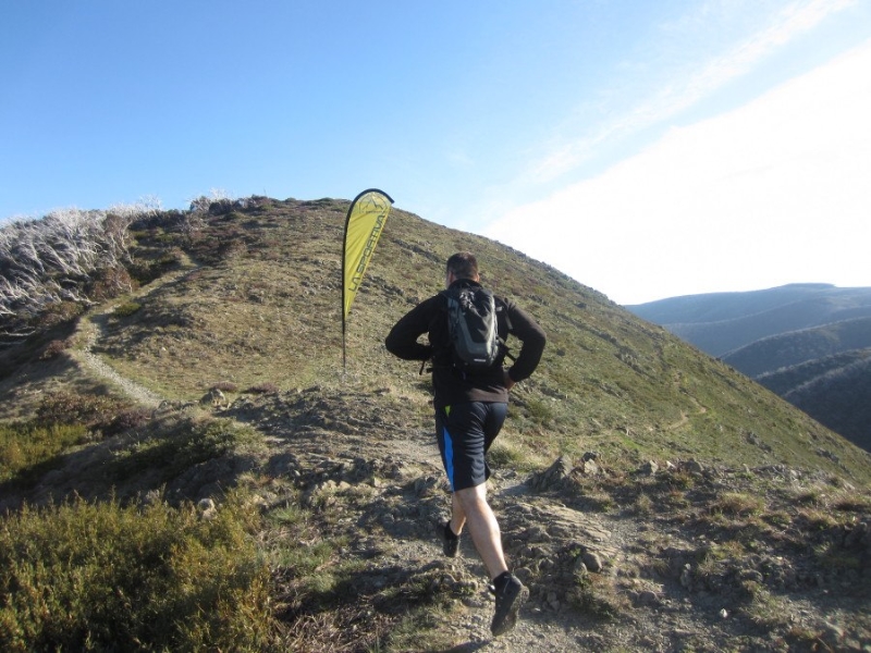
Running Wild organises trail runs in some of Victoria’s most spectacular mountain country, including Feathertop, Mount Buller, Lake Mountain, as well as the 160km long Alpine Challenge, which is a major fund raiser.
Image: Running Wild
The organisers say
Our motto is great runs – great places – great people. We do not run “races” as such, we are about the running experience, enjoying the country, experiencing what nature has to offer – weather, terrain and your ability to push yourself and get to know your body and your limits, and the social experience. That is what running and wild running is all about, however if you want to run fast and race, that’s fine too.
They are organising some new runs in 2014: the ‘Vertical K’ Series, the Victorian Mountain Running Championships and the Mount Buller Mountain Running Festival.
If running in mountain terrain appeals, then check out the various races. One of the things I appreciate about the organisers approach is that they see the run as a ‘mutual support event; it is not a race in the traditional sense. For safety reasons all participants must offer assistance to others in distress.’
The Alpine Challenge is especially impressive: it covers ‘some of the best, hardest and most exposed high country in Australia including Mt Feathertop, Mt Hotham, The Fainters, Spione Kopje, Mt Nelse and Victoria’s highest mountain, Mt Bogong’.
Their 2014 season of runs starts in early February.
Check here for a background on the recent upgrade of the walk.
It identifies the walk as being part of a bigger program:
Walk Victoria’s Icons is a trademark brand comprising a portfolio of four long distance walks located in iconic regions renowned for their outstanding natural landscapes, wildlife and cultural values across Victoria. With a vision to be compelling, world-class, year round sustainable walking experiences, the Great Ocean Walk, Grampians Peaks Trail, Falls to Hotham Alpine Crossing and Coastal Wilderness Walk represent the quintessential nature-based attributes of the State – from dramatic coastlines to rugged mountain peaks, from remote waterways and inlets to alpine and sub-alpine scenery.
As four distinct walks the Walk Victoria’s Icons walks are designed to capture discerning high yield experience seekers who have a desire to be immersed in exceptional natural beauty that is supported by high quality products and services.
It is seen as being a
guided 2 day walk of 25km, with potential for 4 days, offers an experience that will be as challenging as it will be rewarding.
So far, so good: more people out in the hills….
The Falls to Hotham Alpine Crossing Master Plan will be lead by Parks Victoria in partnership with Tourism North East, Tourism Victoria and Regional Development Victoria.
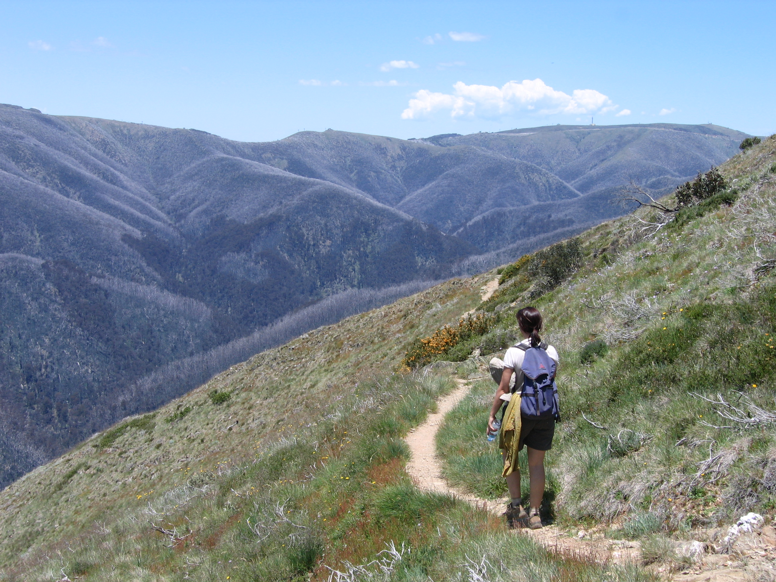
The preferred route goes from Falls Creek, around Rocky Valley dam to Wallaces hut, then across the High Plains, descending to Dibbins hut, then downstream along the Kiewa to Diamantina spur, up to Feathertop, and out to Hotham along the razorback.
The documents say:
The main driver for this project is the need for a resolved, design-led, strategic master plan and implementation strategy (the master plan) for the FHAC which considers regional tourism and commercial opportunities in the context of recent changes to public land policy, particularly tourism investment in national parks.
The tender documents show that private accommodation is planned to be developed. Included in the brief for the tender is the requirement that the master plan:
Identify settings where opportunities may exist for potential private sector investment in on-walk roofed accommodation and/or services;
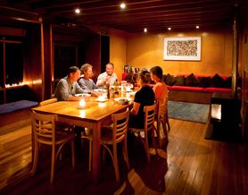
Coming soon to a national park near you? Image: Cradle Mountain huts
They use the ‘precedent image’ of private huts along the Overland Track, Tasmania.
A final decision is expected by 2015.
What do you think?
It is great that the government is providing resources to further develop walking tracks to get more people out into parks.
It is orientated towards a market that is happy to pay to have ‘luxeries’ while in the bush, like high quality acommodation, so potentially brings a new group of people into the mountains, who would currently tend to stay in the neighbouring resorts.
However, it could be the thin end of the wedge in terms of developments within parks.
It will probably bring new walking track infrastructure to what is at present a relatively remote area with only a rough trail (the Diamantina spur).
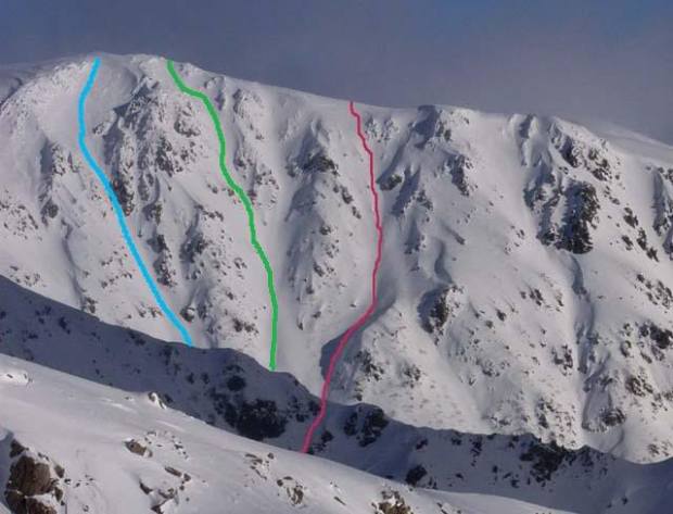
This is a great resource: the ‘gnarliest runs in Oz’, from the Huck & Dyno website (in two parts – Victoria and the Main Range in NSW).
The NSW feature has all the obvious things, and Victoria includes excellent coverage of places like Mt Buller, Feathertop and Bogong, and also some gems which are off the beaten track, like Mt Howitt.
A few years ago I put a lot of effort into expanding the ski wiki posts on backcountry skiing in Australia (mostly the VIC and TAS sections) but a big failure with this is the lack of images. In contrast to my effort, James and Sam, who are behind Huck & Dyno, have some gorgeous pictures of the mountains and general terrain, plus many of the actual runs. Visually beautiful.
I like their intro:
When you get down to it, Australia is the flattest driest continent on Earth. By definition, the skiing here is the worst in the world. … So it’s easy to write the place off as a land of sunburnt sweeping plains. Or, if you’re a skier, patchy cover, ice and crud, short shallow runs and snowmaking.
Even the highest mountain, good old Kosciuszko, is a hill with a road to the top… The very first time I ever went XC skiing, we made it to the top! Snowboarders were drinking beer up there! Fun for the whole family!
The enthusiastic might even bother to look over at the ‘Main Range’, hoping to see a craggier peak. But nope, Mount Townsend and Northcote and Lee all look pretty tame over there.
But then one day you’ll bother to climb the second highest peak, Mount Townsend, and have a look from the top of there and, HOLY CRAP, there it is…
So begins our investigation into the gnarliest lines in Oz.
With winter finally bearing down on us, I hope this inspires you. Get out there and enjoy!
Recent warm weather has really burnt off much of the snowpack remaining in the Victorian Alps, especially on lower elevation and north facing slopes. But there are still some great slopes and gullies, especially those facing south and east.
The following trip report by Sam Leitch comes from Mountain Watch, and features some great images of spring conditions on Mt Feathertop’s impressive east face.
Anyone who has skied/ boarded this terrain will know Hellfire and Avalanche gullies, this is serious country which can be dangerous because of cornice collapse, slide avalanches, and ice, even occasional rockfall. Being east facing it can quickly become extremely icy once in the shadows. Graeme Nelson, a highly experienced skier died here in the winter of 2011.
With spring in full swing and plenty of snow, conditions were great, but as Mike Garrett found on his trip to the Blue Rag Range, things don’t always go according to plan.


Recent Comments