Search

Mountain Journal

Environment, news, culture from the Australian Alps

Tag

Victorian Alps

cattle grazing in Alpine Park ‘before winter’?

Rob Harris provides an update on the alpine grazing proposal in the Weekly Times.

You will be pleased to know you have a full 10 days to provide input on more than 20 documents. The paperwork is available here.

Environment Minister Ryan Smith with mountain cattle graziers, Wonnangatta Valley. source: MCAV

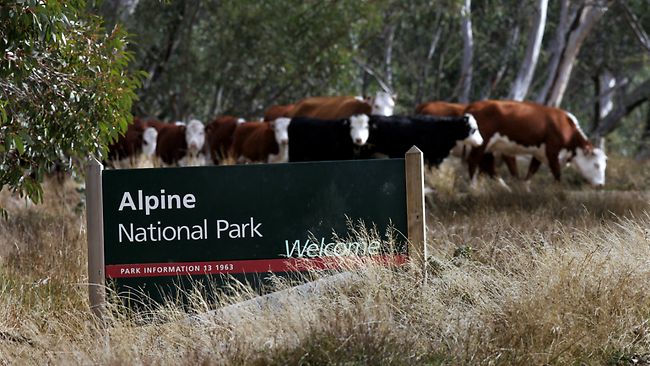
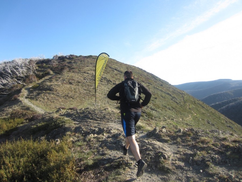
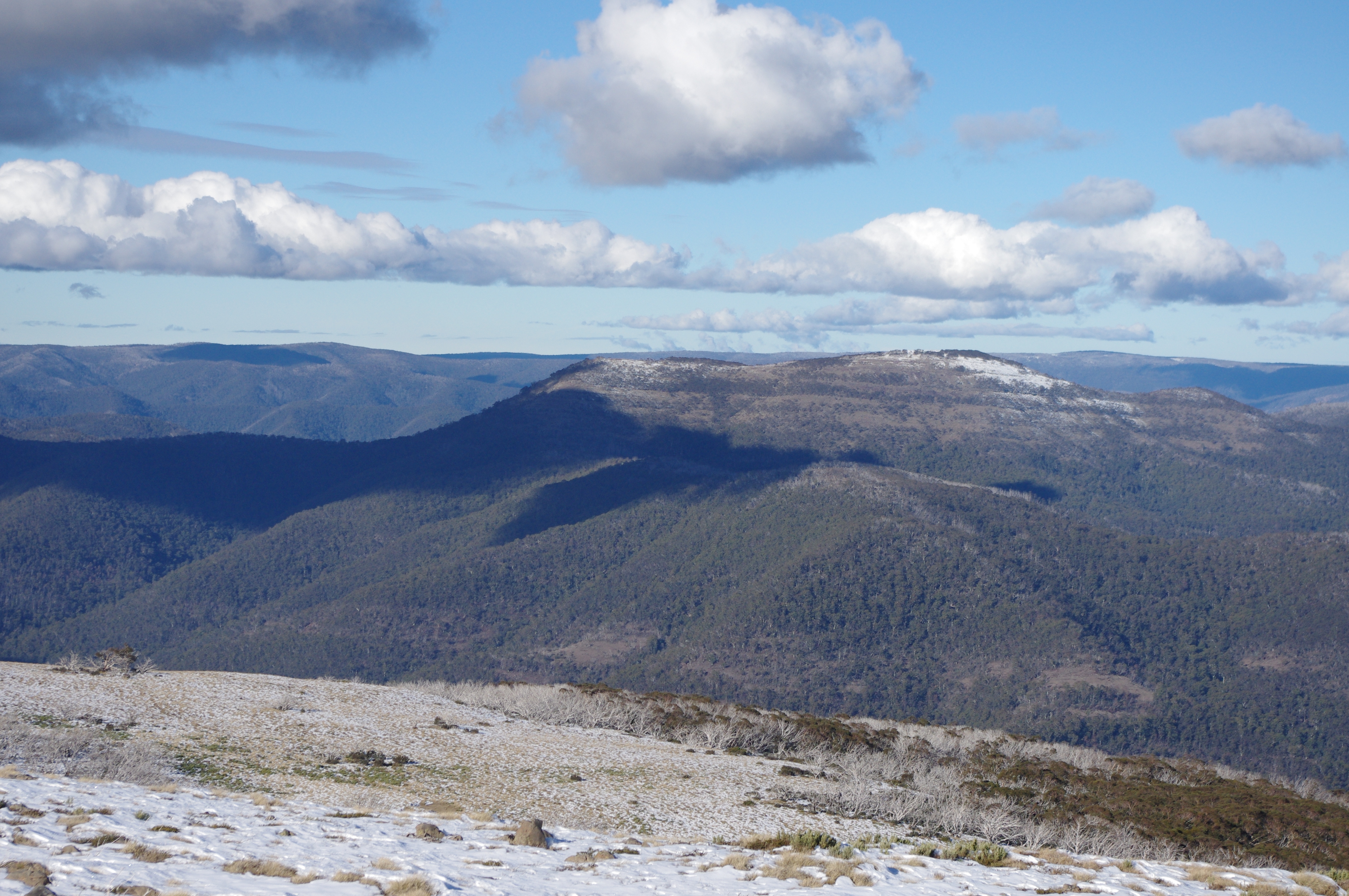
Cattle grazing in the Alpine National Park could return after a full assessment of a proposed grazing trial

CATTLE could graze again in the Alpine National Park before winter after the Commonwealth agreed to a full assessment of a proposed trial.

Environment Minister Greg Hunt last week opened a 10-day consultation period.

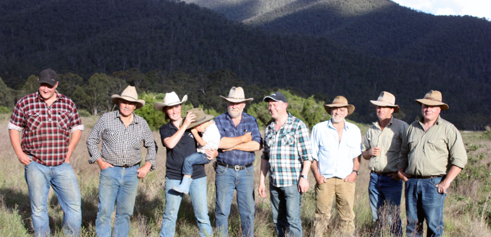
Mountain Cattlemen’s Association of Victorian president Charlie Lovick said the decision for a “full federal environmental assessment” made sense.

“No doubt it’s a polarising issue and it’s going to continue to be, but this takes some of the politics out of it and now the worthiness of a trial can be accessed,” Mr Lovick said.

“The 10-day period and assessment means we could still get up there by late March and a short trial this year before returning next year could certainly be advantageous.”

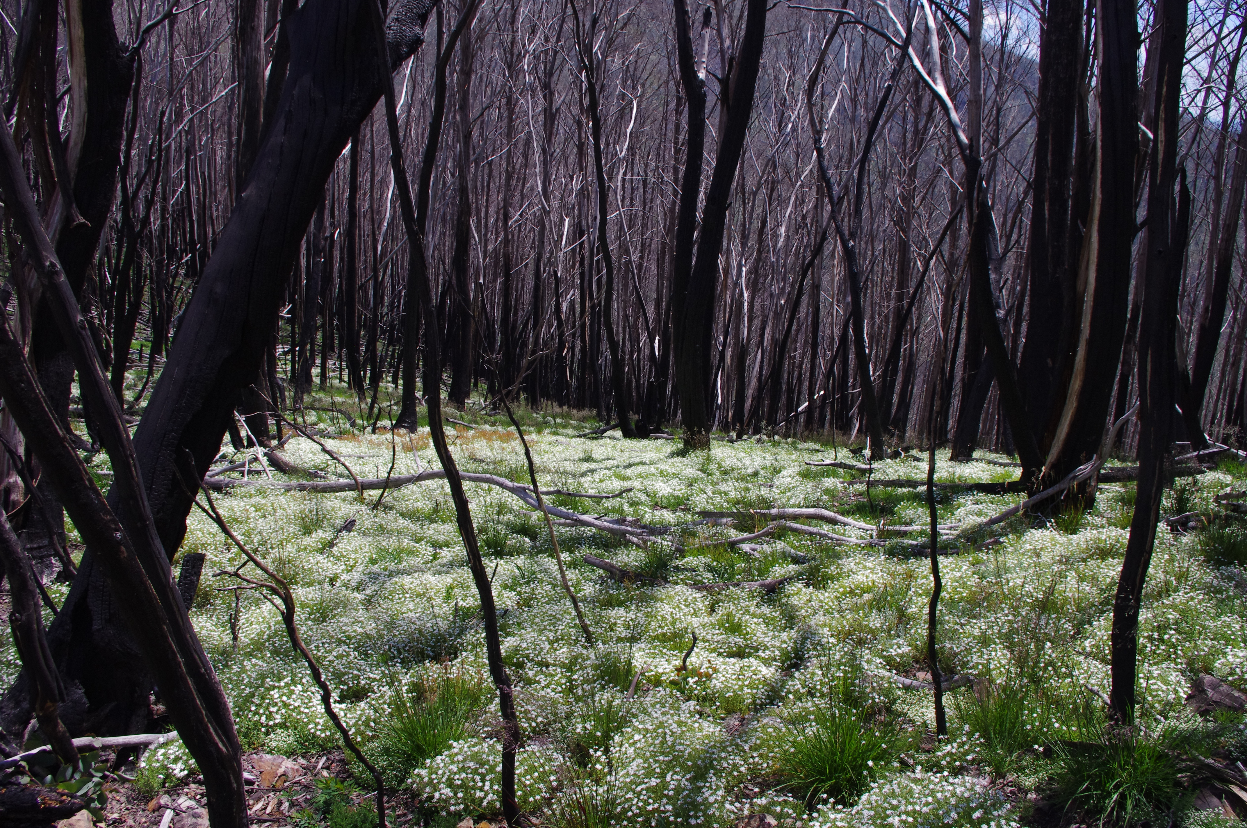
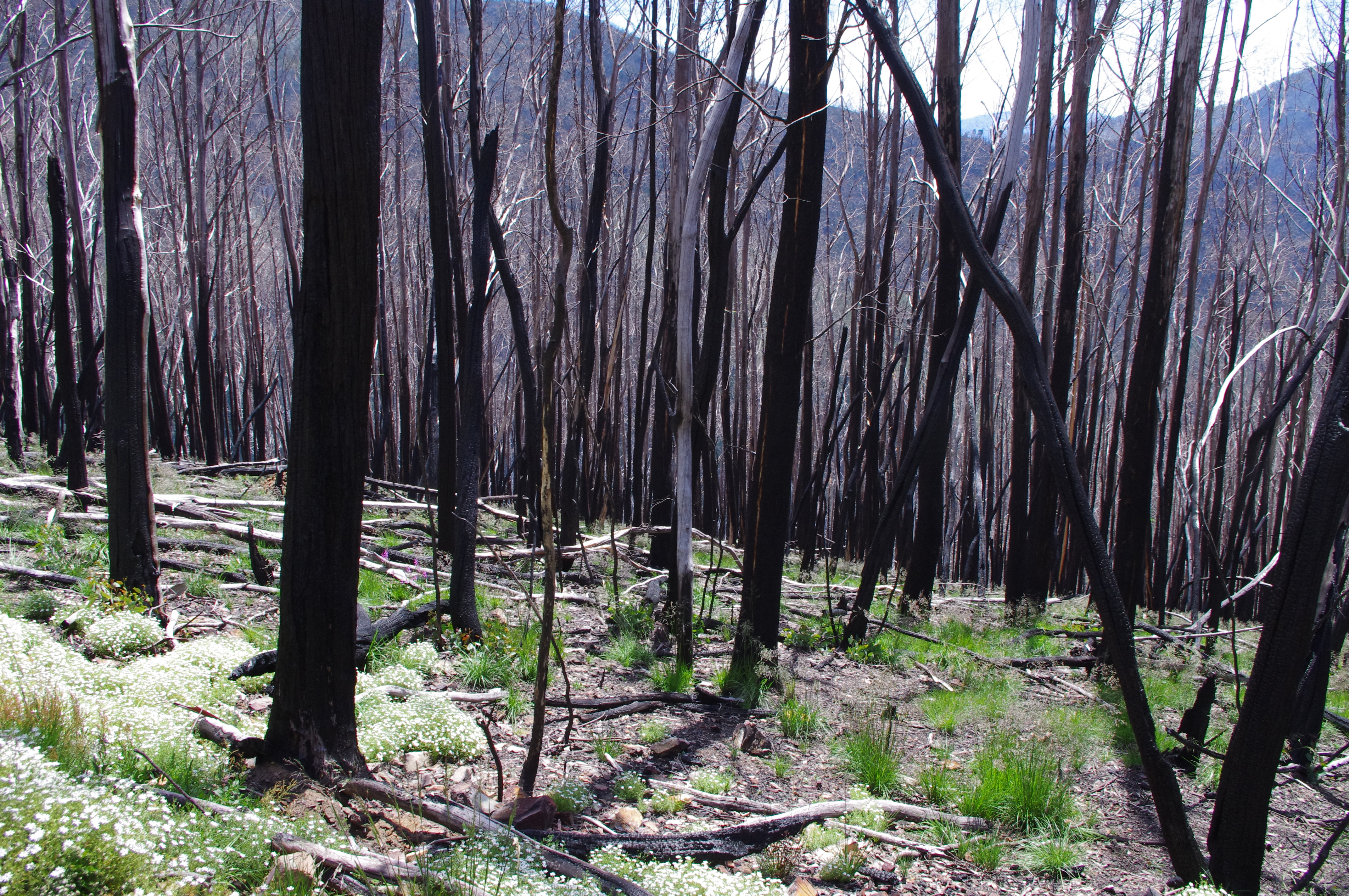
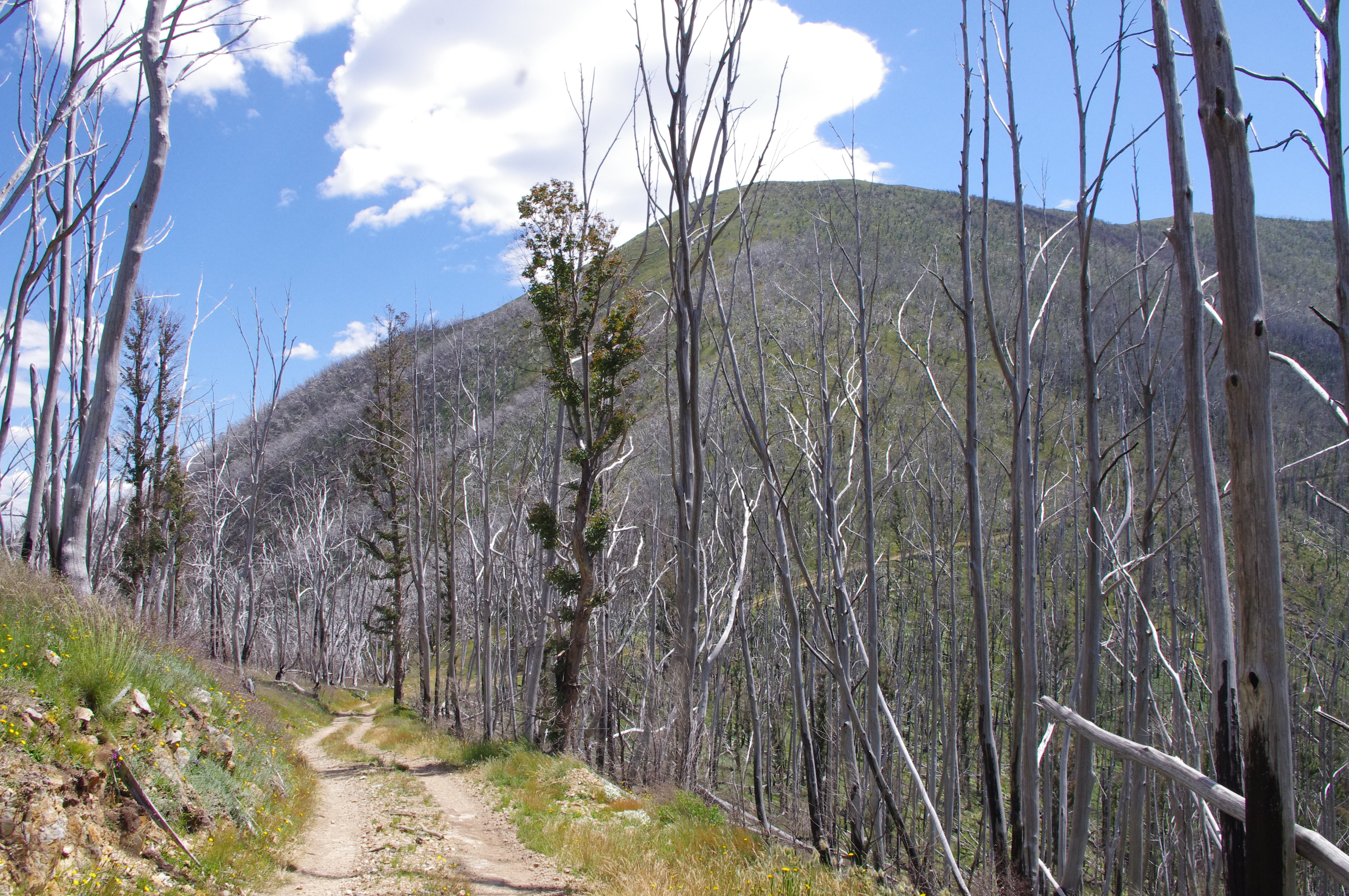
The proposed three-year grazing trial of 60 cattle would take place in the remote Wonnangatta Valley.

Projects deemed by the Commonwealth likely to have a “significant impact” on nationally protected areas requires federal approval.

The process requires the State Government to publish assessments that “clearly articulates any impacts” and will also take into account expert scientific advice and public submissions.

A decision is expected by the end of next month.

Victorian Environment Minister Ryan Smith was asked to submit more information about the trial – particularly a survey of native flora – to the Commonwealth last month.

Grazing in the national park was banned by the Bracks government in 2005.

Mr Smith said the Coalition Government believed there was a “clear need to investigate”.

Past scientific studies, including one by the CSIRO, have ruled grazing did not reduce the risk of fire in Alpine areas.

The Victorian National Parks Association criticised plans to return cattle as “a back door way of getting cheap grazing for their mates” while the Australian Society of Native Orchids has written to the federal minister opposing the return of cattle.

Alpine grazing proposal sent for assessment

alpine grazingTom Arup from The Age newspaper is reporting that the Victorian government’s cattle grazing proposal has been referred for assessment by the Environment Department. It is good to hear that the poorly developed proposal hasn’t been approved and will require further investigation.

However, with the tendency of this government to approval destructive projects, the threat is not yet averted. The state government could use the additional time to actually inform people about the plan by providing more details on how the proposal has been framed. Without additional data, it seems like a deal for some mates rather than a well thought out scientific proposal to see if grazing can reduce fire risk.

Victoria’s alpine cattle grazing trial will face an assessment

Victoria’s cattle grazing trial in the Alpine National Park will face an assessment under the federal environment laws, scuppering any chance of cattle grazing the park this summer.

Federal Environment Minister Greg Hunt has deemed the project a ”controlled action”, meaning that first it will need an assessment by his department, and then his approval. The trial, which the state government says is necessary to see if grazing reduces bushfire risk, would see 60 head of cattle released into the Wonnangatta Valley for three summers.

A larger trial was blocked by the federal government in 2012 under national environment law for the threat grazing posed to the natural and heritage values of the region.

For background on the proposal, check here.

Buffalo Chalet facing partial demolition, renovation, reopening

Image: Sustainable Melbourne

The Mt Buffalo chalet is more than a century old, and an icon of the Victorian mountains. There is nothing else remotely like it, inter twined as it is with the post invasion history of the Buffalo Plateau. The chalet is included in the Victorian Heritage Register for its architectural, historical and social significance.

It was closed in 2007, and has been in deterioration since then.

There have been various attempts to save the Chalet, get it renovated and reopened, but as time goes by, the damage to the building continues to grow, making any plan to re-open the whole building for accommodation ever more unlikely.

There are now plans to lift heritage protections to allow demolition of several sections of the lodge.

The Government wants to re-open the publicly-owned building as a visitor day centre and cafe in a $7.5 million restoration.

There is a good story from Chris McLennan of The Weekly Times about the current state of the Chalet and the plans to demolish part of it and reopen the front section of the building.


Woods Point bushfire refuge deemed illegal

With bushfire season still in full force, the kindest thing that can be said about the Victorian Government order to the community of Woods Point that they abandon their fire refuge is that it is very badly timed.

Woods Point is one of the most isolated towns in the state, in a valley in the Victorian high country. Long sections of heavily forested country must be traversed if people are to leave in the case of fire threat and the need for a community refuge is both obvious and necessary.

The following report comes from The Weekly Times, written by Chris McLennan.

Fury as Woods Point bushfire refuge deemed illegal

Woods_Point_Bridge_Street_005A SMALL Victorian town will defy a Victorian Government order to abandon their fire refuge.

Woods Point residents rely on the old gold mine tunnel which has saved the town’s population once before.

Despite the tunnel being the state’s only officially recognised fire refuge for years, new rules governing the construction of refuges have seen the government and local council in the last few weeks refuse to accept legal liability for the structure.

Signs nominating the tunnel as a fire refuge are to be removed and residents fear a gate on the entrance will be padlocked.

”Do they want us to die?” member of the town’s safety committee, Margaret Martyn said.

Fire Services Commissioner Craig Lapsley yesterday said the tunnel, known locally as the adit, did not meet the new building requirements to be a community fire refuge.

The Country Fire Authority yesterday began an assessment of the tunnel hoping to reclassify it as a “Neighbourhood Safer Place” but the question of legal liability remains.

Mr Lapsley said the CFA, Victoria Police and the Fire Services Commissioner would continue to work with Mansfield Shire Council to resolve the issue.

He said before the 2009 Black Saturday bushfires, there was an adhoc and inconsistent approach to the designation of community fire refuges.

You can read the full story here.

volunteers needed for Australian Alps Walking Track Project

Conservation Volunteers Australia and Parks Victoria are calling for volunteers to help restore remote sections of the 650-kilometre Australian Alps Walking Track.

Helicopter Spur
Helicopter Spur

Last summer saw helpers spend 120 days in Alpine National Park Across repairing 23 kilometres of track, laying 930 metres of rubber matting and installing water bars to prevent erosion at locations including The Knobs, Mount Sunday and Mount McDonald.

Remote sections of the track are difficult to maintain over time and help is needed to clear fallen timber off the track, install rubber tiling, brush-cut overgrown vegetation and to install crucial signage and symbols to help guide bushwalkers on their adventures in the Australian Alps.

There will be three projects in March and April which are rated hard walking, and involve remote camping in the King Billy/ Mt Magdala/ Mount Clear/Knobs areas of the Alpine National Park.

Full details here. (Search for Victorian projects on the map, then click the project in the Alpine national park) or check this leaflet on the trips.

For more info, contact volunteer engagement officer Adam Smolak on asmolak@conservationvolunteers.com.au

The trips are:

Australian Alps Walking Track Project Mt Clear/Nobs Area
2nd to 8th March 2014
16th to 22nd March 2014
Please check here for more info.

Australian Alps Walking Track Project King Billy Mt Magdala Area
30th March to 5th April 2014

See more here.

mountain towns #1. Mansfield

the main drag, Mansfield

Out on a broad plain, and encircled by hills, with distant views of the west side of Mt Buller and the front range of the mountains, whats not to like about this town?

Mansfield was established as an agricultural centre, providing support to gold mining in the surrounding areas, and then logging was a major driver for many decades. It was one of the first inland Victorian towns to evolve into a diverse tourist and tree change community, largely because it is the entry point to the Mt Buller alpine resort.

Food, gear and brews. Things to do. Playgrounds.  Check here for the story.

Life, death, rebirth and new terrain

near Mt Wills
near Mt Wills

I have been out checking some of my special places, to see how they are faring after last summer’s Feathertop fire. The north razorback fire burnt hot up and out of the Ovens river, past Mt Smythe and into the Upper Buckland River and swinging east around the massive bulk of Hotham and towards Dinner Plain.

Many of the forests along the Sugarloaf Ridge were badly burnt and now big swathes of burnt out country have been clearfelled to protect the Great Alpine Road. I understand the need to cut out the alpine ash close to the road that had been killed in the 2013 or earlier fires, but a major over clearing has happened on the slopes of Mt St Bernard, where fire killed snowgums well back from the road had been clearfelled for no obvious reason.

IMGP6236Parts of this country have been burnt three times in a decade. Each year, the land becomes ever more of a mosaic of new burn, older burn, and pockets of old forest – alpine ash and snow gum – that have survived each onslaught. The 2013 fire has killed off forests, glades, slopes that had survived the earlier fires. The headwater country of the Ovens, Buckland, and Wongungarra were hammered hard over the past summer. To my eyes that land seems poorer, from too many burns in too few seasons.

IMGP6251Fire has always been a part of our landscape. And climate science clearly tells us that longer and harder fire seasons are our future. These last few days I have wandered through alpine ash slopes and snow gum forests that had been completely scorched. Other areas have been lightly burnt, others spared altogether. The fire burnt hot up out of the Ovens, then seemed to turn back around some of the higher ridges on the Divide slower and with less heat. Its incredible to see some areas thick with new fern and daisys, while other areas as still mostly bare soil and logs, dead trees still black, streamers of bark rattling in the breeze. In some areas wattle are shooting back, in others, the beginning of Elderberry Panax groves or thick rushes of snow gums re-shooting around the burl of parent trees. If anything, the most recent fires have increased the mosaic effect on the ground.

Below tree line, the forests on these mountains can look so similar from a distance. Up close it is a mix of montane forests merging to alpine ash, leading to snow gum, the mix of vegetation in each place all dependent on slope and aspect, altitude and soil, fire history and circumstance. These most recent fires have added to the mix of already complex ecosystems and forest types.

In my mind I can see a future of more frequent fires, longer summers, warmer winters, and the land that I know and love so well being transformed into something new and poorer. Less old growth, trees pushed beyond their limits, less diversity of living things. But in the short term – summer to summer, the annual cycle that my mind can hold and understand – I see nature adapting and filling the spaces created by each fire. There is a deep ability for tenacity and resilience, seeking balance. The great unknown we face is that we do not yet understand the point at which we will have crossed beyond the balance of resilience and natural cycle into the time when balance will be broken by a human induced future. Some days I am frightened that no one knows, or will even be able to identify, that point of no return, when resilience is surpassed by a new reality that will make our familiar lands a new country, one that is foreign and strange, beyond anything we have known before.

Running Wild

Running Wild organises trail runs in some of Victoria’s most spectacular mountain country, including Feathertop, Mount Buller, Lake Mountain, as well as the 160km long Alpine Challenge, which is a major fund raiser.

Image: Running Wild
Image: Running Wild

The organisers say

Our motto is great runs – great places – great people. We do not run “races” as such, we are about the running experience, enjoying the country, experiencing what nature has to offer – weather, terrain and your ability to push yourself and get to know your body and your limits, and the social experience. That is what running and wild running is all about, however if you want to run fast and race, that’s fine too.

They are organising some new runs in 2014: the ‘Vertical K’ Series, the Victorian Mountain Running Championships and the Mount Buller Mountain Running Festival.

If running in mountain terrain appeals, then check out the various races. One of the things I appreciate about the organisers approach is that they see the run as a ‘mutual support event; it is not a race in the traditional sense. For safety reasons all participants must offer assistance to others in distress.’

The Alpine Challenge is especially impressive: it covers ‘some of the best, hardest and most exposed high country in Australia including Mt Feathertop, Mt Hotham, The Fainters, Spione Kopje, Mt Nelse and Victoria’s highest mountain, Mt Bogong’.

Their 2014 season of runs starts in early February.

Cattle grazing – decision put off til 2014?

alpine grazingThe political rumour mill is suggesting that federal environment minister Greg Hunt won’t give approval to the Victorian government’s grazing trial before Christmas. The Victorian government proposes putting cattle back into a  section of the Alpine National Park to see if it can reduce fuel loads in the Wonnangatta valley.

However, the proposal has been undermined by the fact that only limited information has been presented about how the trial would be managed. In a worrying development, it would seem that the state government has also  withheld significant information from the federal environment department, about possible impacts of the project.

Refusing to fast-track approval of this project would be prudent for a minister who is already under fire for signing off on a growing number of environmentally destructive projects.

Lets hope common sense prevails and the federal government requires considerably more information than a desk top study to decide if this is actually a scientifically robust proposal.

Australian Alps Walking Track – volunteers needed

Mt Clear from The Bluff

Thanks to Wild magazine for this one

Conservation Volunteers Australia and Parks Victoria are calling out for volunteers to help restore remote sections of the 650-kilometre Australian Alps Walking Track.

Last summer saw helpers spend 120 days in Alpine National Park Across repairing 23 kilometres of track, laying 930 metres of rubber matting and installing eight water bars to prevent erosion at locations including The Knobs, Mount Sunday and Mount McDonald.

Park ranger Nigel Watts said: “It’s a win-win situation for us and for them; an opportunity to get out into the Alps, help with managing this area and enjoy this beautiful landscape.

“Remote sections of the track are difficult to maintain over time and help is needed to clear fallen timber off the track, install rubber tiling, brush-cut overgrown vegetation and to install crucial signage and symbols to help guide bushwalkers on their adventures in the Australian Alps.”

The first three projects in Januray and February are rated easy walking but require volunteers who are especially fit and strong to lay rubber tiles and use heavy mattocks over five full days. Accommodation will be provided in Falls Creek.The track work is all on the Bogong High Plains.

The last three projects in March and April are rated hard walking, and involve remote camping in the King Billy/ Mt Magdala/ Mount Clear/Knobs areas.

Full details here.

For more info, contact volunteer engagement officer Adam Smolak on asmolak@conservationvolunteers.com.au

Science society urges governments to axe cattle grazing trial in Victorian Alps

?????????????????????????????????????????????????The federal environment minister Greg Hunt is due to make a decision shortly on the Victorian government’s plan to put cattle back into the Alpine National Park. With only a few working days til Christmas, will the minister do one of those shonky announcements just before the summer holidays that governments are famous for?

Or will he do the reasonable thing and allow additional time for his department to consider the information that the state government withheld from him?

Recently, Mr Hunt approved major coal and gas facilities adjacent to the Great Barrier Reef. Refusing a poorly developed ‘scientific whaling’ (sorry, ‘scientific’ grazing project) would help re-build some of his reputation as the minister for the environment.

The following is from The Age, journalist Tom Arup.

Victoria’s leading scientific society has called on the state and federal governments to abandon plans for a cattle grazing trial in the Alpine National Park, saying peer-reviewed evidence shows it would fail to cut fire risk.

In a letter to state Environment Minister Ryan Smith, the normally conservative Royal Society of Victoria has questioned the merits and scientific basis of a trial to test whether cattle grazing decreases the risk of bushfires by reducing fuel loads. About 60 cattle would be released into the Wonnangatta Valley for three years if the trial is approved by the Commonwealth.

In the letter, society president Dr Bill Birch says the trial ignores published evidence that cattle grazing has no measurable effect on fuel reduction, but has serious impacts on the diversity of species in the local area.

”The plan for the proposed trial is not clear and shows little evidence of sound scientific structure,” Dr Birch writes.

Dr Birch says among the trial’s failings are that the vegetation in the Wonnangatta Valley represents only a proportion of that found throughout the Alpine park, meaning the results could not automatically be applied to the entire region. He also said wildfires burn more intensely and move differently to controlled burns, which would be used in the trial, meaning any effect on fuel reduction by cattle would not be measurable.

”The Royal Society considers the proposed trial as another example of so-called scientific study, undertaken without adequate appreciation or even demonstrated knowledge of the literature and which is characterised by inadequate planning and inadequate scientific rigor,” Dr Birch writes. ”We suggest that the trial be abandoned.”

Executive officer of the Mountain Cattlemen’s Association, Graeme Stoney said: ”There is no doubt grazing reduces fuel in the grazing areas.”


Fire in the Crosscut Saw area

crosscut sawThe CFA is reporting ‘fire activity in the northern Wonnangatta Valley.  This fire has started as a result of last nights lightning activity.  The fire is close to the Australian Alps Walking Track and the Macalister Springs Hut.  The fire is currently active in the Cross Cut Saw Section of the track and visitors are advised to avoid the area’.

The fire is in the Terrible Hollow and apparently burning up towards Mt Buggery. As of midday Dec 20, it was listed as being 10 ha in size.

Scroll down for updates

UPDATE. 21 DEC

The fire is close to the Australian Alps Walking Track and the Macalister Springs Hut.  The fire is currently active in the Crosscut Saw Section of the track and visitors are advised to avoid the area.
The Australian Alpine Walking Track is closed from King Billy Saddle through to Barry Saddle (where Barry Saddle adjoins the Wonnangatta Road).
Closures to the Alpine Walking Track include: Howitt Spur Walking Track, Queen Spur Walking Track, King Spur Walking Track and Macalister Springs Walking Track. (This general area of closures to the Australian Alpine Walking Track is also known as the Howitt Crosscut Speculation Area).
Smoke will be visible in the area.  Aircraft will be operating in the vicinity of Mt Buller and Snowy Range today and tomorrow.

You can  find updates here.

UPDATE. DEC 22

The fire is still going and described as being in the ‘Cross Cut Saw’ area (now 42 ha in size), with the Alpine track and surrounding areas closed. Fire breaks are being cut on the south east and eastern flanks, and fire retardants on the western sides.

UPDATE. DEC 23

The fire is now described by the CFA as being ‘contained’ at 45ha in size. The area outlined above remain closed.

UPDATE. DEC 24

The CFA has announced that the fire is now contained, although it appears that previously announced track closures are still in place. Check with Parks Vic before going near the area.

Blog at WordPress.com.

Up ↑