Search

Mountain Journal

Environment, news, culture from the Australian Alps

Tag

Australian Alps Walking Track

‘It was hard, beautiful, scary, mountainous and stunning’. A journey along the AAWT

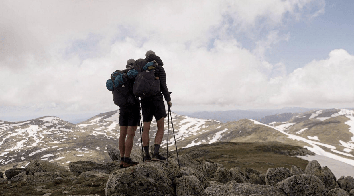
The 2024 edition of the Mountain Journal magazine (available here), had a focus on human powered crossings of the Australian Alps. Of course many of these focused on the Australian Alps Walking Track (AAWT). Since then, more people have been sending stories about their journey along the AAWT. It has been wonderful to hear about their experience along the trail: the challenges, the special times, the hardships and lessons learnt.

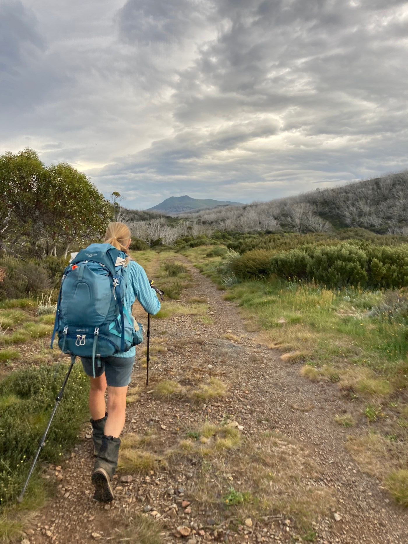
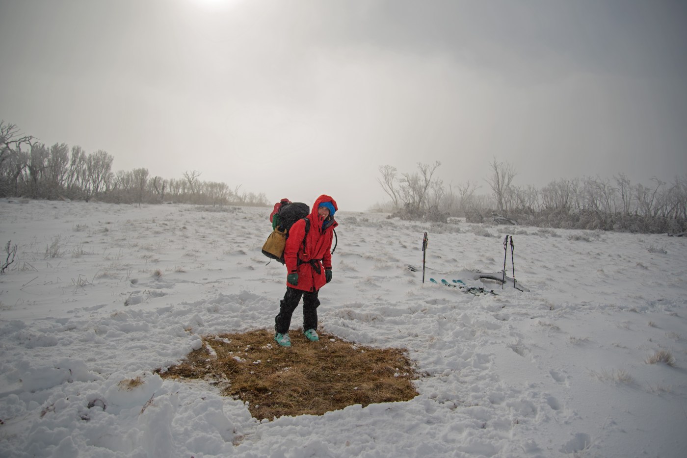
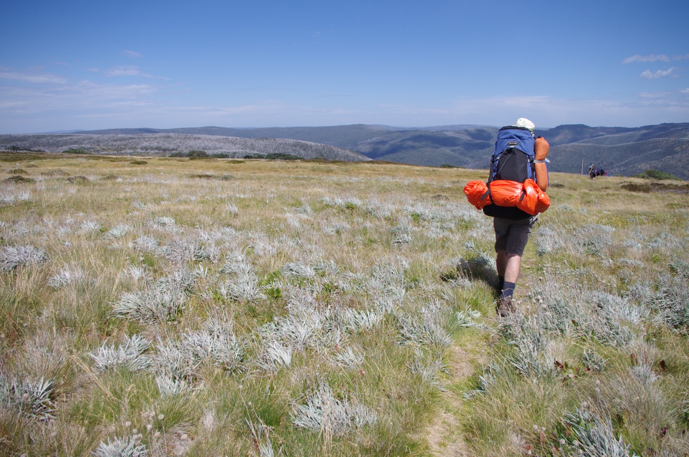
This is from Tanya Deer and is her tale of walking the AAWT with her husband in January 2023. There are some lovely reflections and a good reminder that the AAWT is a trip that is well outside regular walking: its multiday nature allows you to go deep as you travel through an ever changing landscape: ‘I am full of gratitude for the experience, for those I love, for my body and for the environment I am in’.

Continue reading “‘It was hard, beautiful, scary, mountainous and stunning’. A journey along the AAWT”

Why did you walk the AAWT?

Long distance walking tracks have a strange allure. They wind through incredible landscapes and offer us time out, an opportunity for reflection and challenge, and a chance of meeting ourselves, others and the land itself.

There are, of course, many great long distance walks in Australia. Some well known like the Overland Track in lutruwita/ Tasmania, and some less known such as the Penguin to Cradle, which starts at Bass Strait on the north coast of Tassie and allows a connection with the Overland, or the McMillans Track, which follows an old route cut through the mountains of Victoria.

Then there is the Bibbulmun Track in WA, which stretches 1,000 km from Kalamunda in the Perth Hills, to Albany on the south coast, winding through the heart of the scenic South West of Western Australia.

Of course, it is the Australian Alps Walking Track (or AAWT) that stands out as our premier long walk, stretching almost 700 kilometres from Walhalla near Victoria’s Latrobe Valley almost all the way into Canberra. Unlike many famous long distance walking tracks, the AAWT is very much a solo effort. Rather than there being mass numbers of walkers starting each day, it is possible to go for days on end without meeting another human. In some sections the track is sketchy or overgrown. The track goes through or past very few human settlements so resupplies can require a bit of work to organise.

Continue reading “Why did you walk the AAWT?”

BTAC gets to work on the AAWT

If you have ever wandered on a walking track in the mountains, you have enjoyed the fruits of someone else’s labour. Walking tracks are cultural artifacts that allow us to access the forests, mountains and rivers that we love. Often they follow earlier paths: settlers followed First Nations routes out of Gippsland into the high country. Miners and graziers cut rough tracks into the gold diggings. Sometimes these turned into commerce highways as large population centres grew around the diggings. Nowadays the foot tracks in the high country are all about recreation.

But with increasing fires across the mountains, many tracks can become crowded out through a mass of regrowth. And as trees killed in bushfires start to collapse, many tracks become crossed by fallen logs and the tracks become multiple braids, often ending in dead ends, making navigation difficult and increasing the likelihood of walkers becoming lost. Land management authorities have limited funds to maintain the trail network and have many demands on their time.

Continue reading “BTAC gets to work on the AAWT”

AAWT Track Angels – a solution to a long-distance problem!

Long distance walking tracks often attract kind souls who assist the walkers with food, water, beers, lifts, accommodation and other assistance. The ‘Trail Angels’ of the Pacific Crest Trail in the USA are famous for their kindness to hikers. Mick Webster describes the Track Angels of the AAWT.

This was originally published in the 2024 print edition of Mountain Journal magazine (https://themountainjournal.com/mountain-journal-magazine/), which had a series of stories about human powered crossings of the Australian Alps.

Continue reading “AAWT Track Angels – a solution to a long-distance problem!”

Mountain Journal magazine #4 now online

Once a year we produce the Mountain Journal magazine. It is distributed through mountain and valley towns from Melbourne to Canberra each autumn. 2024 is the fourth print edition, and the magazine is being distributed at present.

You can also enjoy this PDF of the magazine MJ4.

Continue reading “Mountain Journal magazine #4 now online”

655: FOR THE WILD

Running 655km across Australia’s toughest alpine track to save our wild places.

The two of us have always dreamed of running the 655km Australian Alps Walking Track (AAWT). It’s a track spoken of in a quiet reverence, by old hardened hikers who have seen it and done it all. It’s one of the country’s oldest, steeped in Indigenous and colonial history, and is as brutal as it is beautiful (and it is, above all else, beautiful). Ascending a cumulative 35,000m (approximately four times Mt Everest), the track traverses the ridgeline of the Great Dividing Range from an old gold-mining town called Walhalla (two hours’ drive from Melbourne) all the way through to Canberra. Forcing explorers to overcome the extreme heights (and depths) of the majestic Australian Alps across a typically 30 to 40-day journey, the AAWT is not a track to be trifled with.

And that’s why, one summer’s day, we set out to run it – all in an effort to save our wild places. And now we’re asking for your help to share our story.

Continue reading “655: FOR THE WILD”

The Hills Sisters Ski the AAWT

The Australian Alps Walking Track (AAWT) is the premier long distance walking track through the Australian mountains. It starts in Walhalla in Victoria, crosses the Victorian Alps and the Snowy Mountains and goes almost to the outskirts of Canberra. It is 650 to 704km in length, with an epic 28,000 metres of elevation gain during the length of the walk.

Marita Hills recounts her winter journey along the AAWT with her sister Angela.

Continue reading “The Hills Sisters Ski the AAWT”

A solo journey on the AAWT in support of mental health

Elise Marcianti reflects on a 300 km solo journey from Kosci to Bright along the Australian Alps Walking Track (AAWT). Her journey – done as a fund raiser for mental health campaign Moving For The Mind –   started with an ultra in Kosciuszko then hiking down to Bright, drawing illustrations of the mountain huts along the way.

Continue reading “A solo journey on the AAWT in support of mental health”

Now is the time to speak up against commercial development in the Alpine national park

The Falls to Hotham Alpine Crossing (FHAC) is a 37km hike located in the Alpine National Park in north eastern Victoria. The hike generally is done as a 3 day trip, and links the resort towns of Falls Creek and Mt Hotham (starting and finishing slightly outside each town). It is hugely popular.

The creation of the walk, which simply connected existing tracks was a smart way to create an ‘iconic’ walk without much in the way of infrastructure (there are camping platforms at the two suggested overnight sites).

However, like other state governments, the Victorian government has been focused on encouraging private commercial development within national parks, including within the Alpine National Park. The Falls to Hotham Alpine Crossing Master Plan proposes an ‘improved’ option for the FHAC which would make it a 57-kilometre, multi-day route which will take in the Diamantina Spur and Razorback as well as the Bogong High Plains.

Continue reading “Now is the time to speak up against commercial development in the Alpine national park”

Guided walk to Mt Wills, May 20

Last month Friends of the Earth hosted a mountain roadtrip to visit some special places in the Alps. This included a walk to Mt Wills and the areas threatened by logging.

The forests that will be cut were very impressive, older alpine ash forests.

Mt Wills itself is a magical ‘island in the sky’ of isolated snow gum woodland, largely dominated by older trees.

We had a lot of requests to host another walk, so here it is.

Public walk to Mt Wills and the proposed coupes

Saturday May 20

Continue reading “Guided walk to Mt Wills, May 20”

More logging along the AAWT

The Australian Alps Walking Track (AAWT) is the country’s premier long distance walking trail. The 700 km long track crosses the Australian high country from Walhalla to the outskirts of Canberra. More and more people walk the track each year and it is becoming increasingly well known around the world, attracting walkers from Australia and overseas. It is a great example of the sort of nature based tourism that the alps are famous for. Walking, camping, skiing, trail running, mountain biking and paddling all continue to grow in popularity across the alps. People do not visit in order to see logging coupes (and a growing number of logged higher elevation areas are failing to regenerate, slowly transforming much of the landscape into a wasteland).

However, as we pointed out recently, logging now threatens the area between Victoria’s highest mountain, Warkwoolowler / Mt Bogong and the refuge of old growth snow gum woodlands on the summit of Mt Wills. Four planned logging areas will cut across a section of the AAWT as it leaves Big River Saddle and climbs onto Mt Wills, creating a large clear cut across the track (details here).

However, this is not the only section of the AAWT which is scheduled to be subjected to logging. From Mt Wills, the AAWT heads south, drops into the Glen Valley, and climbs onto the next range to the east. As it curves back south, a series of three coupes, with an area of about 130 hectares, will cut right up against the track.

Continue reading “More logging along the AAWT”

A wander up Mt Wills & logging along the AAWT

Victoria’s highest mountain, Bogong (Warkwoolowler in the Waywurru and Dhudhuroa languages, meaning the mountain where Aboriginal people collected the Bogong Moths) is protected in the Alpine National Park.

Most people approach the mountain from the Kiewa Valley or across the Bogong High Plains. There is another route on the eastern side, following the appropriately named Long Spur to Mt Wills. This is all high elevation woodland and forests, and is the route by which the famous Australian Alps Walking Track (AAWT) leaves Bogong as it heads towards the Snowy Mountains. The 700 km long AAWT crosses the Alps from Walhalla to the outskirts of Canberra, and follows Long Spur from Bogong to Mt Wills before turning south and dropping into the valley of the Mitta Mitta River.

Mt Wills itself is a magical ‘island in the sky’ of isolated snow gum woodland, largely dominated by older trees. While it is connected by the long and high ridge back to Bogong, mostly the land around the mountain falls away to deep river valleys and forests that are initially dominated by Alpine Ash.

Now logging threatens the area between Bogong and Mt Wills.

Continue reading “A wander up Mt Wills & logging along the AAWT”

Blog at WordPress.com.

Up ↑