Victoria’s highest mountain, Bogong (Warkwoolowler in the Waywurru and Dhudhuroa languages, meaning the mountain where Aboriginal people collected the Bogong Moths) is protected in the Alpine National Park.
Most people approach the mountain from the Kiewa Valley or across the Bogong High Plains. There is another route on the eastern side, following the appropriately named Long Spur to Mt Wills. This is all high elevation woodland and forests, and is the route by which the famous Australian Alps Walking Track (AAWT) leaves Bogong as it heads towards the Snowy Mountains. The 700 km long AAWT crosses the Alps from Walhalla to the outskirts of Canberra, and follows Long Spur from Bogong to Mt Wills before turning south and dropping into the valley of the Mitta Mitta River.
Mt Wills itself is a magical ‘island in the sky’ of isolated snow gum woodland, largely dominated by older trees. While it is connected by the long and high ridge back to Bogong, mostly the land around the mountain falls away to deep river valleys and forests that are initially dominated by Alpine Ash.
Now logging threatens the area between Bogong and Mt Wills.
The higher mountain areas on this side of the Bogong High Plains are largely intact, although significant areas have been burnt, often several times in close succession, in recent years. But now there is a threat posed by logging in the area where the AAWT/ Long Spur track starts the climb up to Mt Wills, which would create a large clear cut area of more than 100 hectares.
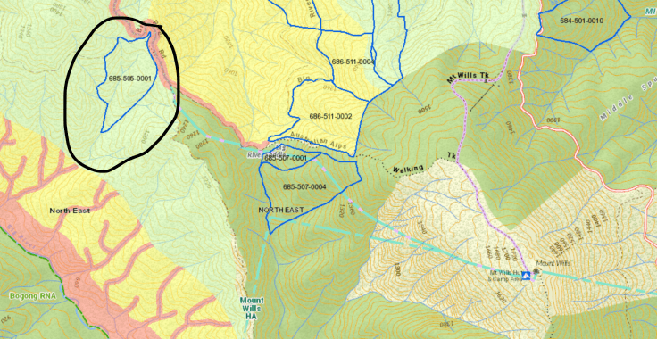 ABOVE: the coupe which is circled is in the upper Big River. To the right are the three coupes along the AAWT where the images were taken.
There are four coupes in total planned for the Long Spur area:
- three where the AAWT starts the climb up into the intact snow gum woodlands of Mt Wills and
- one closer to Bogong itself. This last one is a worry because it is in the headwater area of the Big (Mitta Mitta) River, which flows from a valley between Mt Bogong and the Bogong High Plains. The Mitta is one of the most important rivers in the state and feeds the Dartmouth Dam, and then the Murray River.
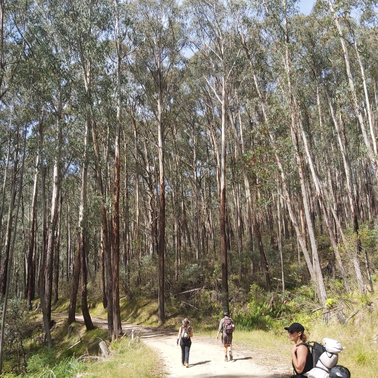
To check what is at stake from the proposed logging, Friends of the Earth hosted a public walk to Mt Wills and the planned logging area along the AAWT on Saturday March 18. They found some spectacular alpine ash forests above Big River saddle which would be devastated if they were logged. Older Alpine Ash is getting rarer by the year. There is no justification for logging these precious forests.
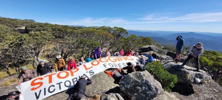
ABOVE: the banner action held as part of the walk to Mt Wills and the AAWT.
Background – Alpine Ash at risk
The situation facing Alpine Ash is so dire that the Victorian government has an aerial seeding program which aims to keep the vegetation community viable. The Intergovernmental Panel on Climate Change has noted that ‘There is risk of transition or collapse of alpine ash and snow gum woodland, due to hotter and drier conditions with more fires’.
‘If regenerative capacities of the dominant canopy tree species are exceeded, a long lasting or irreversible transition to a new ecosystem state is projected, with loss of characteristic and framework species including loss of some narrow range endemics’.
After the 2019/20 Black Summer fires, it has been reported that up to 10,000 hectares of Alpine Ash in the east of the state are at risk of ecological collapse.
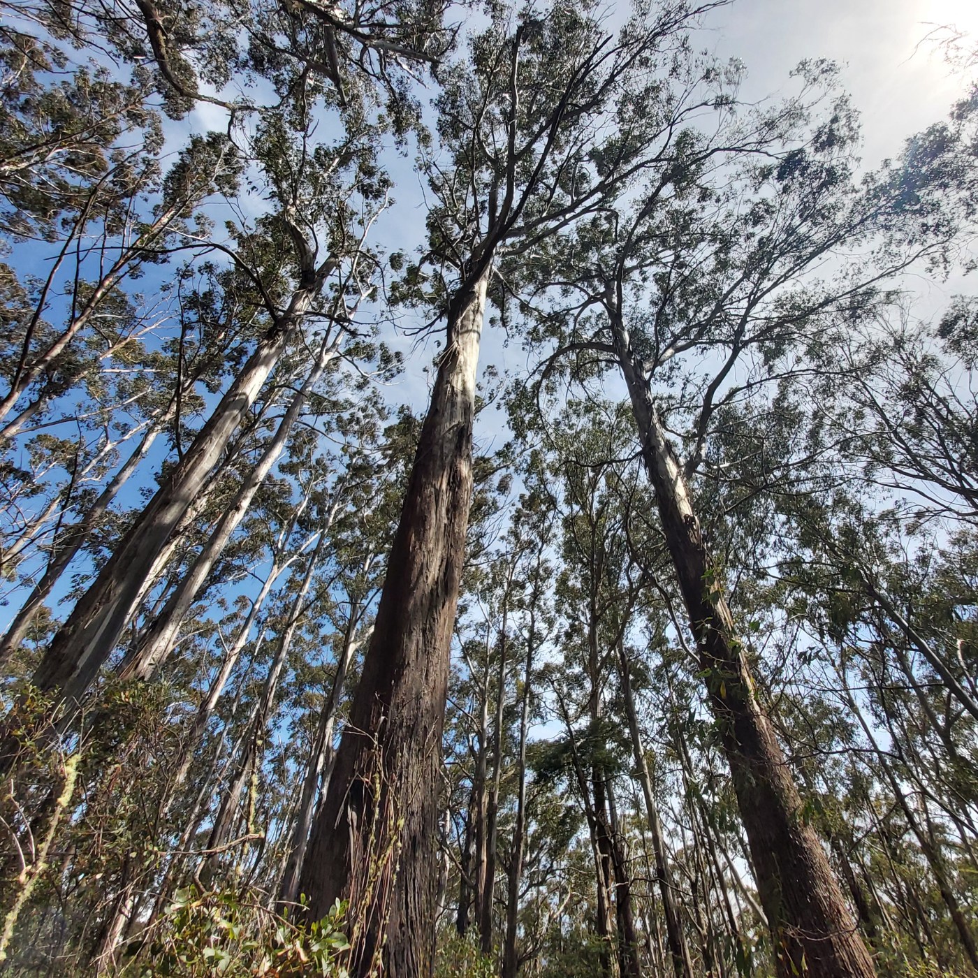
We know that large old trees in ecosystems in Victoria which are dominated by Alpine Ash are in ‘rapid decline’ (source). More frequent fires are leading to an ever younger age of the forests that have survived. Yet the forests along the AAWT above Big Saddle that are within the planned coupes are relatively older in age. In the face of all we know, how can this logging be justified?
Take action
If this logging concerns you and you want to voice your concern, please check this report from Friends of the Earth about their recent visit to the AAWT. Scroll to the end to see the action points.
The images here are from the walk on March 18.
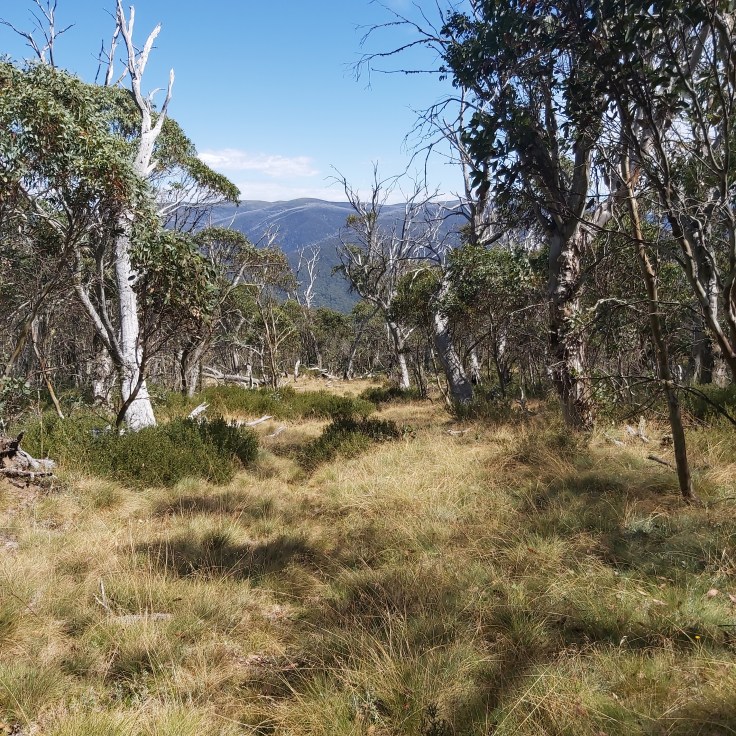
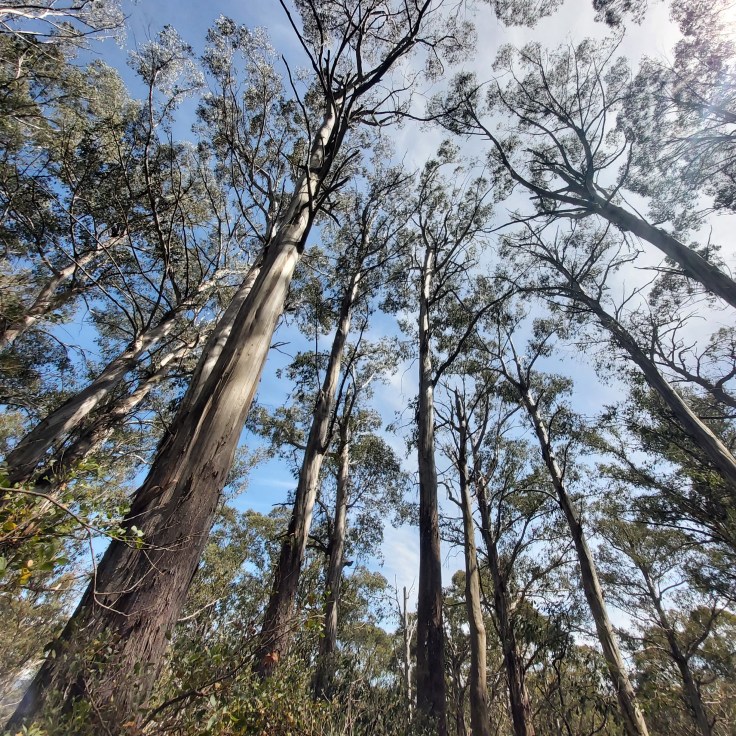
ABOVE: the descent along the AAWT towards Big River saddle, through the snow gum country above the alpine ash
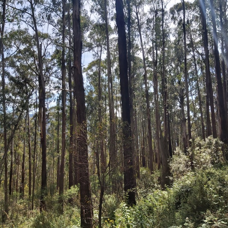
ABOVE: the forests near Big River Saddle


March 22, 2023 at 12:34 pm
Hi Cam,
” Most people approach the mountain from the Ovens Valley”
You mean the Kiewa Valley? Or the Mountain Ck valley?
Regards, Ern
[FROM CAM: well spotted Ern, I have amended that bit. Thanks.]
………………………… Ern Reeders # 0408 530106