The NSW government is one step away from allowing aerial control of feral horses in Kosciuszko National Park. After years of delay, and continued growth in horse populations, this is huge news and a crucial step for our threatened native wildlife and the fragile alpine ecosystems they call home.

The Victorian backcountry festival will be happening soon at Mt Hotham (September 1, 2, 3). Now in its 6th year, the festival offers tours, workshops, a demo village, ski in outdoor bar on a hilltop, repair cafe, avalanche safety courses, an opening night party, films and a speakers program.
You can register for the festival here. The full program will be posted on the backcountry festival home page shortly.
As part of the speakers program, there will be a great event at The General in Mt Hotham village, with presentations on how to turn concern for the mountains into meaningful action.
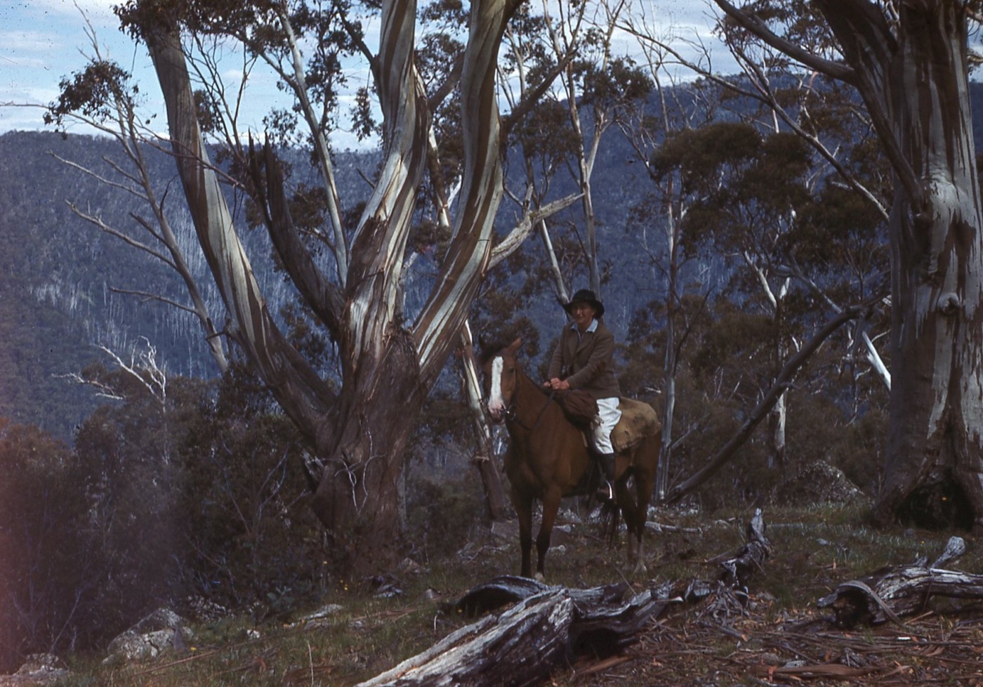
In the 2023 print edition of Mountain Journal (available as a pdf here), we acknowledged the legacy of Maisie Fawcett. Maisie was an ecological pioneer who is remembered for her ground breaking work in the Victorian high country. In this story from Karina Miotto, Latrobe University, Maisie’s legacy is considered in the broader context of her work as a woman operating in a time where society – and science – were heavily dominated by men.
A quiet achievement took place last summer in the Victorian Alps. Scientists gathered to re-measure botanical plots first set up more than 75 years ago by one of the pioneering women in science. This is the story of that woman.
Continue reading “Maisie Fawcett and her eternal legacy for Australian science”
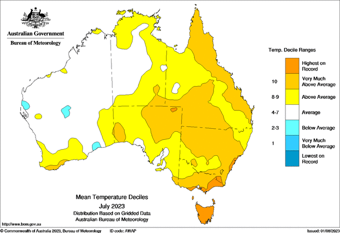
We know that climate change is reducing the overall amount of snow we receive in Australia. The snow pack has been in decline since at least 1957. We also know that the loss of snow is being felt especially at lower elevations.
This is certainly being experienced this winter, where places like Tasmania and lower resorts like Mt Selwyn have had almost no snow.
Continue reading “Lower elevation resorts rapidly becoming non viable under climate change impacts”
Australia has always experienced erratic weather and climate extremes. But, as demonstrated in this cartoon from National Oceanic and Atmospheric Administration (NOAA), human induced climate change is now ‘super charging’ those natural cycles.
So, when we get an El Nino pattern, it is hotter and drier than it would have been otherwise. Same with the wetter conditions that come with a La Nina event.

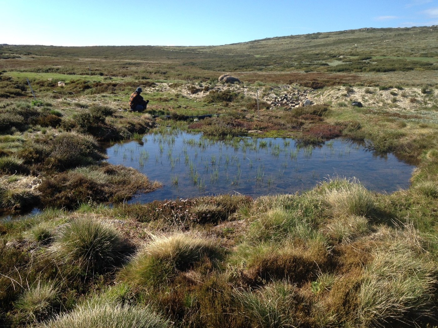
The announcement that native forest logging will end in eastern Victoria on January 1, 2024 is great news for the forests of the high country.
We wrote a brief piece explaining the implications of the announcement here.
As we noted in that story, this means the state will be spared another six years of intensive logging and allow us to start the generations long work of restoring a landscape that has been deeply impacted by intensive logging and repeat fires in recent decades.
However, significant areas of the high country are still included in an updated Timber Release Plan (TRP) which could be logged before the January 1 cutoff date.
We are watching a number of key areas, including Mt Stirling, the headwaters of the Little Dargo, and Mt Wills area to ensure that no last minute ‘cut and run’ logging occurs.
It is good to note that Alpine Resorts Victoria is saying that proposed logging at Mt Stirling ‘may not proceed given the cessation of logging by January 1, 2024’.
The road to the planned coupes on Mt Stirling will be closed until the end of winter. But if you are up in the mountains, please keep an eye open for any last minute logging. And let us know if you see anything: cam.walker@foe.org.au

Now in it’s 6th year, the Victorian backcountry festival will happen at Mt Hotham again over the first weekend of September.
The three day event (September 1, 2, 3) features the normal program that we all love – guided tours, workshops, a speakers program, demo village, repair cafe, and the saki in outdoor bar on a mountain top.
The festival is 100% volunteer run and the committee is working hard to deliver another great event.
Registration for the festival is now open, with an early bird rate of $40 for the weekend. This covers basic and very important costs like insurance for the festival. Registering will mean you receive details of the tour program when it is announced. Registrations after July will be $50, so get in now and save.
You can register here.
https://events.humanitix.com/2023-victorian-backcountry-festival-early-bird-tickets
Back in 2016, lightning storms ignited a number of fires in central and western lutruwita/ Tasmania, which turned into large scale events that ‘threatened the core refugia of Gondwanan vegetation, particularly the largest stands of the endemic conifer Athrotaxis cupressoides’ (Pencil Pines). Pencil Pines are already limited to very small areas of Tasmania. Burnt Pencil Pines are unlikely to recover ‘given their slow growth, limited seedling establishment and projections of increased fire weather and lightning ignitions associated with drier soils.’
Although the climate of western Tasmania has not changed very much, as yet, as a result of global warming, the incidence of dry lightning strikes has increased markedly from last century to the present. Therefore these type of lightning caused fires are expected to increase. This could put the very survival of Pencil Pine communities at risk.
One of the fires that created greatest concern started near Lake Mackenzie, on the north western end of the Central Plateau. Significant areas of Pencil Pines were burnt.
With scattered groves of Pines burnt, and unlikely to recover without some form of intervention, what are our options?
Seven years on from the fires, research from the University of Tasmania, shows what is being done to assist recovery.
Continue reading “Post fire recovery of Pencil Pines at Lake Mackenzie”
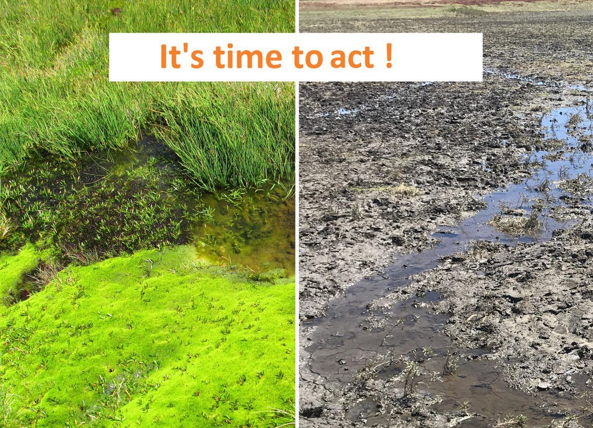
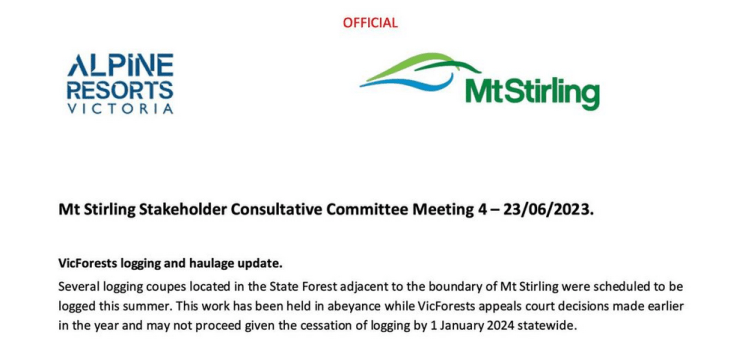
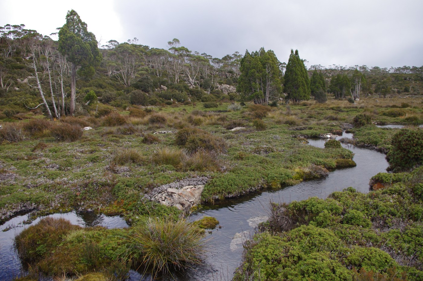
North East Victoria is home to more than 2,000 hectares of Alpine Peatlands, an endangered ecological community listed under the Environment Protection and Biodiversity Conservation Act (1999).
Alpine Peatlands, or Alpine Sphagnum Bogs and Associated Fens, are a priority ecological community for the North East Catchment Management Authority (CMA) supported through a five-year project to protect and enhance these unique environments.
This five-year, cross-regional project is coordinated by the Victorian Alpine Peatlands Project Coordinating Committee (VAPCC) and delivered in collaboration across three CMA regions (North East, East Gippsland and West Gippsland) with Parks Victoria. This project is funded by the Australian Government’s National Landcare Program.
Now a new video has been released at https://youtu.be/QmyxVs7lXHA, developed by North East CMA to mark completion of the Cross Regional Victorian Alpine Peatlands Protection Project. Partners in the video are Parks Victoria, East Gippsland CMA, West Gippsland CMA and Gunaikurnai Land and Waters Aboriginal Corporation.
Continue reading “New video celebrates alpine peatland protection”

Many regional areas are in danger of being ‘developed to death’ as people move from major cities, seeking a Tree or Sea Change. From coastal areas like the Bellarine Peninsula to the Otways, to valley towns in north eastern Victoria, people are flocking to regional centres close to attractive places. The covid lockdowns allowed many people to transition to online work, which has further driven the trend towards relocating in regional areas. This is, of course, causing many problems as farmland and remnant vegetation is swallowed up (usually by low density sprawl), with growing demands for water supplies and waste treatment, and growing impacts on local community services like healthcare and schools.
This is playing out in many areas, including Bright in north eastern Victoria.
Continue reading “Housing development in Bright facing strong community opposition”
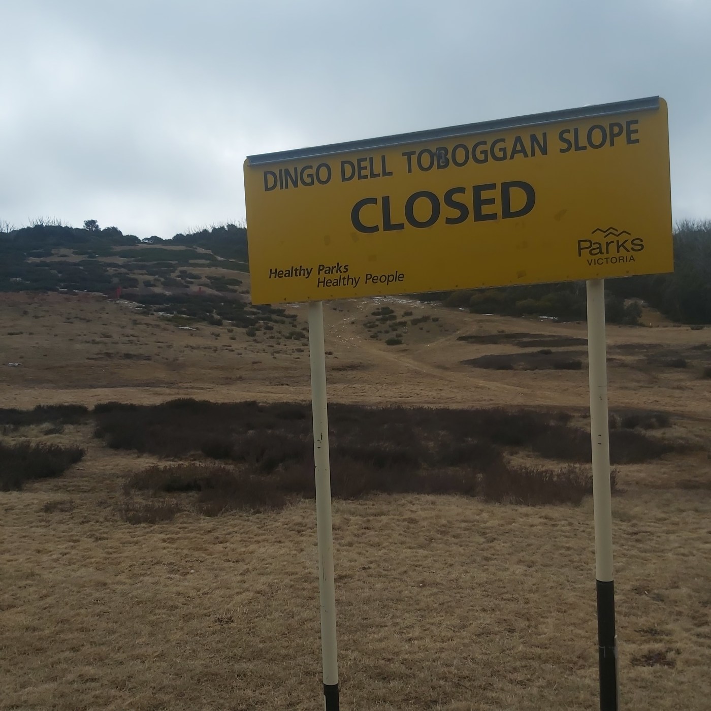
Recently I was enjoying an evening hanging out at Bluff Spur hut on Mt Stirling. The 9 folks there had long and interesting yarns and, as is usual in a backcountry hut, many of the chats often focused on the adventures we have enjoyed in the mountains.
A common theme was favourite places, and favourite people and at some point Bill Barker, head of ski patrol at Mt Hotham, came up and we agreed he was a living legend. We discussed our favourite huts (King Saddle, Cleve Cole and Vallejo Ganter), favourite mountains (Feathertop, Bogong), and favourite camping spots (well that would have to be a secret).
I got an idea for Mountain Journal magazine #4. What are the icons of the mountains we love? What people, what places, what forests, what institutions? I am hoping you will feel inspired to write a brief piece on your favourite mountain icon, for publishing on the website and (later on) in the next edition of the magazine.
An Icon is
‘A person or thing widely admired especially for having great influence or significance in a particular sphere’.
It might be a person who inspires you, a place, a mountain hut, a river, a business or other institution.
Anyone who is paying attention to the state of our winters knows that they are getting more erratic. Often they start later (it’s now a rare thing to ski on natural snow on opening weekend) and winter snow is subject to more rain events, with big impacts on snow pack. While our climatic patterns go through natural wetter and drier cycles, climate science tells us that these patterns will become more extreme, with less overall snow and shorter seasons over time.
While all resorts track snowfall, the benchmark of snowfall in Australia over time comes from Spencers Creek, at a site at 1,800 metres above sea level, in the Main Range of the Snowy Mountains.
The area is midway between Perisher Valley and Thredbo, and has been visited by weather observers every week during winter since the mid-1950s, when the Snowy Hydro scheme was being constructed. The information collected by Snowy Hydro provides our best snapshot of snow pack over time. Sadly the data shows that snowpack has been in decline since 1957.
Now Protect our Winters (POW) has discovered that the frequency of data collection at Spencers Creek has decreased in recent years.


Recent Comments