Victoria’s highest mountain, Bogong (Warkwoolowler in the Waywurru and Dhudhuroa languages, meaning the mountain where Aboriginal people collected the Bogong Moths) is protected in the Alpine National Park. It sits high above the town of Mount Beauty and is a drawcard for hikers, skiers and backcountry snowboarders. There are no roads on the mountain, and access is slow because of the steep climb up from the valley. It is an alpine wonderland of wildflowers in summer and deep snow in winter.
Most people approach the mountain from the Ovens Valley or across the Bogong High Plains. There is another route on the eastern side, following the appropriately named Long Spur to Mt Wills. This is all high elevation woodland and forests, and is the route by which the famous Australian Alps Walking Track (AAWT) leaves Bogong as it heads towards the Snowy Mountains. The 700 km long AAWT crosses the Alps from Walhalla to the outskirts of Canberra, and follows Long Spur from Bogong to Mt Wills before turning south and dropping into the valley of the Mitta Mitta River.
Mt Wills itself is a magical ‘island in the sky’ of isolated snow gum woodland, largely dominated by older trees. While it is connected by the long and high ridge back to Bogong, mostly the land around the mountain falls away to deep river valleys and forests that are initially dominated by Alpine Ash.
A new threat to these mountains
The higher mountain areas on this side of the Bogong High Plains are largely intact, although significant areas have been burnt, often several times in close succession, in recent years. But now there is a threat posed by logging in the area where the AAWT/ Long Spur track starts the climb up to Mt Wills, which would create a large clear cut area of more than 100 hectares.
There are four coupes in total planned for the Long Spur area:
- three where the AAWT starts the climb up into the intact snow gum woodlands of Mt Wills and
- one closer to Bogong itself. This last one is a worry because it is in the headwater area of the Big (Mitta Mitta) River, which flows from a valley between Mt Bogong and the Bogong High Plains. The Mitta is one of the most important rivers in the state and feeds the Dartmouth Dam, and then the Murray River.
The coupes are listed in the Victorian government’s Timber Release Plan, and scheduled for logging any time between now and 2026. You can find maps on the state government’shttps://maps.ffm.vic.gov.au/fip/index.html?viewer=fip Forest Information Portal.
The coupes are:
685-507-0001 (9.4 ha)
685-507-0004 (45 ha)
686-511- 0002 (45 ha) – an adjacent coupe (686-511-0004 of 33 ha has already been cut)
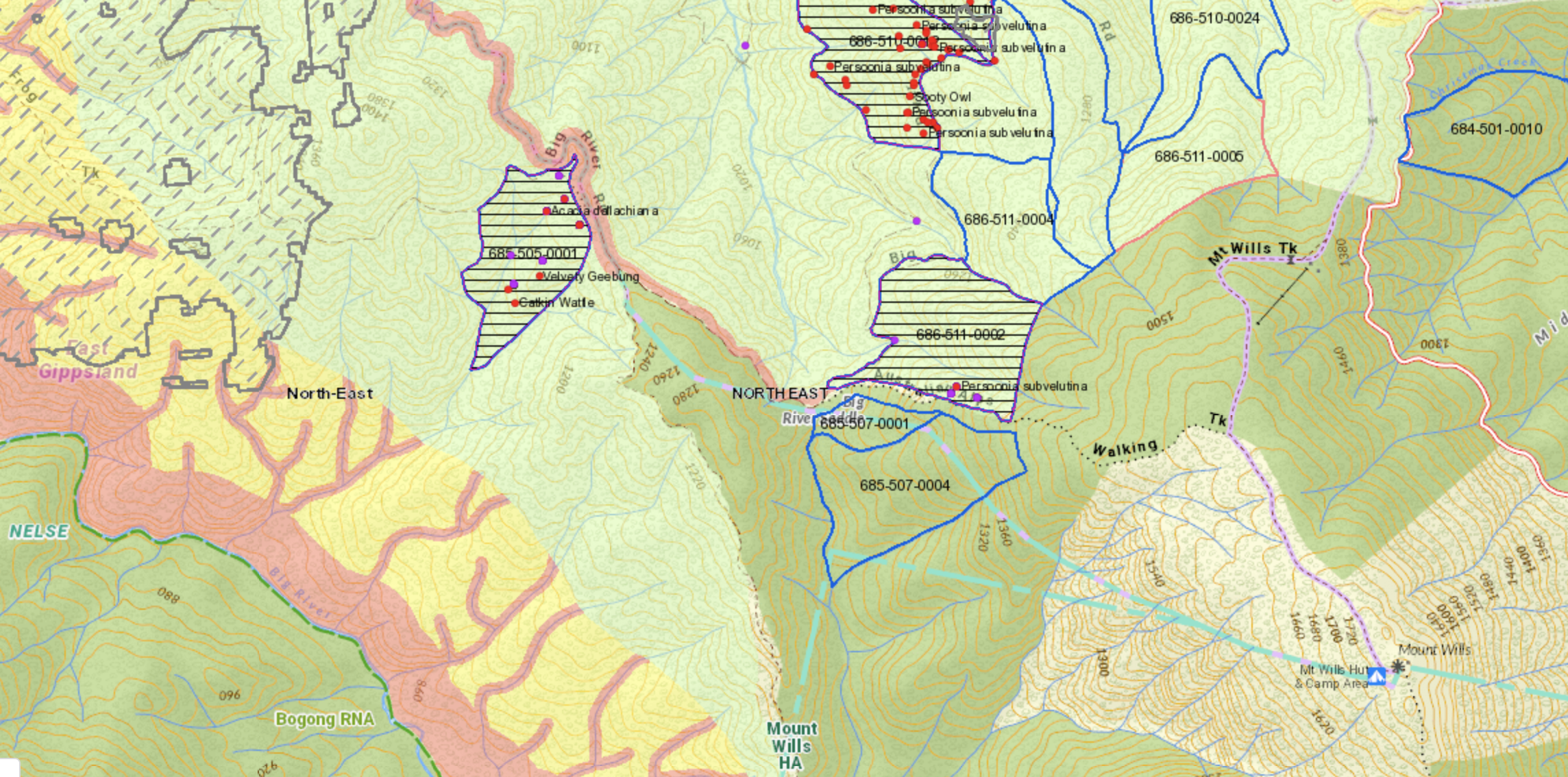
ABOVE: map showing the coupe in the Big River valley (centre left) and around the AAWT (centre right)
The coupe in the upper section of the Big River valley is:
685-505-0001 (35 ha and a 2 ha road corridor). The upper Big River has not previously experienced logging in the way the northern side of Mt Wills has. The headwater area of the Big River starts on the Bogong High Plains, and flows into the Glen Valley, where it becomes the Mitta Mitta. It is a hugely
These coupes contain ‘modelled old growth’ according to VicForests surveys.
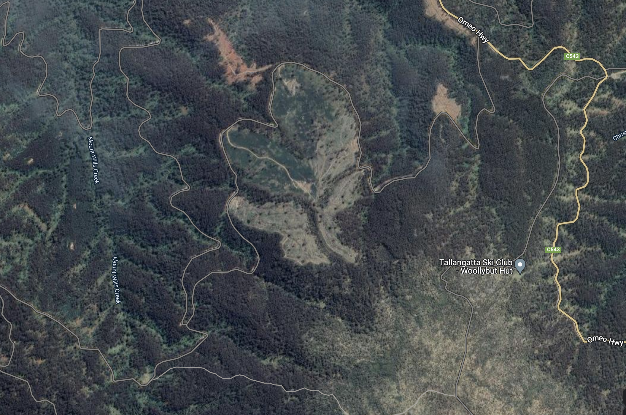
ABOVE: showing logged areas to the north of the planned coupes
In recent years there has been substantial logging to the north and north west of Mt Wills, along the edge of the Omeo Highway. These new coupes will push further into the wilder country of the higher mountains and will directly impact on the AAWT. The old forests of Mt Wills are of incredibly high ecological value, and having fire prone regrowth forests down hill on the north western side of the mountain poses a significant long term threat to these forests.
Take action
With all the damage caused by the 2019/20 fires across the mountains and East Gippsland, there is just no excuse to be cutting older forests like these.
Please add your voice to the call to protect these forests: Please contact the environment minister and urge her to protect the Mt Wills coupes by removing them from the Timber Release Plan: lily.dambrosio@parliament.vic.gov.au
If you’re short for time, please sign this letter to the Minister.
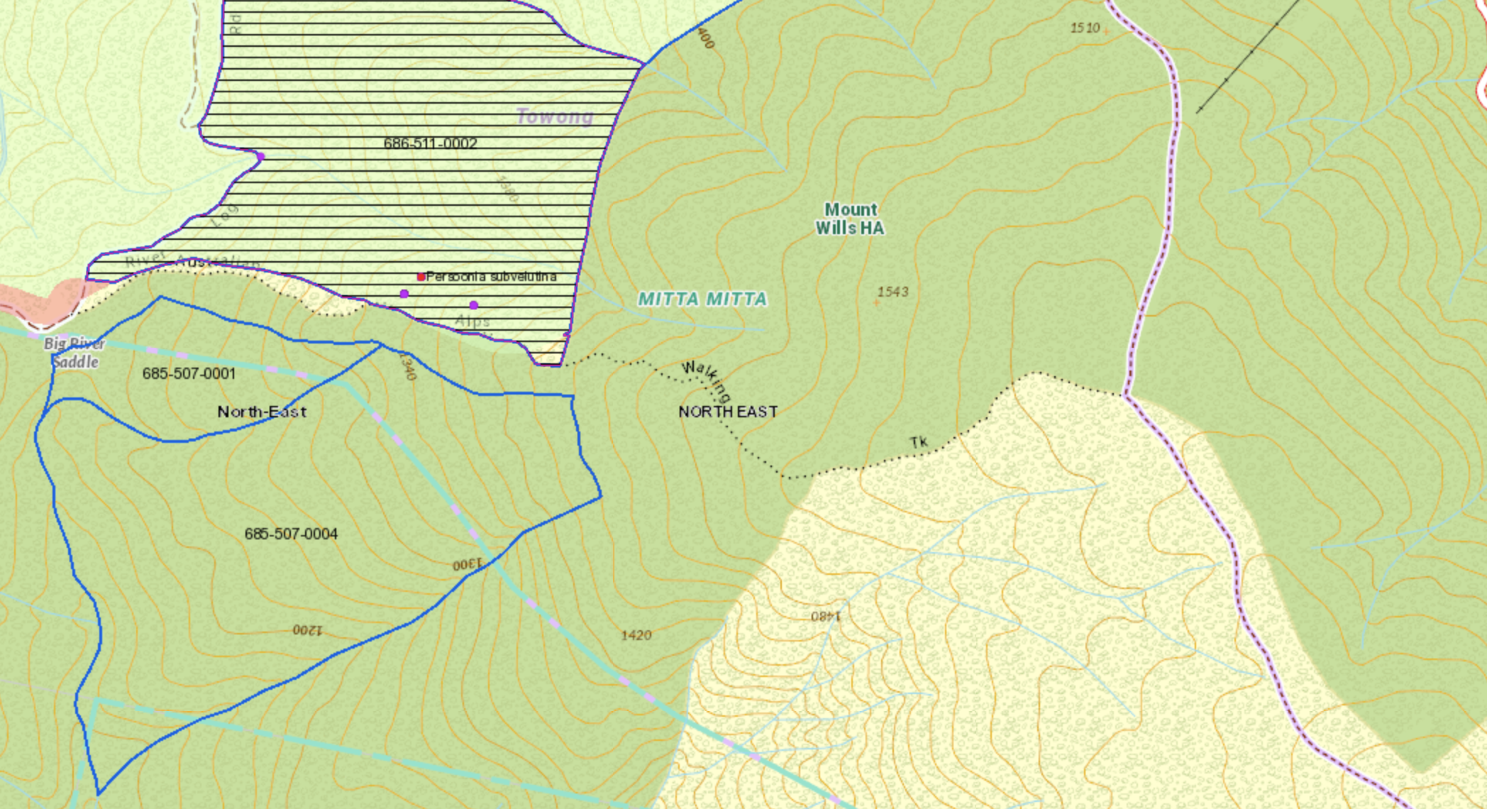
ABOVE: if walking the AAWT from Bogong to Mt Wills, please take a photo along the section shown in the map above – uphill from Big River Saddle as you walk towards Mt Wills. As shown here, there are planned coupes on both sides of the AAWT (with a narrow buffer of trees to be left along the actual AAWT).
Please tell people about these special forests and the need to protect them. If walking in the Bogong / Mt Wills area along the AAWT, please take an image of the forests as you walk through – see the map above – tag in the Minister @LilyDAmbrosioMP and add the hashtag #ProtecttheAAWT and #ProtecttheMitta
Join one of our fieldtrips to visit these forests and document how special they are. Contact cam.walker@foe.org.au for details.
A simple thing you can do is to sign this letter to the Victorian minister for the Environment, urging her to act on the recommendations of the Icon at Risk report which outlines threats to the Victorian high country.
And it would be great if you would also call on the Victorian government to create additional firefighting capacity to look after remote and wild areas like the Mt Wills plateau. There is information here.
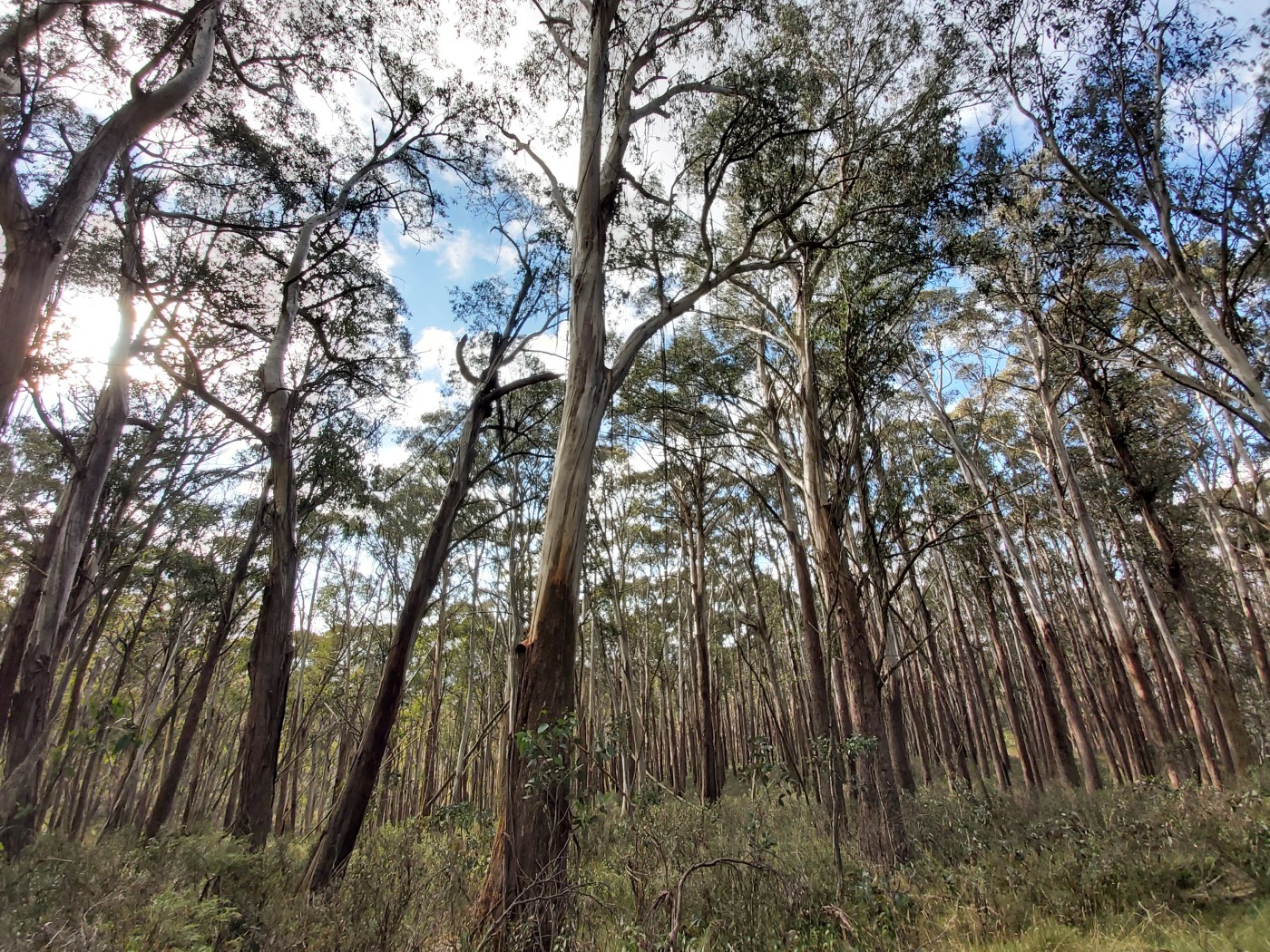
The header image from this story shows Alpine Ash forests on the northern slopes of Mt Wills.
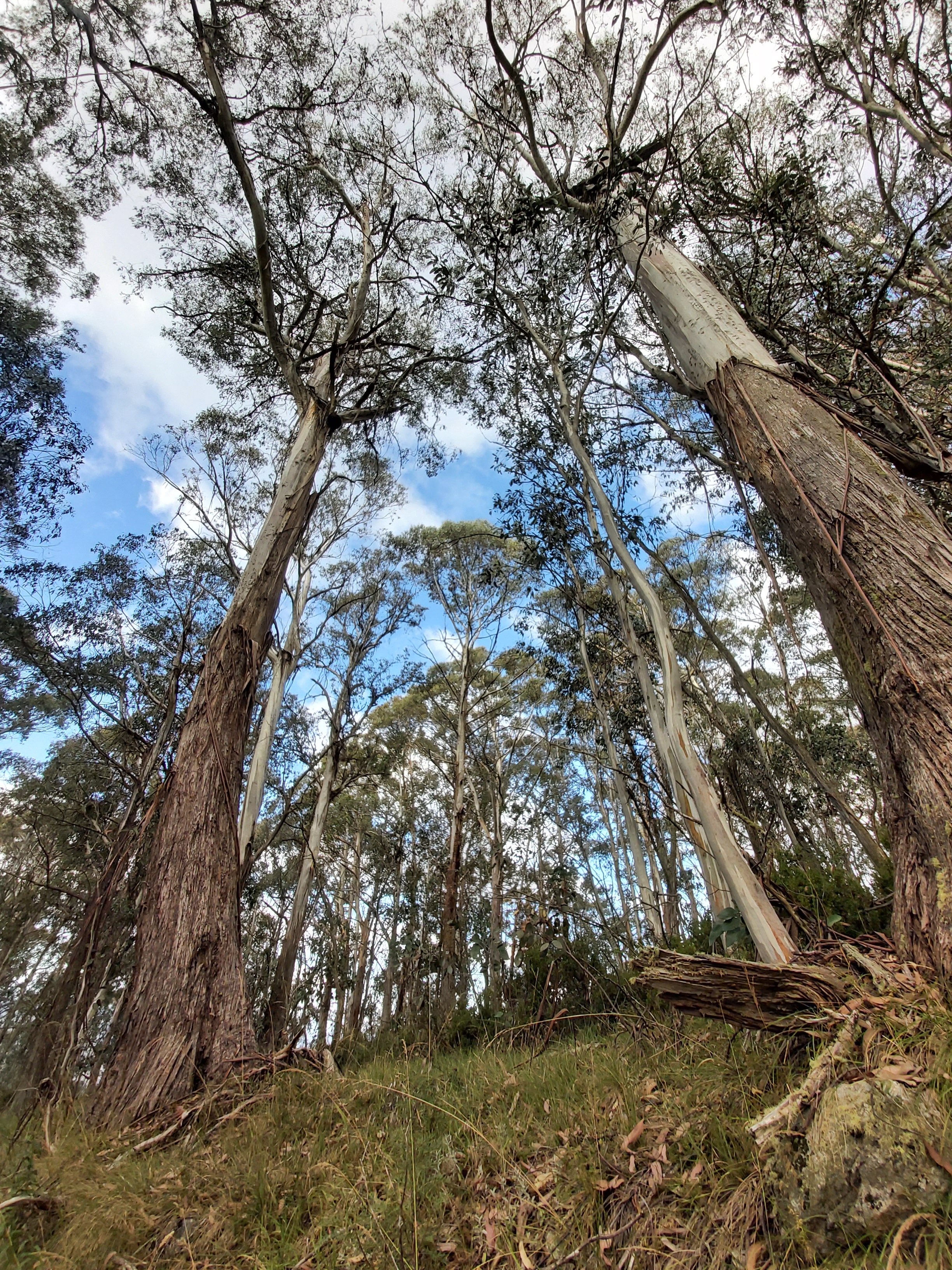
ABOVE: Alpine Ash forest near the coupes


October 4, 2022 at 8:28 pm
Cam, I’ll share the link to this post in various environmental Farcebook groups.
October 5, 2022 at 9:56 pm
We must stop logging the precious old growth forests t Bogong and Mount Wills
We cannot afford the serious and extensive damage to our old trees and the vulnerable ecosystems they support. Please put an end to this irresponsible removal of the lungs of the earth. We are on track for 3-4 degrees of global warming by 2100 which is incompatible with civilization. These old trees and forests comprise the best carbon capture and storage systems we have. Please show leadership and protect these forests and our Earth.