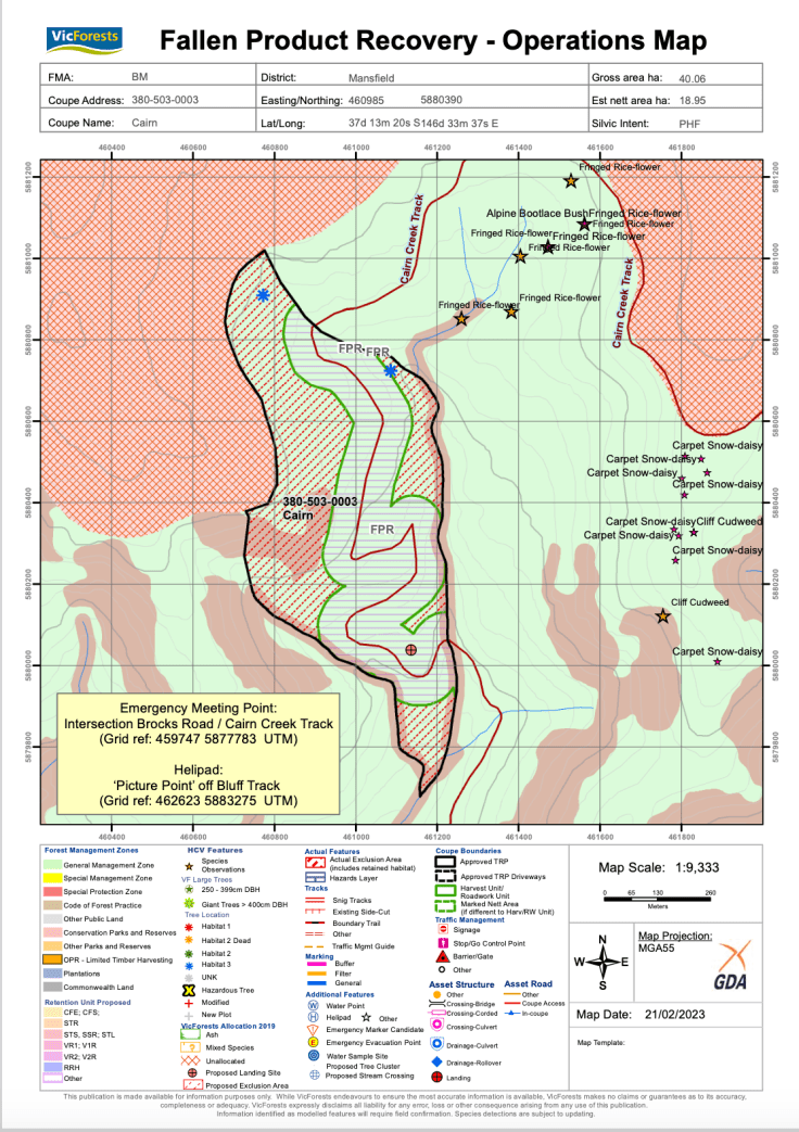
It appears that logging operations are about to start in the upper Jamieson River in the Victorian high country, to the south east of Mt Buller. The operations, covering a coupe which is 40 hectares in size (coupe 380-503-0003) will occur right up against the edge of the Alpine National Park, just south of Mt Lovick. This is one of a cluster of coupes which are scheduled for logging. It also includes a significant roading operation to upgrade the existing track.
Please scroll down for updates.
The Alpine National Park is largely based on ‘economic boundaries’: that is, the higher sub alpine zones were put into the park, whereas lower elevation taller forests with valuable alpine ash and other timber species were excluded from the park so they could be harvested (some areas of ash were subjected to ‘once only’ logging before being placed in the national park). Logging in the upper Jamieson has been going on for decades, and this latest area is in Cairn Creek, a tributary of the North Branch of the Jamieson, which flows into Lake Eildon.
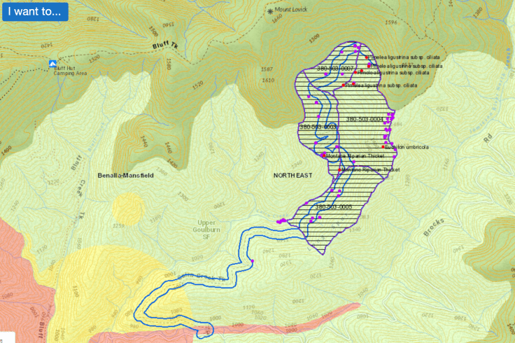
ABOVE: map of the four coupes (the Alpine National Park is the dark green). Map source: https://maps.ffm.vic.gov.au
How do you know when an area is about to be logged? When it appears on the Timber Harvesting Safety Zone (THSZ) website.
What is in this forest, what timber will it produce (and how much of that will be low grade pulp or paper)? It’s hard to know. The THSZs are normally only listed a day or so before logging operations or roading starts so that pesky citizen scientists can’t get into the forest to see if there are threatened species.
Not having been into the upper Jamieson for a while I assume this area is affected by the fires that were started by lightning strike on January 31, 2019. I expect that the coupes will be a mix of burnt but still living alpine ash, probably merging into snow gums at the higher elevations. The alpine ash forests upslope from the coupe contained some wonderful older ash forests. Because of the implementation of the THSZ it is not possible to enter the area to see if logging has in fact started.
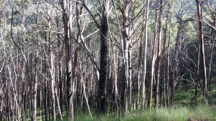
ABOVE: this fire damaged alpine ash forest is in the vicinity of the planned coupes.
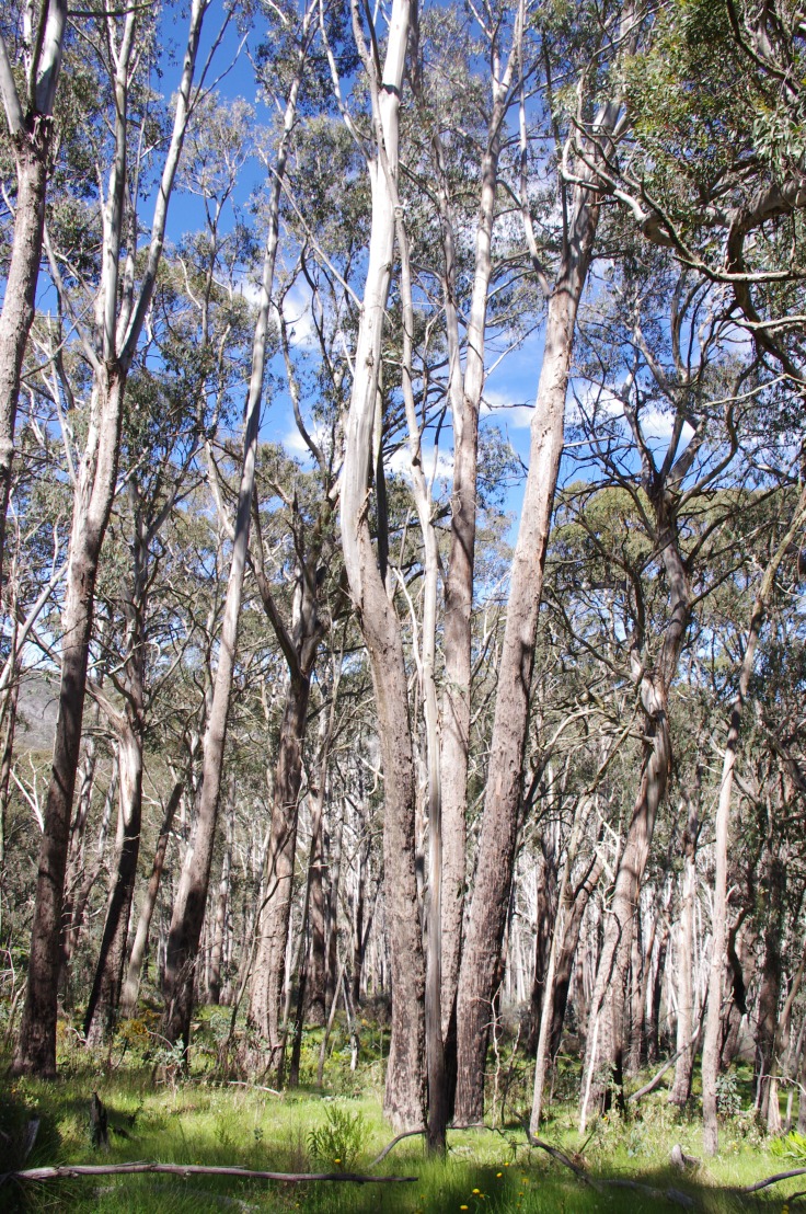
ABOVE: Alpine Ash forest within the Alpine National Park, close to (and slightly uphill from) the current planned logging coupes.
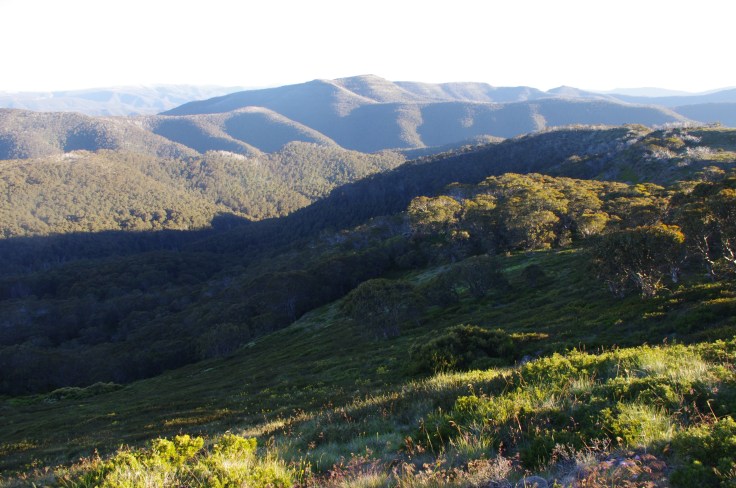
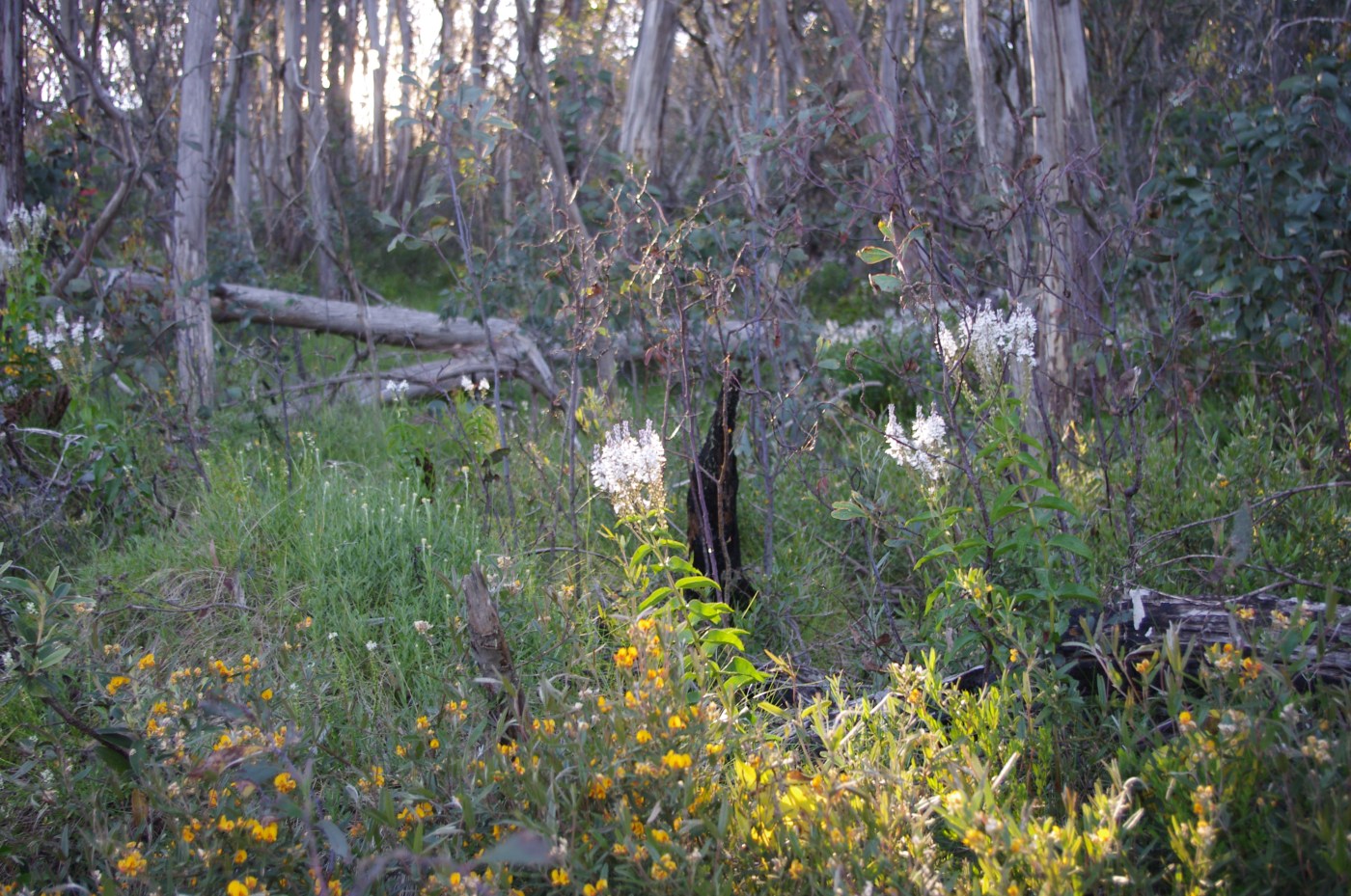
PHOTO: just above the logging coupes, Mt Lovick summit area.
Whatever ecological features are currently to be found in coupe 380-503-0003 are likely soon to be gone.
Sadly we know that VicForests often fails to properly revegetate the higher elevation forests after logging operations have ceased (for instance check this example from Mt Delusion). Let’s hope we don’t see failed regeneration after this logging is done.
UPDATE March 24


March 7, 2023 at 11:05 am
Hi all, send this blog to your local MP.. damn well shoudln’t be happening for MANY reasons.