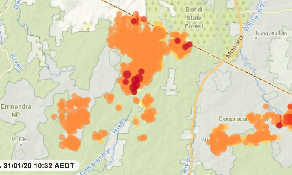
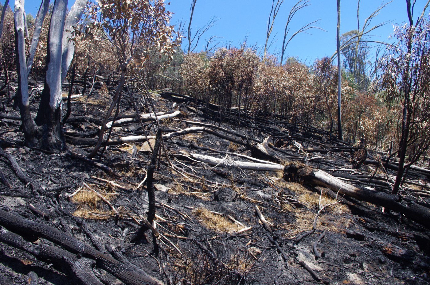
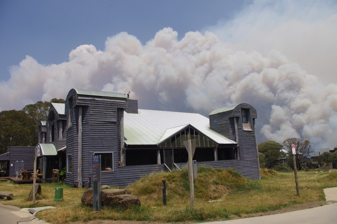
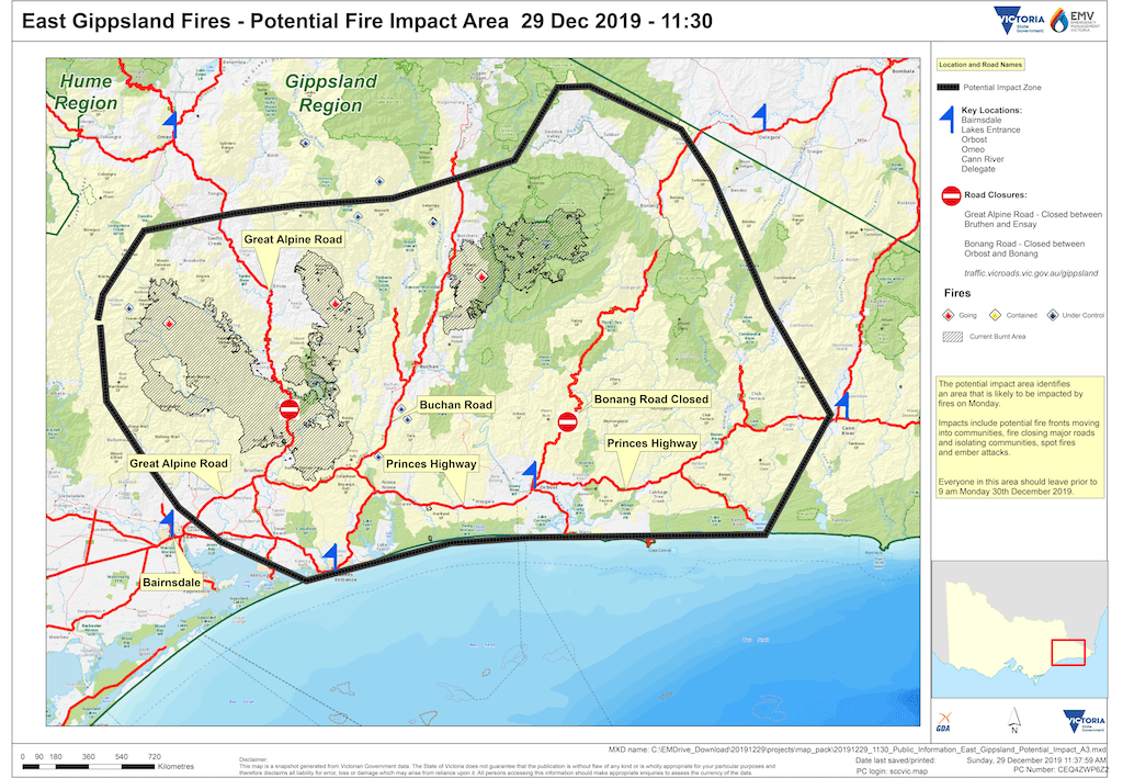
The fires across East Gippsland this summer have had devastating impacts on land and forests, waterways and native species, local economies and people’s lives and properties.
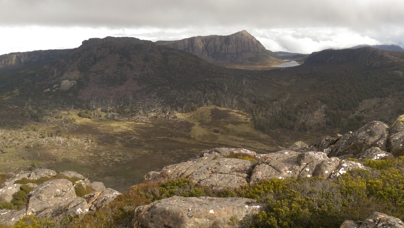
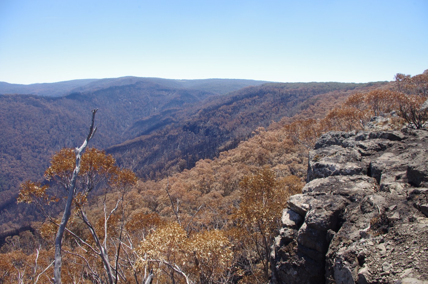
One glimmer of good news has been the fact that many of the cool temperate rainforest strong holds have been spared from much of the fire. Most of the famed Kuark forest has not burnt (or has possibly been ‘burnt lightly’ according to reports from the field), and the Errinundra Plateau has been spared any major fires. It appears that the Goolengook rainforest has been partially burnt. (Extra info here).
But now there are reports that back burning operations were carried out several days ago between the VIC/NSW border and the Errinundra Plateau, in order to save the Bondi pine plantations in southern NSW. Yesterday (JAN 30) in the 40 degree heat, the fires from these spotted across the Coast Range Road into the most valuable area of the Errinundra national park. The scale of these fires is not yet known.
We will update as additional information comes to hand.
[With thanks to Jill Redwood for this information]
Continue reading “Are Errinundra’s rainforests now burning?”
 ANNOUNCEMENT: Melbourne screening cancelled for now
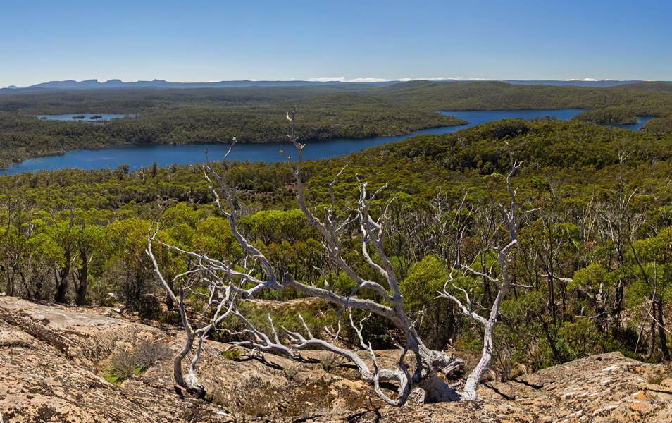


Recent Comments