Search

Mountain Journal

Environment, news, culture from the Australian Alps

Tag

forestry

A wander up Mt Wills & logging along the AAWT

Victoria’s highest mountain, Bogong (Warkwoolowler in the Waywurru and Dhudhuroa languages, meaning the mountain where Aboriginal people collected the Bogong Moths) is protected in the Alpine National Park.

Most people approach the mountain from the Kiewa Valley or across the Bogong High Plains. There is another route on the eastern side, following the appropriately named Long Spur to Mt Wills. This is all high elevation woodland and forests, and is the route by which the famous Australian Alps Walking Track (AAWT) leaves Bogong as it heads towards the Snowy Mountains. The 700 km long AAWT crosses the Alps from Walhalla to the outskirts of Canberra, and follows Long Spur from Bogong to Mt Wills before turning south and dropping into the valley of the Mitta Mitta River.

Mt Wills itself is a magical ‘island in the sky’ of isolated snow gum woodland, largely dominated by older trees. While it is connected by the long and high ridge back to Bogong, mostly the land around the mountain falls away to deep river valleys and forests that are initially dominated by Alpine Ash.

Now logging threatens the area between Bogong and Mt Wills.

Continue reading “A wander up Mt Wills & logging along the AAWT”

Logging to start soon in the Upper Jamieson Valley?

It appears that logging operations are about to start in the upper Jamieson River in the Victorian high country, to the south east of Mt Buller. The operations, covering a coupe which is 40 hectares in size (coupe 380-503-0003) will occur right up against the edge of the Alpine National Park, just south of Mt Lovick. This is one of a cluster of coupes which are scheduled for logging. It also includes a significant roading operation to upgrade the existing track.

Please scroll down for updates.

Continue reading “Logging to start soon in the Upper Jamieson Valley?”

Logging and riding don’t mix

Nature based tourism is an enormous part of the economy of many regional centres. Skiing, mountain bike riding, bushwalking, bird watching, camping, paddling, trail running all provide a growing part of the local economies of towns across the country where there are public lands with opportunity for adventure.

Sadly, logging and destructive land activities impact on many areas. The fact is that people don’t want to walk or ride through a logging coupe or open cut. But logging currently threatens a number of important nature and outdoor tourism activity.

Continue reading “Logging and riding don’t mix”

Its time to #ProtecttheMitta

The Big/ Mitta Mitta River flows from the Bogong High Plains, travels south then swings north into the Dartmouth Dam. It is one of Victoria’s most impressive mountain rivers, and is a drawcard for fishers, paddlers, campers and people who enjoy quiet time by a river.

Sadly, logging is now planned for an initial coupe in the headwaters of the river.

Action to highlight the threat posed by logging to the Mitta Mitta River.

Thursday March 16, 10am – 11am.

Meet at 10am. Mitta Mitta action on the river – highlighting the threat of logging in the headwaters of this important river system. This will be a simple ‘photo op’ in the river and a chat and cuppa tea around the fire with like minded people.

You can rsvp for the event here. You will be emailed additional information on logistics.

This is happening as part of the Mountain Roadtrip (March 14 – 19).

Check here for further information about the logging in the upper river.

Getting there

Meet at the Big River campground. This is where the Omeo Highway crosses the Big River in Glen Valley. This is about a 50 minute drive north from Omeo via the Omeo Highway, or a 60 minute drive from Mitta Mitta along the Omeo Highway. Search google maps for ‘Big River Bridge Campground, 4466 C543, Glen Valley VIC 3898’ for full details on the location.

Logging is planned upstream from the bridge towards the Bogong High Plains in the headwaters of the Big River. The coupe in the upper section of the Big River valley is 685-505-0001 (which is 35 ha in size, with a 2 ha road corridor). You can find out more about the logging here.

Screen Shot 2023-02-16 at 5.11.20 pm

Above: this map shows the coupe in the upper Big River (circled).

Walk to Mt Wills

Victoria’s highest mountain, Bogong (Warkwoolowler in the Waywurru and Dhudhuroa languages) is protected in the Alpine National Park. It sits high above the town of Mount Beauty and is a drawcard for hikers, skiers and backcountry snowboarders. It is an alpine wonderland of wildflowers in summer and deep snow in winter.

However, surrounding areas continue to be logged. And now a series of logging coupes are proposed along the Australian Alps Walking Track (AAWT) between Mt Bogong and Mt Wills. Additionally, a coupe is planned in the headwaters of the Mitta Mitta River, close to the AAWT.

If this concerns you, please join us for a walk to Mt Wills on saturday March 18. It is about a 90 minute walk up a good 4WD track to reach the summit. We will take a photo of the group on the summit with Mt Bogong as our backdrop as part of our campaign to build awareness about this new threat to mountain forests.

Continue reading “Walk to Mt Wills”

Join us for a walk up Mt Bogong/ Warkwoolowler to oppose logging of mountain forests

Victoria’s highest mountain, Bogong (Warkwoolowler in the Waywurru and Dhudhuroa languages) is protected in the Alpine National Park. It sits high above the town of Mount Beauty and is a drawcard for hikers, skiers and backcountry snowboarders. There are no roads on the mountain, and access is slow because of the steep climb up from the valley. It is an alpine wonderland of wildflowers in summer and deep snow in winter.

However, surrounding areas continue to be logged. And now a series of logging coupes are proposed along the Australian Alps Walking Track (AAWT) between Bogong and Mt Wills. Additionally, a coupe is planned in the headwaters of the Mitta Mitta River, a major river which starts on the Bogong High Plains.

If this concerns you, please join us for a walk to Mt Bogong on Friday January 20. We will walk up Staircase Spur. We will take a group photo with banner on the summit as part of our campaign to build awareness about this new threat to mountain forests.

Continue reading “Join us for a walk up Mt Bogong/ Warkwoolowler to oppose logging of mountain forests”

Logging at Mt Stirling – what’s at stake?

With news that logging could commence on Mt Stirling as soon as this week, Friends of the Earth (FoE) activists visited the mountain over the weekend of November 18 – 20. Assisted by Friends of Mt Stirling and the Victorian National Parks Association, we visited most of the planned coupes and carried out night time surveying for threatened animal species in a number of them.

What we found was a rich diversity of forests and ecosystems, from mid elevation mixed species forests, areas dominated by alpine ash, and in the higher Number 3 area, proposed coupes that were a mix of older snow gums intermixed with alpine ash. While we did not spot either Greater Glider or Yellow-bellied Gliders (YBG), we found forests within the coupes with likely habitat for these species and an active YBG feed tree.

Continue reading “Logging at Mt Stirling – what’s at stake?”

Mountain forests miss out on protection


In November 2019 over 96,000 hectares of Immediate Protection Areas (IPAs) were announced by the Victorian government alongside the Victorian Forestry Plan which will see an end to native forest logging by 2030. IPA boundaries for four areas have now been finalised.

However, there has been no additional protection of forests threatened with logging in the Victorian high country.

Continue reading “Mountain forests miss out on protection”

Major logging operations to start at Mt Stirling

A considerable number of areas of forest on and around Mt Stirling are due to be logged soon (November 2022 onwards). This will have significant impacts on tourism (a number of the areas will be cut along the popular Circuit Road), will further fragment the important alpine ash forests on the mountain, and threaten the viability of older alpine ash and snow gum forests upslope due to the highly flammable nature of logging regrowth..

Continue reading “Major logging operations to start at Mt Stirling”

Logging threat to Victoria’s high country

Victoria’s highest mountain, Bogong (Warkwoolowler in the Waywurru and Dhudhuroa languages, meaning the mountain where Aboriginal people collected the Bogong Moths) is protected in the Alpine National Park. It sits high above the town of Mount Beauty and is a drawcard for hikers, skiers and backcountry snowboarders. There are no roads on the mountain, and access is slow because of the steep climb up from the valley. It is an alpine wonderland of wildflowers in summer and deep snow in winter.

Most people approach the mountain from the Ovens Valley or across the Bogong High Plains. There is another route on the eastern side, following the appropriately named Long Spur to Mt Wills. This is all high elevation woodland and forests, and is the route by which the famous Australian Alps Walking Track (AAWT) leaves Bogong as it heads towards the Snowy Mountains. The 700 km long AAWT crosses the Alps from Walhalla to the outskirts of Canberra, and follows Long Spur from Bogong to Mt Wills before turning south and dropping into the valley of the Mitta Mitta River.

Mt Wills itself is a magical ‘island in the sky’ of isolated snow gum woodland, largely dominated by older trees. While it is connected by the long and high ridge back to Bogong, mostly the land around the mountain falls away to deep river valleys and forests that are initially dominated by Alpine Ash.

A new threat to these mountains

The higher mountain areas on this side of the Bogong High Plains are largely intact, although significant areas have been burnt, often several times in close succession, in recent years. But now there is a threat posed by logging in the area where the AAWT/ Long Spur track starts the climb up to Mt Wills, which would create a large clear cut area of more than 100 hectares.

Continue reading Logging threat to Victoria’s high country

Walk to the Little Dargo, November 2022

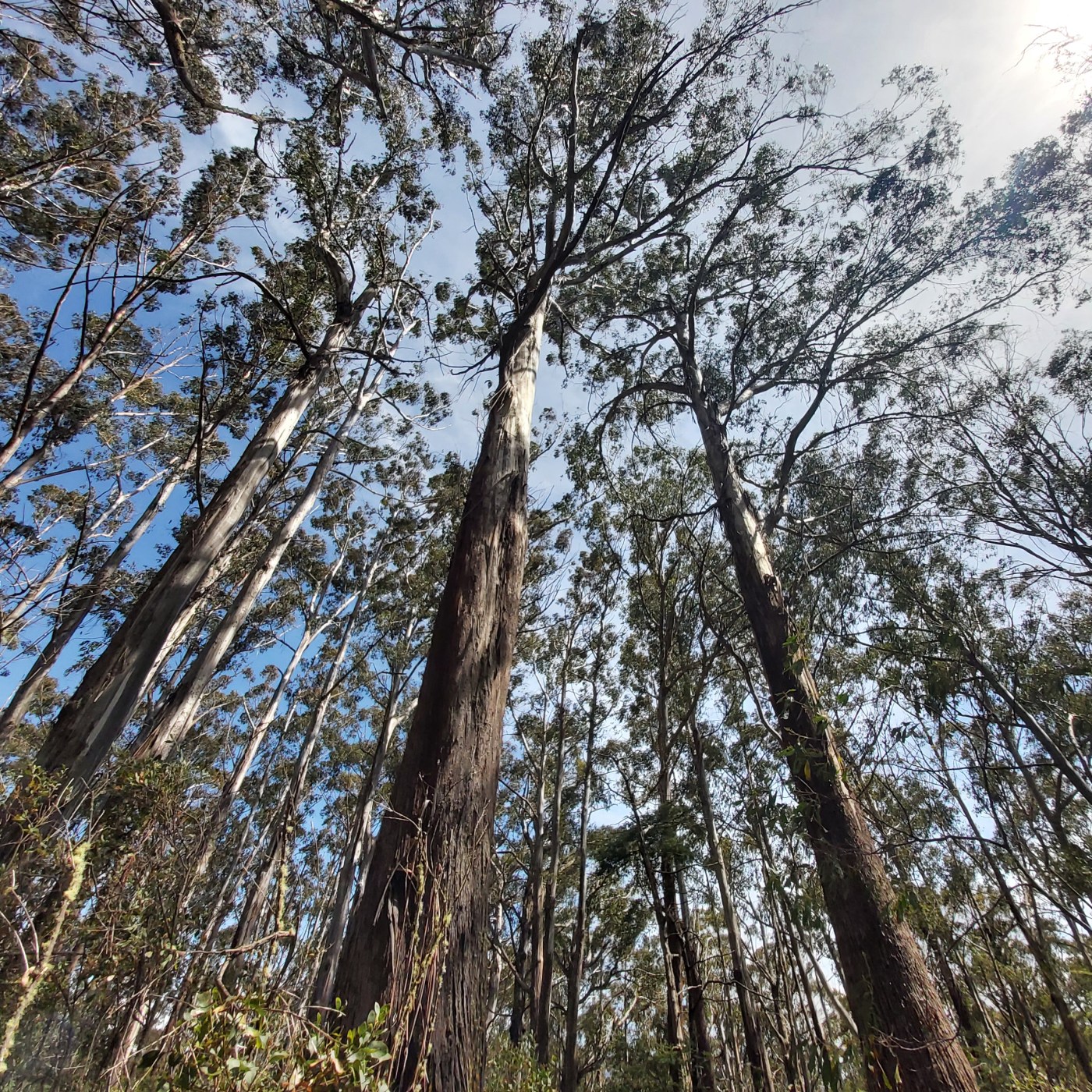
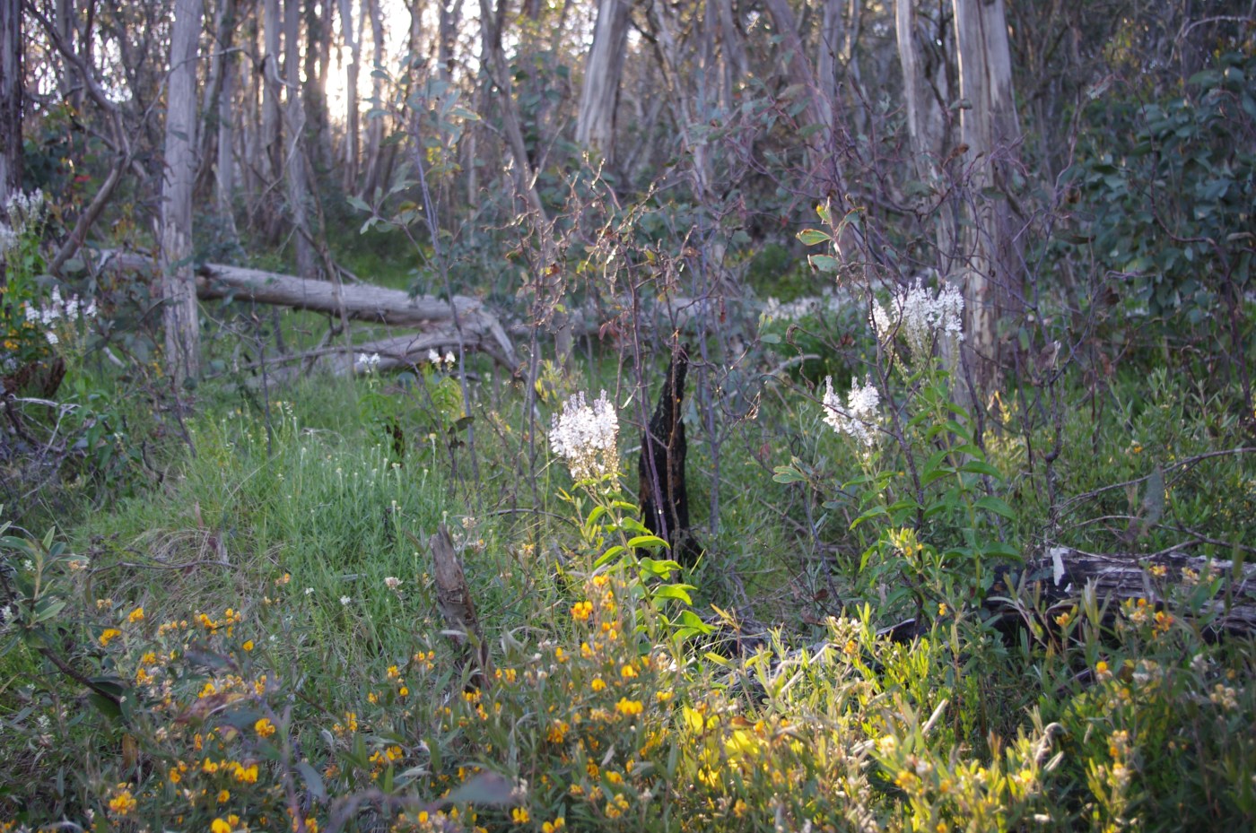
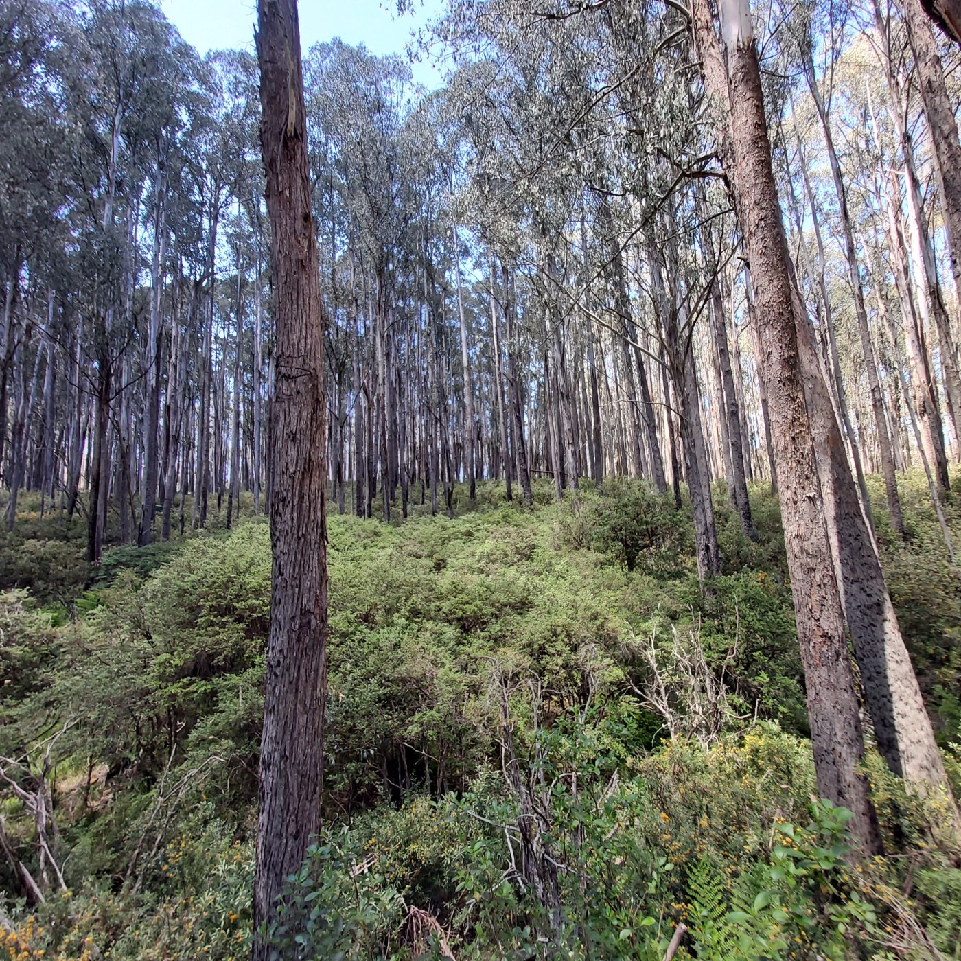
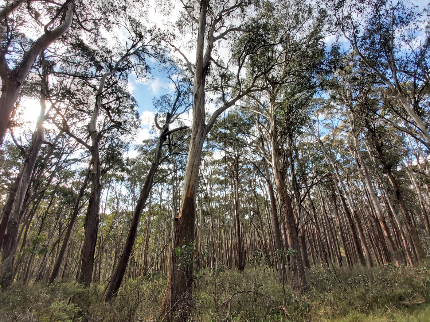
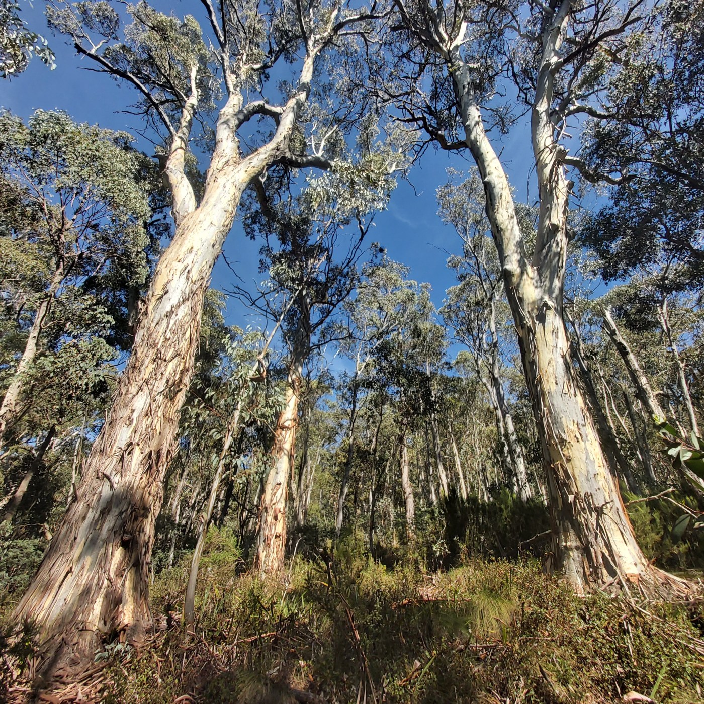
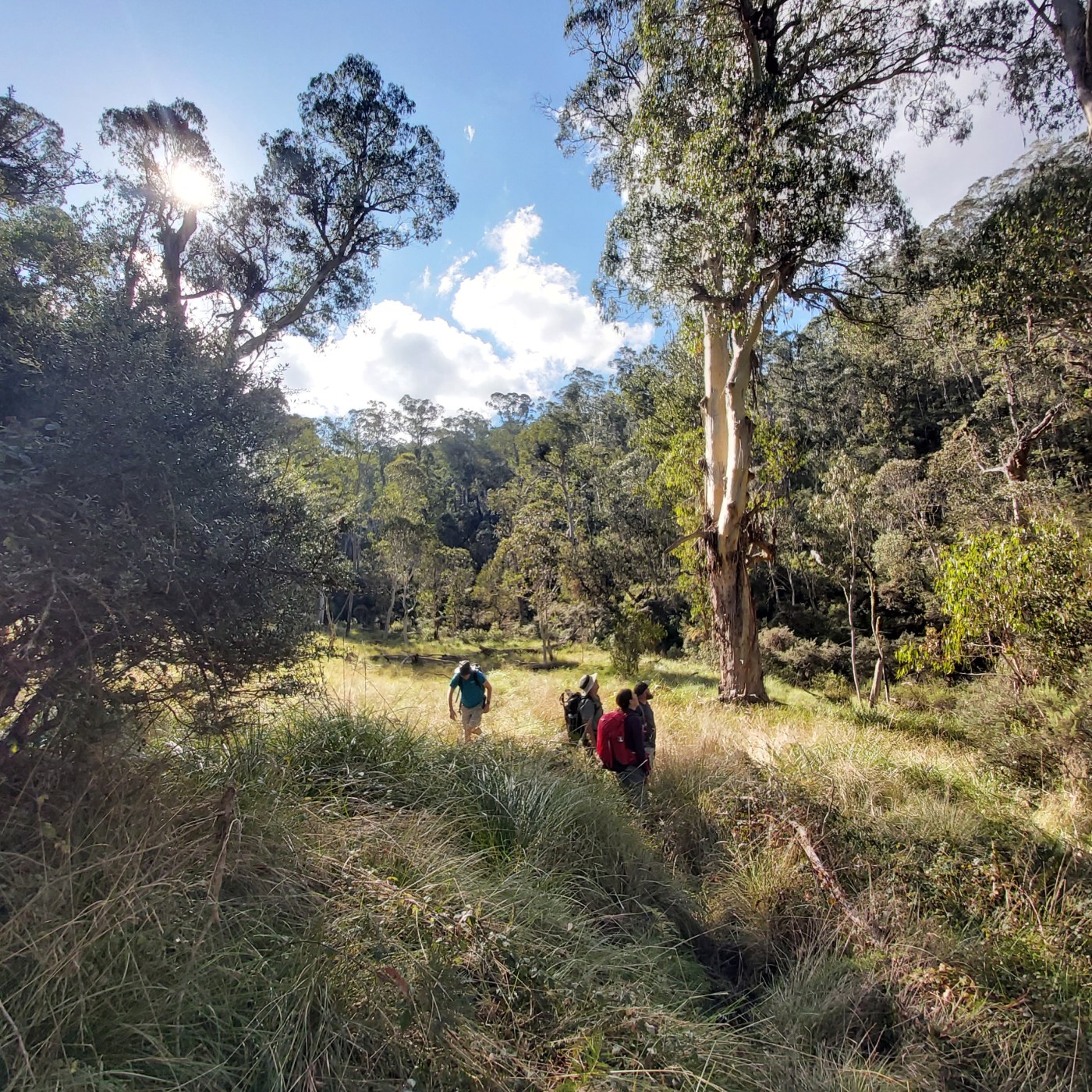
The fires of 2019/20 burnt huge areas of north eastern Victoria. The remaining unburnt forests are more important than ever. One of these areas lies in the headwaters of the Little Dargo River, just south of Mt Hotham. It is a pristine area, without roads, and containing mature forest, much of it dominated by Alpine Ash. It is an area of state forest that lies right next to the Alpine National Park.

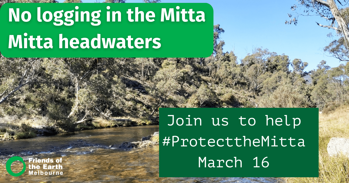
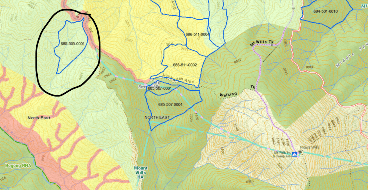
The state government logging agency, VicForests, intends to log a total of 11 “coupes”, or sections, of mature forest in the upper Little Dargo River, possibly starting in the spring of 2022 once the roads are opened after winter. These coupes are located in a series of clusters, where separate sections of bush will be harvested, creating a large zone of cleared land over time. Extensive roading networks will be needed to access the coupes.

Despite a strong community campaign, as of September 2022, the coupes remain on the VicForests Timber Release Plan, meaning they could be scheduled for logging at any moment. We do, however note that the planned logging road through the Alpine National Park has now been removed from the plan.

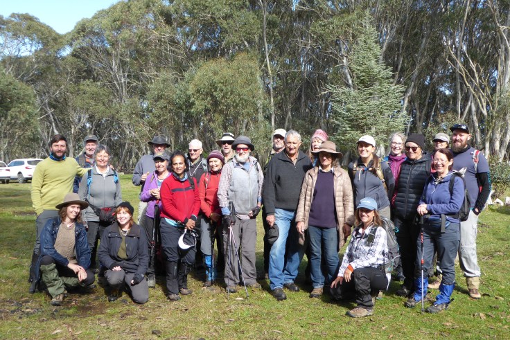
If you missed our previous trip to visit the Little Dargo, you have another chance to see this special place.

In conjunction with the Treasure family, we are hosting a walk in to the valley over the weekend of November 19 and 20. You are welcome to arrive on the saturday, and the walk will happen on the sunday.

This free trip will offer:

  • A shorter ( 2 – 3 hour) walk in to the edge of the Little Dargo headwaters
  • A longer (5 – 6 hour) walk into Fred’s Flat on the Little Dargo river
  • A chance to hear from Christa Treasure and Ray Anderson about the cultural value of the Little Dargo and surrounding area
  • The opportunity to help set up a potential base camp should the government continue with plans to log this precious area and protest becomes necessary

We will also be educating people driving through the area about the threats to the Little Dargo and looking for a team to be out on the Dargo High Plains road to engage with people driving past to explain the threat posed by logging.

Details

The Dargo High Plains is about a 6 hour drive from Melbourne, and accessed via a good 2WD road from either the Great Alpine Road or the township of Dargo.

You will need to be self sufficient in terms of food and camping gear and have suitable gear for the walks (we will circulate a list prior to the trip).

Please rsvp here so we know how many people to expect.

WHEN

November 20, 2022 at 8:30am – 2:30pm

WHERE

Dargo High Plains
Dargo High Plains road
Dargo High Plains, VIC 3862
Australia
Google map and directions

P1040195
CONTACT

Cam Walker · cam.walker@foe.org.au · 0419338047

Christa Treasure speaks out on the need to protect the Little Dargo

As has been reported on Mountain Journal many times, a precious remnant of unburnt forest on the eastern side of the Dargo High Plains is in imminent danger of being logged. What makes this place so special is that it sits within the headwaters of the upper Little Dargo River and is completely free of roads. It has survived recent fires in the area, but will be devastated by the plan to cut 11 coupes within the upper valley. This could happen as soon as spring 2022.

A spirited campaign by locals and environmental campaigners has seen the state’s logging agency (VicForests) announce that it will not proceed with controversial plans to push a logging road through a section of the Alpine national park. Now the call is focusing on getting the remaining coupes removed from the logging schedule.

This is an unusual campaign because it draws together a mountain grazing family with environmental campaigners. The Treasure family have grazed cattle on the Dargo High Plains and surrounding areas for five generations. Christa Treasure talks about the historical and cultural significance of the area to her and the Treasure family and how logging will devastate this history.

Continue reading “Christa Treasure speaks out on the need to protect the Little Dargo”

Blog at WordPress.com.

Up ↑