A fire is burning out of control in the south west of Tasmania. It started as a result of a lightning strike on December 27. It is being reported that it has already grown to 10,000 hectares and currently considered ‘out of control’ and hence fire services are unable to contain it. The ABC reports that 150 members of the Tasmanian Fire Service are currently fighting it but ‘there’s no way of stopping it at this stage’.
It threatens iconic areas like Lake Rhona and is moving towards Mt Field National Park and the towns of Maydena, Tyenna and National Park. A westerly change which is passing through the state could change direction of the fire so check the Tasmania Fire Service (TFS) website for details if you’re in the area (see below for all links).
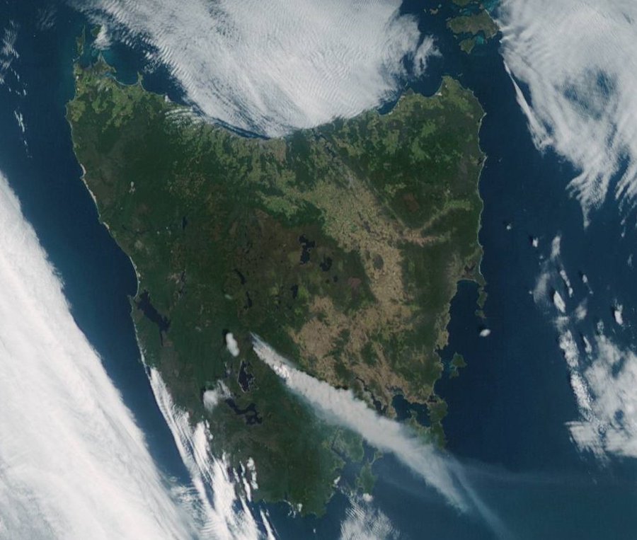
Header image of the fire comes from http://satview.bom.gov.au/
The fire
[More recent information is at the top]
UPDATE FEB 5:
An update on what ecological communities have been burnt.
An initial analysis (based on the fires up until Feb 5) of what types of vegetation have been burnt so far in this summer’s fires is heartening. According to Dr Sam Wood, only very small areas of fire sensitive vegetation have been identified as being burnt. The majority of the burned area is comprised of flammable vegetation communities (ie, communities adapted to fires).
Dr Wood and colleagues report that:
We analysed vegetation maps (TASVEG: https://www.thelist.tas.gov.au) and the mapped perimeters of the major fires (up to February 5 2019; http://www.fire.tas.gov.au/) to determine the proportion of the burned area covered by the dominant vegetation communities in Tasmania (Figure 1; Figure 2). Our analysis does not include unburned patches within the fire perimeter. These will be accounted for in subsequent analyses based on high resolution satellite imagery.
Our analyses show that – so far, at least – only 3.2% of the total burned area of the 2019 fires in Tasmania is rainforest (Figure 2). This includes fire complexes burning in the Tasmanian Wilderness World Heritage Area, where rainforest accounts for 3.5% (Gell River), 3.7% (Southwest) and 3.9% (Riveaux-Pedder) of burned area (Figure 1). This is consistent with past fires in Tasmania’s south-west, where rainforest occupied approximately 6% of total burned area (Wood et al. 2011; Marsden Smedley and Kirkpatrick 2000). Based on our analysis, rainforest types that are known to be particularly vulnerable to fire (King Billy Pine, Pencil Pine) have largely escaped the fires to date (~2 ha burned) but this will need to be confirmed with on-ground reconnaissance.
UPDATE FEB 3:
An update on where the fires are burning across the state.
UPDATE JAN 21:
The current size of the fire is estimated at 19,616 hectares.
The fire is approximately 20km northwest of Maydena township. The southern fire edge is approximately 7km north of Adamsfield.
Resources currently deployed to the Gell River bushfire include 100 personnel and 9 aircraft. Tasmanian fire crews are being assisted by 30 specialists from the NSW Rural Fire Service.
Firefighting efforts continue in the southeastern and southwestern corners of the fire (north of the Gordon Gorge) and along the northeastern edge.
UPDATE, JAN 5:
- The fire has burned through nearly 15,000 hectares of mostly button grass.
- The Parks and Wildlife Service says ‘at this stage the fire hasn’t approached [Lake Rhona], we expect it may potentially do so in the next couple of days, but if it does it’s certainly a site that’s well prepared’. Preparation includes identifying sensitive areas such as the alpine plateau around Lake Rhona where sprinklers have been trialed as a precaution. Also for the first time, authorities have used a long-term retardant sprayed from the air.
- It has created a pall of smoke that covers much of southern Tasmania
- Watch and act warnings for towns adjacent to the Park have been downgraded, check the TFS website for more information.
- Firefighting aircraft support was grounded during the day yesterday because of poor visibility and strong winds, but as conditions eased, they have been able to resume water-bombing.

Further information from the ABC available here.
UPDATE, 6pm, 4/1/19: The fire has nearly doubled in size again since this morning. Now at 15,000 ha. in extent.
 JAN 4: Andrew Darby reports that ‘the new map of extent by the Tas Fire Service shows a very damaging tongue of this fire burning down the Gordon River Valley, past Lake Rhona (not over, just yet) and closing on the tall forests of Florentine Valley as it heads towards Mount Field’.
Because of the scale of the fire and difficulty of fighting it, an aerial tanker has dropped fire retardant on areas around the fire boundary.
The Weekly Times reports that up to 600 people have been forced to evacuate Mt Field National Park. The Gordon River Rd at Westerway is closed to all West-Bound traffic. The TFS has issued a smoke alert for the Greater Hobart, Derwent Valley, Huon Valley and D’Entrecasteaux Channel
 UPDATE, Jan 4, 4pm: On January 4, Andrew Darby updated that ‘the Tas Fire Service (TFS) is doing an awesome job of updating maps of this unfolding #WorldHeritage tragedy for us’. But sadly, ‘This map shows the fire has indeed reached wilderness jewel Lake Rhona, and crossed the Gordon River into tall forests’.
Clearly the on-ground teams are waging a heroic campaign against the fire in exceptionally difficult conditions.
Fire fighting priorities
During the 2016 fires that devastated fire sensitive vegetation in Tasmania, there were a number of suggestions that Parks and Wildlife Services’ firefighting efforts appeared ‘poorly prioritised’ in terms of early response to the fires in remote areas. According to the Tasmanian National Parks Association, fire response prescriptions prioritising rare and threatened fire sensitive species were not ‘effectively implemented’. Now a similar claim has emerged with the current fire:
Andrew Darby also reports that ‘this fire was first reported a week ago. I’m told Tasmanian Parks Service elected not to call in (their) heaviest forces. Now on the doorstep of wilderness jewel, Lake Rhona, it threatens to cross Gordon River into #WorldHeritage forests. A natural heritage tragedy.’
Climate change links
Widespread wildfires in early 2016 caused devastating damage across large areas of the Tasmanian World Heritage Area, including significant sections of vegetation which is not fire adapted, such as Pencil Pine forests.
At the time, and in follow up investigations, it became clear that increased fire risk due to climate change posed an existential threat to these vegetation types. Now additional research has confirmed the trend towards more extreme fire seasons. It suggests that we reached a ‘tipping point’ sometime around the year 2000 and that, since then, there has been an increase in the number of lightning-caused fires and an increase in the average size of the fires, “resulting in a marked increase in the area burnt”.
Andrew Darby writes that ‘this is another #climate disaster for the Tas wilderness’. Certainly, dry lightning strikes, prolonged dry summers and high temperatures are consistent with what climate science says is coming in terms of fire risk in Tasmania.
Updates
For updates, check the #GellRiver hashtag, The Tasmanian Fire Service on twitter, or via their website. Check here for the current list of bushfires, including the Gell fire.


January 4, 2019 at 6:14 pm
Well, of course, I don’t “like” this. It’s terrible, the bushfire season starts earlier and goes on longer every year.
January 5, 2019 at 10:37 pm
That is really terrible. The last huge fires resulted in the loss of ancient trees. One of my sons works with fires the fires in Victoria and it appears they also grow bigger/wilder every season. Safe travel for all our emergency response teams where ever they travel