Conservation Volunteers Australia and Parks Victoria are calling for volunteers to help restore remote sections of the 650-kilometre Australian Alps Walking Track.
Helicopter Spur
Last summer saw helpers spend 120 days in Alpine National Park Across repairing 23 kilometres of track, laying 930 metres of rubber matting and installing water bars to prevent erosion at locations including The Knobs, Mount Sunday and Mount McDonald.
Remote sections of the track are difficult to maintain over time and help is needed to clear fallen timber off the track, install rubber tiling, brush-cut overgrown vegetation and to install crucial signage and symbols to help guide bushwalkers on their adventures in the Australian Alps.
There will be three projects in March and April which are rated hard walking, and involve remote camping in the King Billy/ Mt Magdala/ Mount Clear/Knobs areas of the Alpine National Park.
Full details here. (Search for Victorian projects on the map, then click the project in the Alpine national park) or check this leaflet on the trips.
For more info, contact volunteer engagement officer Adam Smolak on asmolak@conservationvolunteers.com.au
The trips are:
Australian Alps Walking Track Project Mt Clear/Nobs Area
2nd to 8th March 2014
16th to 22nd March 2014
Please check here for more info.
Australian Alps Walking Track Project King Billy Mt Magdala Area
30th March to 5th April 2014
The following comes from Snowboarder Magazine. There is a trend emerging of snowboarders and skiers – who are often keenly aware of how climate change is already impacting on mountain environments – taking on a more vocal attitude about the need for change. This is one more example of this.
Marie-France Roy has earned many accolades during her snowboarding tenure for her talent when standing sideways. She has put out some of the most influential video parts of the past decade and has chops in both the backcountry and the streets.
Last season, Marie embarked on a journey to give back to the sport she loves and create a film that would share the stories of snowboarders who are committed to living in a way that positively affects the environment as much as possible. The movie is called “The Little Things” and will follow Marie and the rest of the crew this season before culminating in a release in fall 2014.
The following update is an excert from an article in The Age, journalist is Jason Dowling.
Surge of activity could see Victoria playing mine host
Victoria could soon boast a new commercial iron ore mine amid a surge of mining activity.
A combination of increased mineral prices and a supportive state government is driving a rejuvenated local mining sector with hot interest in exploration licences.
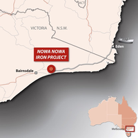
This week Eastern Iron advised the stock exchange it had moved into the environmental approvals phase for a commercial iron ore mine at Nowa Nowa, 30 kilometres from Lakes Entrance.
The proposed East Gippsland iron ore mine would be in the Tara State Forest, and would include a 25-hectare open pit.
The mine would have a span of about 10 years and produce about 1 million tonnes of iron ore a year to be exported from near Eden.
Eastern Iron’s managing director, Greg De Ross, said he did not believe there were environmental reasons to prevent the mine, and said the area had already been heavily logged.
”It is certainly not pristine wilderness,” he said. ”There are no show-stoppers from an environmental perspective.”
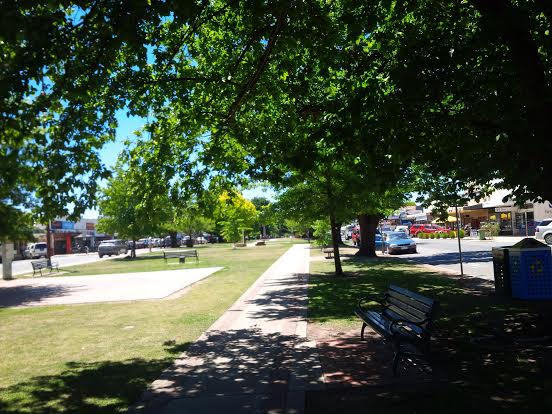
Out on a broad plain, and encircled by hills, with distant views of the west side of Mt Buller and the front range of the mountains, whats not to like about this town?
Mansfield was established as an agricultural centre, providing support to gold mining in the surrounding areas, and then logging was a major driver for many decades. It was one of the first inland Victorian towns to evolve into a diverse tourist and tree change community, largely because it is the entry point to the Mt Buller alpine resort.
Most fires in the mountains (so far) have been in the foothills (see news item below from The Gippsland Times) or East Gippsland. However the CFA is now reporting fire activity in various locations in the high country.
There is a fire roughly 20km NNE of Benambra Township and the high ridge country near Mt Matlock. Check the CFA site for details.
As of friday morning, Jan 17, the CFA is reporting that
Firefighters are responding to a fire in the TAMBORITHA-CAREY RIVER area 15kms NE of Licola.
UPDATE ON TAMBORITHA FIRE, Jan 22
Fire is still going, now 150 ha in size, and the regions identified below are still closed.
UPDATE JAN 19
The fire is currently 120 hectares in size.
The Lake Tarli Karng walking track network is closed. Visitors should also stay away from tracks north of the Avon Wilderness area and the Mount Wellington to Millers Hut 4WD area.
JAN 17 NOTE ON TAMBORITHA FIRE:
Campers and walkers in the Carey River catchment, north of the Avon Wilderness Park, the Lake Tarli Karng track network and the Mount Wellington to Millers Hut 4WD area are advised to leave and all visitors should stay away from these areas.
Ground crews will be checking for vehicles and walkers, with air support if necessary.
Additionally, there is advice for Ensay, Omeo, Swifts Creek, Benambra:
Firefighters are responding to a fire in the 33 KM NE SWIFTS CREEK area in the vicinity of Brumby Rock.
There is currently no threat to communities, but you should continue to stay informed and monitor conditions.
Fire crews battle High Country lightning blazes
FIRE conditions are predicted to significantly worsen on Friday with Severe Fire Danger Ratings forecast across Gippsland.
For Sale a top temperature of 41 degrees has been forecast for Friday with a light shower of two and the chance of a thunderstorm from the early afternoon.
Work by DEPI, Parks Victoria and CFA fire fighters on Wednesday prevented the spread of many fires across Gippsland.
A band of lightning crossed parts of central and east Gippsland and sparked many small fires.
The majority of these fires have been in the area north of Briagolong and the area north of Bruthen.
Firefighting aircraft and dozers were dispatched to support firefighters on the ground.
Gippsland regional fire controller Bryan Russell commended fire crews for their speedy work in very hot and uncomfortable conditions.
As the Gippsland Times went to press crews were fighting fires at Briagolong, Dargo, Treasures, Waterford, Castleburn, Cobbannah.
In the east fires were also burning.
An all clear advice had been issued for fires at Mossiface, Bruthen and Wiseleigh.
In the US, Protect Our Winters has just launched what it is calling its ‘Riders Alliance’, a group of 53 professional snowsports athletes, committed to fighting climate change and speaking out for the environment.
It is a remarkable line up of some of the best skiers and boarders on the planet.
As they say in the release, “Climate change is affecting our lives and careers and it’s in our best interest to use our passion to mobilize the community and bring a new perspective to the policy discussion.”
It’s great to see leadership being taken by so many high profile athletes. The group includesGretchen Bleiler, Jeremy Jones, Sage Cattabriga-Alosa, and Ingrid Backstrom.
The POW Riders Alliance was developed as a central platform for athletes to speak out and create a social movement against climate change. For example, POW recently led a group of 17 athletes to Washington, D.C. for meetings with US Senators and has reached over 20,000 young students with a message of climate action delivered by pro athletes.
POW believes that by combining the athletes’ passion with their influence, first-hand experience and immense media reach, it represents a new, powerful approach to environmental advocacy.
With the Winter Olympics just a couple of weeks away, POW and Olympic athletes from the Riders Alliance will launch an initiative to call attention to climate change on the world’s largest sports stage in Sochi, Russia in partnership with a group of graduate students from the Yale School of Forestry.
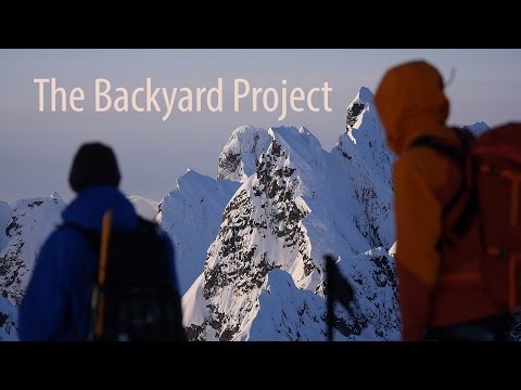
In a world where a big part of living the ‘dream’ is to have the ability to travel wherever you want wherever you want, a decision to stay at home and enjoy your own back yard becomes a radical action.
Skiers/ boarders are as bad as anyone else in the rich world. And there is no doubt that the rest of the world offers mountains that we can only dream of. But the fact is that constant holiday travel by large numbers of people across the world is not sustainable.
Overseas travel is great, but so is the decision to stay at home, to really appreciate the challenges and opportunities that your backyard offers.
In this film featuring athlete Justin Lamoureux, who is sponsored by Arc’teryx, he sets out to ride all 30 mountains he can see from his backyard.
As he says:
“Our backyards are often overlooked for farther and more exotic adventures”.
Full points for walking (and paddling) the talk with a low carbon adventure. He lives in Squamish, British Columbia, which is surrounded by mountains, rising from sea level to 9,000 feet. This film follows his mission to try to ride them all in a single winter.
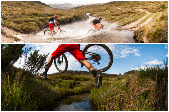
This is a nice 5 minute video from Flow magazine about riding in the Thredbo area which is available here.
Flow is a great, homegrown Australian MTB magazine, available in newsagents. More info here.
Flow says:
“Thredbo has held a very special place in Australian mountain bike folklore for over two decades now. Lord knows how many of our most famous downhillers cut their teeth on the legendary Cannonball Run downhill, or how many National Round after-parties have run wild in the village…
But despite its strong history, over the past ten years it had started to become clear that Thredbo’s lustre was fading a little; other alpine resorts were investing heavily in mountain biking and Thredbo was losing ground. Simply having ‘the hill’ was no longer enough. Thankfully, rather than allowing the mountain biking program to slip metaphorically downhill, Thredbo too have launched a program of rejuvenating the mountain bike side of their operations. Since our first trip to Thredbo over 15 years ago, we’ve held this place in high esteem, and so we had to come see for ourselves just what changes were underway at Thredders”.
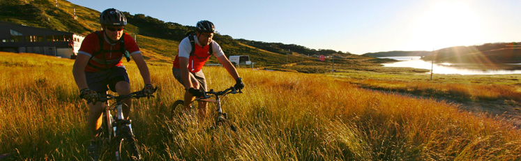
Falls Creek resort management has announced that the long awaited XC1 and XC2 trails are now open.
The following comes from resort management:
For the past 2 years Falls Creek Resort Management has been busy at work bringing to life a dream shared by those who love the resort. In 2013 this dream is realised with the opening of the first 2 of 4 BRAND NEW mountain bike trails.
Under the commission of World Trail – the best bike trail builders in the business, months of development has joined years of planning to bring the new trails to completion. Head to Slalom Plaza now and try them out yourself
The Grand Opening of the new trails will take place in early 2014 but as a present to everybody visiting the Resort, the 2 XC trails in the wombats area were made open and free to use in time for Christmas! Stop in at the Visitor Information Centre at Falls Creek Resort Management to pick up a trail map when you arrive.
The new trails have been developed in the Gully, Summit and Wombats Ramble ski areas. The trails are so fresh that we haven’t even had time to name them yet! Each trail will be named and graded prior to opening (click right to name one of them yourself) but in the interim, we have detailed each trail’s path and location for you to get to know them.
Wombats Ramble XC Loops
Intermediate
The most visible trails are found amongst the snowgums of the Wombats Ramble area (you may have seen parts of them riding the Falls Express Chairlift last Winter). Able to be ridden as one giant loop, the network consists of two trails – one riding uphill and one riding down. Whilst classified as cross country, there are some great downhill features and corners to navigate at speed.
The trails are intersected by the Aqueduct trail which means you can also ride each as a separate loop – one above the aqueduct and one below. Keep an eye out for some spectacular viewpoints and rocky outcrops along the way.
International DH Trail
Intermediate
We all love skiing and boarding the International Poma area in Winter. This downhill trail now brings just as much fun in Summer! Starting at the Summit Chair top (click here for chairlift operation dates), the trail winds down under the Poma line before zig-zagging down Grand Coer ski run and cutting through Short & Curly to the base of the Summit Chair.
Gully XC Trail
Intermediate
This trail connects the popular “Wishing Well” spot to the Gully region by the base of the International Poma and Gully Chairlift. Winding its way down, it is classed cross country but with a downhill aspect.
Bike Rental
Mountain Bikes are available to rent at Frueauf Village in Falls Creek (Schuss St). Adults full suspension bikes (Kona) are available for $65 per day or $50 per half day (extra day $50). Kids Kona bikes with front suspension are also available for the day rate of $45 (extra day or half day $30).
Helmets are provided with rentals and bookings are recommended by calling 0427 166 335.
A number more rental options will become available toward the new year.
Shuttle and Chairlift Access
New in 2014 will be a weekend MTB shuttle service to take riders and their bikes to the top of the trails – all Summer long. An announcement will soon be made on the commencement of this service.
Like in previous years, the Summit Chairlift will be operational over specific event weekends to allow for lift-accessed biking of the trails – particularly the International downhill trail. Click here for more info.
Downhill Descent Weekends
Cedarwood Apartments in conjunction with Alpine Gravity is hosting a series of downhill descent tour weekends, taking in the new MTB trails as well as existing favourites between Falls Creek and Mt Beauty.
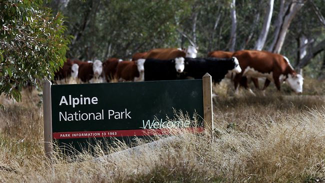
The following comes from Rob Harris at The Weekly Times. It is interesting to note that this trial is ostensibly about whether cattle grazing can reduce fuel load, yet the Mountain Cattleman rep keeps talking about invasive species in the valley.
Given that cattle introduced most of the invasive species in the first place it seems to be an ‘own goal’ type argument to run if you want to see cattle brought back.
As with the earlier attempt to get cattle into the Alpine Park, it would appear that the Victorian government has done a poor job of compiling the information that the federal minister needs to make an informed decision on the trial. Given that the Wonnangatta trial has been a concept endorsed by the environment minister for at least a year, it is hard to fathom why this second application has been managed so badly.
Fears for native orchid put high country cattle trial on hold
A THREATENED native orchid could prove the latest hurdle to returning cattle to the high country.
The Victorian Government’s push to begin a three-year trial in the Wonnangatta Valley this month has been put on hold after the Commonwealth sought more information about the habitat.
The Australasian Native Orchid Society of Victoria is the latest conservation group to raise concerns about a return to alpine grazing, after it was reported a survey of rare and threatened plants in the area was not included in Victoria’s application to the Commonwealth.
The Wonnangatta Valley is home to one of two known populations of the native orchid diuris ochroma, or pale golden moth.
Society member Richard Thomson said the group had written to federal Environment Minister Greg Hunt seeking protection for the native flower.
“Having chosen this venue virtually in the middle of the park – where there is plenty of state forest which would have been equally as suitable and wouldn’t run the same risks to the environment – just seems totally weird to me,” Mr Thomson said.
Mr Thomson said it was “ridiculous” the Victorian Government would put the native flower at risk.
If the trial is approved by the Commonwealth, 60 cattle will be released into the Valley for a three-year trial.
A spokesman said Mr Hunt was awaiting information from his Victorian counterpart that would allow the department to make a “fully-informed decision”.
A spokeswoman for Victorian Environment Minister Ryan Smith said an updated survey of the native habitat would be provided to the Commonwealth. She said the “experience and expertise gathered over 170 years” should be included in land management.
The mountain cattlemen, removed from the park in 2005 by the Bracks Labor Government, will this weekend hold their annual high country “get together” on the Omeo High Plains.
Mountain Cattlemen’s Association of Victoria president Charlie Lovick said the decision to stop grazing Wonnangatta had grown into a fire trap “infested with invasive species”.
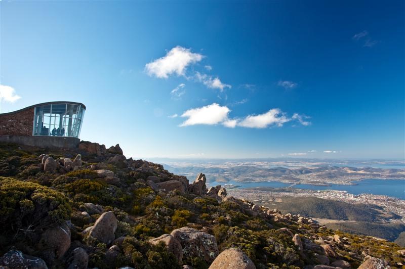
The long running campaign to ‘open’ the mountain to major commercial development is now one step closer to fruition. For some background on the issue, check here and here.
there is already substantial viewing infrastructure on the mountain
Mt Wellington opens for development under new management plan
MT Wellington is open for business, with a new management plan allowing for a wide range of commercial development, including a controversial cable car.
The Wellington Park Management Plan, which took effect this week, opens the gates to commercial development at the pinnacle and The Springs.
The tourism industry has welcomed the potential for new drawcards at the Hobart landmark, which attracts more than 350,000 visitors every year.
Tourism Industry Council Tasmania boss Luke Martin said the plan was “overdue, historic and very welcome”.
“It creates the possibility of a whole series of new markets on the top and at The Springs,” Mr Martin said.
The plan allows for a visitor centre, interpretation centre, viewing shelter cafe, restaurant and take-away food premises, bus terminal, council depot, shuttle buses, cable cars and aerial ropeways, and funicular rail and cable-rail systems.
There has been no commercial development on the mountain since a health spa and chalet were destroyed by bushfire at The Springs in 1967.
Mr Martin said there was great potential for tourism development on the pinnacle.
“We have 350,000 tourists going to the summit each year, with no economic activity out of them,” he said.
“There is a market for something on the summit to vastly improve what’s there now.
“Even if the cable car doesn’t happen, we will still get something.” Environment, Parks and Heritage Minister Brian Wightman said the plan allowed for a range of developments in the park, including a cable car.
“The new plan strongly promotes the development of new visitor services and infrastructure on Mt Wellington, but also ensures its special values are protected,” he said.
Developments specifically allowed at The Springs include a backpacker hostel, bed and breakfast establishment, holiday cabin, residential hotel, walkers bunkhouse/hut and cable-rail systems.
While the plan allows for commercial development at The Springs and the pinnacle, Wellington Park Management Trust chairwoman Christine Mucha said the trust preferred major development to be centered at The Springs.
“We would like to see The Springs developed and Hobart City Council would like to see it developed,” she said.
“It is the central point to start walks and bikes and it is lacking facilities.” Hobart developer Ali Sultan’s approval for a visitor centre, restaurant and carparking at The Springs expires next month.
Hobart Lord Mayor Damon Thomas said no one could do anything at The Springs until that lapsed.
“The playing field opens up but not until that happens,” Ald Thomas said.
The new plan was “a big step forward,” Ms Mucha said.
“It was two years in the making and before the Planning Commission for nine months.
It’s not just about Mt Wellington, it’s the whole mountain range, Glenorchy and crown land.” Greens environment spokeswoman Cassy O’Connor said talk of development on the pinnacle was disturbing.
“It’s disappointing and disturbing to hear the state’s Environment Minister talking up inappropriate development such as a cable car on Mt Wellington,” she said.
“Brian Wightman knows very well that any cable car on the mountain would damage its natural and cultural values.”
Cable car proponent Adrian Bold said his group had waited for the plan to be ratified before taking the next step with their cable car vision.
They will have a proposal launch next month, a second round of public consultation and the plans before the council by mid-year, he said.
“We are very excited the plan is finally ratified,” he said.
Worn Wear is an exploration of quality – in the things we own and the lives we live. This short film takes you to an off-the-grid surf camp in Baja, Mexico; a family’s maple syrup harvest in Contoocook, Vermont; an organic farm in Ojai, California; and into the lives of a champion skier, a National Geographic photographer, and a legendary alpinist. It also features exclusive interviews with Patagonia founder Yvon Chouinard.
Released as an antidote to the USA Black Friday and Cyber Monday shopping frenzy, Worn Wear is an invitation to celebrate the stuff you already own.


Recent Comments