
The Dargo High Plains, in Victoria’s High Country, and surrounding ranges are facing an onslaught of logging activity. It is well beyond the sealed road network and out of sight for most people. Lisa Roberts reports on a recent trip to this remote mountain country.
‘We watched the mist come out of the forest over the hill and race across the cleared smashed country and fall when it reached the trees on the other side. Up here, the trees call in the clouds and the clouds drop into the trees and this is where the water comes from’.
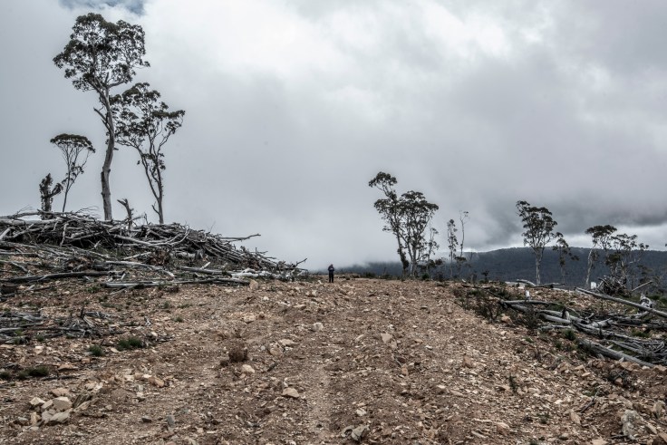
On the 12 Mile Hill the habitat didn’t get lost. In 2018 it was wilfully destroyed by the Government logging agency VicForests. You won’t see this old mountain forest again and neither will those who come after you.
Despite the ecological catastrophe of the 2019-20 Summer bushfires which burnt through 1.25 million hectares of forest in East Gippsland, hundreds of coupes and 20,000 hectares of forest including key unburnt refuges are scheduled for logging in East Gippsland.
‘We grow it back’, Vicforests claim, yet an independent report finds that 30% of coupes have failed to grow back.[1] Regrowing a natural complex forest ecosystem from such wounded land is fraught. If trees do grow back, its not ‘like for like’ – it’s a highly flammable, water hungry monoculture of single preferred species, unlikely to survive bushfires, deer or drought.
Further up the mountains, on the edge of the plains, Vicforests logged 700 hectares of unburnt forest at the old Jones Creek mine and smashed a road through Alpine tree frog sites to get there. In 1911 the Waterworks Trust shut down the Jones Creek goldmine because it sluiced into the creek and polluted the Mitchell River all the way to Bairnsdale.
Over the next range, the plains fall east to the Little Dargo River, another 700 hectares of forest both sides of the river is scheduled. One coupe in this cluster was logged and burnt in 2020, but the rest of this forest won’t fall without a fight. [2]
Up here in the Little Dargo, the Dargo, the Wongungarra, the Wonnangatta, the Crooked and Mitchell River catchments are old mountain forests that call in the clouds. These forests create the rain that flows into Gippsland Lakes, redgum plains and 22,000 people living downstream.[3] Up here, the trees call in the clouds and the clouds drop into the trees and this is where the water comes from.

12 Mile Hill: Gunnai Kurnai Country on the Dargo High Plains road north of Mt Ewen, south of the Dargo High Plains.
Photos November 2021
Lisa Roberts is a photographer who chases disappearing trees. Recent work with text by Louise Crisp includes Coupe Portraits: Walking the Damaged Forests of East Gippsland (Gunaikurnai Country) http://cordite.org.au/chapbooks-features/coupe-portraits/
1: After the Logging. Failing to regrow Victoria’s native forests. Margaret Blakers, 2021
3: 2019 study finds Melbourne loses 15 billion litres of water annually from logging the catchment
Modelling water yields in response to logging and Representative Climate Futures.
Chris Taylor, David Blair, Heather Keith, David Lindenmayer
https://www.sciencedirect.com/science/article/pii/S0048969719328712


January 10, 2022 at 4:36 pm
this is utterly disgusting how in the Name of trust and empathy could loggers Been allowed
to go into this area is not freehold its park as far as I knew.