The Australian Alps Walking Track (AAWT) is one of the premier long distance walking trails in Australia. While the distance (around 650 kilometres) is impressive, it is the fact that it passes through so much remote country that makes a full crossing such a feat. And it has an epic 28,000 metres of elevation gain during the length of the walk. Unlike many long hiking tracks around the world there are only a small number of points to easily get off the track or to resupply, and this adds to the pre planning and commitment required to walk across Australia’s highest country.
Mountain Journal often features stories from people who have walked the track. What struck me about this reflection from Geoff Law was that he paid deep attention to the environment as he passed through the mountains. In a time of climate change there are existential threats to many animal and plant species, but as Geoff also notes in this story, ‘this landscape has been battered by fires, roads, logging and intrusive tourism developments. But the mountains and valleys endure. The ecosystem as a whole survives.’
We hope you enjoy this story.
The AAWT – May 2026
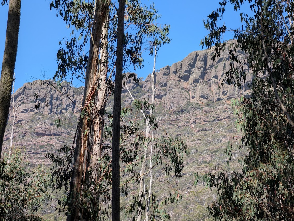
The Australian Alps Walking Track (AAWT) is said to be Australia’s longest continuous walking trail. It snakes its way along approximately 650 km of rugged country between the heritage mining town of Walhalla in Gippsland to Tharwa on the outskirts of Canberra. The trail follows a mix of pathways, including gravel logging roads, some glorious stretches of walking track, 10 km of bitumen road at Mt Hotham, long sections of four-wheel-drive track, and areas where the ‘track’ disappears completely in tussocks or scrub. It traverses steep mountain ridges, high alpine plains and deep forested valleys.
From late March to early May 2026, I walked the length of the AAWT. In some ways, it was bit of a homecoming. I had visited many of the mountains traversed by the AAWT as part of my bushwalking apprenticeship in Victoria during the 1970s and early 1980s before moving to Tasmania. Experiencing the remoteness and beauty of these high places instilled a love of wild country in me. My angst at witnessing the march of ever more logging roads into otherwise pristine valleys brought me to the periphery of the movement that was attempting to protect Australia’s alpine wilderness through the establishment of new national parks. Walking the AAWT in 2026 was not just a way of reconnecting with the Alps after a long period of absence, but also to see how these mountains have fared over the past 45 years. The trek was a digital detox, an escape from daily news, and a meditative immersion in the natural world and the simple routines of walking and camping for an extended period.
I loved the birdsong. Rising early to the warbling of magpies was redolent of happy childhood camping trips in Victoria. At one memorable morning-tea break, I was serenaded by a choir of carolling currawongs that then followed me along the trail for another 10 minutes. The virtuosic mimicry of lyrebirds was a frequent delight – their imitations of the songs of other birds seeming more authentic than the originals. If disturbed on the track, the lyrebirds fluttered off uttering shrieks of comical agitation.
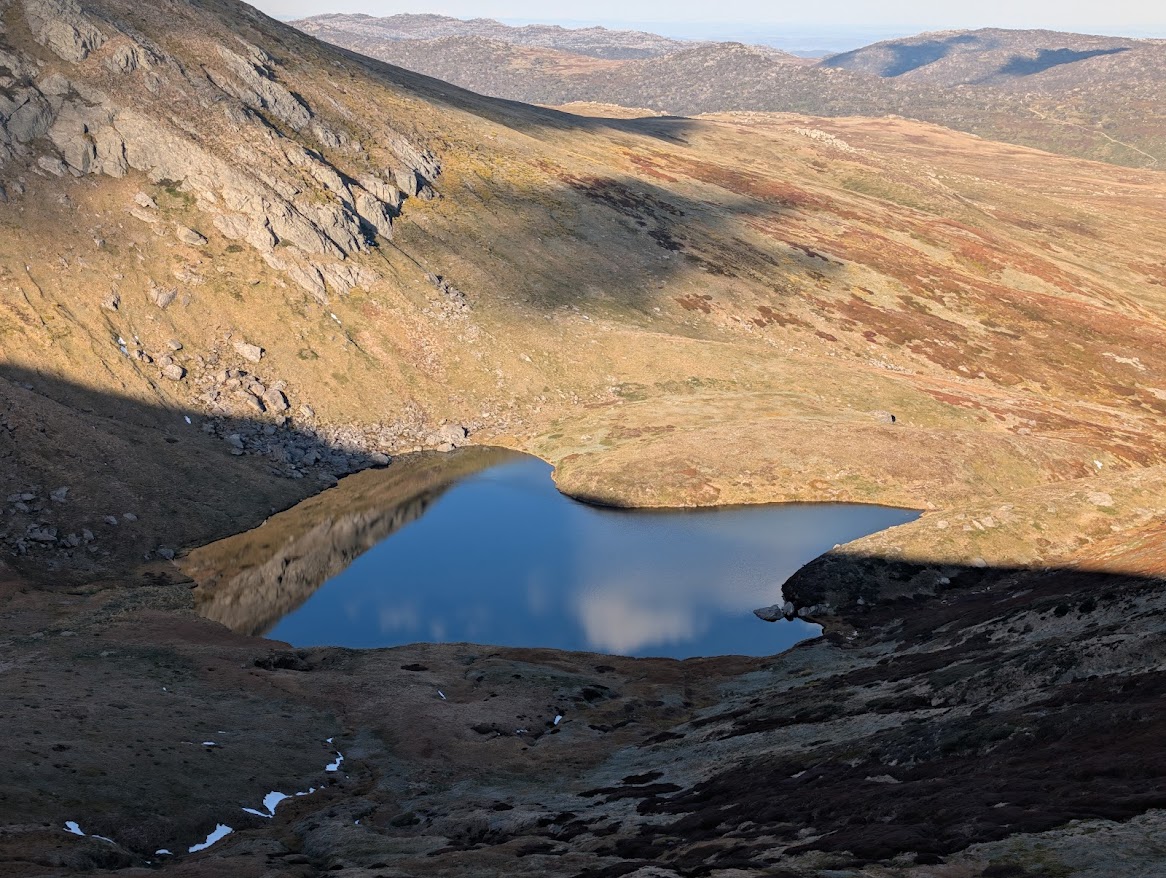
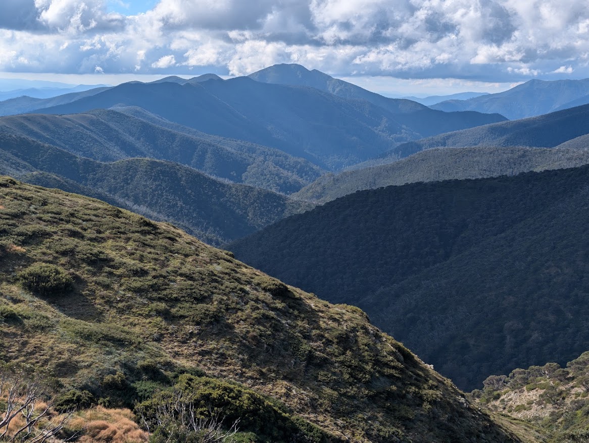
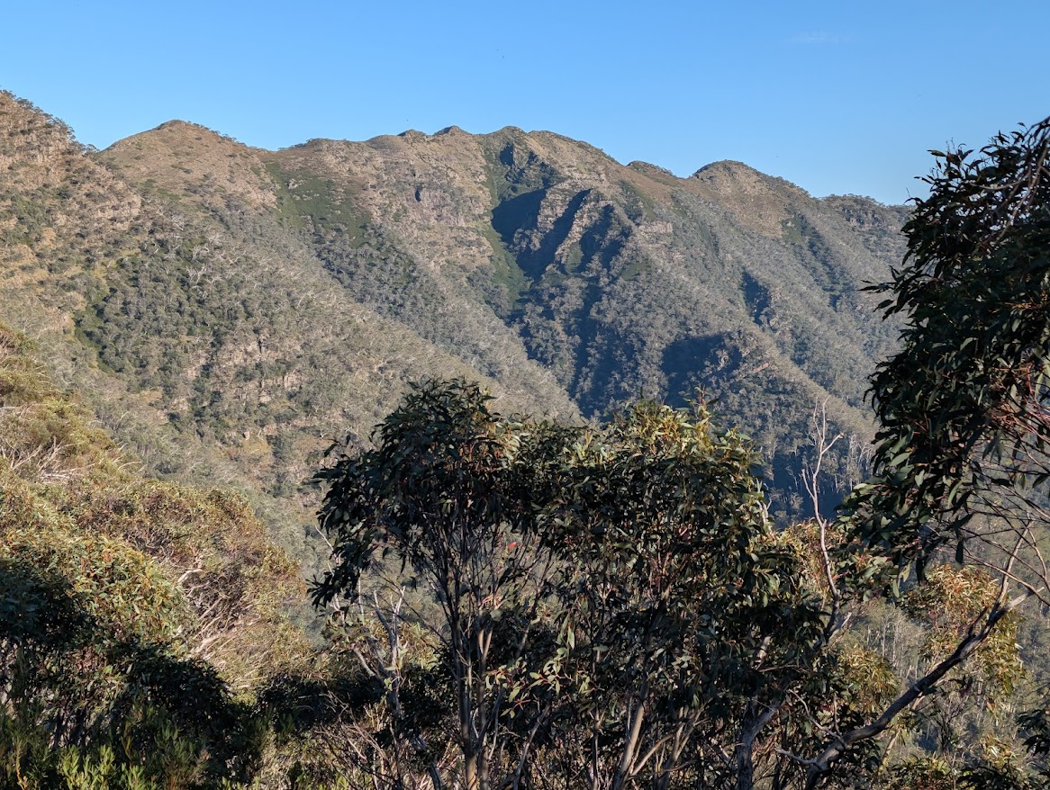
Most of the great rivers of south-eastern Australia, such as the Murray, Snowy, Goulburn and Murrumbidgee, have their headwaters in the Alps, and peering into the depths of their valleys from on high comprised another feature of the trail. These rivers start as lively streams tumbling through the tussocks above the treeline before winding their way amongst the spurs and ridges of catchments that seemed immense.
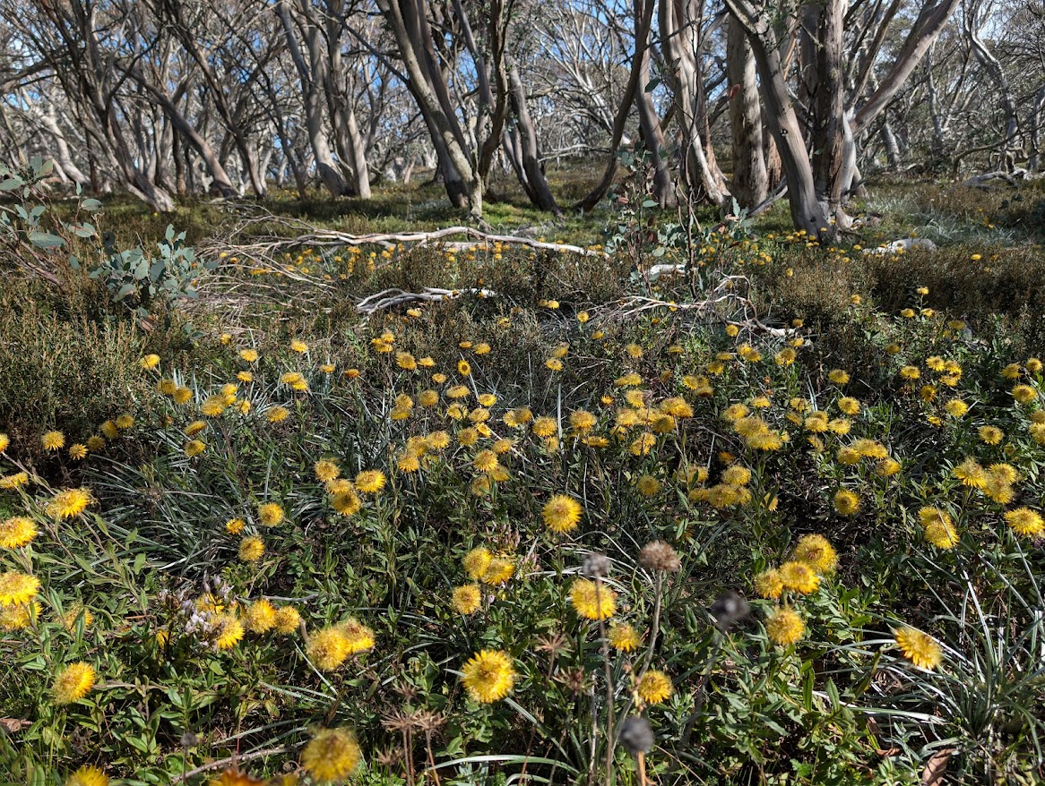
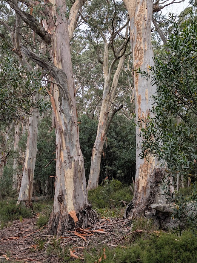
The formless character of the ranges in southern Victoria helped focus my attention on the native vegetation that blankets them. The forests transform seamlessly from rainforest species, such as myrtle beech in the wet gullies of the Baw Baw plateau, to towering mountain ash and alpine ash, to extensive tracts of snow gum. Now and then, I’d be stopped in my tracks by the startling beauty of an individual tree.
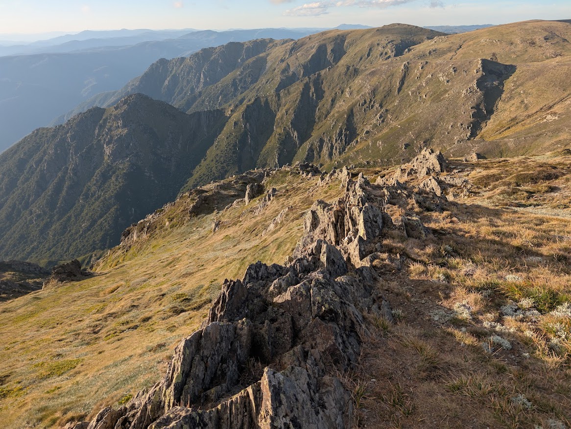
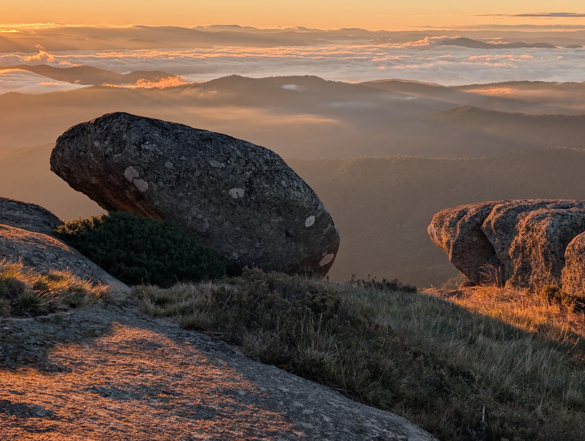
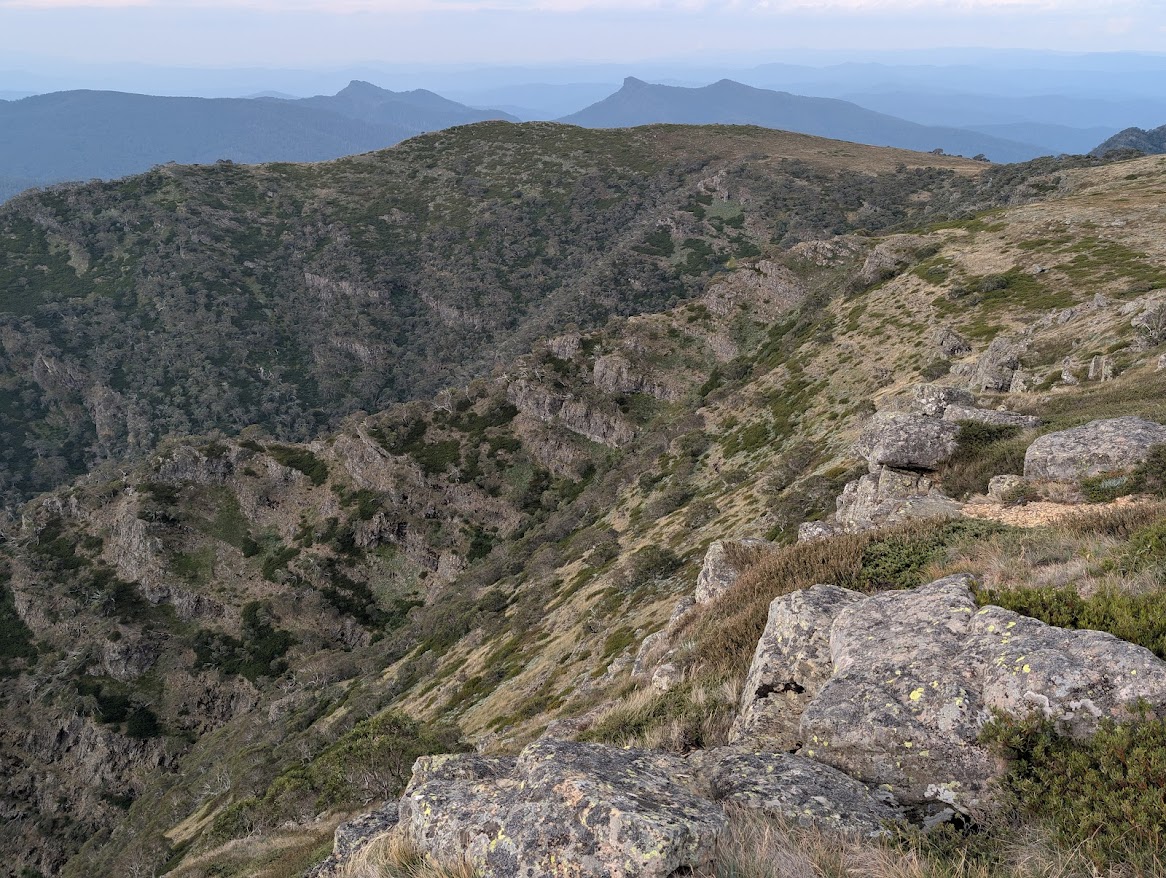
The climactic moments of the walk were those on the high ridges of the Main Range in NSW. The views of Watsons Crags and into the Geehi valley from vantage points above 2000 metres in elevation were quite stupendous. The peaks around Victoria’s Mt Howitt (including evocatively-named features such as Hell’s Window, the Crosscut Saw, Mt Buggery, the Razor and the Viking), are similarly spectacular. The view of Mt Feathertop from Mt Hotham is a classic vision of the Australian Alps. And the Baw Baw plateau, with its unburnt fens, old growth snow gums, mountain ash and rainforest, is a botanical gem.
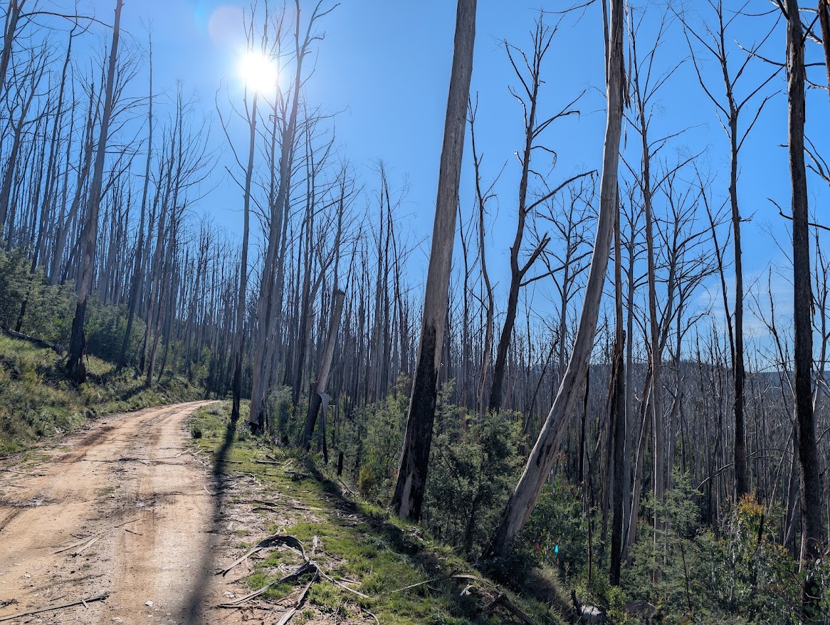
It wasn’t all sweetness and wonder. The state of the AAWT is a microcosm of how the Alps have been treated by successive governments. Sections of the trail in Victoria follow hazardously steep erosion scars made by bulldozers. Prolonged trudging along logging roads illustrates just how much of the high country has been subjected to the criss-crossing tentacles of this destructive form of intrusion. Sections of the trail which followed old, partly overgrown vehicle tracks have recently been bulldozed to form ugly, wide firebreaks, with felled trees strewn either side of the swathe. At Mt Hotham, the desecration of the mountains for ski resorts has expanded since I last visited in 1981, with the ridge to Mt Loch taken over by vehicle tracks and ski lifts. Blackberries, which I well remember from the valley floors in the 1970s, have spread into the sub-alpine zone. Feral animals are also more prevalent. In Kosciusko National Park, I saw more horses, pigs and deer than I did kangaroos. I didn’t see a single emu. Thank heavens the ACT government has had active programs for culling feral animals in Namadgi National Park.
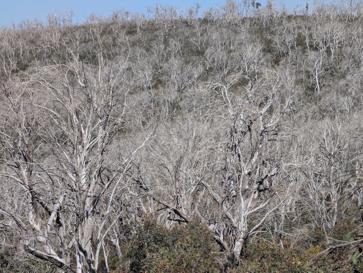
The main impact on the alpine landscape over the past 45 years, however, has been the devastation caused by intense and too-frequent wildfires, particularly the ‘megafires’ of 2003, 2006-07 and 2019-20. In my favourite parts of Victoria’s alps, around Mt Howitt, the impacts were less severe than I had feared, with numerous stands of ancient snow gums still intact, but many parts of the Kosciusko National Park, tragically, have been blitzed. In a northern part of the park, I walked for three days with barely a living tree in sight. The terrain consisted of shallow tussocky valleys and low hills on which every tree was a bleached, white skeleton – for as far as the eye could see. In many areas, the regrowth from 2003 had been knocked out by the 2019-20 conflagration. It was desolate. When I finally entered some intact forest about two hours’ walk north of Kiandra, my joy was visceral.
‘Oh my god! Living trees,’ I shouted to non-existent companions. ‘Trees with leaves on them! Even the grass looks greener.’
This happy situation prevailed for some days, with the gorges, caves and waterfalls of Blue Waterhole providing an intriguing accompaniment to the idyllic plains and unburnt forests.
And this is the positive part of situation with the Australian Alps. Yes, this landscape has been battered by fires, roads, logging and intrusive tourism developments. But the mountains and valleys endure. The ecosystem as a whole survives.
Two of Australia’s foremost experts in World Heritage, Geoff Mosley and the late Jamie Kirkpatrick, have authored reports describing the values of the Australian Alps from an international perspective. This ancient, weathered landscape, with its great diversity of eucalypt forests, is an outstanding example of Earth’s evolutionary history. The grand sweep of natural vegetation, from wet to dry and from low to high, is an ecological asset of global significance.
Geoff Mosley was one of the champions of national-park status for the Victorian alps in the late 1960s through to the 1980s. In late 1971, when the reality of a long-distance walking trail in the Alps was still in its infancy, he walked from the outskirts of Canberra to Mt Skene in Victoria, with large parts of the route he followed eventually being incorporated into the AAWT. I’m incredulous that he achieved this feat over the course of only 19 days of walking. (An equivalent section took me more than a month.) Geoff’s tenacity and vision when he was director of the Australian Conservation Foundation from 1973 to 1986 helped achieve declaration of Victoria’s Alpine National Park in 1989.
The Alpine National Park, however, should be regarded as a work in progress, as a look at its convoluted boundaries will show. Extensions of the park to encompass adjacent wild country would greatly enhance its integrity. Now that the Victorian government has ended logging of native forests on public land, there’s no resource-extractive reason against protecting the upper catchments of rivers such as the Jamieson and Barkly, and establishing links between the Alpine, Baw Baw and Yarra Valley national parks.
The most difficult and compelling challenge when it comes to management of the Australian Alps is that of protecting pockets of intact or recovering forest from the ravages of future megafires. With atmospheric carbon dioxide having increased by over 50% since pre-industrial times, and still rising, the impacts of summer bushfires will become ever more devastating. A policy of attacking outbreaks as soon they are detected with all the resources at the country’s disposal is necessary if we are to contain the deathly spread of vast tree graveyards across the high-country landscape.
For those interested in the statistics associated with the AAWT, its official length is 650 km, with the guidebook by Chapman, Chapman and Siseman giving a figure of 661 km to take account of recommended variations. Total climbing (not counting side trips) is over 28,000 metres – about three Mt Everests. I completed the AAWT on day 51, having had eight nights (and four full days) in accommodation just off the trail. I did several side trips, including to the summits of The Pilot, Mt Kosciusko, Mt Townsend and Mt Jagungal and to the gorges and caves of Blue Waterhole. Other side trips were water-themed. During March and early April, it was frequently necessary to descend into deep gullies to find water for the night and the next day, especially on the section from Rumpff Saddle to Mt Hotham during which the official trail does not cross a single stream. Several weeks later, I made a rather large detour to avoid fording a rain-swollen Murrumbidgee River. I had five food drops, with the walk thereby segmented into two 10-day stages, one 7-day stage and three 6-day stages. My heaviest pack was about 28 kg, leaving Rumpff Saddle with water for that day’s walk and 10 days’ food to get me through to Hotham.
Many thanks to the people who helped me complete the AAWT by placing or retrieving my food-drop containers, by giving me a lift from Traralgon to Walhalla, by providing bursts of welcome company along the way, and by accommodating and feeding me in Jamieson, Thredbo and Canberra.
I’m very glad I decided to walk the AAWT. For several years I had vacillated, worried that I would find the impacts of mega-fires too heart-breaking. And while the areas of damage are indeed large, there also remain similarly large stands of intact and scenic oldgrowth forest. As future fires occur, such tracts will become even more ecologically and scenically significant. After seven weeks in the Alps, my abiding impression is of a vast world-class landscape deserving of World Heritage nomination.
About Geoff
 Geoff Law has worked to protect wilderness in Tasmania since 1981, working on campaigns to stop the Franklin River dam and to protect old growth forests from logging. He was closely involved with the successful efforts to extend the Tasmanian Wilderness World Heritage Area in 1989 and 2013. In 2013, Geoff became a member of the Order of Australia in recognition of his contribution conservation. He has also worked on World Heritage issues in other parts of Australia and in Indonesia.
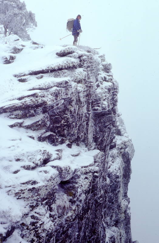
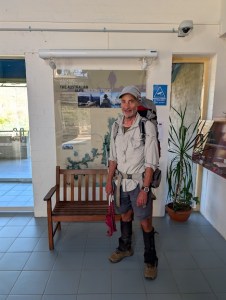
IMAGE: Geoff in May 2026 at the completion of the AAT at the visitors’ centre in Namadgi National Park, Tharwa, ACT.
HEADER IMAGE: On Carruthers Peak, Main Range, Kosciuszko National Park, NSW.


Leave a comment