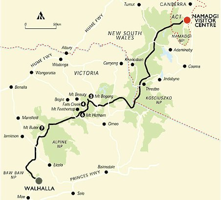
 The Australian Alps Walking Track (AAWT) is one of the premier long distance walking trails in Australia. While the distance (around 650 kilometres) is impressive, it is the fact that it passes through so much remote country that makes a full crossing such a feat. Unlike many long hiking tracks around the world there are only a small number of points to easily get off the track or to resupply, and this adds to the pre planning and commitment required to walk across Australia’s highest country.
Mountain Journal often features stories from people who have walked the track. This reflection from Jon Miller represents a trip based on an unusual SOBO (south bound) journey. Unlike many people, Jon and his friend Cath walked from the ACT south into Victoria.
Hiking the Australian Alps Walking Track
Everyone has their own reasons for walking the Australian Alpine Walking Track. Everyone tackles it differently and has different experiences. What follows is the way I did it.
The AAWT has it’s origins back in 1968 when the Victorian Government established an inquiry into the feasibility of creating a walking track spanning Victoria’s High Country. Work was commenced in 1970; six years later, the Alpine Walking Track (as it was then known) was completed. It went from Walhalla in Gippsland to Tom Groggin on the NSW border. In the early 1990s, the track was rerouted to Cowombat Flat near the source of the Murray River, and extended through NSW and ACT to finish at Namadgi National Park Visitor Centre in Tharwa. It was then named the Australian Alps Walking Track – a bit of a mouthful so commonly shortened to The Alps Track or The Alps Walk.
Thirty-odd years later, I was walking to the shops in my home-town of Bright when Cath, an old bush-walking friend from Melbourne pulled up next to me. She asked me if I wanted to do the AAWT. I thought about it for less than a minute before agreeing.
Then the hard work started; months of planning and preparation ensued. Working out where campsites and water sources were, how far we could walk in a day, how much food to take, where to put food drops, and what to put in the food drops. How many gas canisters, how much sunscreen, toilet paper, toothpaste, hand-sanitiser. And dozens of other details.
Finally all the preparation complete, the food drops were in place, and it was time to hike.
Most people walk the track from south to north. The main reason given for this is to tackle the harder Victorian section while you’re still fresh leaving the easier NSW section for the end. Cath wanted to do it in the opposite direction to get her hiking legs on the easier section. I had no objection to this, so north to south it was. This had the unexpected advantage of the sun being at our backs on long, hot days.
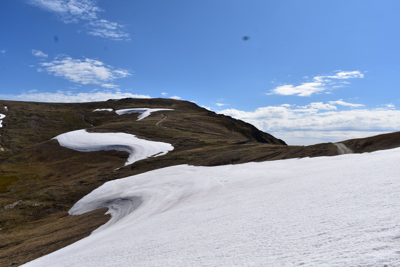
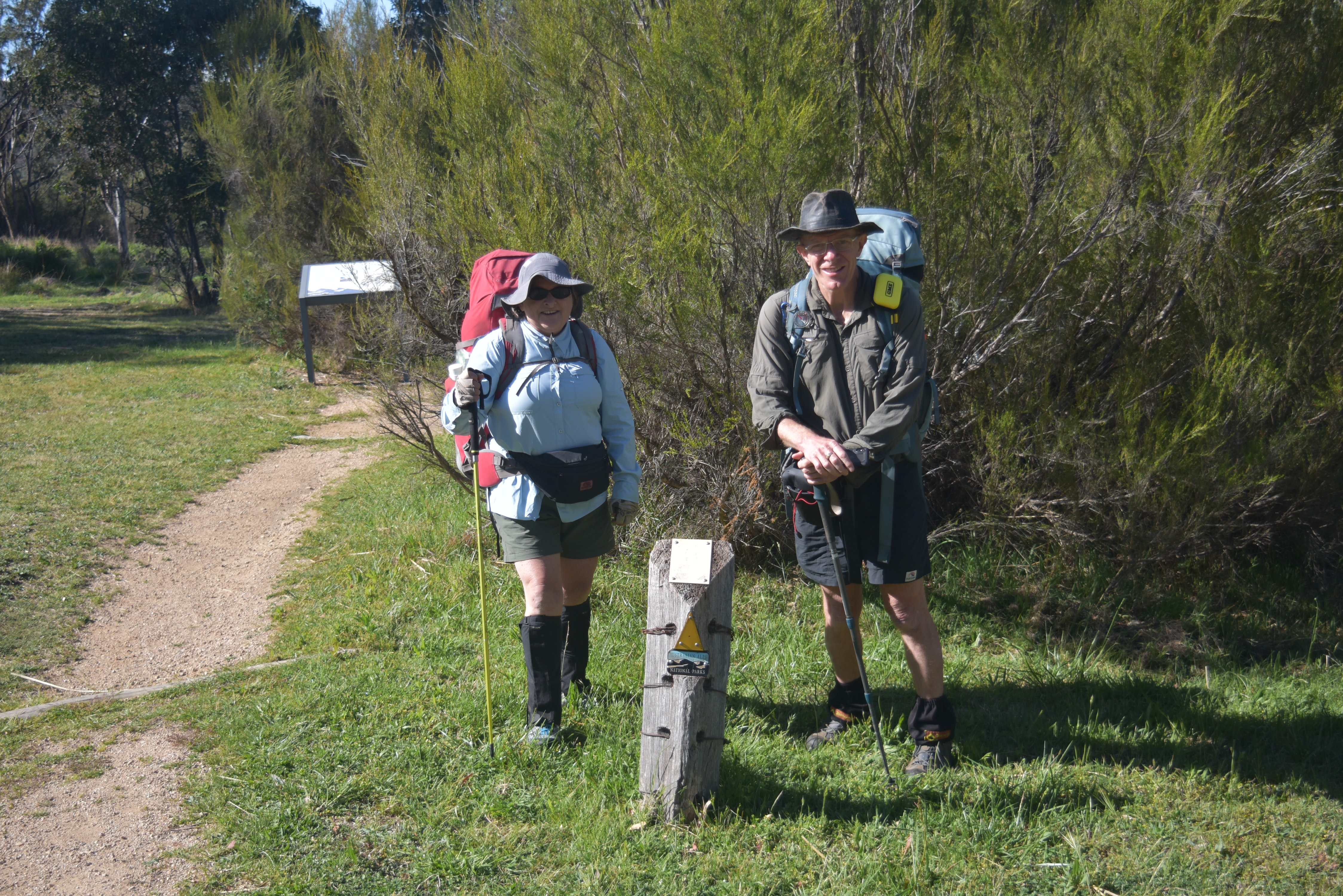
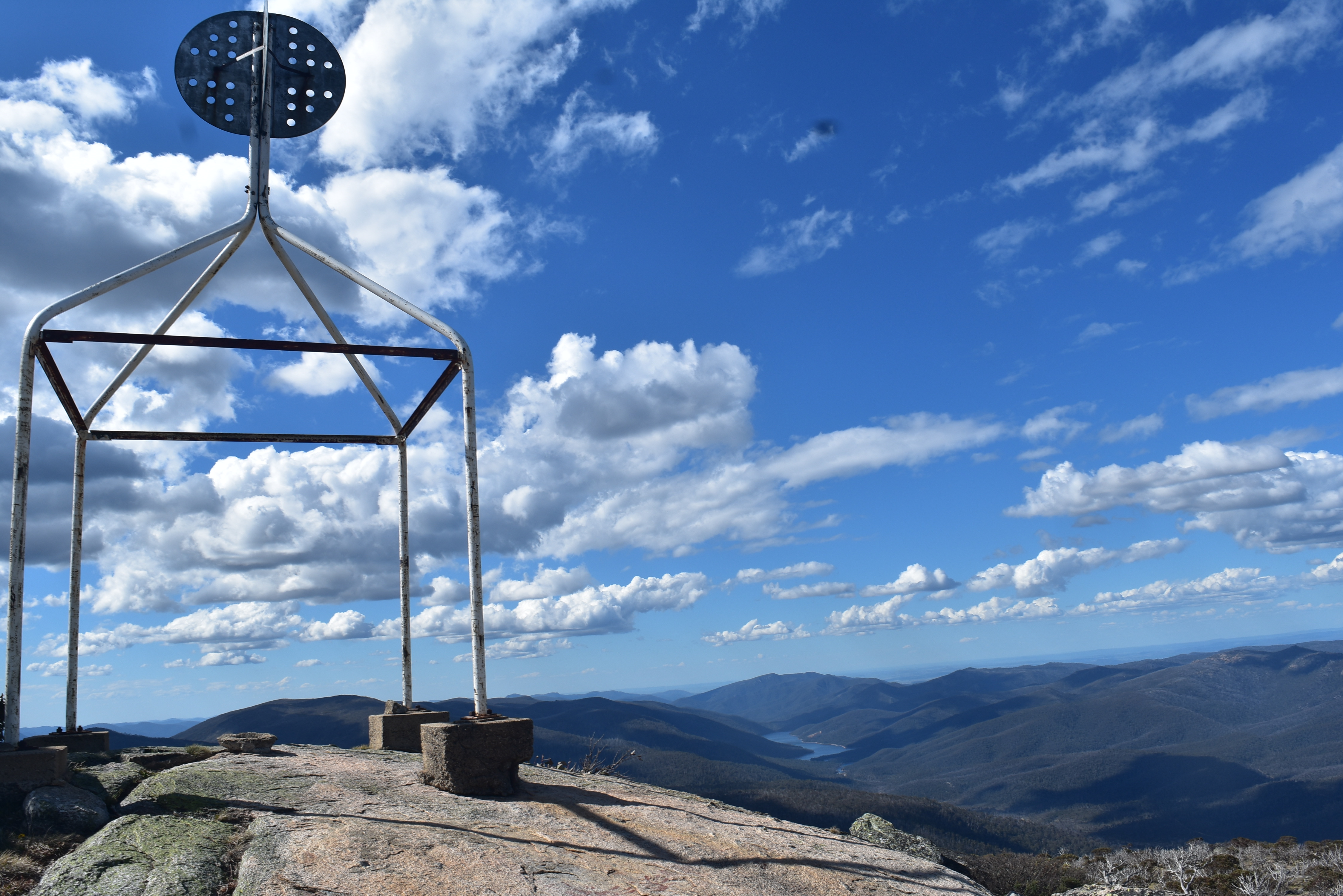
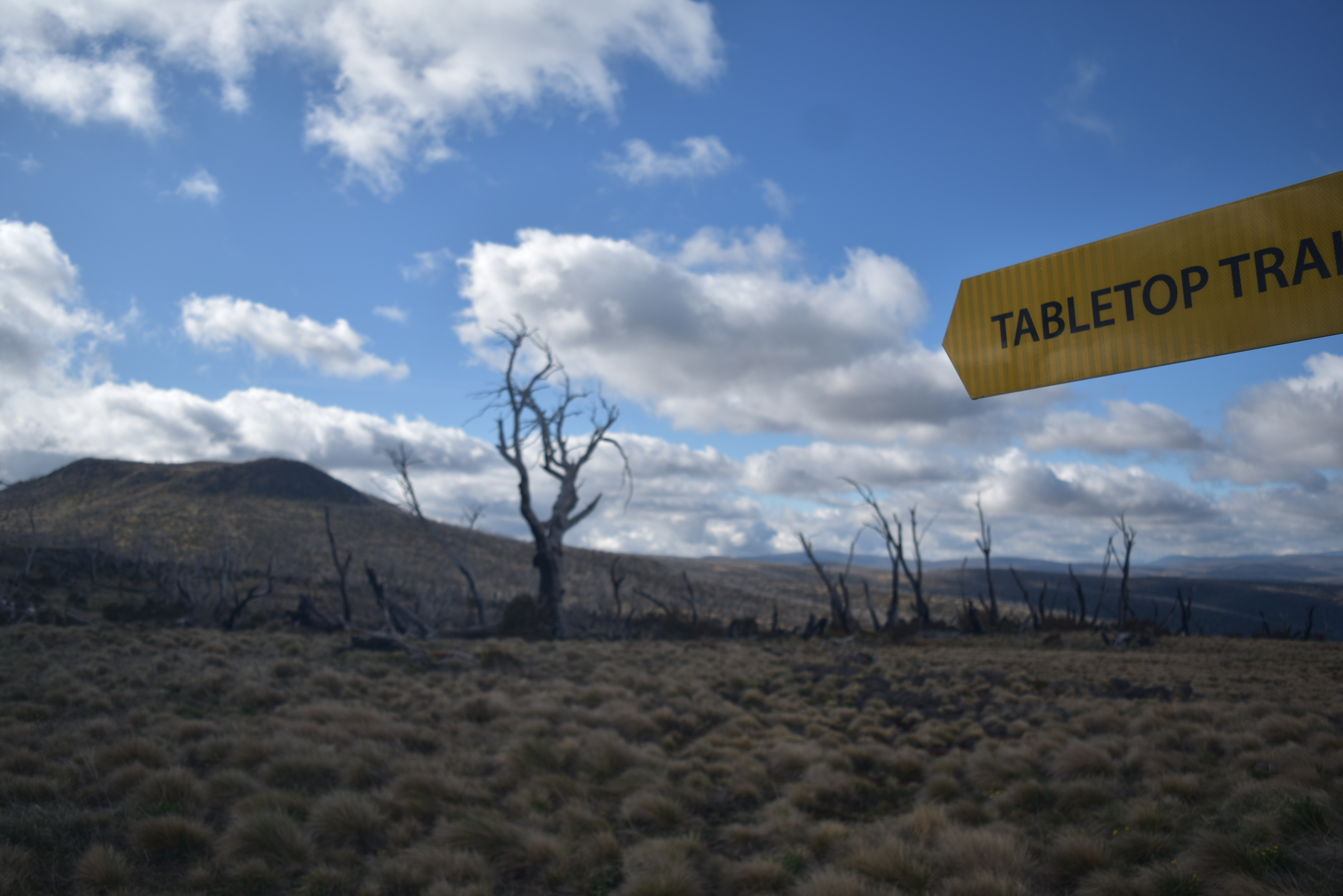
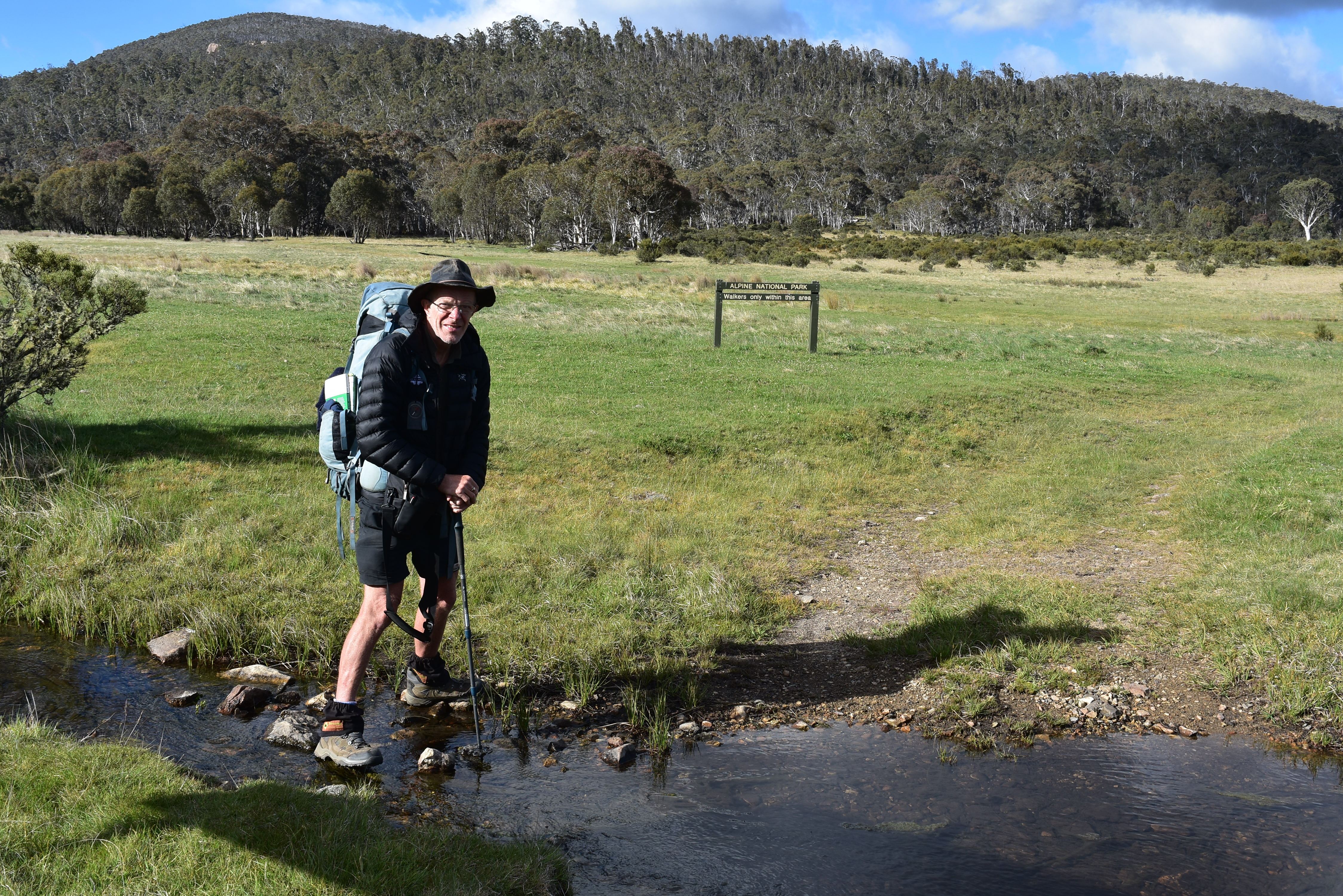
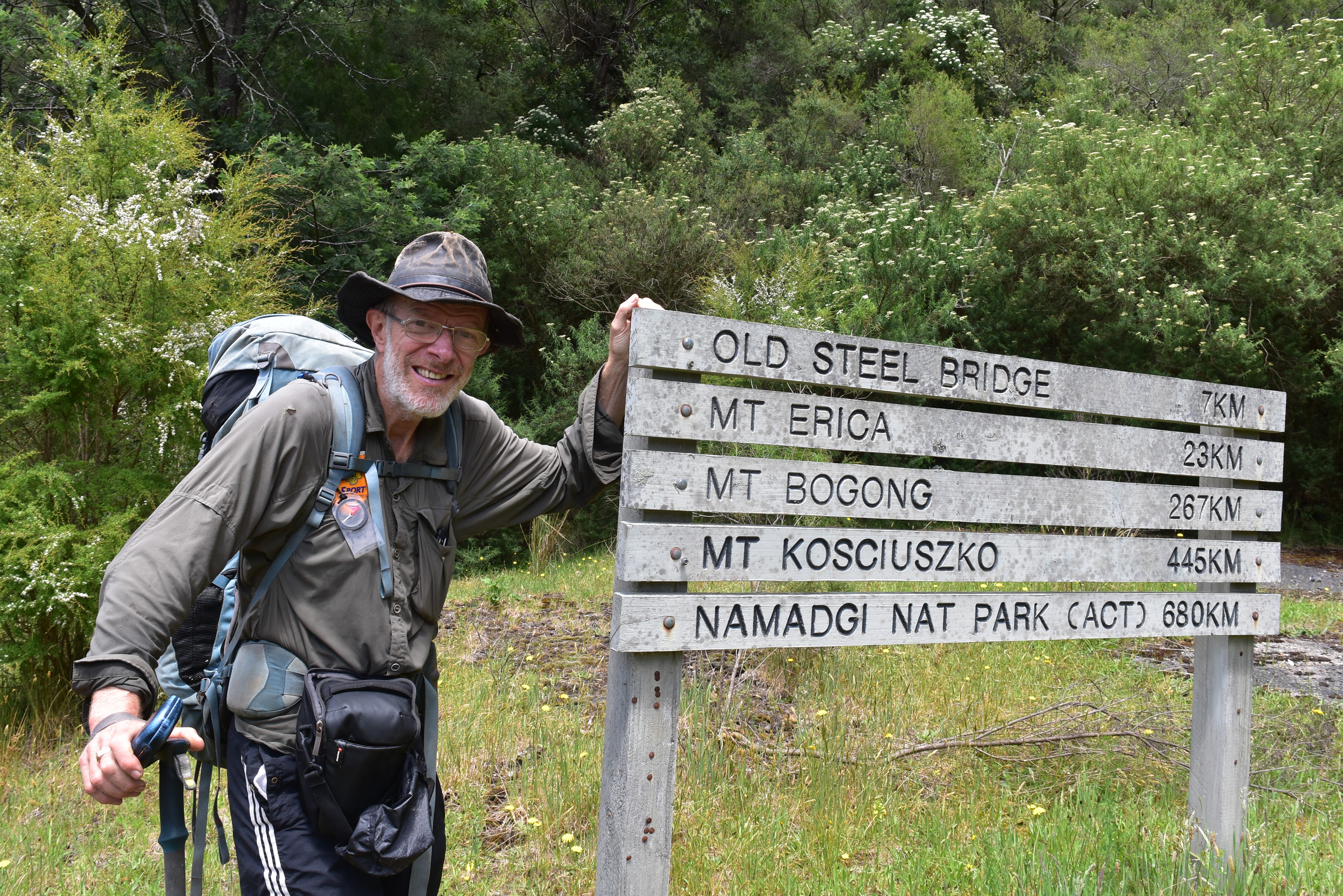
We arrived at the Namadgi National Park Visitor Centre. After the obligatory pre-hike photos and a chat with the ranger, we set off. It wasn’t long before we started climbing. It was slow going and I tried hard not to think too much about the mammoth task ahead of us. The track levelled off after the Mount Tenant turn-off, but there was a lot of uphill for the first three days to Murray Gap on the Bimberi Range. This marks the border between ACT and NSW. There’s a rough foot-pad from Murray Gap following the ridge up to Bimberi Peak. At 1931 metres, this is the highest point in the ACT so I had to visit. It’s only a handful of kilometres to the summit but the return trip took me the best part of five hours – very slow going as I lost the pad many times. The views from the top over Southern Canberra were amazing and well worth the effort. It was also the last phone signal for many days.
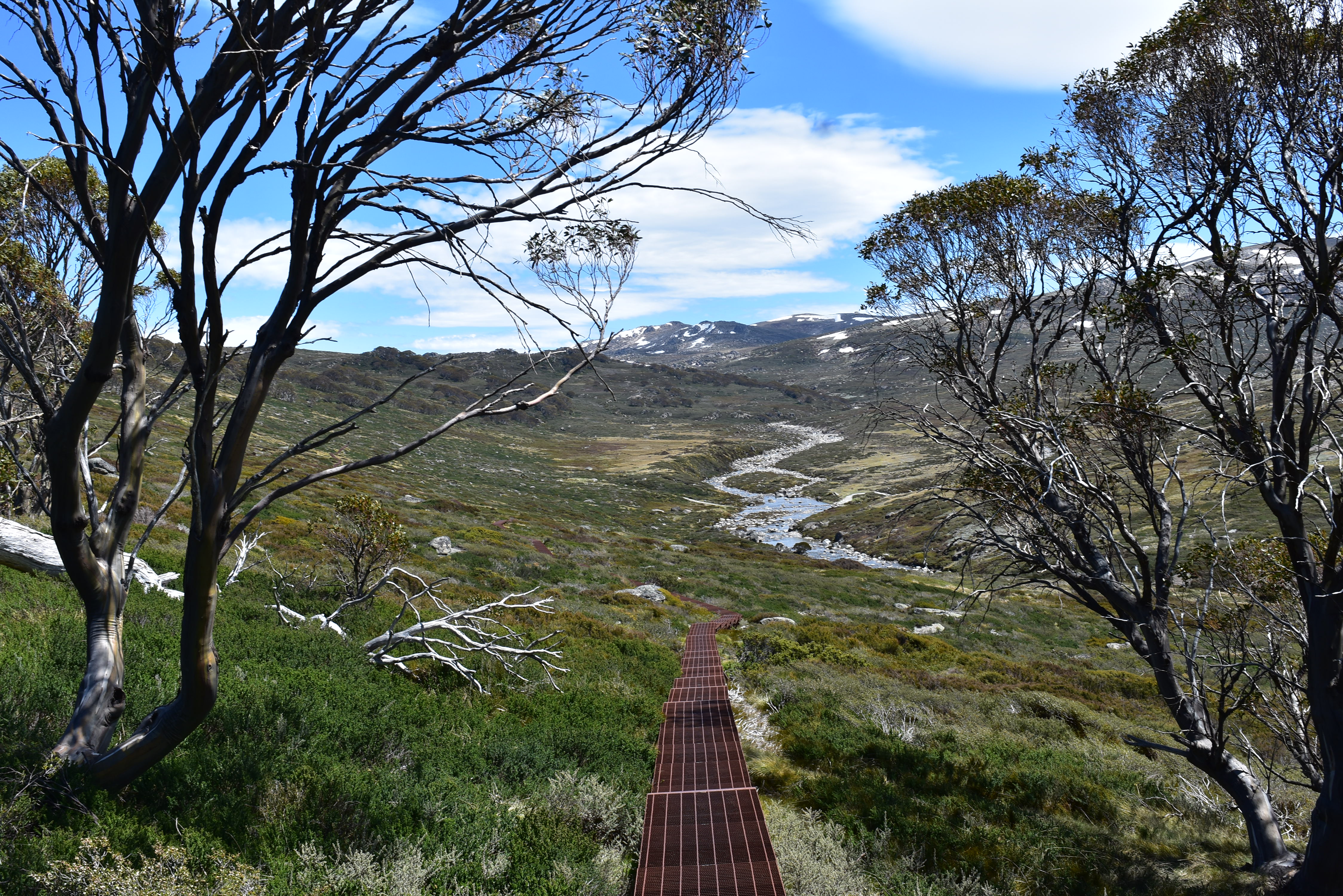
After almost three days of hiking uphill, it was a relief to descend from Murray Gap into Kosciuszko National Park. It was easy going through the Coolamen Plains. The big difference we noticed in NSW is the amount of feral horse activity. While they have been eliminated from ACT, it’s only recently that an aerial shooting program has been initiated in NSW. We didn’t see many wild horses but there were dozens of carcasses left to rot. Not great for hikers in the short term but hopefully, some long term benefit.
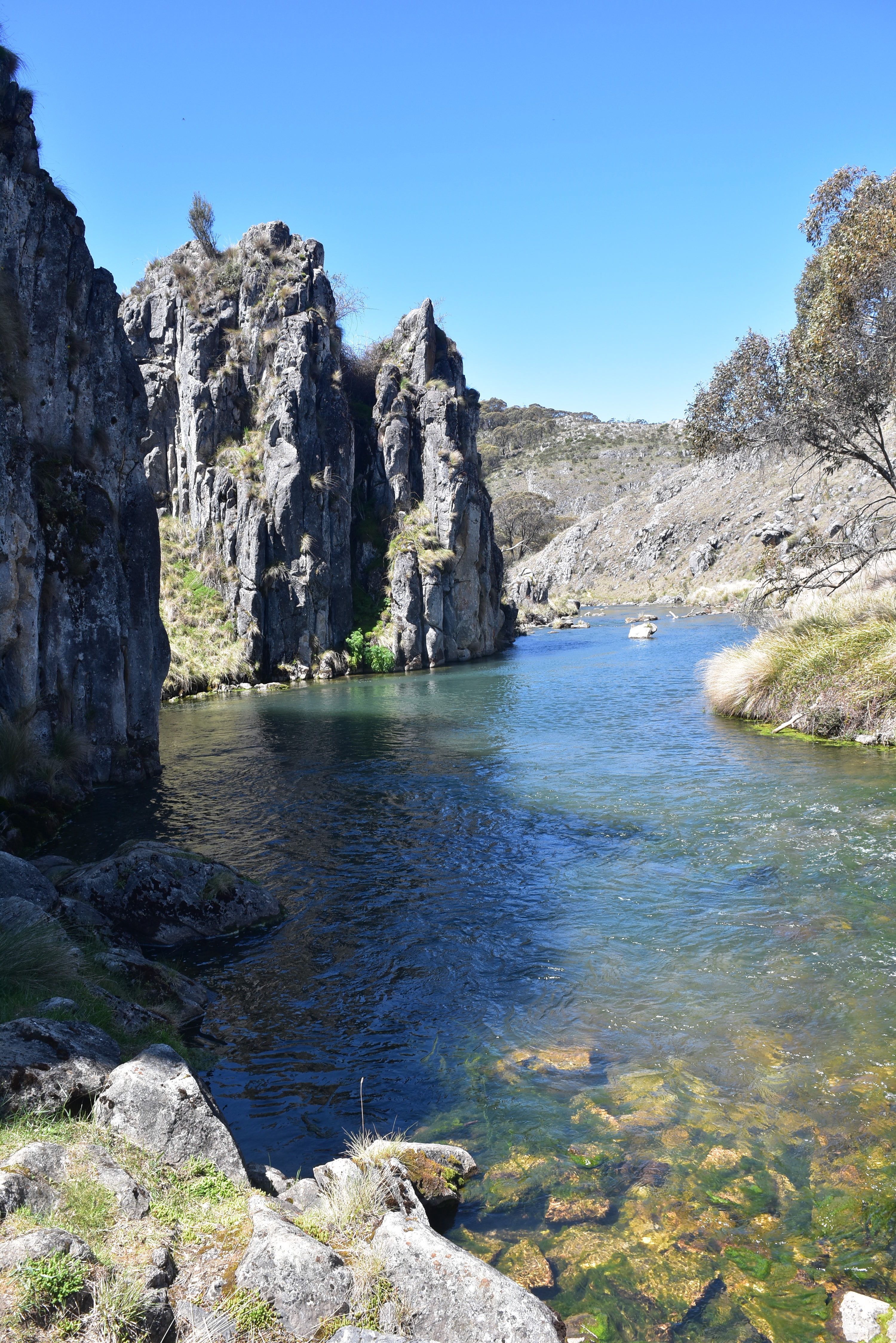
We took a side trip off the main track to Blue Waterholes, a beautiful campsite with some caves and cool streams for swimming. It was here that we met Alicia, another friend who did the walk two years previously. Alicia had some bad weather when she walked this northern NSW section. She was happy to join us for a week and enjoy it in sunshine,
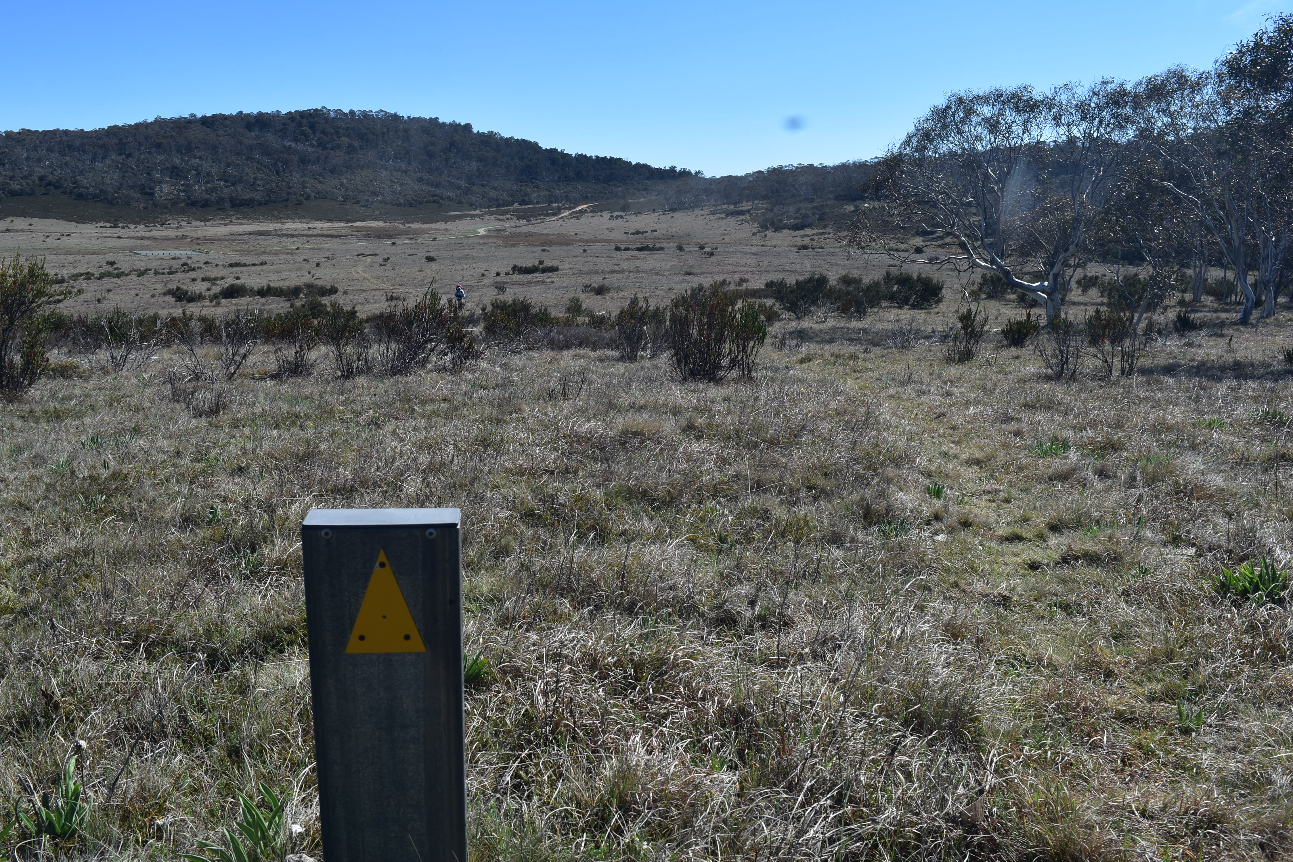
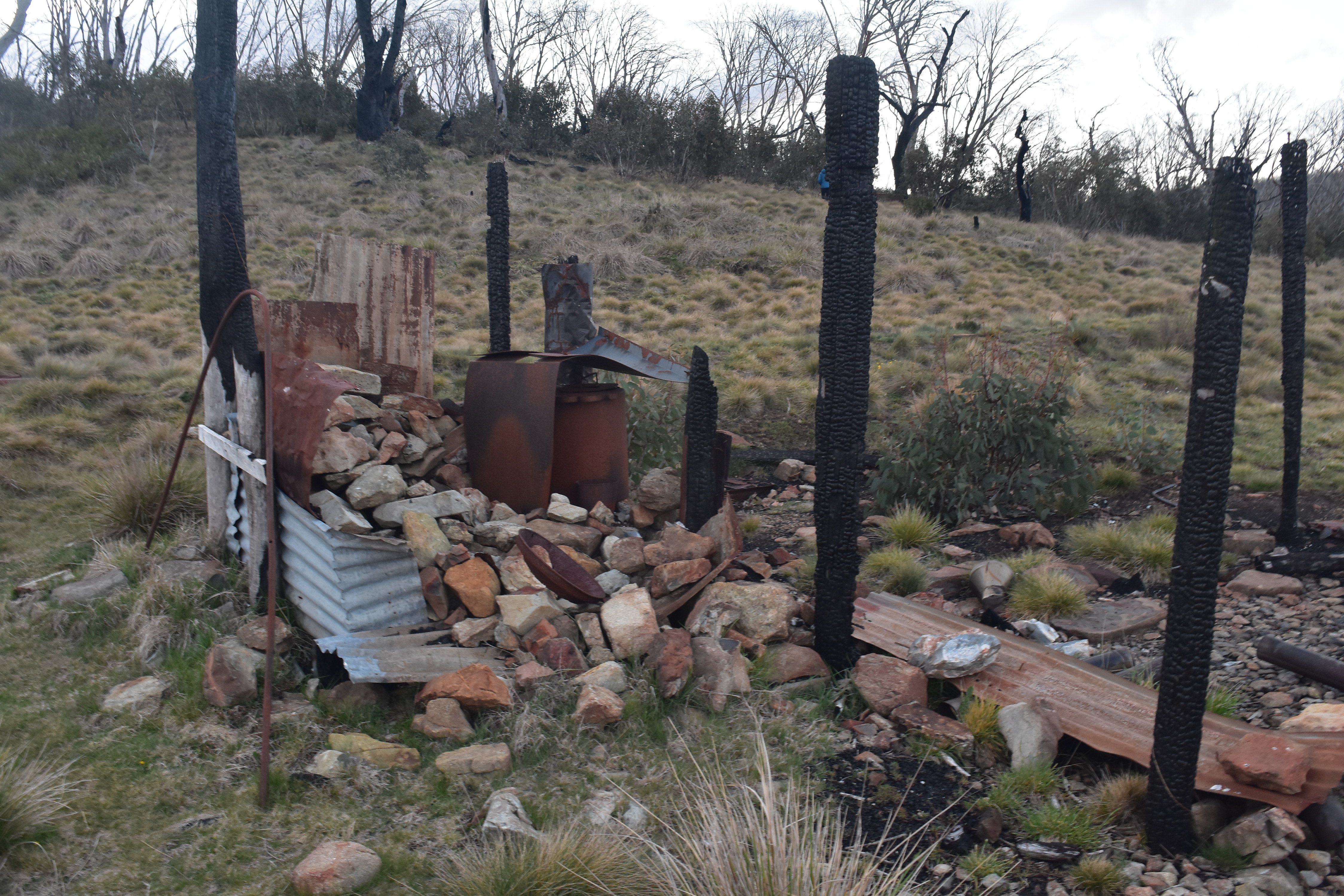
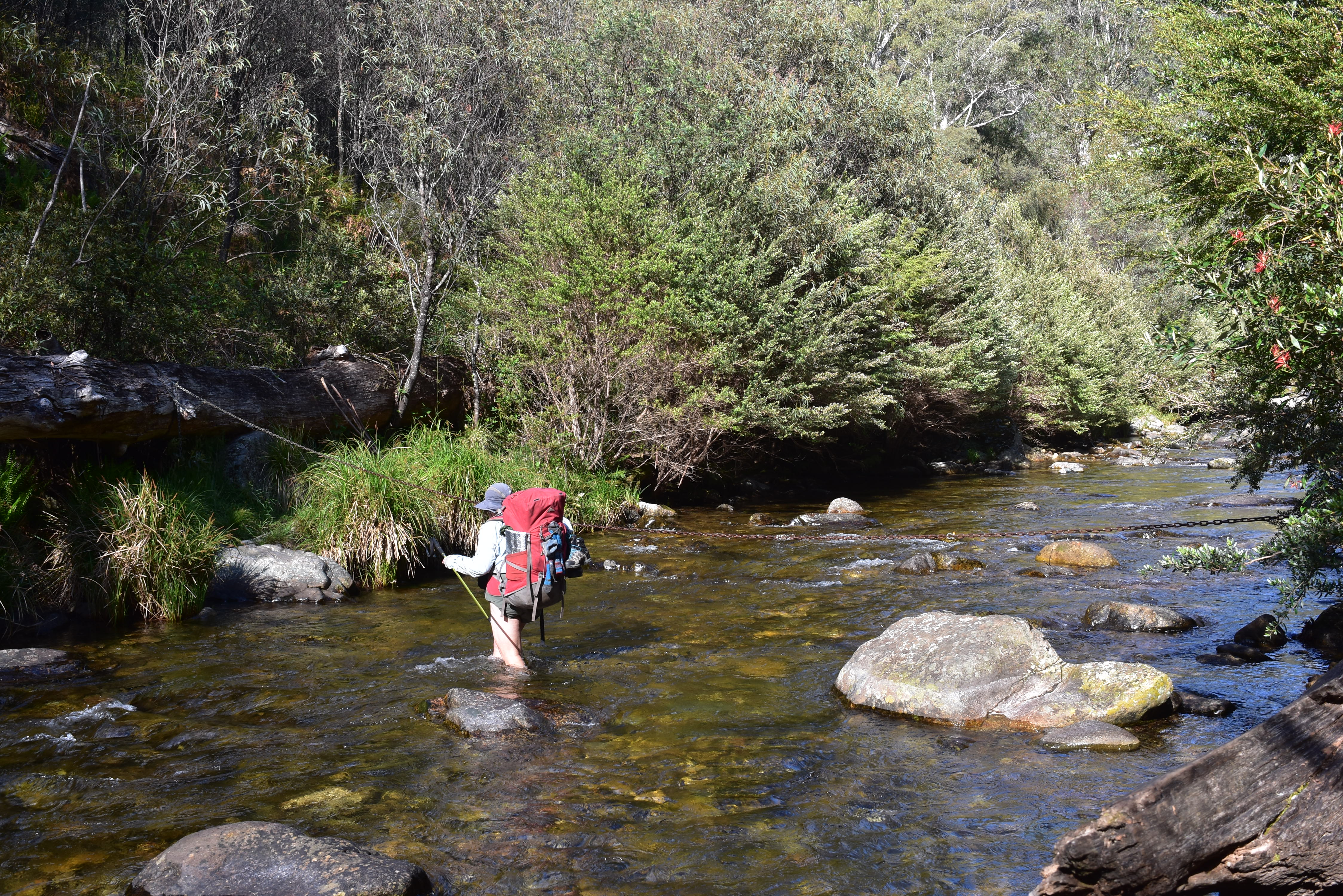
It was fairly easy walking for the next few days over the plains, though there were some icy-cold rivers to wade across. There were lots of huts to camp at which were invariably very-well maintained, largely thanks to the Kosciuszko Huts Association. We crossed the Snowy Mountains Highway at Kiandra and soon started to see the damage from the 2019/2020 fires – it was very sad but also heartening to see the new growth coming through.
Naturally, the terrain got hillier as we got closer to the Main Range. A couple of days out of Thredbo and we had to decide whether to take the official track or take a detour along the more picturesque Rolling Grounds. High winds meant we opted for the lower and more sheltered official route. Though we still had a beautiful camp up near the headwaters of the Snowy River.
We didn’t take the side-trip to Mt Kosciuszko as we’d both been to the summit on previous occasions. Instead, preferring to get to Thredbo quickly.
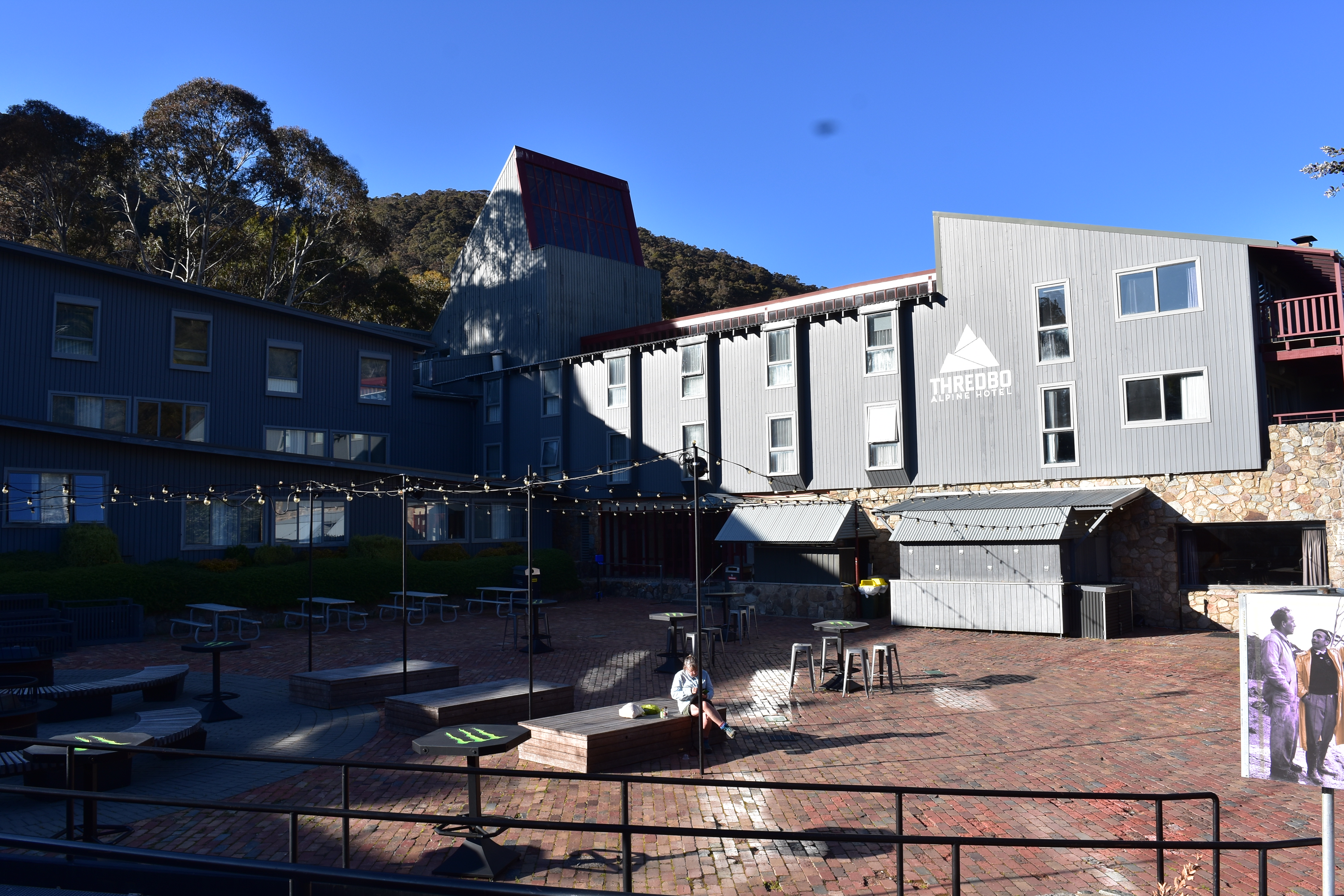
Walking into Thredbo felt a little surreal after two weeks in the wilderness, Suddenly there were hot showers, clean clothes, bakery lunches and pub dinners to be had. We arrived on Melbourne Cup day and had dinner with some friends from Victoria who coincidentally were in the area. They picked up some additional equipment from Wilderness Sports in Jindabyne which was enormously helpful.
It was mainly hiking on fire trails for a few days down to Cowombat Flat and the Victorian border. We stepped across the trickle that was the headwaters of the Murray River. And took a side trip to Indi Spring that was it’s actual source.
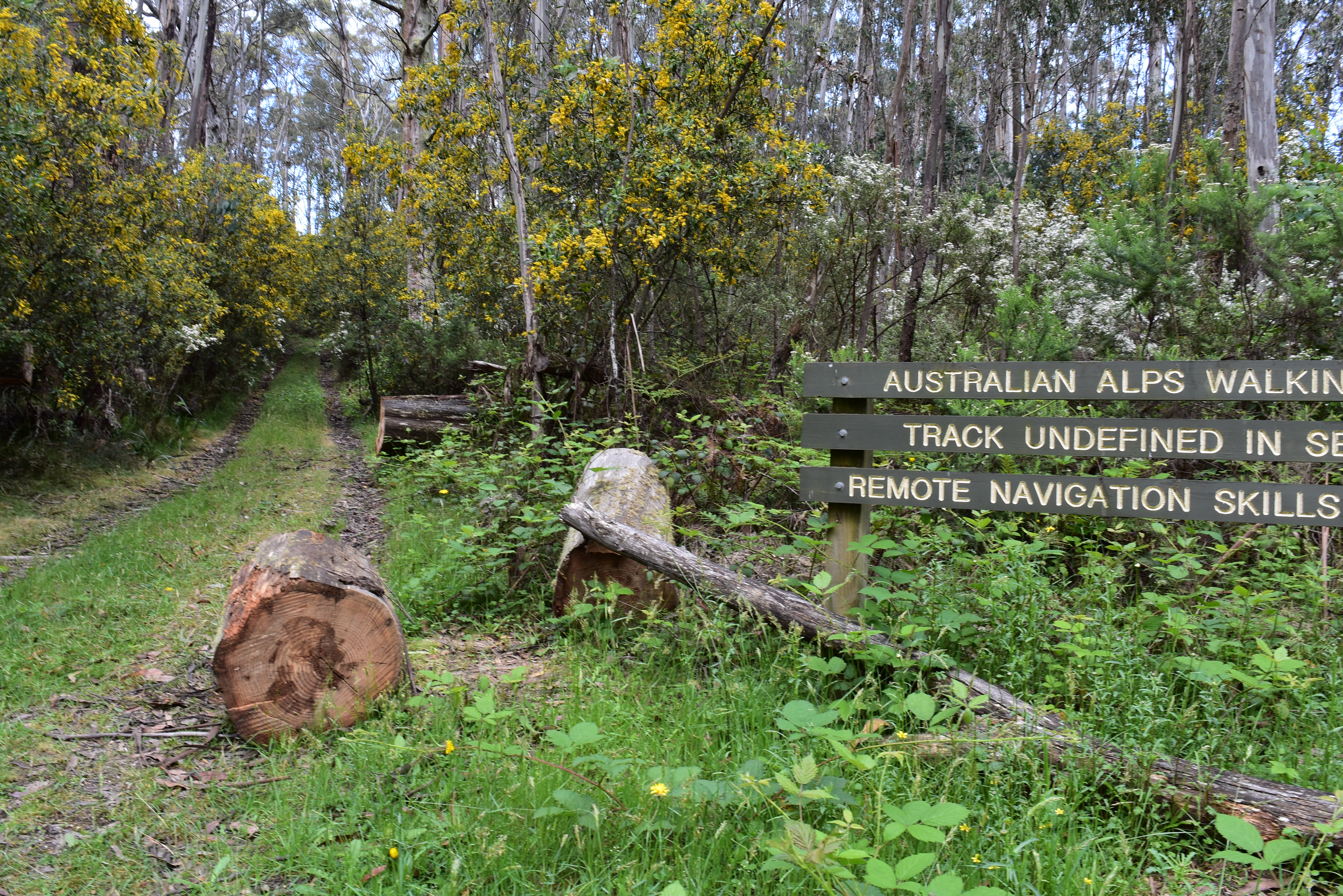
From Cowombat Flat to the Omeo Highway was a big unknown for me; not an area that I’d ever been to nor knew anything about. It’s the most remote area of the track and doesn’t get a lot of love. It was hard work pushing through the scrub, looking for an ill-defined track. Dozens of brumby pads criss-crossed the area meaning we had to really pay attention to our route. It was all made even harder with lush regrowth following the 2019/20 fires impeding our progress. At one stage, we took a long road detour to avoid the densest part of the forest.

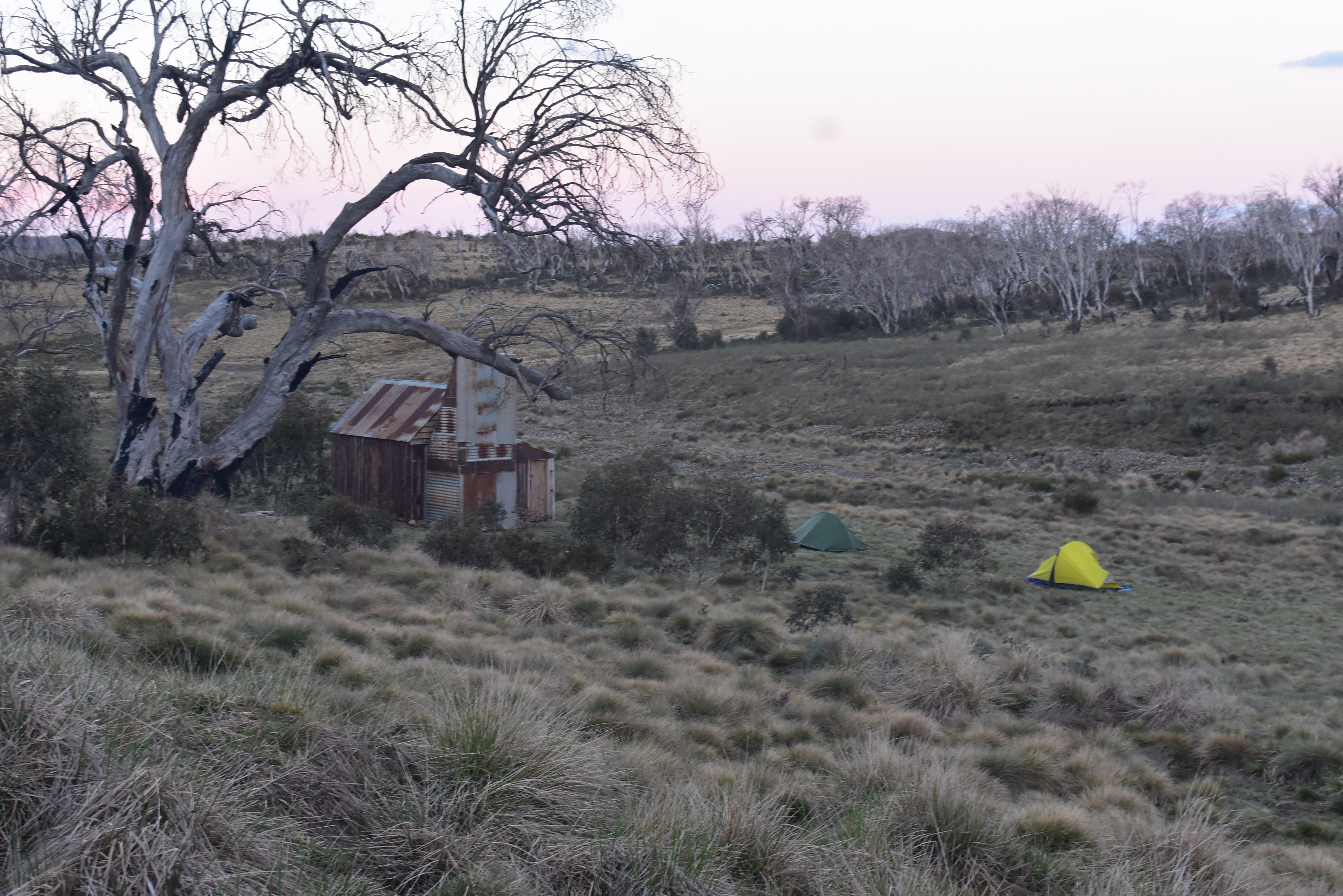
We finally crossed over the Omeo Highway and climbed up to Mt Wills, I was in familiar terrain again. One day out of Hotham and a massive storm forced us to hole up in Cope Hut for a day. We were almost four weeks into the hike and it was the only significant rain we’d seen.
Many friends from home had planned to meet up with us at Mt Hotham but the weather put us a day behind schedule. The Hotham party was delayed by a day, fortunately most people were still able to attend.
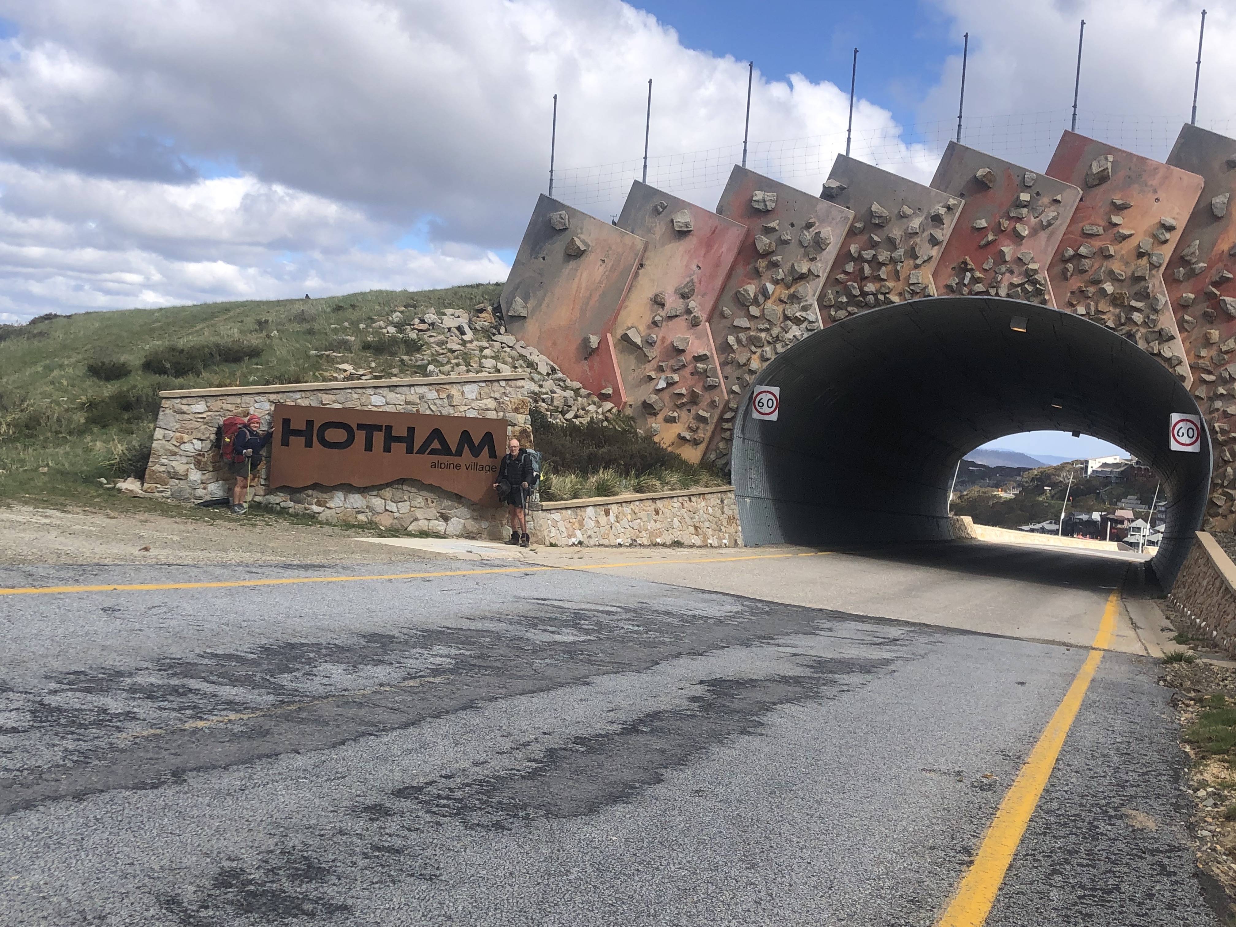
From the Mt Hotham resort, it’s a 9km walk along a narrow bitumen road to rejoin the track. Fortunately, our friend Cathy was one of those to join us for the party on the previous night. She kindly drove us out there and hiked with us until lunchtime. On our first night out from Hotham, camping at the old Mt Murray Hut site, we couldn’t find water despite searching for two hours. With the benefit of hindsight, we should have used the two hours to keep walking to the next known water source. We scraped by with some fresh food we’d picked up at Hotham. And a surprise food drop; friends Mat and Nicki had run out the day before and left a container of tomatoes and strawberries for us. We’d entered the part of The Track known as the Dry Barries. There are very few natural water sources; until the installation of strategically located rainwater tanks, this section would have been extremely difficult in summer.
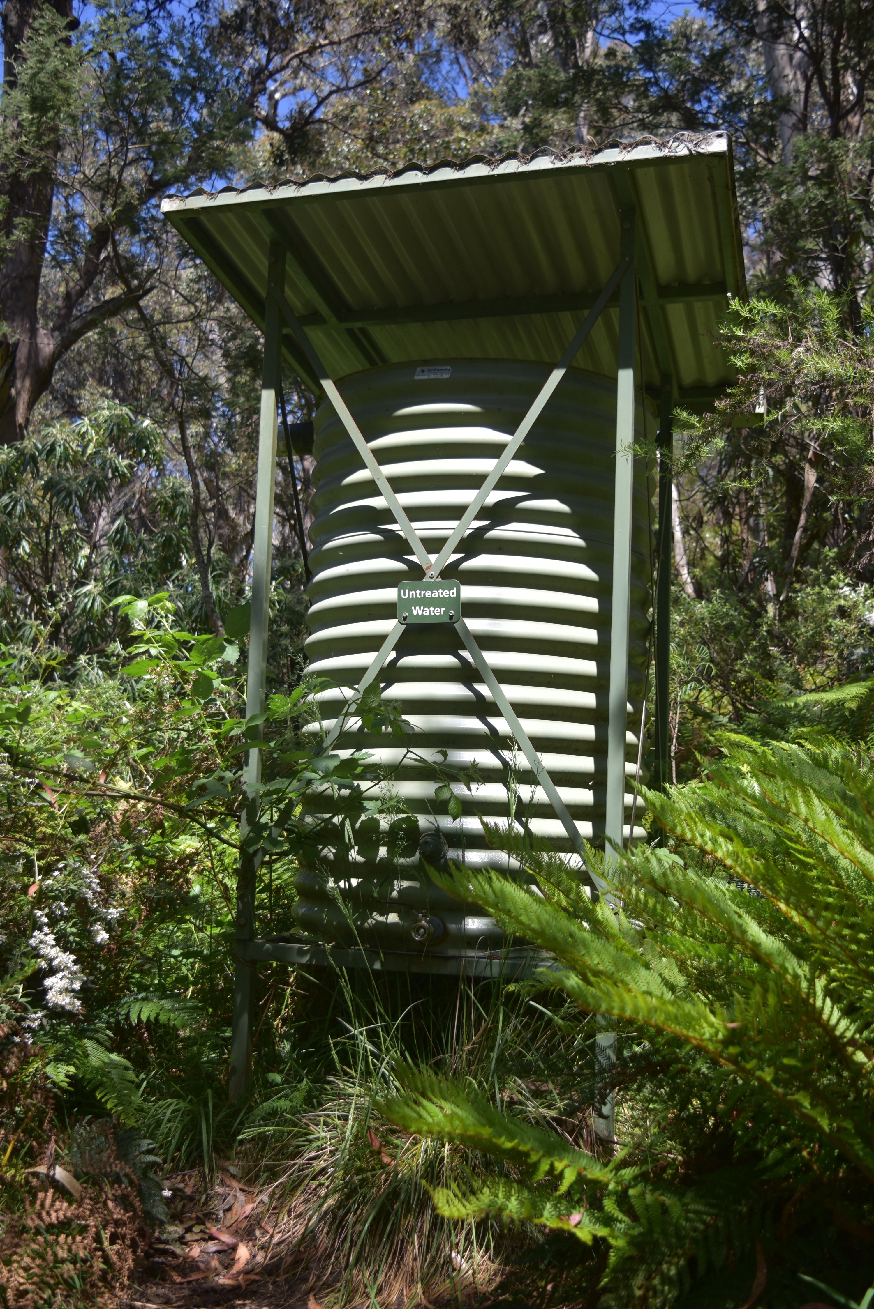
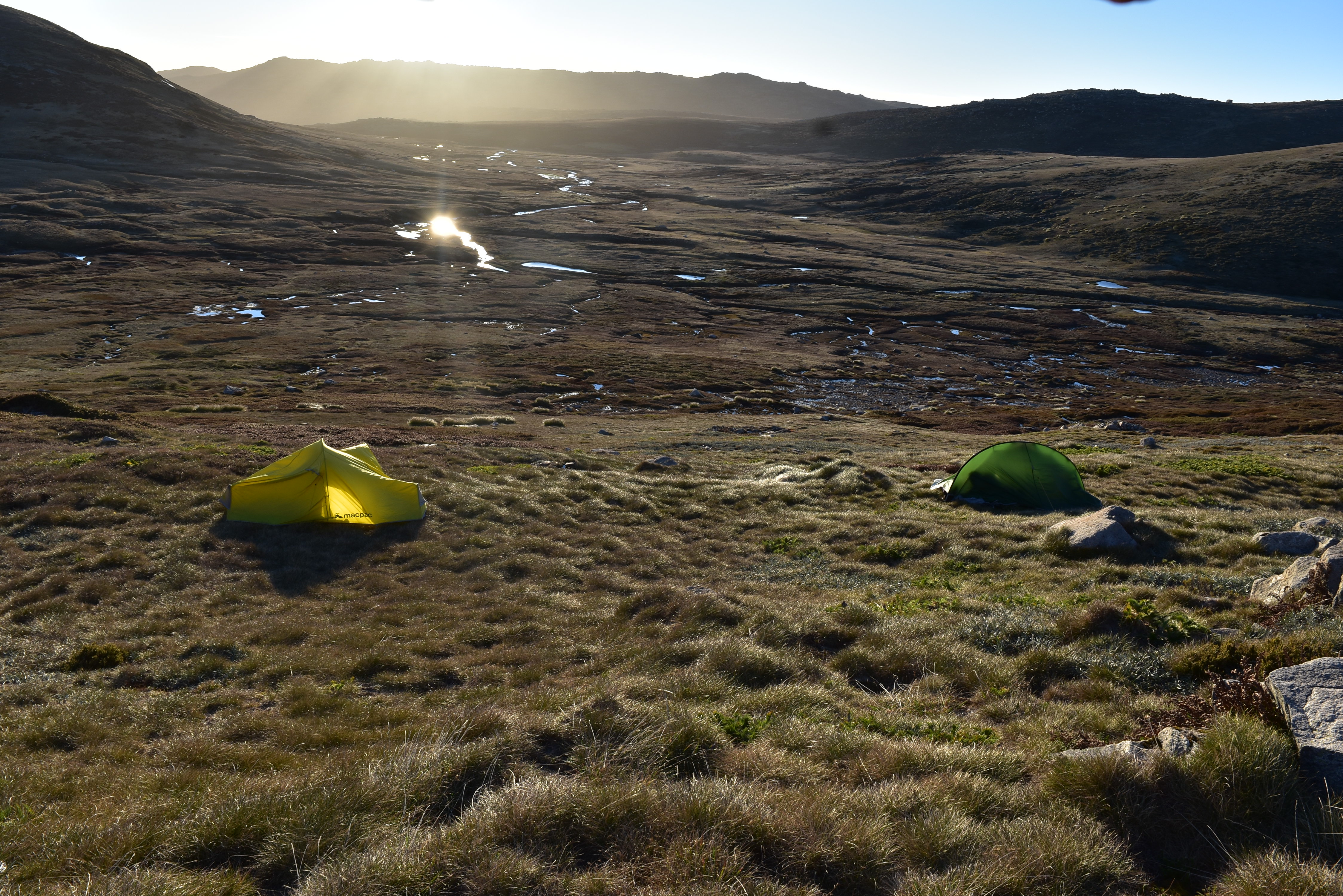
We arrived at the water tank at Barry Saddle by late morning. The next reliable water was only 6-7km away but it was on the other side of The Viking. We’re not fast walkers and there was no guarantee that we’d get there before dark. So we loaded up with 5-6 litres of water each and set off up the mountain. As expected, it was a long, slow climb. However, we made it to the top well before sunset; we had enough time to make it down to Viking Saddle and the next water source. But it was a beautiful spot, we had adequate water with us, so we decided to camp near the summit. One of the best campsites for the whole trip.
We started quite early the next day after a beautiful sunrise. The first kilometre or so down to Viking Saddle was very slow as it was very steep and rocky. We also had the infamous Chute and Chimney to deal with. These involved removing packs and passing them down to each other while we clambered down. After Viking Saddle, it was no easier. There were hundreds of fallen trees criss-crossing the track over a handful of kilometres. And it wasn’t just one tree at a time. Each tree would take several of its neighbours when it fell over the track leaving a maze of trunks and limbs to clamber over, under or around.
Once we’d cleared this area, there were huge rock slabs to traverse, then the long slog up Mt Despair. Walking got easier by mid-afternoon so we picked up the pace and made it to Camp Creek at the foot of Mt Speculation that night.
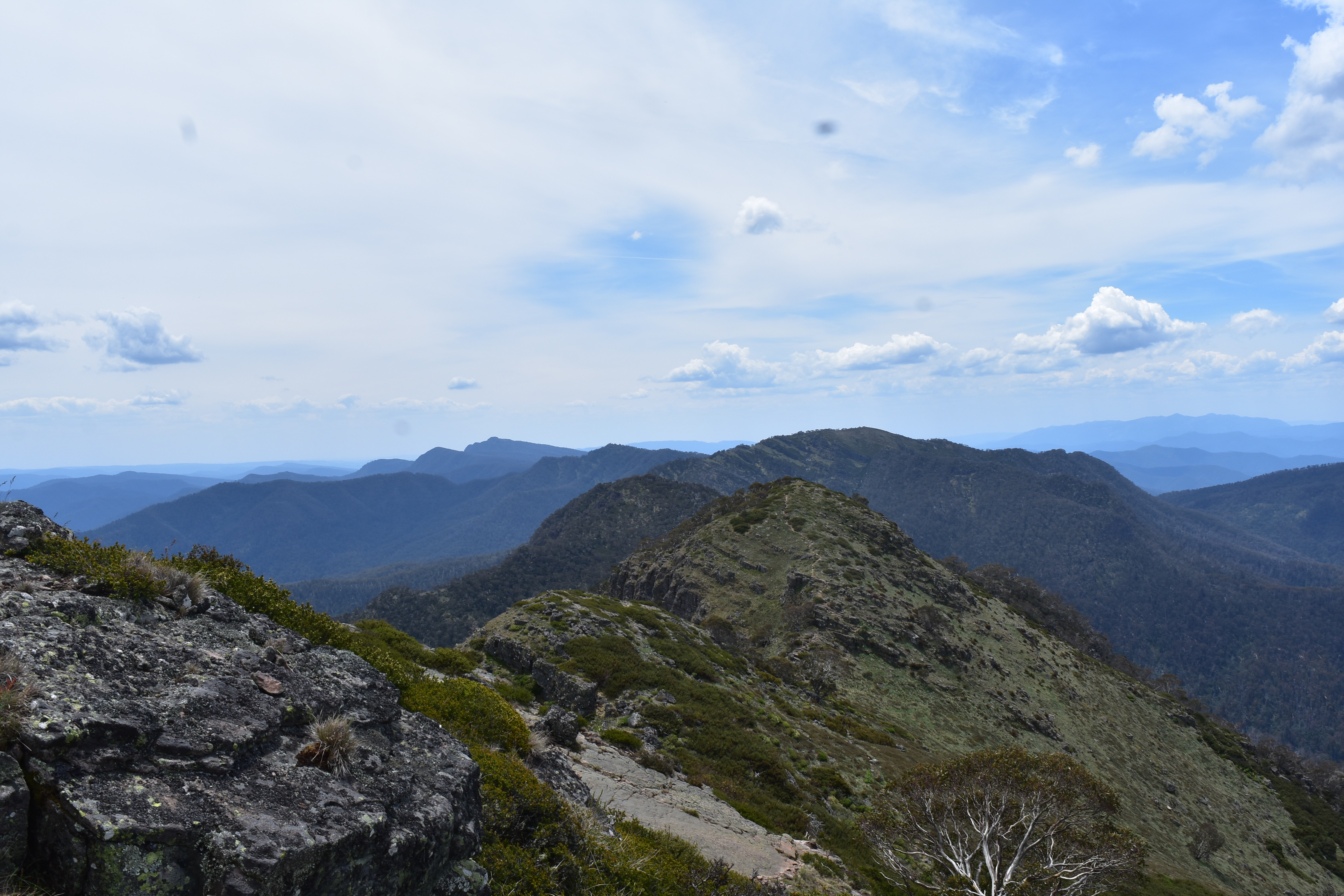
From Mt Speculation along the Crosscut saw was challenging but, as anybody who has walked this section will know, it was incredibly scenic – one of the highlights of the trip.
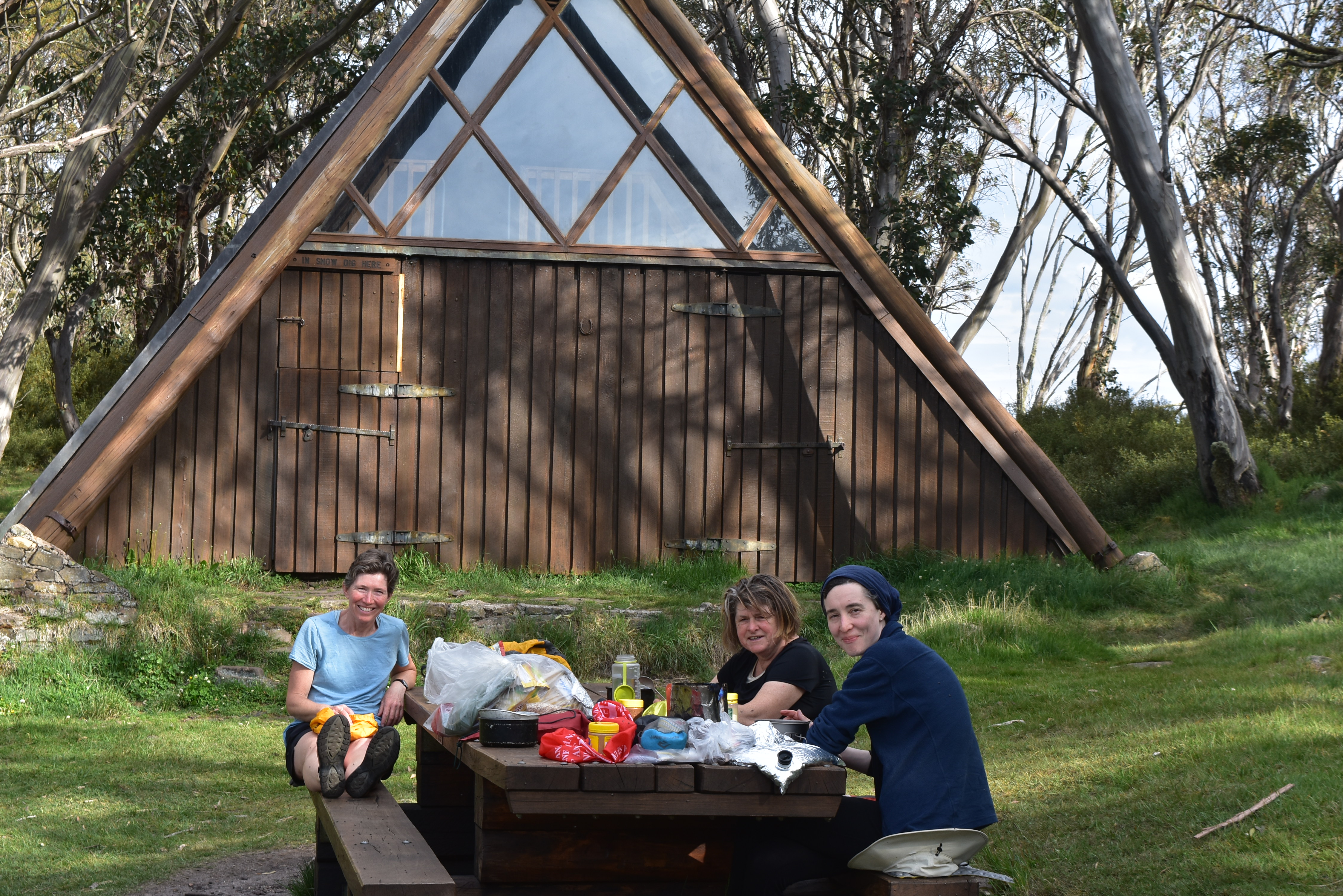
After a pleasant night at the iconic Vallejo Gantner Hut, we headed over Mt Howitt towards the King Billys. Light rain started to fall but it got heavier and heavier as the day went on. By late morning, it was bucketing down so we took a detour off the main track and headed towards the shelter of Lovicks Hut. We stayed there for two nights, sheltering from the weather. It wasn’t a great forecast for the next day but we were running low on food and couldn’t afford another day off. There was some rain but nowhere near what we expected. We were still off the main AAWT, camping at Upper Jamison Hut for the night.
The rain eased the next day; it was a lot better than forecast but it was never far away for the rest of the hike.
The Baw Baw plateau was spectacular, with massive snow gums looming through the fog with the rain bringing out the colours in their bark – highlighting the wrinkles in their elephant-like skin. Not to mention the massive rock formations. Despite the beauty, we didn’t linger. The weather wasn’t great but we were very close to the end and keen to finish.
It rained hard just before arriving in camp on our last night. We put up our tents in pouring rain and cooked dinner in the vestibules. No last night celebrations were to be had. Fortunately, the skies had cleared by the morning for an easy half day walk in to Walhalla. I got a little bit emotional as I got closer to town – looking back over the past six weeks and what an amazing experience it was. I finally completed a walk I’d wanted to do since I first heard about it, half a lifetime ago.


Leave a comment