Bushfires have burnt more than 90,000 hectares of land in Tasmania this summer. The Gell River fire in the south west is still burning. There have been fears expressed that large areas of fire sensitive vegetation have been impacted. An initial desk top assessment carried out by researchers at the University of Tasmania suggested that the areas of these vegetation types affected was very small.
Now the Tasmanian Parks and Wildlife Service has provided an update on what types of vegetation was involved in the fires and the likely impacts on what they define as ‘Extreme fire sensitive communities’. Their assessment is that very small areas of these communities was impacted.
All text below is from the Parks and Wildlife website.
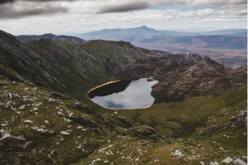
The header image used with this post shows how sprinkler lines set up at Lake Rhona were able to prevent damage to fire sensitive communities (photo credit: Stu Gibson).
Despite cooler conditions in recent weeks, active fire-fighting efforts continue with hundreds of hot spot areas remaining within fire grounds. Efforts have been continuing to extinguish these hot spot areas. Significant fire weather conditions were experienced (in early March) which caused some existing hot spots to become active. The Gell River fire and the Riveaux Road fire both flared up in some locations.
The Gell River fire experienced flare ups near Boyes Basin on Lake Gordon, Clear Hill, Adamsfield and the Gordon Range; in spite of the severe fire weather, the fire spread was relatively constrained.
The western part of the Riveaux Road fire in the TWWHA experienced flare ups in isolated locations around Mount Picton, but also did not spread significantly.
The cool change which came through Saturday night resulted in the fire activity once again abating.
Background
A number of fires were ignited by dry lightning that crossed the state in late December 2018 and mid-January 2019. The storms of 15 January 2019 resulted in approximately 2,400 lightning strikes and caused over 60 new ignitions.
The Tasmania Parks and Wildlife Service, in partnership with the Tasmania Fire Service, Sustainable Timber Tasmania and a number of interstate and international emergency service personnel, have been working for over two months in very hot, windy and sometimes unpredictable conditions in order to contain all the fires across Tasmania.
The Parks and Wildlife Service has used every tool available, including the use of heavy machinery, retardants and water-bombing, in order to halt fire spread and protect life, property and infrastructure. Vulnerable natural, cultural and historic values have also been successfully defended from the fires to date. During the current fire-fighting efforts Parks has used many established remote area firefighting techniques as well as trialling new methods of fire suppression – some of which have come from implementation of the recommendations in the wake of the 2016 fires.
Modelling of fire behaviour has enabled the use of strategic intensive water-bombing, the best placement of constructed firebreaks, the aerial application of long-term retardant, the installation of kilometres of sprinkler lines and the wrapping of heritage huts in sisalation to protect these timber structures from ember attack.
The Fuel Reduction Program burns conducted by the Parks and Wildlife Service in the TWWHA and other reserved land have also slowed the progress of the burn, particularly in the western parts of the TWWHA. The long awaited and much appreciated rain and calmer weather conditions in mid-February aided the emergency service suppression efforts. However, there is no rainfall of consequence predicted in the near future and the potential for dry lightning may see the fire situation change again.
To date, the fire area has affected around 93,000 ha, or about 5.8 percent, of the Tasmanian Wilderness World Heritage Area and approximately 42,600 ha, or 3.4 percent, of other reserves managed by the Parks and Wildlife Service. Much of the affected area within the Tasmanian Wilderness World Heritage Area is in very remote and rugged terrain.
Preliminary impact assessment
The Parks and Wildlife Service has begun assessing the impacts of the fires on natural and cultural values, as well as built assets, such as walking tracks.
In addition, a desktop analysis of the mapped fire boundaries has provided some preliminary understanding of the impact. This analysis suggests that a variety of vegetation types ranging from communities that exhibit extreme fire sensitivity, to communities that are fire adapted, have been affected by the fires.
Extreme fire sensitive communities are vegetation communities that contain components that will not recover from fire. This includes communities such as rainforest with king billy pine, alpine conifer communities, alpine deciduous beech communities and rainforest with deciduous beech.
Very High fire sensitive communities are vegetation communities that have a degree of fire resilience. For example, rainforest will be impacted by fire but can recover as long as other disturbances are absent in the post-fire period. Examples of Very High fire sensitivity communities include alpine and subalpine heathland without conifers, rainforest without conifers, and mixed forest.
Mixed forest is a forest type that is transitional between wet eucalypt forest and rainforest. It consists of fire adapted eucalypts with a fire sensitive rainforest understorey.
Fire adapted communities are vegetation communities that are not only able to survive fire but require fire for healthy ecosystem functioning. Examples of fire adapted communities include buttongrass, native grassland, eucalypt forest, heathland and scrub.
Early analysis indicates that around 84 percent of the vegetation within the fire boundaries in the Tasmanian Wilderness World Heritage Area is fire adapted. Buttongrass has already begun to reshoot in many places.
Less than 1 percent of the Extreme fire sensitivity communities occur within the current mapped fire boundary areas within the TWWHA. There is confirmation that some unmapped pencil pines on the Denison Range have been impacted by fire. In addition, a few Huon pines growing amongst eucalypts on the Anne River have also been impacted. Aerial surveys have also identified a few King Billy pines growing along the rainforest boundaries near Mount Anne and Mount Bobs that appear singed. From what we have determined, these number less than 10. These are the only impact to conifers currently known.
Within the Tasmanian Wilderness World Heritage Area, about 1.8 percent of the Very High fire sensitivity communities (excluding mixed forest) are within current fire boundaries and about 3.1 percent of the mixed forest is within current fire boundaries.
It is important to note that many of these extreme and very high fire sensitive areas within the fire boundaries will not have burnt due to the patchiness of the fire and the low flammability of these communities.
Other natural values that are known to be impacted include lunettes in the Lake Ada area. It is likely that some peat will have burnt in the fires also.
Several important Aboriginal cultural heritage values are known to be located within the fire boundaries. The impact of the fire on these values is not yet known but Aboriginal Heritage Tasmania have developed plans to assess any impacts.
Extreme and Very High fire sensitivity threatened vegetation communities that are mapped within current fire boundaries within Parks and Wildlife Service managed areas.
| Threatened vegetation community | Fire sensitivity | Conservation status | Area within current fire boundaries (ha) |
| Pencil pine open woodland | Extreme | Rare | 0.5 |
| Pencil pine rainforest | Extreme | Rare | 0.8 |
| King billy pine rainforest | Extreme | Vulnerable | 5.2 |
| King billy pine subalpine scrub | Extreme | Rare | 8.2 |
| Cushion moorland | Very High | Rare | 3.3 |
Despite significant efforts to protect the heritage listed Churchill Hut along the Adamsfield Track it was destroyed by the fire.
Parks and Wildlife Service actions and operations
The Parks and Wildlife Service have utilised many established remote area firefighting techniques this fire season, as well as trialling new methods, in order to halt fire spread and protect vulnerable natural, cultural and historic values.
Modelling of fire behaviour has enabled strategic, carefully considered water-bombing, the best placement of hand constructed firebreaks, the strategic application of long-term retardant, the installation of kilometres of sprinkler lines and the wrapping of heritage huts in sisalation to protect these timber structures from ember attack.
The Fuel Reduction Program burns conducted by the Parks and Wildlife Service have also helped halt the spread of many of these fires.
Fires impact
West Coast
The fires burning in this area include Lynch Hill (2818 ha), Western Hills (6,500 ha) and Fowl Creek (38 ha). The Murchison River fire burnt about 2.5 ha but is now extinguished.
Mount Anne area group
The fires in this group include Celtic Hill (3500 ha), Anne Gorge (1035 ha) and Gallagher Plateau (15 ha). These fires have not spread for a few weeks but still have hot spots around the edges and continue to be suppressed. Fire activity in this area slowed as the fire hit low fuel areas such as the Eliza Plateau, was actively suppressed, or reached boundaries of wetter vegetation.
Sprinkler lines have been installed as a preventative measure to the south of Lake Judd to reduce the likelihood of fire running up the ridgeline to Mount Sarah Jane and impacting sensitive king billy vegetation communities around Lake Judd and the other smaller lakes. Crews have returned to this sprinkler line to make adjustments, top up fuel tanks on pumps and to ensure they are operational.
Mount Anne area impact report
Field impact assessments in the Mount Anne area indicate that the fire has only impacted the very edge of the rainforest boundary to the west of Mount Anne. No alpine vegetation on Eliza Plateau or Schnells Ridge has been impacted. A few Huon pines growing in exposed locations along the Anne River have been impacted. Huon pines growing further down the Anne River in the Anne River Gorge do not appear to have been impacted. The iconic vegetation communities, such as the King Billy forests, Pandani Shelf and the alpine community on the Eliza plateau have not been burnt. The High Camp hut has also not burnt.
Southwest (south of Macquarie Harbour and west of Hardwood River)
The fires burning in this area include Moores Valley (36,255 ha) and Dolphin Ridge (2,913 ha) fires. These fires are all largely in fire-adapted buttongrass moorlands although there are areas of wet forest and rainforest that are likely to have been burnt around the edge of the moorlands. There are some large stands of Huon pine in this area and brief aerial reconnaissance indicates these have remained unburnt.
Southwest fires impact report
A Parks and Wildlife Service desktop analysis indicates that a total of 1,951 ha of Very High and Extreme fire sensitive vegetation occurs within these fire areas with 531 ha being in the TWWHA. This is predominately mixed forest, which is a transition state to rainforest. As such, mixed forest consists of fire adapted vegetation with fire-sensitive components. It is important to note that this value will change and is likely to be reduced as a more accurate fire boundary becomes available and unburnt patches are eliminated from within the boundary.
Wilmot and Frankland Range
The fires in this area include Wilmot Range (105 ha), Lake Pedder (1,120 ha), Wombat Peak (243 ha) and Mount Solitary (1,371 ha). These fires have run to natural boundaries and have not spread further for some days. The values in this area are similar to the Southwest group, with the fires being largely in buttongrass moorland. The Wombat Peak fire was most likely ignited by the lightning event of January 15th but did not appear until January 31st.
Wilmot and Frankland Range impact report
A Parks and Wildlife Service desktop analysis indicates that a total of 48.9 ha of Very High fire sensitive vegetation (including mixed forest) occurs within these fire areas. Similar to the above impact reports, this value is likely to change.
Huon River area group
In January the fires which started to the west of the Picton River on Parks and Wildlife Service managed land, merged with other fires. Together they became known as the Riveaux Road fire (63,000 ha). While rain and milder conditions earlier this month halted the spread of this fire, after the hot weather of the last week, the fire again became active. Numerous hot spots have been identified and continue to burn near established fire boundaries in various locations along the edge of the fire.
Huon River area impact report
A Parks and Wildlife Service desktop analysis indicates that 4,535 ha of Very High and Extreme fire sensitive vegetation occurs within these fire boundaries on reserved land. This includes 218 ha of Extreme fire sensitive vegetation, which is about 0.2% of the total Extreme fire sensitive vegetation within the state.
Gell River
The Gell River fire (32,980 ha) was ignited in late December by a dry lightning storm that crossed the state on the evening of 27th December 2018. The fire has burnt through the Vale of Rasselas and up into the Denison, Gordon and Tiger Ranges and into the Florentine Valley. The western front of the fire reached Lake Gordon and travelled some way back up the Denison Range. Protection works for the western side of Lake Rhona were implemented as a precaution. After the hot weather of the last week, many hotspots once again became active.
Gell River impact report
An on-ground impact assessment of the Denison Range indicates that most of the alpine vegetation burnt is not highly fire sensitive and will recover. Some pencil pines around Crooked Lake have been fire impacted.
Great Pine Tier
The Great Pine Tier fire has burnt 51,185 ha and impacted a number of Highland Lakes communities. Parks and Wildlife Service have taken action to prevent the fire spreading into the Walls of Jerusalem National Park and western lakes area. Firefighters constructed containment lines, consisting of a handline and sprinklers in the Lake Ada area. The firebreak is a combination of slashed line that follows an existing track and a section of handline.
Great Pine Tier impact report
The calmer weather over the last few weeks has meant that the Great Pine Tier fire has not progressed for some time, although there are still active hotspots. A Parks and Wildlife Service desktop analysis indicates that a total of 2,399.6 ha of Very High and Extreme fire sensitive vegetation occurs within this fire boundary. Only 0.2 ha of this value is of Extreme fire sensitivity. Most of the fire sensitive communities occur in the northern section of the fire, to the west of Liawenee.
Other fires
There are a number of other fires burning in parks and reserves outside of these areas. These include Precipitous Bluff (1 ha), Nevada Peak (4 ha), Hylands Road, Murdunna (43 ha), Browns Plains, Corinna (7 ha), Jubilee Range (60 ha) and Rapid River (477 ha). All these fires are currently contained.


Leave a comment