As fire seasons get longer and more intense, the impacts on the mountains that we love are already obvious. The forests get younger as wave after wave of fire kills the older trees and sometimes come so frequently they also kill off the new generations of seedlings.
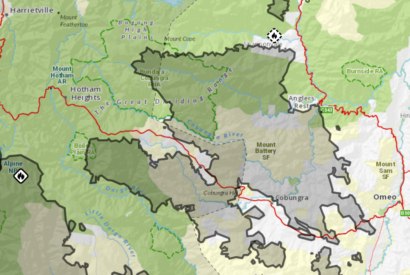
Wildfire has devastated large swathes of snow gum habitat in the last few decades, with significant fires in the Victorian High Country in 1998, 2002/3, 2006/7 and 2013. Over 90% of the Victorian distribution of snow gums has been burned at least once since 2003. Each of the large fires of the last 15 years has overlapped to some extent, leaving thousands of hectares of snow gums burned by wildfire twice, and sometimes three times.
The take home message from research into snow gum forest is that if we want to have a hope of keeping remaining old forests, we need to exclude fire from them wherever possible.
I thought I would check out some forests that were burnt this summer. The news is a mix of good and bad.
The Tabletop fire
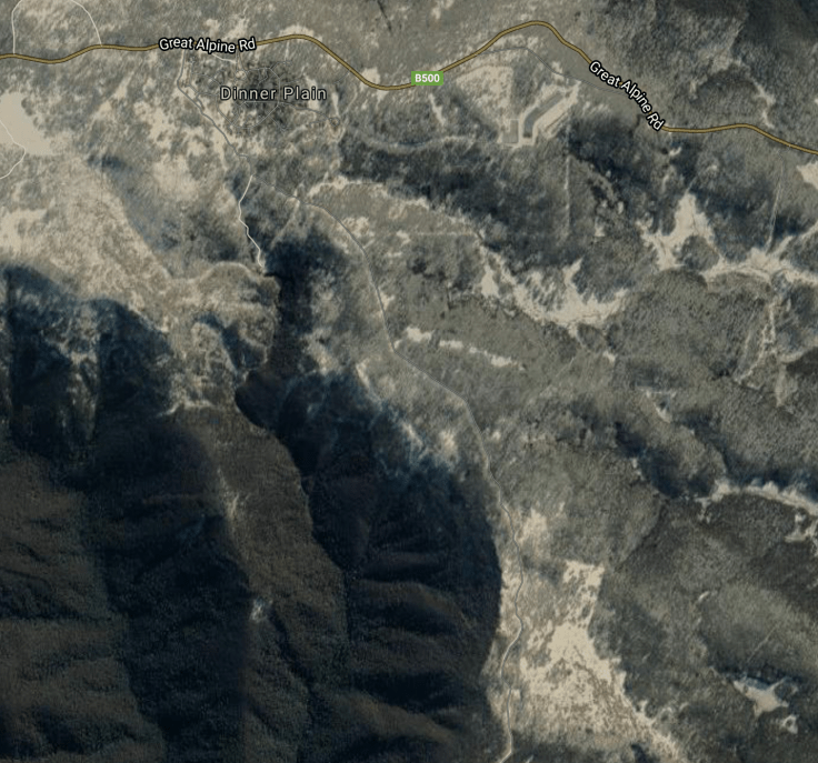
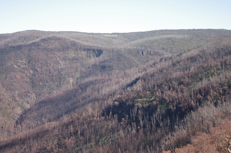
Mt Tabletop is just south of JB Plain in the Alps, between the Mt Hotham ski resort and the village of Dinner Plain. There is a scientific Reference Area there which has been partly burnt. The fire was triggered by a lightning strike on new years eve 2019. It grew, threatened the village of Dinner Plain twice in early January, then moved eastwards where it merged with other fires to eventually burn more than 40,000 hectares. Included in these fires was a lot of snow gum forests. Some sections of these fires burnt very hot and hence have been very destructive.

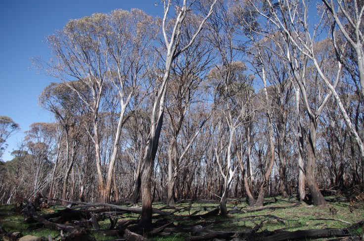
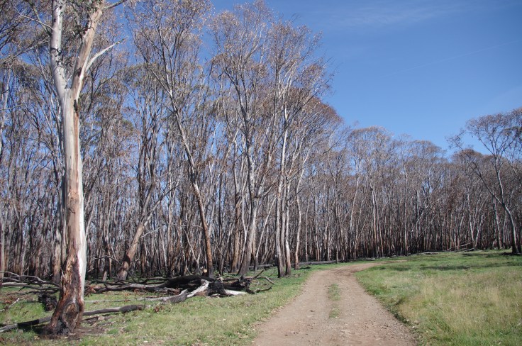
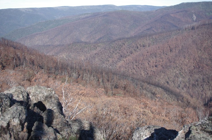
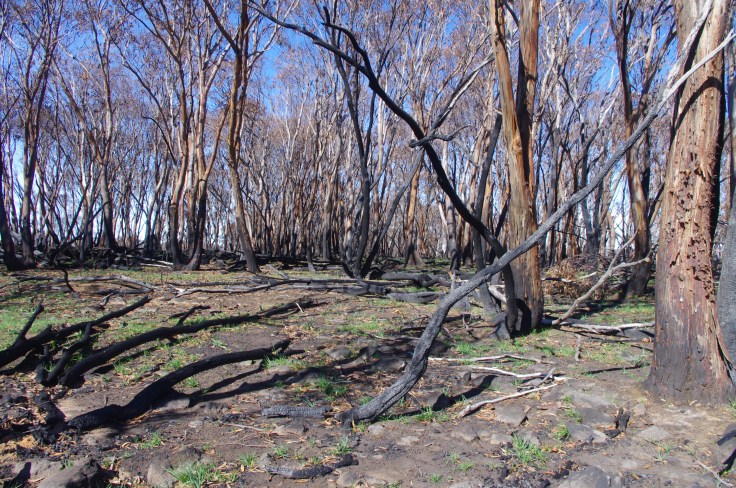
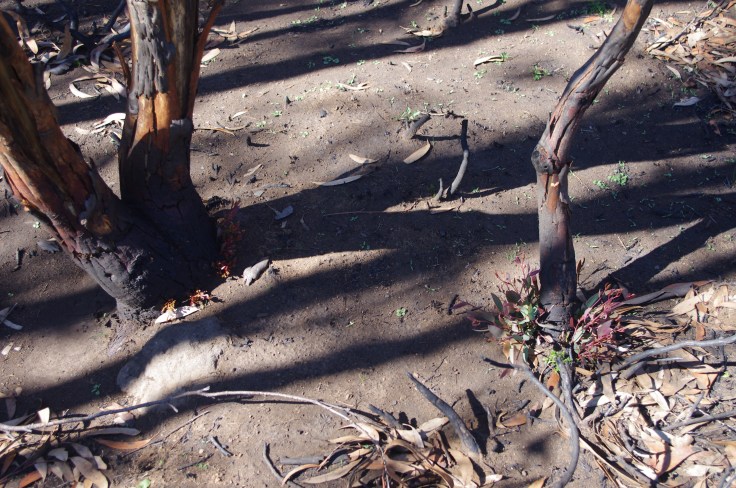
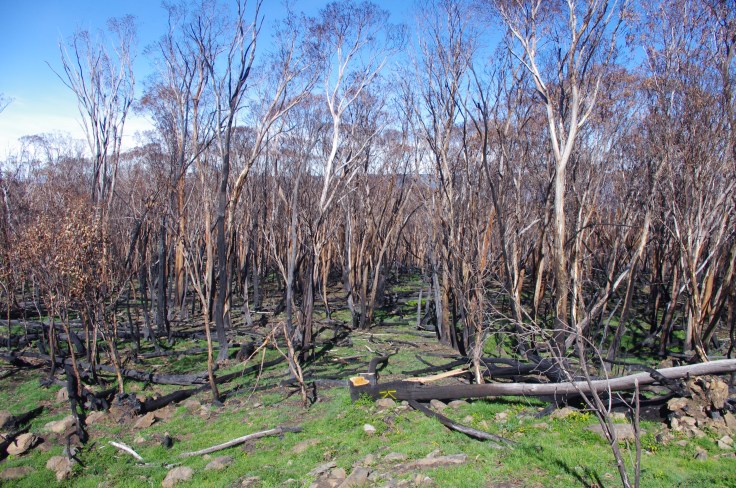
I went and checked out the fire south of Dinner Plain, to Precipice Plain and beyond. It’s been three months since the fire and there is, as you would expect, a huge amount of growth on the ground, especially of grasses, and some resprouting of trees that were burnt.
Generally the fire burnt less intensely in the north end, nearest Dinner Plain. But south of Precipice Plain, there has been devastation, with apparently many parent trees killed and very little resprouting from lignotubers.
What is obvious is that many of the trees killed in the last fire (2006/7 was bad in this area) are now falling over, leading to log piles forming that burn incredibly hot once they catch on fire. It was obvious that many of these areas must have burnt so hot that a lot of the seed in the soil was killed, as regrowth under these tress was noticeably less than in surrounding sections of forests.
The fire burnt past Mt Tabletop, around the edge of JB Plain (Large Air Tanker aircraft were deployed on this part of the fire in early January and stopped the spread towards the Dinner Plain village), and also burnt into the valley between Tabletop and Precipice Plain (Precipice and Tabletop Creeks, which flow into the Dargo). The impacts on the alpine ash forests in the valley looks terrible, with very few pockets of green growth visible.
Yes, this is an entirely unscientific wander through these forests. But it felt like this part of the world is that bit poorer as older forests burn once again, with – in most likelihood – ever smaller gaps until the next fire.
(We could have knocked this fire off with early intervention. This is my thinking on why we need a new remote area fire fighting force to tackle fires started by lightning strikes).
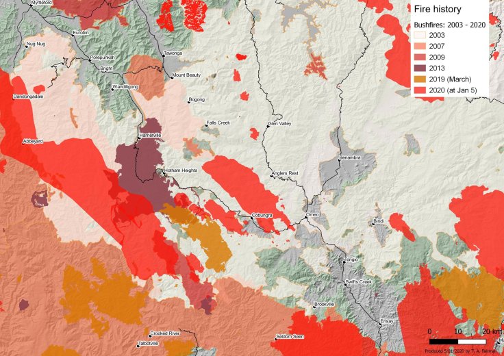
This map (via Tom Fairman) shows recent fires in the area, highlighting the fact that some sections of forest have been burnt more than once.


April 5, 2020 at 8:22 am
Thank you