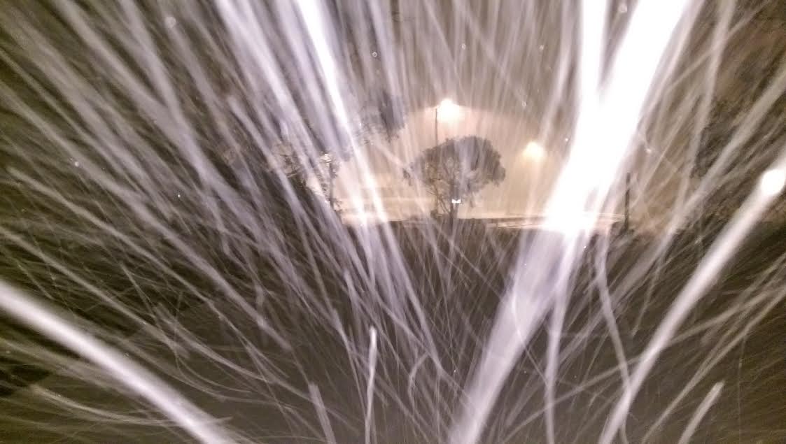
After a fairly ordinary opening weekend, are we finally getting to the real part of winter?
It seems to depend who you talk to but the general answer is YES.
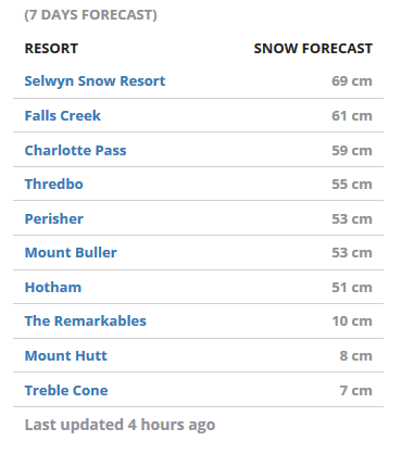
These are the seven day forecasts for Australia from MountainWatch.
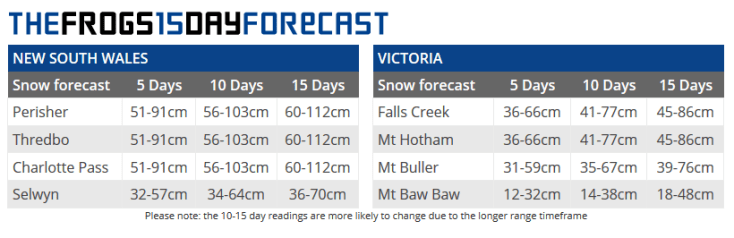
 This is the one from SnowWatch. Obviously, longer term models become less reliable, with a greater chance of the cold front being shunted off by a blocking High system or weakening, etc. We’ve all had our hearts broken many times by seeing a 15 day forecast that looks mind blowing slowly dissolve into drizzle and a bit of cloud, so do ‘adjust your set’ to prepare yourself for disappointment. But the short term forecast looks great.
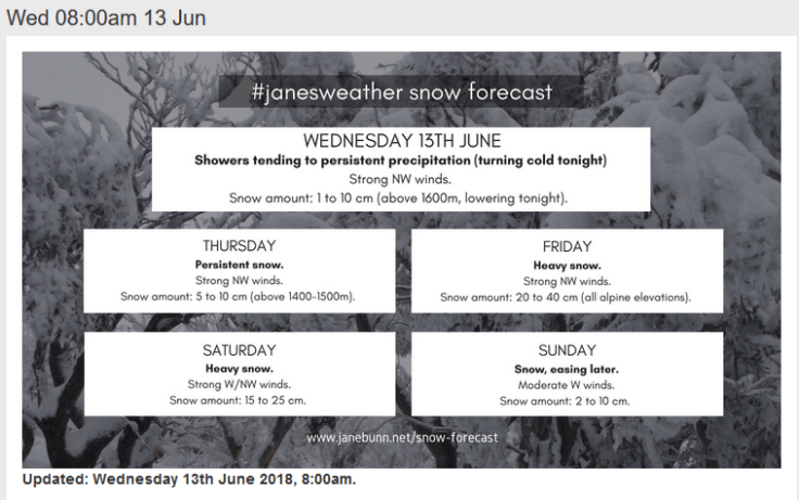
 The Jane Bunn forecast (via ski.com.au) looks pretty spectacular.
A series of cold fronts is passing through, driven by a complex area of low pressure that slowly moves past, just south of Australia.
The heavier snow coincides with the colder air. Its still a little warm today (Wednesday) and Thursday, then we are proper cold from Friday. Snow down to 900 metres on Friday and Saturday, lowering to 600 metres for Saturday night and early Sunday.
Northern resorts see the most from this system as the airflow is northwesterly for much of the time. Baw Baw picks up what is left on Monday into Tuesday.
The high moves in on Tuesday, bringing a return to sunshine.
We’re looking at 40 to 95 cm of snow for northern resorts.
Lets hope this is correct!

 In keeping with our tradition of showing an Australian backcountry film at the start of the program, this year we have a great short production about a late season mission in 2016 to ski Mt Townsend on the Main Range of the Snowy Mountains.





Recent Comments